Maps of United States

The United States, officially known as the United States of America (USA), shares its borders with Canada to the north and Mexico to the south. To the east lies the vast Atlantic Ocean, while the equally expansive Pacific Ocean borders the western coastline. Spanning a total area of approximately 9,833,520 km2 (3,796,742 sq mi), the United States ranks as the third or fourth-largest country by total area, depending on if one includes or omits water area, respectively.
Furthermore, there are numerous geographical regions that form the contiguous United States as well as its various island territories and states. Last, the greatest east-west distance in the 48 contiguous United States is 4,500 km (2796 mi). In regards to north-south, the longest distance in the 48 contiguous states region is 2,660 km (1653 mi).
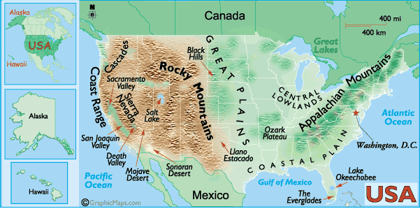
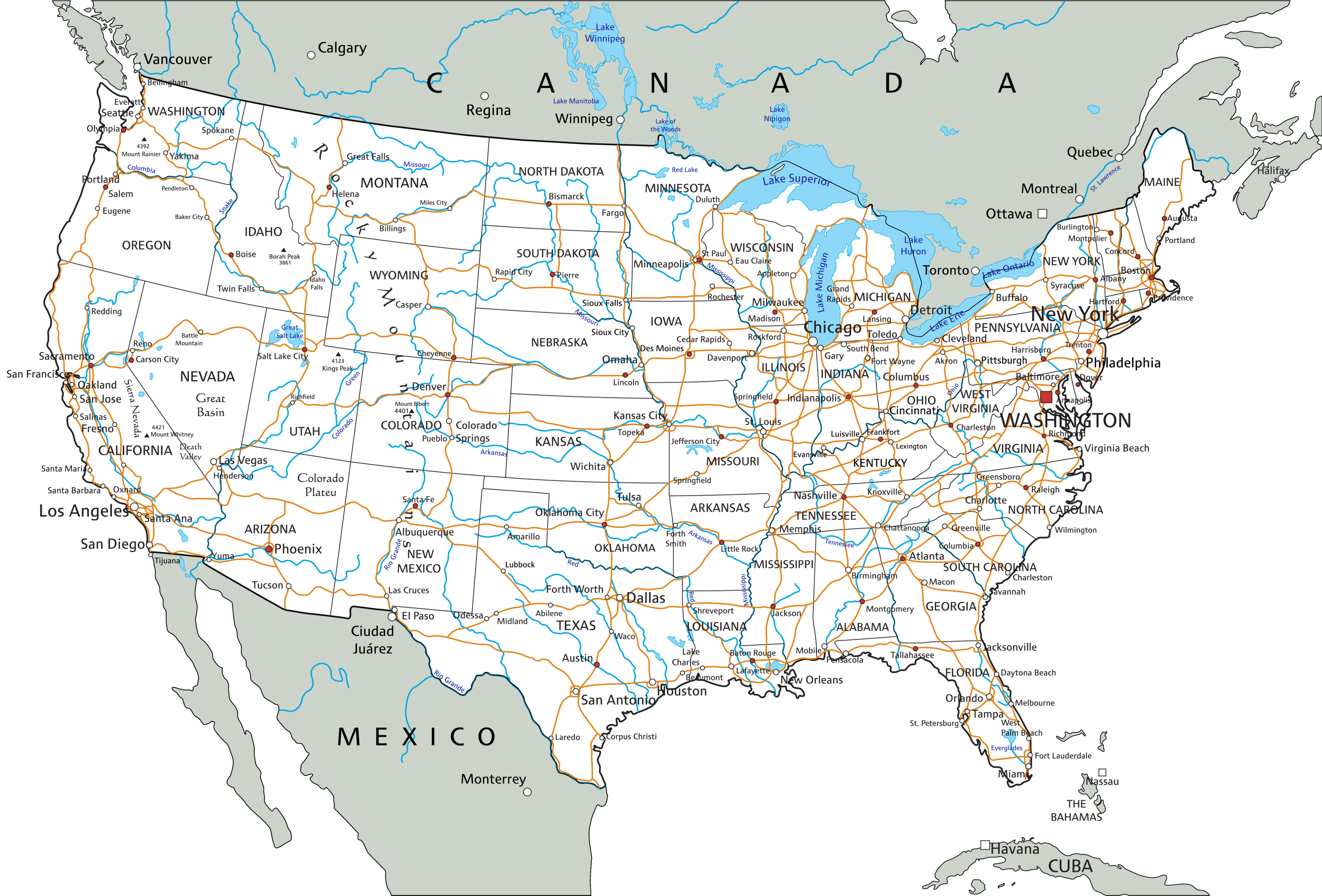
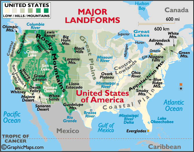
The Atlantic Coastal Plain: Starting in the eastern part of the country, the Atlantic Coastal Plain extends from the northeastern states down to Florida, bordering the Atlantic Ocean. It includes both low-lying, swampy areas, especially in the south, and more elevated regions to the north.
The Appalachian Mountains: Moving westward, one encounters the Appalachian Mountains, a system of ranges extending from the Canadian province of Quebec to northern Alabama. These mountains, which include notable peaks such as Mount Mitchell, were among the first regions settled by Europeans in the colonial period.
The Great Plains: Beyond the Appalachian Mountains lies the vast expanse of the Interior Lowlands, also known as the Great Plains. This region covers much of the central United States and extends into Canada. The Great Plains, characterized by prairies and grasslands, are a hub for agriculture due to their fertile soil.
The Rocky Mountains: Further to the west, the landscape rises again into the Rocky Mountains. This region, which covers a significant portion of western North America, boasts some of the highest peaks on the continent, including Mount Elbert.
The Intermontane Plateaus, including the Columbia and Colorado Plateau, lie to the west of the Rocky Mountains. This region also contains the Great Basin, a largely arid area characterized by desert and salt flats.
The Pacific Coast Range: Finally, on the western edge of the continent, lies the Pacific Coast Range. This includes the coastal mountains along the Pacific Ocean, from Alaska all the way to California. This range also encompasses several active volcanoes and the renowned California coastal areas.
The Alaskan Range: Situated further to the north of the Pacific Coast Range lies the Alaskan Range. This region is home to Mount Denali, formerly known as Mount McKinley, which, at 6.2 kilometers (20,310 feet), is the highest point above sea level in the United States. The range extends across the breadth of Alaska, which itself is a massive, rugged, state that was purchased from Russia in 1867.
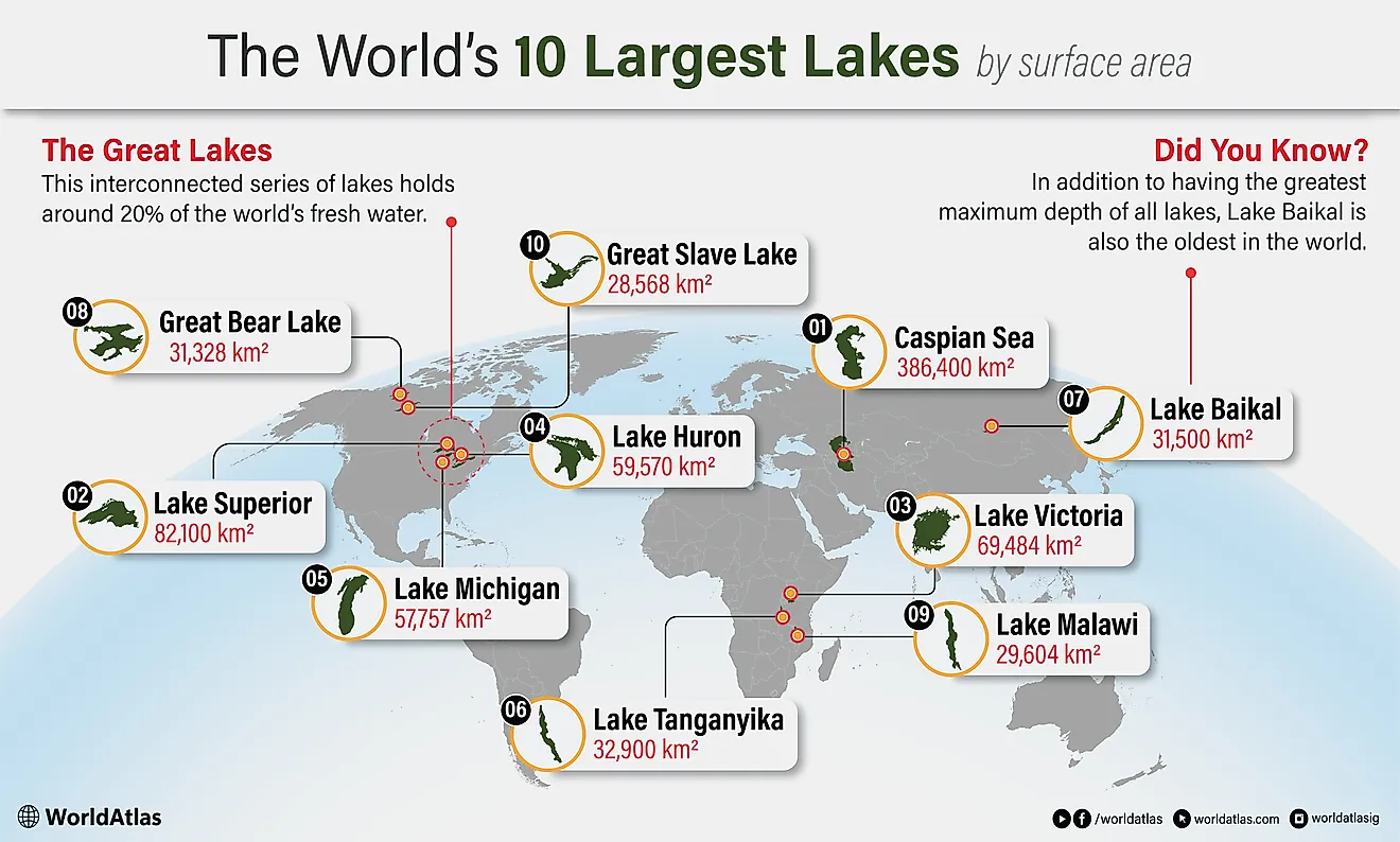
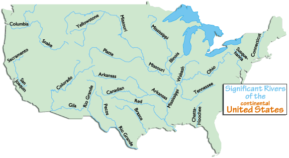
Major Bodies of Water: The United States also boasts a wealth of major bodies of water, rivers, and islands. The Great Lakes, including Lakes Superior, Michigan, Huron, Erie, and Ontario, are located in the northeastern part of the country and form the largest group of freshwater lakes in the world by total area.
Prominent rivers in the United States include the Mississippi, the Missouri, and the Colorado. The Mississippi River, one of the longest in the world, flows south from Minnesota to the Gulf of Mexico, effectively dividing the country into eastern and western halves. The Missouri River, a tributary of the Mississippi, is the longest river in North America. The Colorado River, famous for carving the Grand Canyon, also contributes significantly to the landscape of the Southwest.
Islands: The United States claims numerous islands, with the largest being Hawaii, located in the Pacific Ocean. Other significant islands include the Aleutian Islands in Alaska, and Puerto Rico in the Caribbean. Furthermore, the country has territories in the Pacific, such as Guam and the Northern Mariana Islands, and in the Caribbean, like the U.S. Virgin Islands.
List of US States

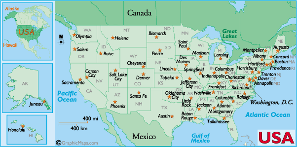
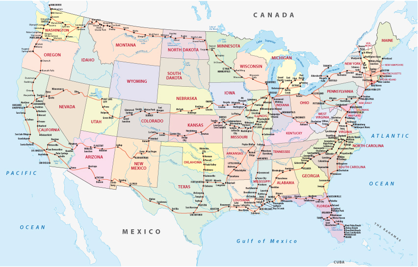
The 50 states are the major administrative divisions of the country. In alphabetical order, these states are: Alabama, Alaska, Arizona, Arkansas, California, Colorado, Connecticut, Delaware, District of Columbia, Florida, Georgia, Hawaii, Idaho, Illinois, Indiana, Iowa, Kansas, Kentucky, Louisiana, Maine, Maryland, Massachusetts, Michigan, Minnesota, Mississippi, Missouri, Montana, Nebraska, Nevada, New Hampshire, New Jersey, New Mexico, New York, North Carolina, North Dakota, Ohio, Oklahoma, Oregon, Pennsylvania, Rhode Island, South Carolina, South Dakota, Tennessee, Texas, Utah, Vermont, Virginia, Washington, West Virginia, Wisconsin, Wyoming
The states are divided into counties, which are further subdivided into municipalities. The District of Columbia is the federal district in which the country's capital - Washington D.C. is based.
The 14 U.S. territories are: Puerto Rico, Guam, U.S. Virgin Islands, Northern Mariana Islands, American Samoa, Midway Atoll, Baker Island, Howland Island, Jarvis Island, Johnston Atoll, Palmyra Atoll (incorporated territory), Kingman Reef, Wake Island and Navassa Island.
Covering a total area of 9,833,520 sq. km, the United States is the world's 3rd largest country. Located along the northern shore of the Potomac River in the federal district of Columbia is, Washington D.C. - the country's capital city. Situated at the southern edge of the State of New York is the New York City - the largest and the most populous city of the U.S.
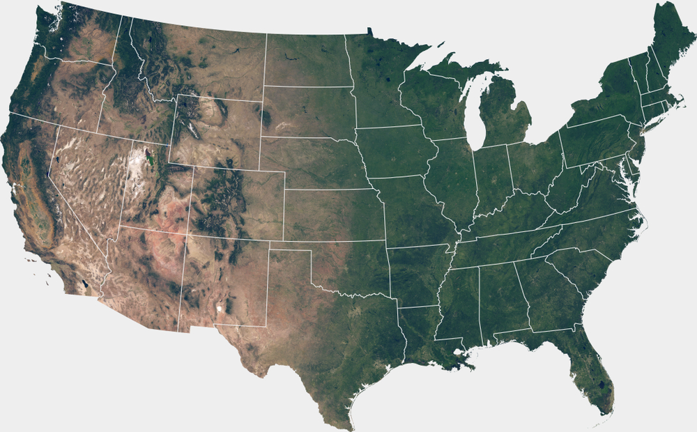
More US Maps
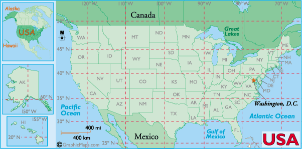

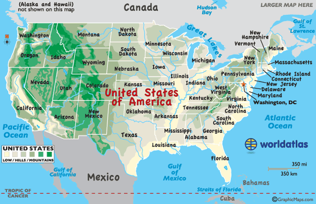
Location of US

The map above shows the location of the United States within North America, with Mexico to the south and Canada to the north. Found in the Norhern and Western Hemispheres, the country is bordered by the Atlantic Ocean in the east and the Pacific Ocean in the west, as well as the Gulf of Mexico to the south.
United States Bordering Countries: Canada, Mexico.
Regional Maps: Map of North America
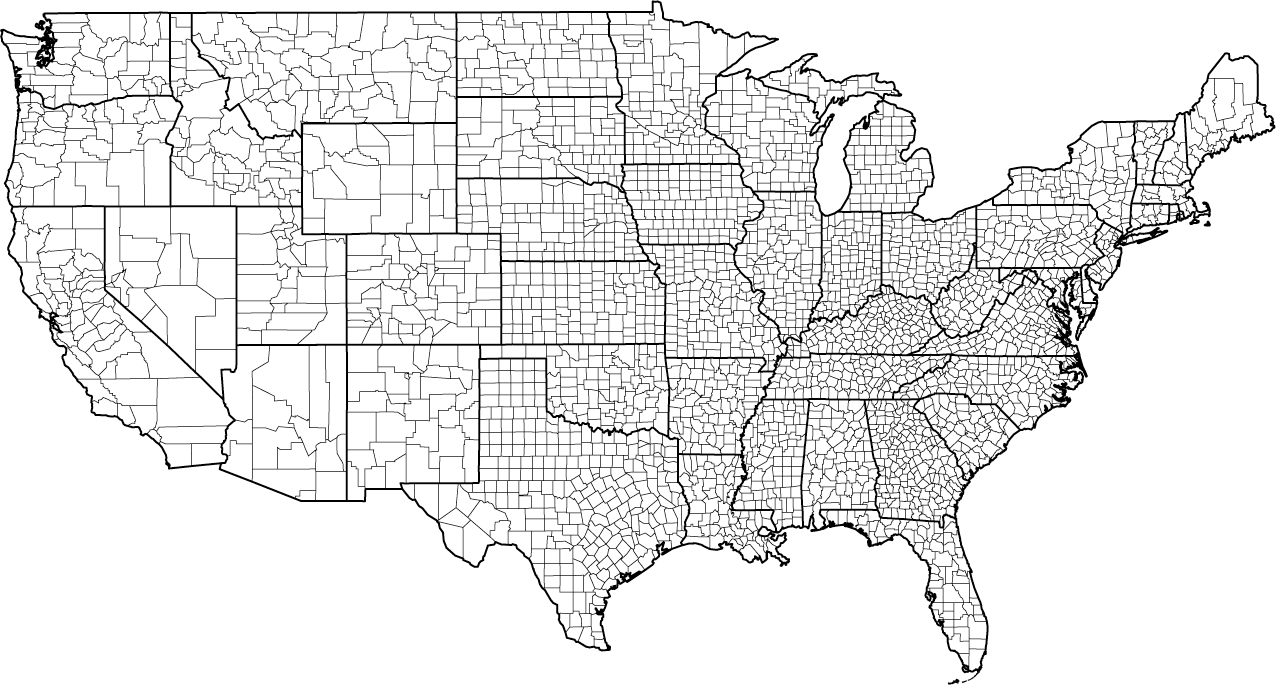
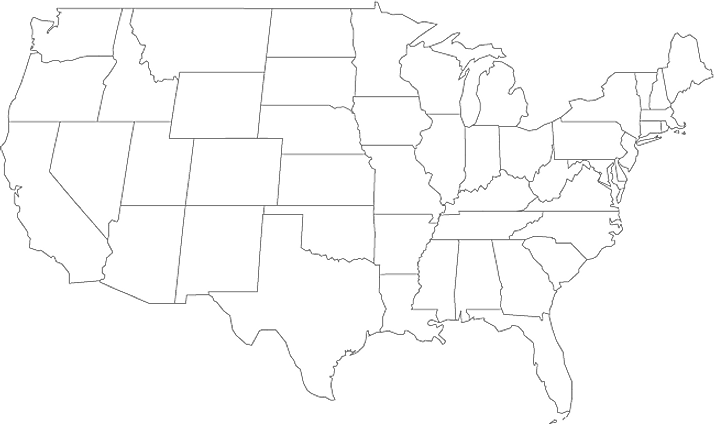
Outline Map of The US

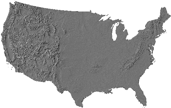
The above blank map represents the contiguous United States, the world's 3rd largest country located in North America. The above map can be downloaded, printed and used for geography education purposes like map-pointing and coloring activities.

The above outline map represents the contiguous United States, the world's 3rd largest country located in North America.
Key Facts
| Legal Name | United States of America |
|---|---|
| Flag |

|
| Capital City | Washington, DC |
| 38 53 N, 77 02 W | |
| Total Area | 9,833,517.00 km2 |
| Land Area | 9,147,593.00 km2 |
| Water Area | 685,924.00 km2 |
| Population | 328,239,523 |
| Major Cities |
|
| Currency | US Dollar (USD) |
| GDP | $21.37 Trillion |
| GDP Per Capita | $65,118.36 |
This page was last updated on January 22, 2024