Colorado Plateau
Also referred to as the Colorado Plateau Province, the Colorado Plateau is a physiographic region of the Intermontane Plateaus that is centered on the Four Corners region in the southwestern part of the United States. Covering an area of 336,700 sq. km, the Colorado Plateau Province comprises the northern half of the US State of Arizona, the western and southwestern parts of the US State of Colorado, the northwestern part of the US State of New Mexico, and the southern and eastern parts of the US State of Utah.
Geography
The Colorado Plateau Province is surrounded by the Rocky Mountains and the Basin and Range Provinces. The Colorado Rockies and the Uinta Mountains of Utah define the northern and northeastern boundaries, while the Rio Grande Rift Valley of New Mexico forms the eastern boundary. The southern boundary of the plateau is formed by the Mogollon Rim that also separates the Colorado Plateau from the Basin and Range Province.

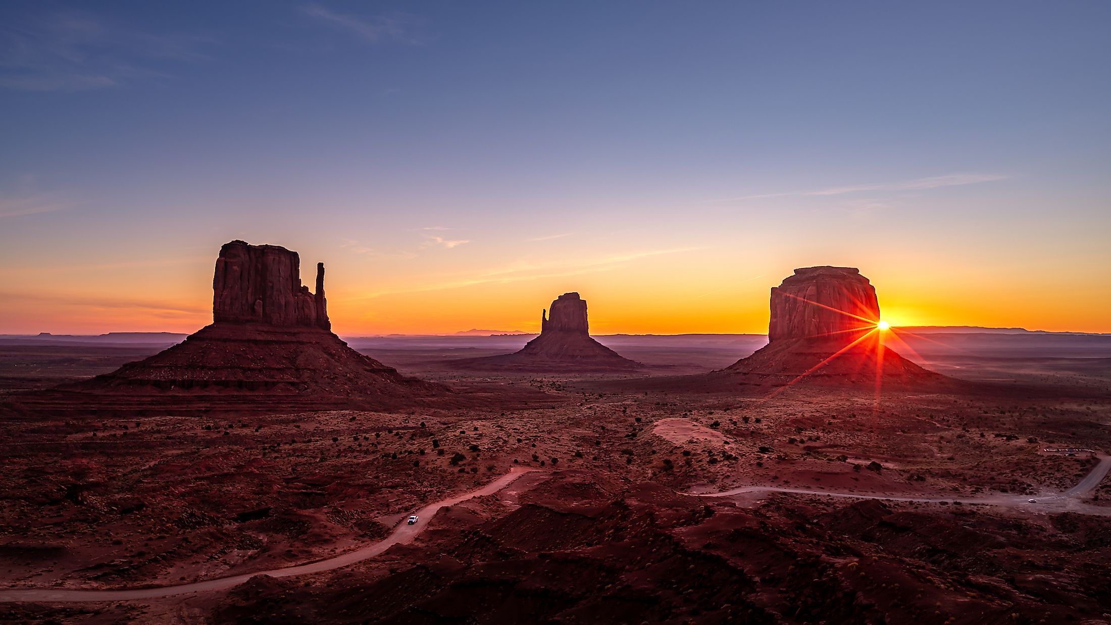
The Colorado Plateau region is characterized by sparsely vegetated plateaus, deeply carved canyons, ancient volcanic mountains, mesas and buttes, valleys, domes, hoodoos, shallow basins, barren badlands, sunken deserts, and flat-lying brightly colored sedimentary rocks. A major part of the plateau area, i.e., about 90% is drained by the Colorado River and its tributaries like the San Juan, Green, and Little Colorado Rivers. The remaining area is drained by the Rio Grande River and its tributaries. Located in the southwestern corner of the Colorado Plateau is the large Grand Canyon. Elevations of the plateau range from 600m in the Grand Canyon to over 3,870m in the La Sal Mountains in the US State of Utah. The Colorado Plateau Province contains the highest concentration of US National Park Service units including a large number of National Parks, National Monuments, and Wilderness Areas.
The Colorado Plateau is divided into the following six sections. These are:
Canyonlands Section: This section occupies the central portion of the Colorado Plateau and features many deeply incised canyons which contain large monoclines and laccolithic mountains like the La Sal Mountains, the Henry Mountains, Carrizo Mountains, Abajo Mountains, etc.

Grand Canyon Section: This section is characterized by the large Grand Canyon that has been created by the Colorado River through continuous weathering and geological processes over time. The Grand Canyon is widely known for its size and colorful landscape and has a length of about 446km, a width of 29km, and a maximum depth of 1,857m. The formation of the Grand Canyon is closely connected with the rise of the Colorado Plateau.
High Plateaus Section: This section is the highest and features high, north-trending plateaus that are separated from each other by faults.
Uinta Basin Section: This is the northernmost section of the Colorado Plateau. The northern boundary of the basin is formed by the Uinta Mountains. The Basin is drained by many creeks and rivers that flow in the southward direction from the Uinta Mountains.
Navajo Section: This section is characterized by fewer less-deep canyons in the US States of Arizona, New Mexico, and small portions of Colorado and Utah.

Datil Section: This section forms the transitional area between the Colorado Plateau and the Basin and Range Province. It is characterized by mesas, valleys and is largely volcanic in origin.
Geology
The major geological structures of the Colorado Plateau include monoclines, igneous laccoliths and volcanic, broad open folds, and salt tectonic features. Precambrian rocks are exposed in the deep Grand Canyon and the uplifts surrounding the Colorado Plateau. These Precambrian rocks mainly consist of older highly metamorphosed gneiss and schist rocks and younger sedimentary rocks. About 1.7 billion years ago, the north-south compression led to the formation of continent-scale lineaments. One of these was the Colorado River Lineament which extended from the northern part of Arizona to Michigan’s Lake Superior Region. The Laramide Orogeny which occurred from the end of the Cretaceous period to the Early Tertiary period resulted in the formation of the Rocky Mountains. About 5 million years ago, the entire Rocky Mountains and the Colorado Plateau were uplifted.
Climate
The climate of the Colorado Plateau region greatly varies from lower to higher elevations. The high Sierra Nevada Mountains of the West Coast prevent the moisture-laden winds from the Pacific to reach the southwestern states. Due to this rain-shadow effect, the annual precipitation of the Colorado Plateau is very low, averaging only 10 inches annually. At the lower elevations of the Colorado Plateau, the temperature ranges from the low 20s to the mid-90s F. At higher elevations, the summer temperature quite rarely exceed 70°F while single-digit temperatures are quite common during winter.
Ecology

At the lower elevations, the Colorado Plateau is covered with arid shrublands and grasses. The higher elevations support woodlands that are dominated by juniper, pinyon pine and shrubs. The montane forests are further dominated by Douglas fir, ponderosa pine, lodgepole pine, aspen etc.
Brief History
It is believed that the Colorado Plateau region was inhabited by the Ancestral Puebloan people who lived in the area about 2000 to 700 years ago. The Spanish missionaries led by Fathers Dominguez and Escalante made a long 5-month trip through a major part of the Plateau region during 1776 to 1777. In 1872, the geologist John Wesley Powell arrived in the area along with his team of geologists and mapmakers and charted the entire Colorado Plateau region. The character of the Colorado River was greatly changed due to the successive constructions of the Hoover Dam in 1930 and the Glen Canyon Dam in 1960.


