Maps of Hawaii

Hawaii, nicknamed the Aloha State, is an archipelago state composed of 8 major islands in the central Pacific Ocean. It lies about 2,300 miles (3,700 kilometers) southwest of the continental United States, 2,800 miles (4,400 kilometers) south of Alaska, and 2,600 miles (4,200 kilometers) north of Tahiti.
Honolulu, the capital and largest city of Hawaii, is located on the southeastern coast of Oahu Island and has a metro area population of just over a million residents.
Settlements on the Hawaiian Islands trace back to 400 C.E., when Polynesians traveled by canoe from the Marquesas Islands, 2,200 miles (3,550 kilometers) away, to Hawaii’s largest island. European contact came much later, with James Cook arriving in 1778. Hawaii eventually became the 50th U.S. state in 1959.
Area
Hawaii has a total area of 10,932 square miles (28,314 square kilometers), making it the eighth smallest state in the US. It is roughly half the size of Croatia and the same size as Albania. Compared to other US states, Hawaii is double the size of Connecticut and nearly 10 times smaller than Colorado.
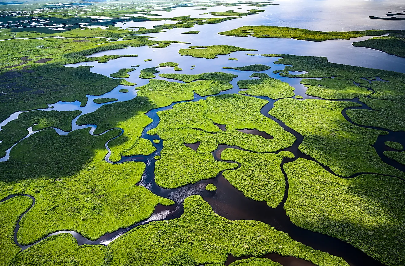
Bodies of Water
Of Hawaii’s total area, 4,509 square miles (11,678 square kilometers) are water. Throughout the state, there are roughly 3,905 miles of river. Notable rivers include the Wailuku River, the longest at 28 miles, flowing through central Hawaii Island; the Hanalei River, stretching 16 miles through Kauai Valley; and the Anahulu River on Oahu, scenic and popular for recreational activities like kayaking. The state also only has five natural lakes, although there are 266 reservoirs scattered throughout the islands.
Beaches
Hawaii is home to some of the most famous beaches in the world, featuring white, red, and black sand, all shaped by volcanic activity. Two notable black sand beaches in Hawaii are Punaluʻu Black Sand Beach, on the southern coast of the Big Island, and Richardson Ocean Park, along the island’s eastern shore. Maui Island’s north shore is known for its excellent windsurfing beaches, such as Hoʻokipa Beach Park and Kanahā Beach Park. Many beaches along the shores of Oahu are prime spots for surfers, such as Waimea Bay Beach Park and Sunset Beach, while Kauai features a 50-mile (80-kilometer) long coastline of white sand, accessible through parks such as Anini Beach Park.
Geographic Regions
Although 137 islands and islets make up the state of Hawaii, there are 8 major islands that define its geography.
Hawaii Island (The Big Island)
Hawaii Island is home to two of the largest volcanoes in the world, Mauna Kea and Mauna Loa, with elevations of 13,803 feet (4,207 meters) and 13,679 feet (4,169 meters), respectively. Its land is rich in diverse geographic features, such as volcanic craters, recent lava flows, and dense rainforests.
Maui
Maui features an array of ecosystems and physical features, ranging from arid, desert-like areas, to green, forested areas with higher rainfall. Erosion has resulted in deep valleys and ridges, and the West Maui Mountains and dormant Haleakalā volcano crater are two significant landmarks.
Oahu
Oahu features two prominent mountain ranges, the Koolau and Waianae, divided by a central plain. Diamond Head, a famous volcanic tuff cone, and the Nuuanu Pali Lookout, known for its steep cliffs, are both located to the island’s southeast.
Kauai
Kauai, the oldest major Hawaiian island, is home to deeply eroded canyons and elevated cliffs, the most famous being Waimea Canyon, sometimes referred to as “the Grand Canyon of the Pacific” and the Napali Coast cliffs.
Molokai, Lanai, and Niihau
Molokai, Lanai, and Niihau are three smaller islands grouped to the west of Maui. Molokai features the tallest seacliffs in the world, while Lanai has a lunar-like topography, famously represented in the Garden of the Gods. Niihau is more arid and desert-like, although there are some areas with wetlands.
Counties Map

The State of Hawaii is divided into 5 counties. In alphabetical order, these counties are: Hawaii County, Honolulu, Kalawao, Kauai, and Maui.
With an area of 16,638 sq. km, Hawaii is the 8th smallest and the 11th least populous state in the USA. Located on the southeastern coast of Oahu Island is Honolulu – the capital and the largest city of Hawaii. It hosts the headquarters of several large Hawaiian companies and is also the state’s principal port, financial and economic hub. Honolulu has been classified as a “Modern City” by international standards with its skyline being dotted with numerous skyscrapers.
Where is Hawaii?

The State of Hawaii (Hawaiian archipelago) is located in the Pacific Ocean to the southwest of the contiguous United States. Hawaii is located in the North Pacific Ocean, just a few degrees south of the Tropic of Cancer, approximately 2,392 miles west of San Francisco; 2,550 miles southwest of Los Angeles; 3,900 miles southeast of Tokyo, and 4,536 miles northeast of Australia.
Regional Maps: Map of North America
Outline Map of Hawaii

The above blank map represents the State of Hawaii (Hawaiian archipelago), located in the Pacific Ocean to the southwest of the contiguous United States. The above map can be downloaded, printed and used for geography education purposes like map-pointing and coloring activities.

The above outline map represents the State of Hawaii (Hawaiian archipelago), located in the Pacific Ocean to the southwest of the contiguous United States. Nicknamed as the "Aloha State", it is the only U.S. state to be completely made up of islands.
Key Facts
| Legal Name | State of Hawaii |
|---|---|
| ISO 3166 Code | US-HI |
| Capital City | Honolulu |
| Largest City |
Honolulu (912,421) |
This page was last updated on August 29, 2024