Maps of Egypt
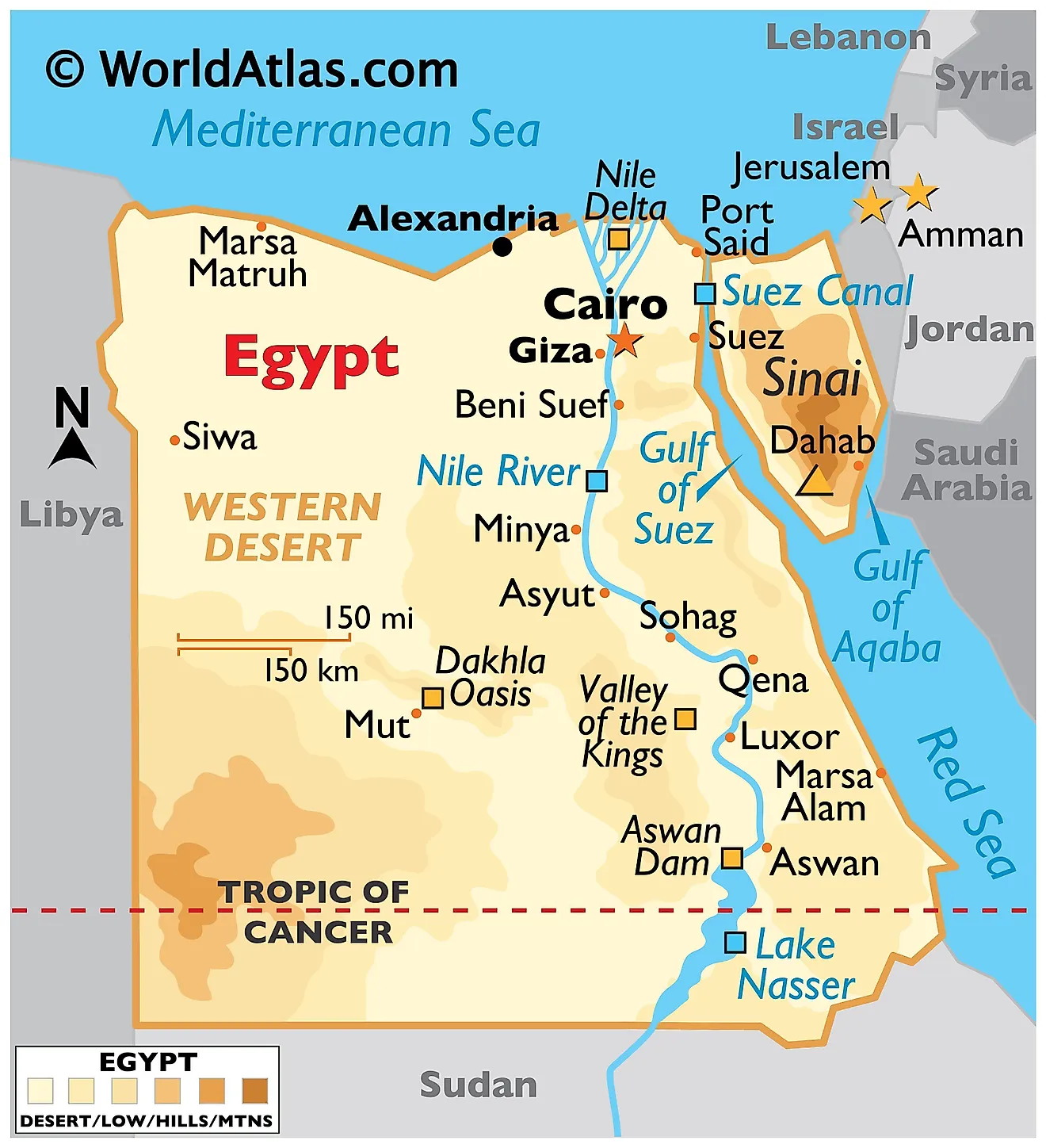
Egypt, officially the Arab Republic of Egypt, is located in northeastern Africa with its Sinai Peninsula stretching into Western Asia. It covers an area of about 1,002,450 km2 (approximately 387,050 mi2). To the north, Egypt meets the Mediterranean Sea, while to the east, it shares a border with Israel and the Gaza Strip. Sudan lies to its south, and Libya to its west. To the northeast, Egypt has coastlines along the Red Sea.
Nile Delta Region: One of Egypt's most significant geographical features is the Nile Delta. The delta stretches from the northern part of Cairo to the Mediterranean Sea. This region is historically fertile and was the cradle of many ancient Egyptian civilizations. The Nile, often regarded as the world's longest river, fans out into a myriad of tributaries in this delta, creating a lush, green landscape in contrast to the surrounding deserts. The majority of Egypt's population resides in this region, benefiting from the rich alluvial soils that the Nile brings.
Nile Valley and Nile River: Flowing from south to north, the Nile River extends for over 1,500 kilometers within Egypt's borders. This river has long been the lifeblood of the country, providing fresh water, transportation, and fertile soils to the regions it passes through. The Nile Valley, which comprises lands immediately adjacent to the river, houses many of Egypt's cities and towns. Beyond just the practical, the Nile has historical and cultural significance, with many ancient monuments and temples found along its banks.
Western Desert: To the west of the Nile lies the Western Desert, which makes up about two-thirds of Egypt's land area and is part of the greater Sahara Desert. This region is predominantly arid, with sand dunes, oases, and rugged plateaus. The oases, such as Siwa and Bahariya, are communities that have historically developed around natural springs. While less populated than the Nile regions, the Western Desert holds mineral resources and has been significant for trade and transportation.
Eastern Desert: The Eastern Desert separates the Nile Valley from the Red Sea. This mountainous and rugged region is rich in minerals like gold and precious stones. Historically, the Eastern Desert has been a source of valuable resources for ancient Egyptian civilizations. The Red Sea Mountains run parallel to the coast, providing a stunning backdrop to the Red Sea's coastal areas.
Sinai Peninsula: Jutting out to the northeast, the Sinai Peninsula acts as a land bridge between Africa and Asia. It is characterized by its mountainous terrain, particularly in the southern regions. Mount Sinai, located here, holds religious significance for many Abrahamic faiths.The peninsula borders the Mediterranean Sea to the north and the Red Sea to the east. It also houses the Suez Canal, a human-made waterway connecting the Mediterranean Sea to the Red Sea and providing the shortest maritime route between Europe and the lands lying around the Indian and western Pacific oceans. Last, the 2,629 m (8,625 ft) high Mount Catherine in the Sinai Peninsula is the highest point in Egypt.
Major Bodies of Water: Aside from the Nile, Egypt's major bodies of water include the Mediterranean Sea to the north and the Red Sea to the east. Both seas are vital for trade, transportation, and tourism. The Red Sea, in particular, is known for its coral reefs and abundant marine life.
Political Map of Egypt
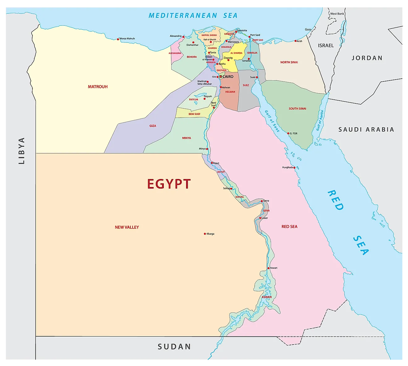
Egypt has 27 governorates. These are Ad Daqahliyah, Al Bahr al Ahmar (Red Sea), Al Buhayrah, Al Fayyum, Al Gharbiyah, Al Iskandariyah (Alexandria), Al Isma'iliyah (Ismailia), Al Jizah (Giza), Al Minufiyah, Al Minya, Al Qahirah (Cairo), Al Qalyubiyah, Al Uqsur (Luxor), Al Wadi al Jadid (New Valley), As Suways (Suez), Ash Sharqiyah, Aswan, Asyut, Bani Suwayf, Bur Sa'id (Port Said), Dumyat (Damietta), Janub Sina' (South Sinai), Kafr ash Shaykh, Matruh, Qina, Shamal Sina' (North Sinai), Suhaj.
With an area of 440,098 sq. km, New Valley is the largest governorate of the country by area. Cairo, the country's capital, is the most populous one.
Where is Egypt?

Egypt is a transcontinental country that stretches from the northeast corner of Africa to the southwest corner of Asia. The Sinai Peninsula of Egypt acts as the land bridge between these two continents. Egypt is located in the Northern and Eastern Hemispheres of the Earth. It has land borders with Sudan to the south, Libya to the west, Israel and the Gaza Strip to the northeast. To the north, Egypt has a coastline on the Mediterranean Sea while the Red Sea and Gulf of Aqaba border it to the east.
Egypt Bordering Countries: Palestine, The Sudan, Israel, Libya.
Regional Maps: Map of Africa
Outline Map of Egypt
The blank outline map of the country of Egypt. The map can be downloaded for free and used for education purpose like map-pointing or for coloring as well.
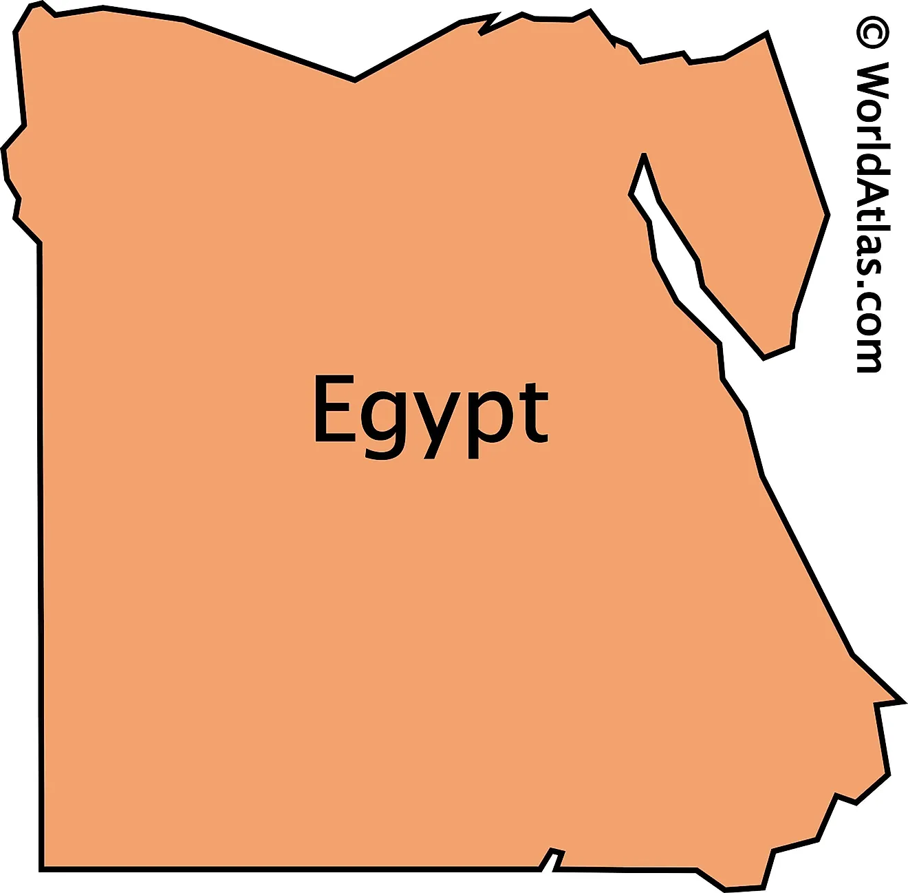
The outline map shows the North African country of Egypt, a country well known for its pyramids and Pharaohs. Egypt is a transcontinental country with the Sinani Peninsula in the extreme right of the country acting as a land bridge between Africa and Asia.
Key Facts
| Legal Name | Arab Republic of Egypt |
|---|---|
| Flag |
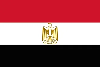
|
| Capital City | Cairo |
| 30 03 N, 31 15 E | |
| Total Area | 1,001,450.00 km2 |
| Land Area | 995,450.00 km2 |
| Water Area | 6,000.00 km2 |
| Population | 100,388,073 |
| Major Cities |
|
| Currency | Egyptian pounds (EGP) |
| GDP | $303.18 Billion |
| GDP Per Capita | $3,020.03 |
This page was last updated on December 19, 2023
