10 Largest US Lakes
Water covers approximately 269,717 square miles of the United States, about 7% of the country, counting its rivers, lakes, inlets, and coastal territorial waters. The lake count alone is staggering: Alaska holds more than three million lakes, most of which have never even been named, while Minnesota claims the most named lakes in the country. But the true giants cluster at the top.
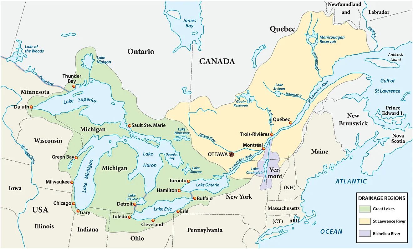
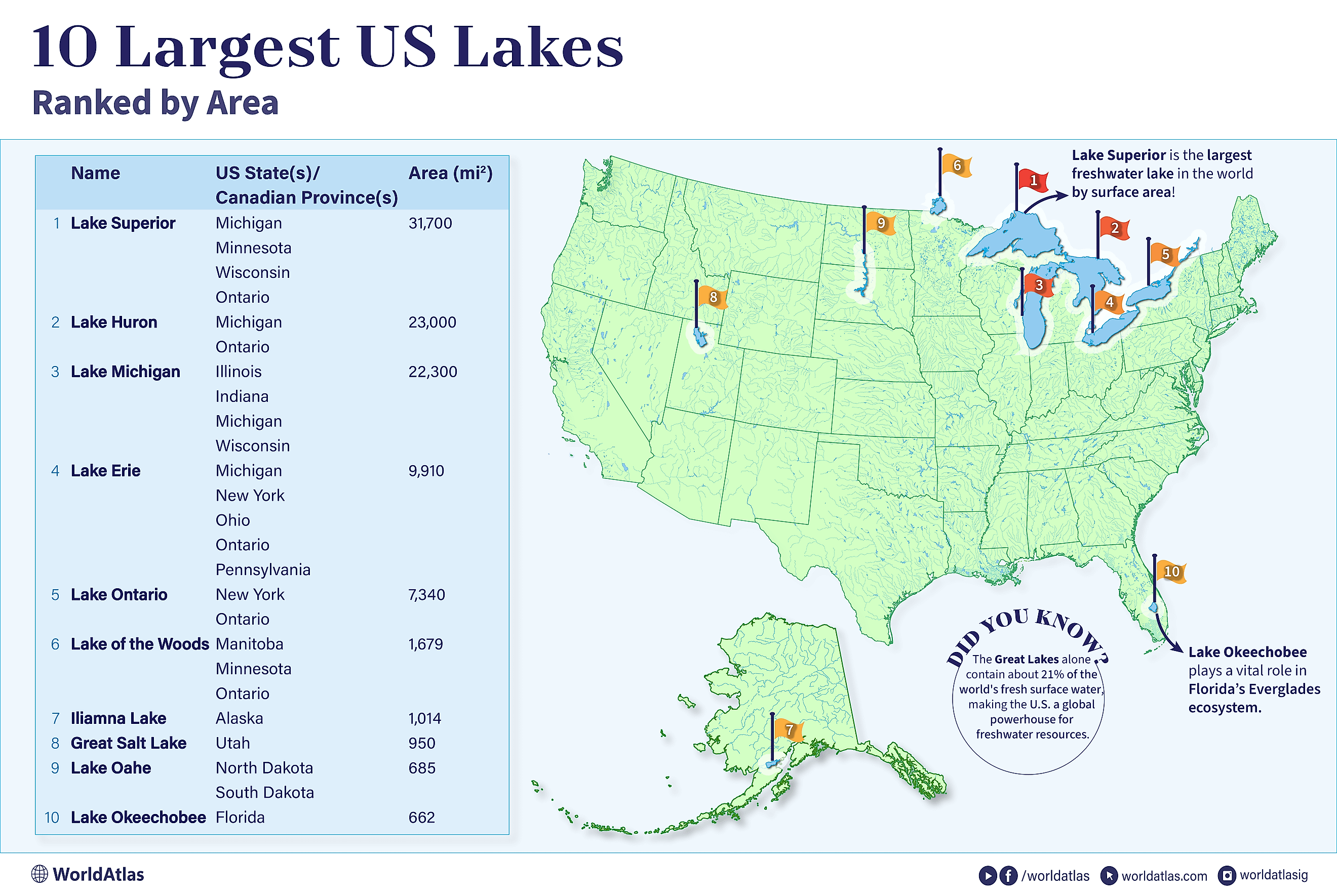
The five Great Lakes monopolize the top of the rankings, spanning a combined 94,250 square miles, nearly the size of the United Kingdom. Lake Superior leads, followed by Lake Huron, Lake Michigan, Lake Erie, and Lake Ontario. The back half of the top ten is a wilder mix: Lake of the Woods, Iliamna Lake, Great Salt Lake, Lake Oahe, and Lake Okeechobee. Nine of the ten are freshwater; the exception, the Great Salt Lake in Utah, is several times saltier than the ocean.
10 Largest Lakes in the United States by Surface Area
| Rank | Name | Location | Area |
|---|---|---|---|
| 1 | Lake Superior | Michigan, Minnesota, Wisconsin, Ontario | 31,700 sq mi |
| 2 | Lake Huron | Michigan, Ontario | 23,000 sq mi |
| 3 | Lake Michigan | Illinois, Indiana, Michigan, Wisconsin | 22,300 sq mi |
| 4 | Lake Erie | Michigan, New York, Ohio, Ontario, Pennsylvania | 9,910 sq mi |
| 5 | Lake Ontario | New York, Ontario | 7,340 sq mi |
| 6 | Lake of the Woods | Manitoba, Minnesota, Ontario | 1,679 sq mi |
| 7 | Iliamna Lake | Alaska | 1,014 sq mi |
| 8 | Great Salt Lake | Utah | 950 sq mi |
| 9 | Lake Oahe | North Dakota, South Dakota | 685 sq mi |
| 10 | Lake Okeechobee | Florida | 662 sq mi |
1. Lake Superior - 31,700 Square Miles

Lake Superior is not just the largest lake in the United States; at 31,700 square miles, it is the largest freshwater lake on Earth by surface area, roughly the size of Austria and nearly twice the size of Denmark. It borders Michigan, Minnesota, Wisconsin, and Ontario, stretching about 350 miles long and 160 miles wide, with roughly 2,800 miles of shoreline.
The volume is where Superior gets absurd. Its roughly 2,900 cubic miles of water amount to about 10% of the world's surface fresh water, enough, by one famous estimate, to flood all of North and South America a foot deep. It is the deepest and coldest of the Great Lakes, bottoming out at 1,332 feet with an average depth near 500 feet. More than 200 rivers pour in; the water leaves through the St. Mary's River on its way to Lake Huron.
2. Lake Huron - 23,000 Square Miles

Lake Huron covers 23,000 square miles between Michigan and Ontario, making it roughly twice the size of Belgium and more than four times larger than Connecticut. It spans 206 miles across and 183 miles north to south, averaging 195 feet deep with a maximum depth of 750 feet and a volume of about 845 cubic miles. Huron's signature is its islands: roughly 30,000 of them, including Manitoulin Island, the largest island in any freshwater lake on the planet. The lake drinks from two giants at once, receiving Lake Superior's outflow via the St. Mary's River and Lake Michigan's via the Straits of Mackinac, a connection so wide and deep that hydrologists treat Michigan and Huron as a single lake wearing two names.
3. Lake Michigan - 22,300 Square Miles

At 22,300 square miles, Lake Michigan is the only Great Lake that lies entirely within the United States, bordered by Illinois, Indiana, Michigan, and Wisconsin. It runs 307 miles long and 118 miles wide, an area roughly 11 times the size of Delaware. Here is the twist: although Huron beats it on surface area, Lake Michigan holds far more water, 1,180 cubic miles against Huron's 845, thanks to an average depth of 279 feet and a maximum of 925 feet. Rivers including the Fox and the Grand feed it, and its water exits north through the Straits of Mackinac into Lake Huron.
4. Lake Erie - 9,910 Square Miles

Lake Erie covers 9,910 square miles, just smaller than Massachusetts and about half the size of Costa Rica, touching Michigan, New York, Ohio, Ontario, and Pennsylvania. It stretches 241 miles long but only 57 miles wide, and it is the shallow one of the family: 62 feet deep on average, 210 feet at maximum. All of Erie's 119 cubic miles of water would fit inside Lake Superior about 24 times. Most of its inflow arrives via the Detroit River, and most of it leaves in dramatic fashion, through the Niagara River and over Niagara Falls, with the Welland Canal carrying the ship traffic around the drop.
5. Lake Ontario - 7,340 Square Miles

Lake Ontario is the runt of the Great Lakes at 7,340 square miles, which still makes it about seven times the size of Luxembourg. Bordering only New York and Ontario and measuring 193 miles by 53 miles, it compensates for its footprint with depth: averaging 283 feet, it holds more than three times the water volume of the much larger-looking Lake Erie. Ontario is the last stop on the Great Lakes conveyor belt, taking in the Niagara River's flow and sending the whole system's water down the St. Lawrence River to the Atlantic.
6. Lake of the Woods - 1,679 Square Miles

After the Great Lakes, the drop-off is steep. Lake of the Woods, sixth at 1,679 square miles, is shared by Minnesota and the Canadian provinces of Manitoba and Ontario, an area slightly smaller than Trinidad and Tobago. Its statistics read like a misprint: roughly 70 miles long, 60 miles wide, and crowded with more than 14,500 islands. The Rainy River feeds it from the southeast, and the water drains northwest through the Winnipeg River, bound for Lake Winnipeg.
7. Iliamna Lake - 1,014 Square Miles

Iliamna Lake, west of Cook Inlet in southwest Alaska, is the largest lake in the state at 1,014 square miles, about the size of Rhode Island, and quite possibly the wildest entry on this list. It runs 77 miles long and 22 miles wide, averaging 144 feet deep but plunging to 988 feet, and it hosts one of the world's only populations of freshwater harbor seals, plus the sockeye salmon runs that sustain them. Fed primarily by the Newhalen, Iliamna, and Pile Rivers, the lake drains southwest through the Kvichak River into Bristol Bay and, ultimately, the Bering Sea.
8. Great Salt Lake - 950 Square Miles

The Great Salt Lake is the largest saltwater lake in the Western Hemisphere, a leftover puddle of the enormous prehistoric Lake Bonneville, and the one entry here whose size depends heavily on when you measure. At its long-term average level the lake spreads across roughly 1,700 square miles; decades of river diversions plus drought have shrunk it to around 950, near the record lows first hit in 2021, and it closed the 2025 water year at the third-lowest level since records began in 1903. Fed by the Bear, Jordan, and Weber Rivers in northern Utah, the lake is a terminal basin with no outlet, which concentrates its salt to several times the ocean's strength. It currently measures about 75 miles long and 28 miles wide, with an average depth of just 16 feet.
9. Lake Oahe - 685 Square Miles

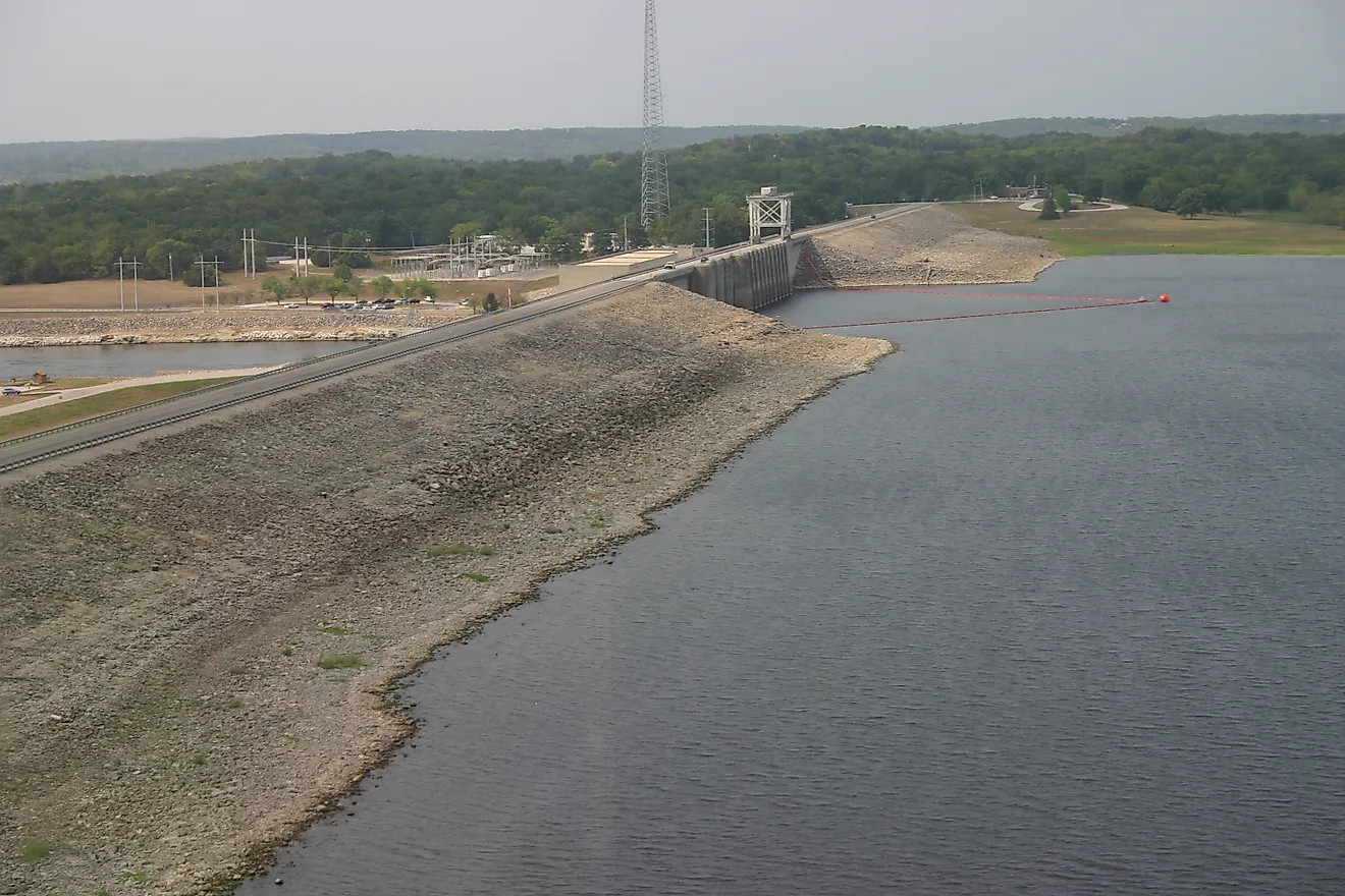
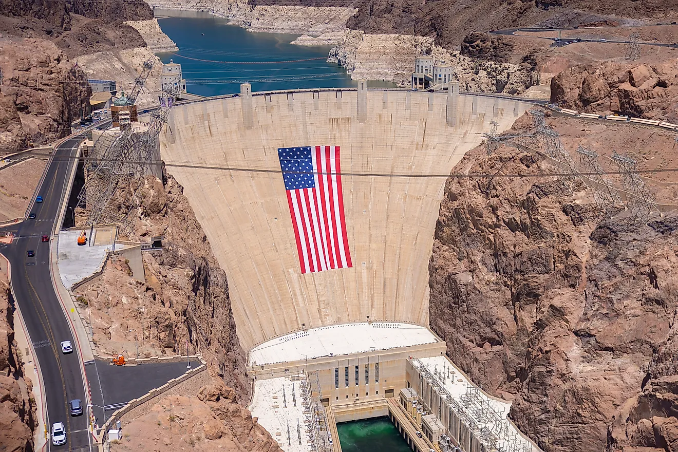
Lake Oahe is the man-made member of the top ten, a 685-square-mile reservoir impounded behind the Oahe Dam on the Missouri River. It begins just north of Pierre, South Dakota, and snakes roughly 231 miles upstream to near Bismarck, North Dakota. Because it is a drowned river valley rather than a round basin, its shoreline runs an astonishing 2,250 miles, longer than the entire Pacific coastline of the Lower 48. Reaching 205 feet deep and holding about 7 cubic miles of water, it takes its main tributary inflows via the Cheyenne, Moreau, and Grand Rivers, with the Missouri carrying the water onward.
10. Lake Okeechobee - 662 Square Miles

Lake Okeechobee in south-central Florida closes out the top ten at 662 square miles, big enough at 36 by 29 miles that you cannot see the far shore from the water's edge. Then comes the punchline: this inland sea averages only about nine feet deep, maxing out around 12, making it one of the shallowest large lakes anywhere. The Kissimmee River supplies most of its inflow from the north, and its water historically fanned south into the Everglades, with the Caloosahatchee and St. Lucie Rivers now serving as its managed outlets.
Rounding Out the Top Twenty
The next tier mixes natural giants, reservoirs, and one famous accident. The figures below round out the twenty largest lakes in the country by surface area.
| Rank | Name | Location | Area |
|---|---|---|---|
| 11 | Lake Pontchartrain | Louisiana | 631 sq mi |
| 12 | Lake Sakakawea | North Dakota | 520 sq mi |
| 13 | Lake Champlain | New York, Vermont, Quebec | 490 sq mi |
| 14 | Becharof Lake | Alaska | 453 sq mi |
| 15 | Lake St. Clair | Michigan, Ontario | 440 sq mi |
| 16 | Red Lake | Minnesota | 427 sq mi |
| 17 | Selawik Lake | Alaska | 404 sq mi |
| 18 | Fort Peck Lake | Montana | 393 sq mi |
| 19 | Salton Sea | California | 347 sq mi |
| 20 | Rainy Lake | Minnesota, Ontario | 345 sq mi |
Guarding the Giants
Lakes the size of small countries can still be fragile. Climate change, plastic pollution, invasive species, and thirsty cities all press on these waters, and the Great Salt Lake's shrinking footprint shows how quickly even a giant can recede. Protections like the Great Lakes Compact and the Clean Water Act have done heavy lifting for decades, and they will need to keep doing it, because the ten largest lakes in America are not just impressive statistics. They are drinking water, fisheries, shipping lanes, and in Superior's case, a tenth of the planet's surface fresh water sitting in one basin.