The Largest Interstate Lakes Shared by Two or More States
From Minnesota’s North Shore on Lake Superior to Chicago’s skyline on Lake Michigan, the United States’ biggest lakes often sit in more than one state at once. A single shoreline can belong to different capitals, counties, and park systems—Lake Erie ties Ohio and Pennsylvania together, and Lake Tahoe splits California and Nevada. This list ranks the largest interstate lakes by surface area, including Great Lakes giants and massive river reservoirs created by dams like Hoover Dam at Lake Mead.
Lake Superior

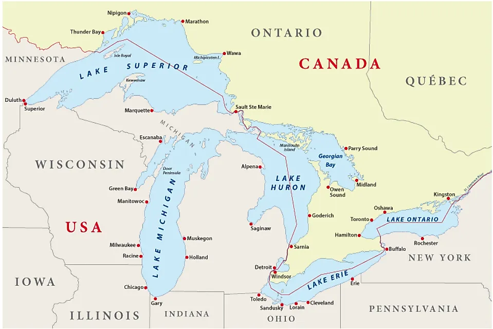
Spanning 31,700 square miles (82,103 square kilometers), Lake Superior is not only the largest of North America's five Great Lakes, but the largest freshwater lake in the world. It is also worth noting that with a maximum depth of 1,332 feet (and an average depth of 483 feet), Lake Superior is the deepest and coldest of its Great Lake peers.

All told, Superior's 2,800-mile-long shoreline lends itself to the entire northern shore of Michigan's Upper Peninsula, Wisconsin's northwestern corner, and the northern half of Minnesota's eastern boundary. Additionally, Ontario, Canada, has a significant stretch of Superior's northern shoreline — from Sault Ste. Marie (southeast) all the way over to Pigeon River Provincial Park (northwest).

Despite being shared by so many sovereign entities, Lake Superior is the least developed/urbanized of the Great Lakes — a product of its northern latitude, dense forests, and uncooperative soils (from an agricultural perspective). As a result, the final crown given to Lake Superior is that it has the purest waters and lowest air pollution of this enormous, post-Ice-Age cluster.
Special Mentions for Lake Huron and Lake Ontario

At 23,000 mi2 (59,569 km2) and 7,340 mi2 (19,010 km2), Lake Huron and Lake Ontario are, respectively, the second and fifth-largest lakes in the United States. And even though both of these Great Lakes span political boundaries, each is shared between Ontario, Canada, and a singular state — Michigan in the case of Lake Huron, and New York in the case of Lake Ontario. Since we're focused specifically on interstate lakes, we won't delve any deeper into these otherwise impressive water bodies.
Lake Michigan

Lake Michigan is shared between four states, but it is the only Great Lake that doesn't wade into Canada. With a surface area of 22,300 mi2. (57,756 km2), it is the third largest lake in the United States, but when ranked by total water volume, Lake Michigan's 1,180 cubic miles moves it up to number two.

As the name suggests, Lake Michigan borders a significant amount of its namesake state — in this case, the entire western shore of the Lower Peninsula. But its over 1,600-mile perimeter also includes all of Wisconsin's eastern shoreline, Illinois' northeastern shore (namely, the Chicago Metropolitan Area), and northwestern Indiana's partly industrialized, partly protected sand dunes waterfront.
Lake Erie

Rounding out this list's Great Lake kickoff is Lake Erie - the fourth-largest of its peers, but third-largest in terms of interstate lakes. Despite possessing a surface area of 9,910 mi2 (25,666 km2), Lake Erie's average depth is a mere 62 feet (with a maximum depth of 210 feet). This, combined with its southernmost latitude, makes it the warmest of the Great Lakes for spring and summertime swimming, but its shallow nature also leads to relatively rapid freezing in the winter.

Lake Erie's 871-mile-long shoreline favors northeastern New York and northern Ohio, but also visits a sliver of northwestern Pennsylvania and a touch of southeastern Michigan. The entirety of its north shore belongs, once again, to the province of Ontario.

If we include its broader basin, Lake Erie sustains 17 metropolitan areas with populations in excess of 50,000. Unfortunately, the corresponding industrial pollution and agricultural runoff have led to serious ecological impacts over the decades. Thankfully, in the late 1960s, American and Canadian regulatory agencies collaborated to reduce algae growth (and thus, improve water quality) by limiting phosphorus exposure.
Lake Oahe

Our first non-Great Lake entry is also the first artificial lake on this list. Lake Oahe is a long and slim reservoir (the fourth-largest in the U.S., mind you) that is the product of the Oahe Dam on the Missouri River. Its southern tip begins at South Dakota's capital city of Pierre, and climbs 231 miles to North Dakota's capital of Bismarck. In between, Lake Oahe racks up a surface area of 685 mi2 (1,774 km2) and 2,250 miles of shoreline.

Thanks to the 51 recreation areas that have set up shop along its shores, Lake Oahe is a mecca for outdoor recreation in the prairies, drawing some 1.5 million annual visitors. The expected water-based activities, such as boating, swimming, fishing, paddling, and water skiing, are all up for grabs, but campgrounds, nature trails, and healthy bird populations open the door to a wide variety of endeavors, too.
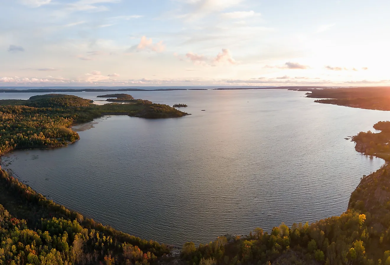
Lake Champlain

At 120 miles long, 12+ miles wide (at its widest), and with a surface area of 435 mi2 (1,127 km2), Lake Champlain has been dubbed the "Sixth Great Lake." Situated between the Adirondacks (to the west) and the Green Mountains (to the east), Lake Champlain's 587 miles of scenic shoreline is enjoyed by New Yorkers and Vermonters alike - and given that its northernmost section sneaks into the French-speaking portion of Canada, Quebecers too.

In terms of prehistoric peculiarities, Lake Champlain packs a one-two punch. For starters, remnants of the oldest known fossil reef on the planet (i.e., Chazy Fossil Reef) can be found across three of Lake Champlain's 71 islands. This alpine haven is also said to be home to a Loch Ness-esque creature affectionately known as "Champ." It could just be a case of misidentified garfish, or propagated folklore playing tricks on eager minds, but with 6.2 cubic miles of water to hide in, who can say for sure? Either way, Champ is legally protected by both the state of New York and Vermont, and continues to play a quirky part in the local culture.
Toledo Bend Reservoir

Formed from the Sabine River upon completion of the Toledo Bend Dam (1967), the Toledo Bend Reservoir has since claimed the crown of the largest lake in both Texas and Louisiana. Stretching 65 miles along the eastern extent of the Lone Star State and western border of the Bayou State, and amassing 284 mi2 (736 km2) of surface area, this man-made water body is not only a hydroelectric asset for the surrounding communities, but an attraction for anglers. Toledo Bend Reservoir's 1,200-mile shoreline is supported by Sabine National Forest, which flanks the entire west side, and is augmented by numerous marinas and campgrounds — allowing fisherfolk to cast off from the grassy shores, or launch deep into its waters. Primary catches include: largemouth bass, white bass, striped bass, crappie, and catfish.
Lake Powell

Another interstate reservoir of serious proportions is that of Lake Powell. Split between southern Utah and north-central Arizona (with a significant section bordered by the interstate Hopi Reservation), this approximately 251 mi2 (650 km2) artificial lake is a product of the Glen Canyon Dam and Colorado River (impounded in 1963). With the help of Glen Canyon National Recreation Area, Lake Powell has become an outdoor recreation juggernaut — drawing some three million annual visitors and earning the nickname, "America's Lake." Boating (i.e., powerboats, houseboats, dinner cruises — you name it!), paddling, waterskiing, and swimming are all popular aquatic activities, but given the expressive desert landscape, climbing, hiking, and monument scouting are also major draws. Don't miss Antelope Canyon, Cathedral in the Desert, Horseshoe Bend, and the namesake landmark within the Hopi Reservation's Rainbow Bridge National Monument.
Kentucky Lake

Close in tow is Kentucky Lake, measuring in at 250 square miles (647 km2) - just shy of Lake Powell's average surface area. But hey, given the desert evaporation (more on this in a moment) and notorious seepage of the previous entry, Kentucky Lake could be poised to move up in the ranks. Either way, this makes Kentucky Lake the largest man-made lake in the eastern United States.

It will come as no surprise that Kentucky is one of the states involved with this interstate reservoir. And given that Kentucky Lake spawned from the Tennessee River (on August 30th, 1944), its second neighboring state should also be quite apparent.

Land Between the Lakes National Recreation Area dominates Kentucky Lakes' northeast shoreline (as well as Lake Barkley's northwestern shore), but Tennessee also contributes the Tennessee National Wildlife Refuge across several units in the south. Collectively, both states tally countless additional state parks, county parks, municipal parks, public access areas, wildlife management areas, camping areas, etc. In other words, Kentucky Lake is a fun and well-managed waterway.
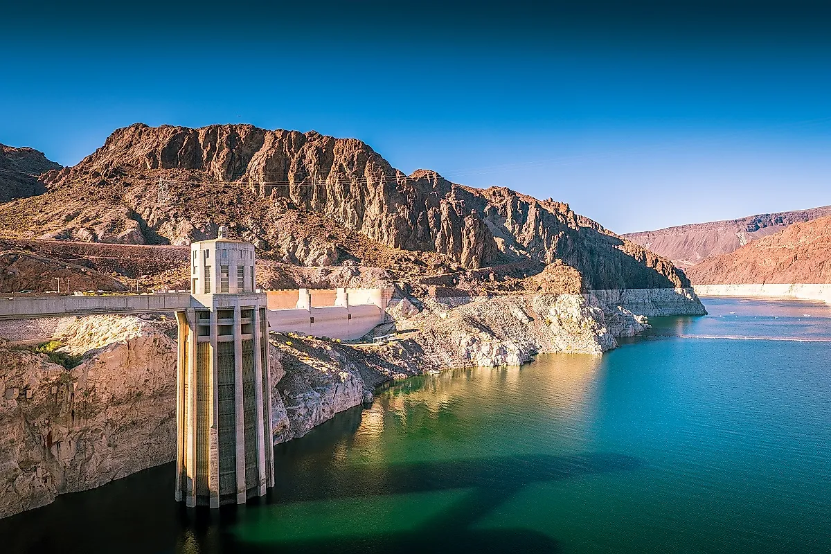
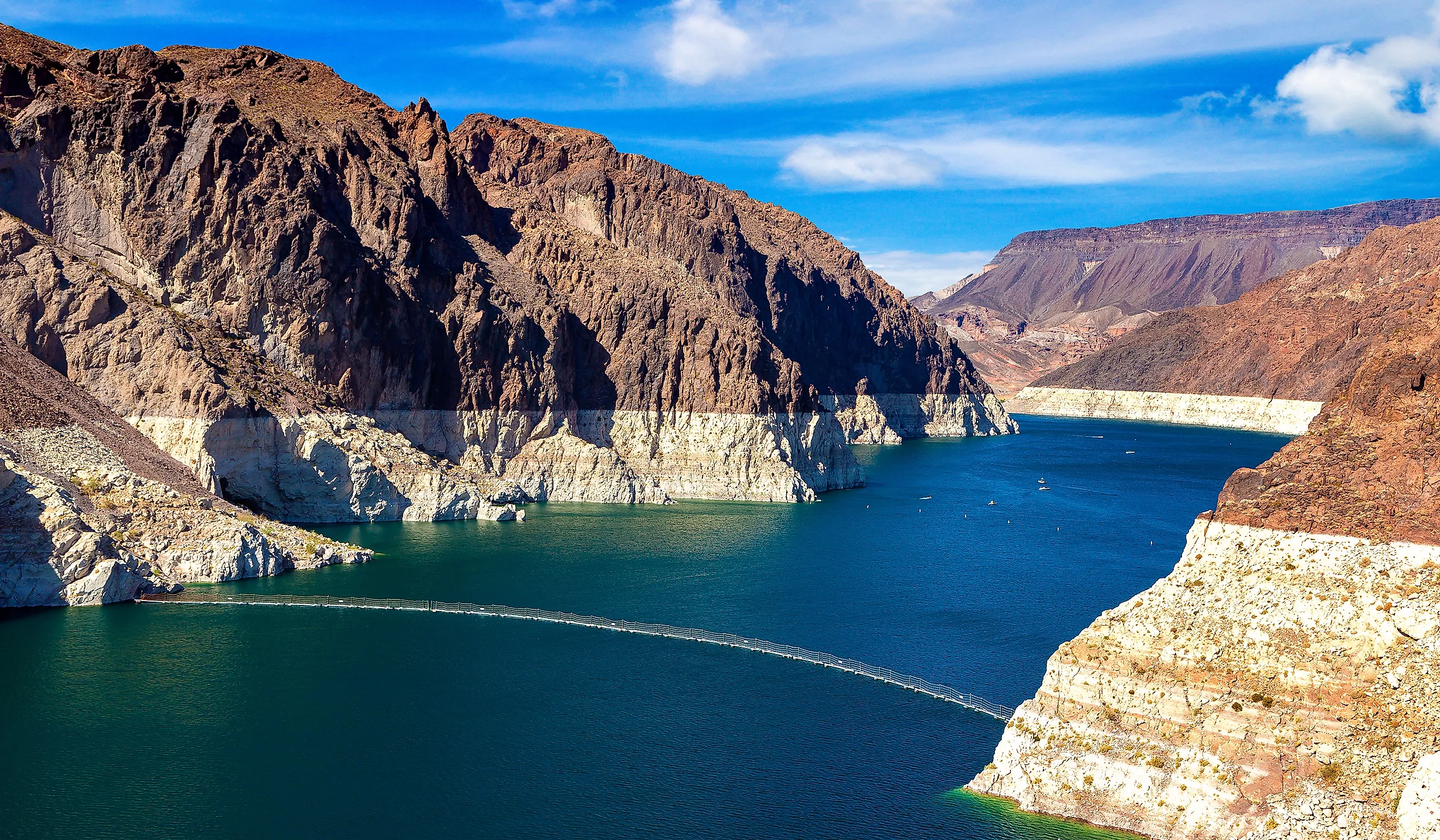
Lake Mead

The Colorado River comes back into frame for this penultimate interstate lake. Lake Mead sits in the southern apex of Nevada — immediately west of Las Vegas - and just sneaks into northwestern Arizona.
Created by the iconic Hoover Dam in the mid-1930s, the purported surface area of Lake Mead is currently 247 mi2 (640 km2), however, as of the writing of this article, rising temperatures along the Colorado River system (Lake Powell included) are creating concerns over water levels, water quality, and hydroelectric output for not just Nevada and Arizona, but the five other Western states involved in the 1922 Colorado River Compact.

Focusing on the sunnier side, the 1.5-million-acre Lake Mead National Recreation Area (i.e., the first of its kind in America) covers not only the eponymous reservoir, but Lake Mojave to the south, and the striking mountains, canyons, and valleys all around. This gives visitors a plethora of activities to indulge in beyond the lights of Sin City.
Lake Tahoe

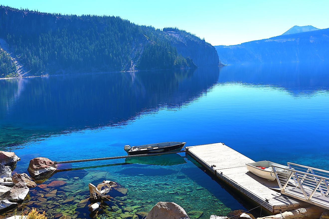
Switching from the sweltering desert to the snowy peaks of the Sierra Nevada, Lake Tahoe is the ultimate high note to end on. Though just the tenth-largest interstate lake (split between California and Nevada), at 191 square miles (495 km2), Lake Tahoe is the largest alpine lake in North America. And with a maximum depth of 1,645 feet, Lake Tahoe is the second-deepest lake in the U.S., behind Oregon's Crater Lake.

Objective accolades aside, this High Sierra beauty drives tourism long after the 15 surrounding ski resorts close for the season. Tahoe's pristine waters, pure mountain air, evergreen backdrop, and almost perpetual sunshine create an intoxicating atmosphere - one that is capitalized on by the 150+ peripheral hotels/lodges/resorts, state parks, hiking and biking trails, and scenic ring road.
Interstate Greatness
These ten interstate lakes are more than just chart-topping measurements — they supply drinking water, power homes, sustain wildlife, and provide a meeting place for neighbors to come and recreate. In some cases, these massive lakes cross between states with drastically different persuasions, and yet, base needs, inspiring scenery, and memory-making activities are shared just the same.