Maps of Tennessee
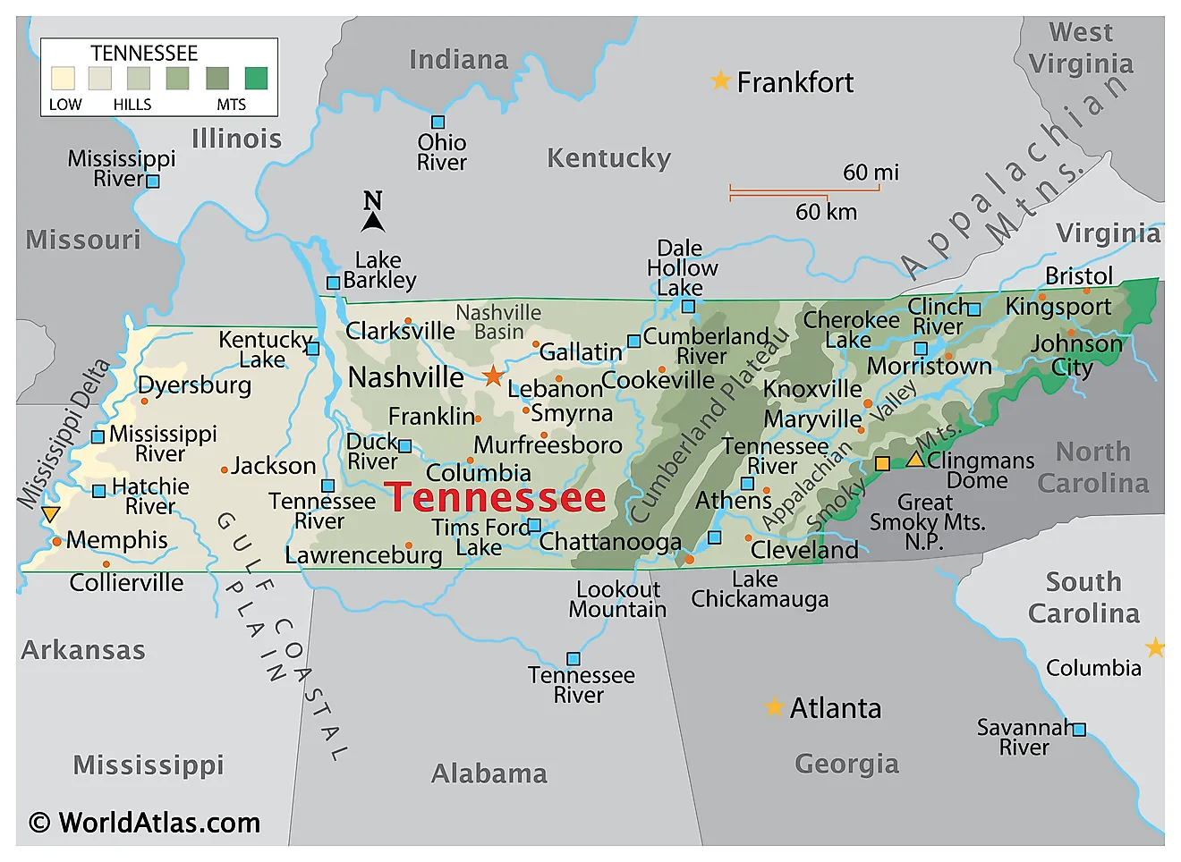
Tennessee, nicknamed the Volunteer State, is located in the southeastern United States. It shares its borders with eight states: Kentucky and Virginia to the north, North Carolina to the east, Georgia, Alabama, and Mississippi to the south, and Arkansas and Missouri to the west. The state also touches the Mississippi River along its western edge.
The state's capital, Nashville, is also its most populous, and is known globally as the heart of country music.
Tennessee attracts visitors interested in seeing the Great Smoky Mountains National Park, Graceland, the National Civil Rights Museum, Dollywood, and the Jack Daniel's Distillery.
Officially becoming the 16th state in 1796, Tennessee's history is woven with stories of the Civil War and the civil rights movement.
Size
Tennessee spans a total area of approximately 42,144 mi2 (109,153 km2), which ranks it 36th in size among the U.S. states. To put it into perspective, Tennessee is almost the same size as Virginia or Kentucky.
The state comprises about 41,235 mi2 (106,798 km2) of land and 909 mi2 (2,355 km2) of water.
Bodies of Water
Tennessee is home to numerous rivers and lakes, including over 60,000 stream miles and some 540,000 lake acres.
In Tennessee, the Mississippi River, Tennessee River, and Cumberland River are the three longest rivers. The Mississippi River, the longest in the U.S., forms Tennessee's western boundary and is a key artery for transportation and commerce. The Cumberland River, at approximately 688 miles long, flows through Nashville and is the second-longest in the state. The Tennessee River, the third longest, stretches about 652 miles.
Additionally, Kentucky Lake is Tennessee's largest lake, spanning approximately 160,000 acres. It stretches southward into the state from Kentucky, created by the damming of the Tennessee River.
Norris Lake, formed by the damming of the Clinch River, covers about 34,000 acres. It is located in the northeastern part of the state and is renowned for its clear waters and scenic beauty.
Chickamauga Lake, with an area of about 36,240 acres, lies along the Tennessee River near Chattanooga. It is known for its excellent bass fishing and hosts several national fishing tournaments.
Climate
Tennessee experiences a variety of climate regions, primarily characterized by a humid subtropical climate.
East Tennessee experiences a humid subtropical climate but tends to be slightly cooler due to the higher elevations of the Appalachian Mountains. Summers are warm and winters are relatively mild compared to more northern latitudes, but the mountain areas can receive significant snowfall. The higher elevations also result in cooler temperatures year-round and more precipitation, which helps sustain the dense forests of the Smokies.
Middle Tennessee also falls under the humid subtropical climate zone. Summers are hot and humid, with temperatures often rising into the 90s Fahrenheit (around 32°C), while winters are mild to cool. Precipitation is distributed fairly evenly throughout the year, supporting the region's agriculture. Middle Tennessee is known for having a slightly longer growing season than the eastern part of the state.
Including parts of the Mississippi Plain, West Tennessee shares the humid subtropical climate, with hot summers and mild winters, similar to Middle Tennessee. However, this region can experience more extreme weather, including heavier rain and occasional severe storms due to its proximity to the Mississippi River. Flooding can be a concern during the wetter seasons.
January temperatures average around 40°F (4.5°C), while July sees averages closer to 85°F (30°C.) The state receives about 1,270 millimeters (50 inches) of rainfall annually.
Topography
The Great Smoky Mountains to the east of the state are home to Clingmans Dome, Tennessee's highest point at 2,025 meters (6,643 feet). The lowest point is the Mississippi River, at 54 meters (178 feet) above sea level.
East Tennessee is located entirely in the Appalachian Mountains, including the Great Smoky Mountains, and is home to fertile valleys like the Tennessee Valley. The majority of Middle Tennessee lies within the Highland Rim and the Nashville Basin. West Tennessee, part of the Gulf Coastal Plain, is dominated by flat lands and fertile soils along the Mississippi River, ideal for farming.
Geology
Tennessee’s geology reflects millions of years of dynamic processes. During the Paleozoic Era (400–300 million years ago), Middle Tennessee's sedimentary rock, primarily limestone and shale, formed in deep ocean environments. The Appalachian Mountains began to rise, while the Cumberland Plateau developed as a sandstone-dominated feature.
In the Mesozoic Era, West Tennessee was submerged underwater along the Mississippi embayment, with marine fossils like mosasaurs and ammonites preserved in Cretaceous sediments. Erosion reduced the Appalachian Mountains to near-modern elevations.
By the Cenozoic Era, receding sea levels exposed land, enabling the formation of rivers like the Mississippi, Tennessee, and Cumberland. The Nashville Basin emerged as a geologic dome uplifted by a mantle plume, with erosion expanding the basin. Cenozoic deposits, primarily sands and silts, accumulated in West Tennessee.
Natural Environment
Tennessee is home to over 2,000 plant species. Forests dominate much of the state, with hardwood species such as oak, hickory, and maple prevalent in upland regions. The tulip poplar, Tennessee's state tree, thrives in the state's fertile valleys and forests. In the Appalachians, spruce and fir trees grow at higher elevations, while rhododendrons and mountain laurels add vibrant colors to the landscape. The Nashville Basin and Highland Rim feature grasslands and wildflowers, including the iconic iris, the state flower.
The state supports mammals like white-tailed deer, black bears, bobcats, and river otters. Birdlife includes species such as wild turkeys, red-tailed hawks, and migratory waterfowl. Tennessee’s rivers and lakes teem with aquatic species, including bass, catfish, and trout. Amphibians like salamanders and reptiles such as turtles and snakes thrive in the state's wetlands and forests.
The Great Smoky Mountains National Park alone hosts over 19,000 documented species, making Tennessee a biodiversity hotspot.
Natural Attractions
The state's nature can be explored through its extensive park system, including the famous Great Smoky Mountains National Park, which attracts millions of visitors annually. Other significant natural sites include the Cherokee National Forest, the Cumberland Gap, and the Natchez Trace Parkway.
Tourist Attractions
The state's major tourist attractions include Graceland, the former home of Elvis Presley; the Country Music Hall of Fame and Museum; and the historic district of Beale Street in Memphis. These sites, along with annual events such as the CMA Music Festival, draw countless visitors.
Regions
Tennessee, from west to east, is divisible into eight primary geographic regions:
Coastal Plain
This region, primarily comprising the Mississippi River Delta, stretches along the western border of Tennessee. It features a flat, fertile landscape shaped by the meandering of the Mississippi River over millennia. The Western Tennessee Plain, a sub-region, is characterized by its rich, loamy soil and agricultural suitability. Further east, the Western Tennessee Uplands rise gently, marked by low hills and dissected plateaus, offering a stark contrast to the plains.
Western Valley
The Western Valley of Tennessee, adjacent to the Coastal Plain, is defined by the meandering course of the lower Mississippi River. This area is characterized by its floodplains and natural levees, which have been shaped by the river's historic flooding and shifting courses.
Western and Eastern Highland Rim
Encircling the Central Basin, the Highland Rim is divided into western and eastern sections. The Western Highland Rim is noted for its rolling hills and fertile valleys, while the Eastern Highland Rim presents a more rugged terrain with higher elevations and steeper slopes. These rims serve as transitional zones between the flat central basin and the elevated plateaus that lie further east.
Outer and Inner Central Basin
Nestled within the Western and Eastern Highland Rims, the Central Basin consists of the Outer and Inner sections. The Outer Central Basin is distinguished by its gently undulating landscape, whereas the Inner Central Basin features a more pronounced topography with distinct hills and valleys. This area is characterized by limestone bedrock, which has influenced the region's karst topography.
Cumberland Plateau
To the east of the Highland Rims, the Cumberland Plateau rises sharply, forming a significant escarpment. This plateau is marked by rugged terrain, steep cliffs, and deep gorges. The area is known for its extensive forests and coal deposits. The highest point in Tennessee, Clingmans Dome, which stands at 6,643 feet (2,025 meters), is located in this region.
Sequatchie Valley
Within the Cumberland Plateau lies the Sequatchie Valley, a narrow and elongated valley known for its distinct linear orientation. This valley is characterized by its fertile land, which stands in contrast to the surrounding rugged plateau.
Valley and Ridge
East of the Cumberland Plateau, the Valley and Ridge region stretches across Tennessee. This area is characterized by a series of parallel ridges and valleys, formed by the folding and faulting of the earth's crust. The ridges are typically composed of resistant sandstone, while the valleys often contain softer limestone and shale.
Unaka Mountains
In the easternmost part of Tennessee, the Unaka Mountains rise as part of the greater Appalachian Mountain chain. This region is characterized by its high mountain ranges, steep slopes, and deep valleys. The terrain here is significantly more rugged and forested compared to other parts of the state.
Counties Map

The State of Tennessee is divided into 95 counties. In alphabetical order, these counties are: Anderson, Bedford, Benton, Bledsoe, Blount, Bradley, Campbell, Cannon, Carroll, Carter, Cheatham, Chester, Claiborne, Clay, Cocke, Coffee, Crockett, Cumberland, Davidson, Decatur, DeKalb, Dickson, Dyer, Fayette, Fentress, Franklin, Gibson, Giles, Grainger, Greene, Grundy, Hamblen, Hamilton, Hancock, Hardeman, Hardin, Hawkins, Haywood, Henderson, Henry, Hickman, Houston, Humphreys, Jackson, Jefferson, Johnson, Knox, Lake, Lauderdale, Lawrence, Lewis, Lincoln, Loudon, Macon, Madison, Marion, Marshall, Maury, McMinn, McNairy, Meigs, Monroe, Montgomery, Moore, Morgan, Obion, Overton, Perry, Pickett, Polk, Putnam, Rhea, Roane, Robertson, Rutherford, Scott, Sequatchie, Sevier, Shelby, Smith, Stewart, Sullivan, Sumner, Tipton, Trousdale, Unicoi, Union, Van Buren, Warren, Washington, Wayne, Weakley, White, Williamson, Wilson.
With an area of 109,247 sq. km, the State of Tennessee is the 36th largest and the 16th most populous state in the USA. Located in the center of the state, in the Cumberland River valley is Nashville – the capital, the largest and the most populous city of Tennessee. Nashville serves as an educational hub of the state and is also known for its great music industry, which has produced several highly talented musicians.
Where is Tennessee?
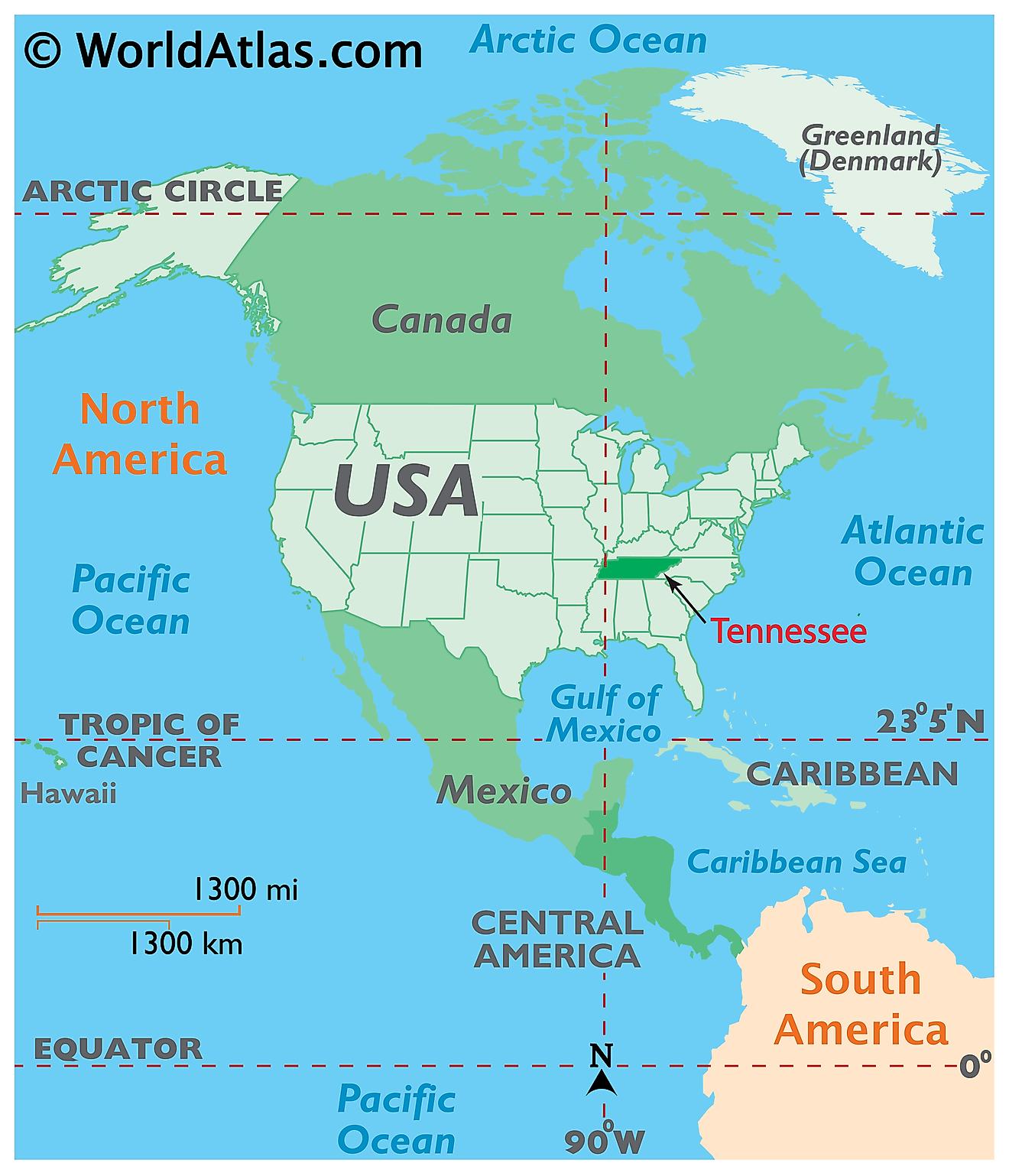
The State of Tennessee is located in the South-Eastern region of the United States. The State of Tennessee is landlocked and shares its borders with 8 different states. It is bordered by the state of Arkansas in the west, by Missouri in the northwest, by Kentucky in the north, by Virginia in the northeast, by North Carolina in the east, and by the states of Georgia, Alabama, and Mississippi in the south.
Regional Maps: Map of North America
Outline Map of Tennessee
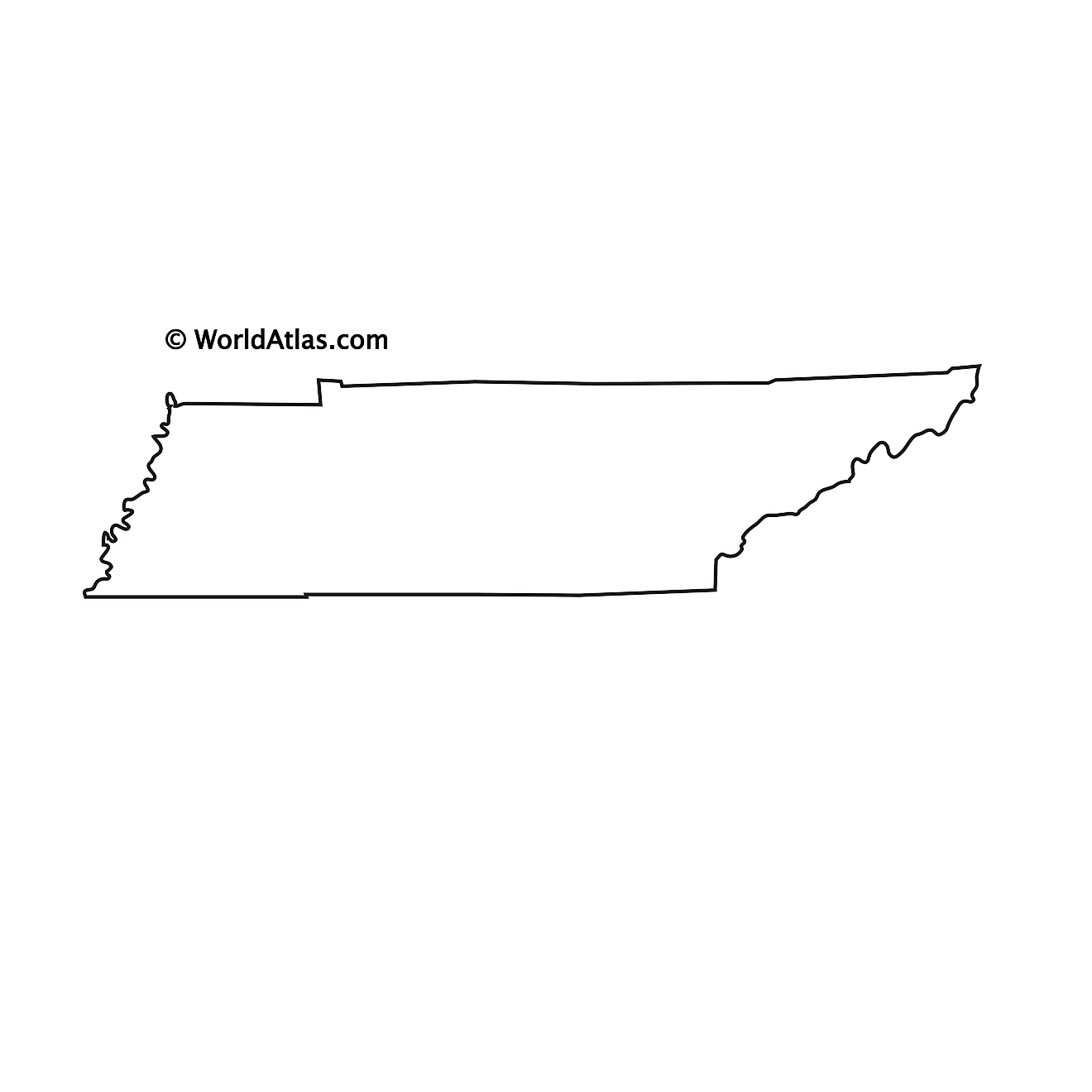
The above blank map represents the State of Tennessee, located in the South-Eastern region of the United States. The above map can be downloaded, printed and used for geography education purposes like map-pointing and coloring activities.
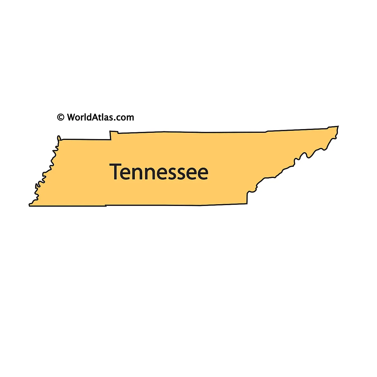
The above outline map represents the State of Tennessee, located in the South-Eastern region of the United States. Tennessee is aptly nicknamed as "The Volunteer State" as in the American Civil War, the state distinguished itself with military leadership, and by the brave, unwavering exploits of its native sons.
Key Facts
| Legal Name | State of Tennessee |
|---|---|
| ISO 3166 Code | US-TN |
| Capital City | Nashville |
| Major Cities |
|
This page was last updated on November 27, 2024


