The Largest River Deltas in North America
The largest river deltas in North America resist a single ranking, because no two are measured the same way. The Mississippi River Delta answers to two federal figures: 357 square kilometers (138 square miles) of birdfoot and more than 29,780 square kilometers (11,500 square miles) of delta plain, and both are accurate. The Copper River Delta in Alaska rose several feet above its own tideline during the 1964 earthquake, turning tidal ground into dry marsh in minutes. The Peace-Athabasca Delta sits deep inland in Alberta, never reaches the sea, and officials still disagree about where it ends. In the Mackenzie Delta, about 1,350 ice-cored pingos rise out of flat tundra. These nine deltas span three countries, and each figure below includes the measure that produced it.
Mississippi River Delta, Louisiana
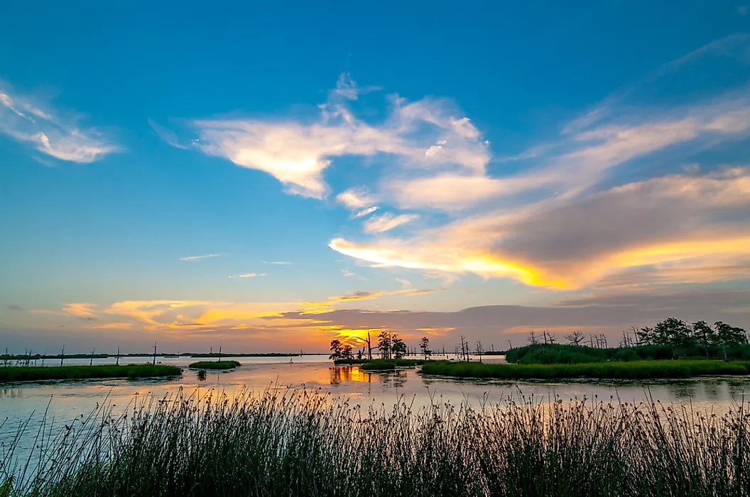
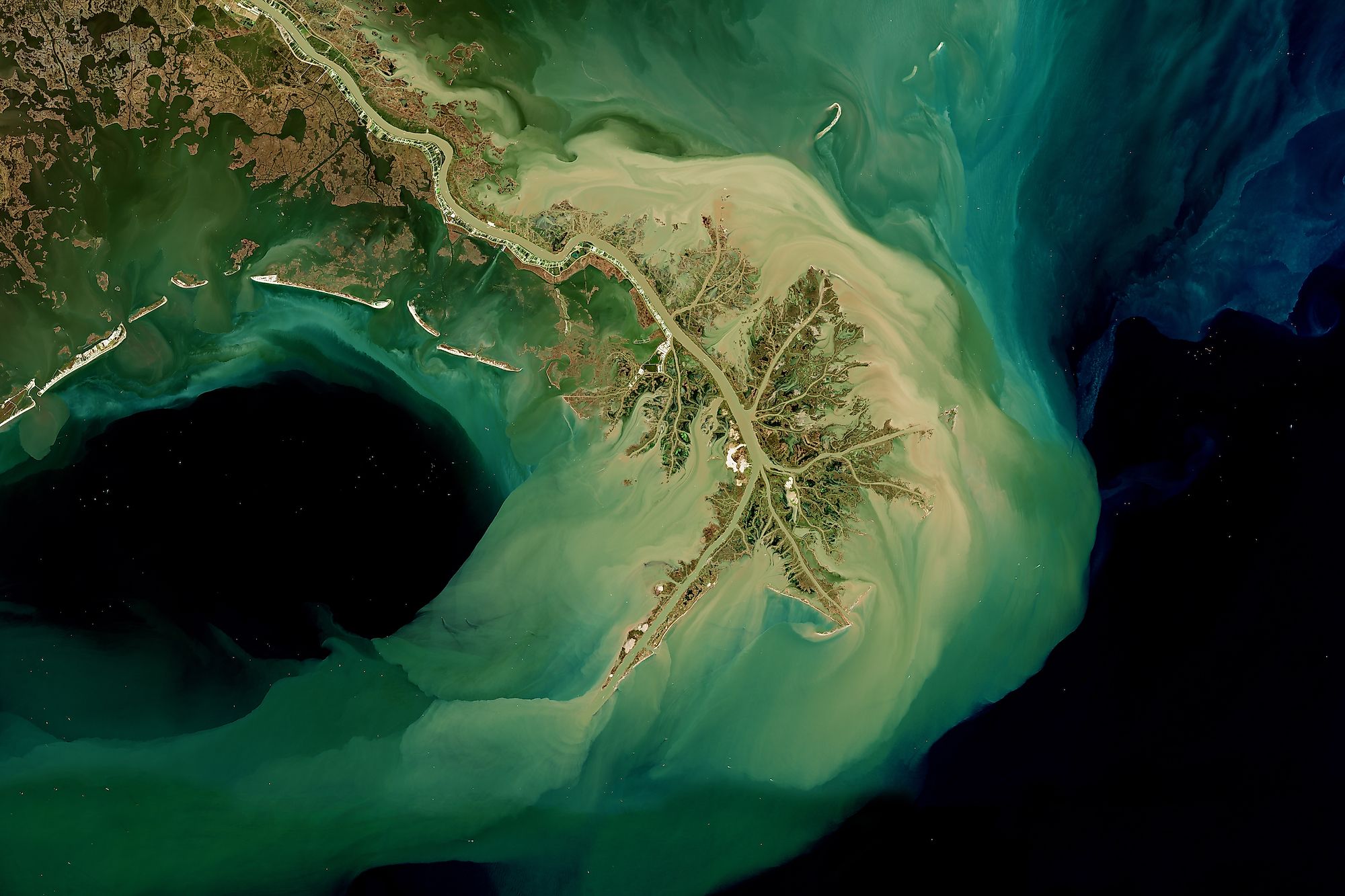
The Mississippi River Delta answers to two numbers, and both come from the same federal agency. Government geologists estimate the delta plain covers more than 29,780 square kilometers (11,500 square miles) of built-up ground. A separate federal measurement put the modern birdfoot at 357 square kilometers (138 square miles) as of 2010. Much of the confusion traces to the name.
The Mississippi Delta that most people picture is a floodplain in the northwestern corner of Mississippi. Reference geographers describe it as the old bottom of the Yazoo and Mississippi rivers, roughly 16,190 square kilometers (6,250 square miles) of black alluvial soil. That region belongs to a different state. The Louisiana coastal zone holding the real delta runs nearly 400 kilometers (250 miles), from Sabine Pass east to the Chandeleur Islands. Coastal Louisiana carries about 37% of the estuarine marsh in the lower 48 states and supports the largest commercial fishery there. Four subdeltas crowd the mouth itself, and all of them are young. West Bay, Cubit's Gap, Baptiste Collette, and Garden Island Bay each took shape between 1839 and 1891.
Atchafalaya Delta, Louisiana

The Atchafalaya takes about 30% of the combined flow of the Mississippi and the Red. Engineering sets that ratio, not the river. Left alone, the Mississippi would have abandoned its channel for the Atchafalaya, which runs a shorter route to the Gulf. The Old River Control Structure, finished in 1963, prevents the capture and keeps 70% of the water where it is.
New ground is forming on the 30% that the structure lets through. Sediment coming down the Atchafalaya builds land at two separate mouths. One is the river's own. The other is the Wax Lake Outlet, an artificial cut the Army Corps of Engineers dredged in the early 1940s to pull floodwater away from Morgan City. Wax Lake built its delta underwater, invisible from the surface for three decades. Flooding in 1973, driven by a cold winter and a wet spring, pushed enough extra sediment through the cut to break the surface. Reeds and willows moved in behind it, and their roots hold the new ground together.
Mobile-Tensaw Delta, Alabama

The Alabama and the Tombigbee join at the head of this delta. The combined water runs south into Mobile Bay through a tangle of tidal rivers, creeks, lakes, and bayous. Federal records refer to it as the Mobile-Tensaw River Bottomlands. Under that title, the Secretary of the Interior signed it onto the National Natural Landmark register on May 30, 1974. Published areas for it disagree by well over 40,000 hectares (100,000 acres), and even the length and the width vary between sources. More than 80,000 hectares (200,000 acres) is the figure every published version supports. State and federal descriptions agree on one comparison: only the Mississippi outranks this delta among river deltas in the contiguous United States.
Alabama land managers route the Bartram Canoe Trail through the middle of it, six day-use paddling routes and six overnight routes threaded among the sloughs. Two overnight campsites are on dry ground. The other four are floating platforms called chickees, which are the practical answer for camping in areas with very little dry land.
Grijalva-Usumacinta Delta, Mexico

The Grijalva meets the Usumacinta at a place called Tres Brazos, three arms, in the municipality of Centla in Tabasco. The area covered by the two rivers below that junction covers 302,706 hectares (close to 1,170 square miles), or 12.27% of the entire state. Mexico protects the wetland as the Reserva de la Biosfera Pantanos de Centla, which was added to the Ramsar list of internationally important wetlands on June 22, 1995.
International records describe a barrier plain of beaches along the coast and, behind it, the floodplain formed by the two river mouths. The boundary encloses 110 permanent and seasonal freshwater bodies. Surveys there have identified 569 plant species, with water-loving communities covering more than a third of the swamp. That reserve boundary is not the only one in use. An ecoregion carrying the same name covers about 17,090 square kilometers (6,600 square miles). Hydrologists rank the site among the most significant of its kind in Mesoamerica, crediting it with an influence that reaches from southern Mexico into northern Guatemala.
Fraser River Delta, British Columbia

Roberts Bank and Sturgeon Bank still draw sediment straight from the Fraser. The flats at Boundary Bay and Mud Bay do not, and the scientific literature calls them abandoned. Geologists sort this delta into four working parts: the river channels, the plain, the tidal flats, and the slope that drops away offshore. Canadian survey work puts the delta at nearly 1,010 square kilometers (390 square miles) above low-tide level. That last phrase is doing real work. Almost no other delta arrives with its measuring line stated so plainly, and the number means little without it.
The whole complex has been building into the Strait of Georgia throughout the Holocene, and it now carries Burns Bog, the South Arm Marshes, and both named banks. Federal fisheries managers make the stakes concrete. Every wild salmon born anywhere in the Fraser network passes through this estuary, and each one spends days or months here before going to sea.
Copper River Delta, Alaska

The Copper River Delta rose clear of its own tideline in a matter of minutes. The 1964 Alaska earthquake lifted the whole thing several feet above its former level. Ground that had been below the tides became intertidal. Ground that had been intertidal ended up above them altogether. Marshland advanced seaward by as much as 1.6 kilometers (one mile). The 1964 event was only the most recent. Forest Service researchers who mapped the aftermath counted at least five such uplifts. Each one shifted where the marsh plants grew.
The delta spans more than 72 kilometers (45 miles) of south-central shoreline, with wetlands extending as far as 48 kilometers (30 miles) inland. Glacial outwash off some of the most heavily ice-covered country on the continent ends here. Every major river feeding the delta carries a heavy load of suspended sediment. Federal managers call it the most important stopover for migrating shorebirds in the western hemisphere.
Yukon-Kuskokwim Delta, Alaska

Alaska's two largest rivers built this delta together, and the ground they made is younger than the story beneath it. Federal wildlife managers describe a generally flat marshland of innumerable lakes and ponds where tundra reaches the Bering Sea. The region was once part of Beringia, the land bridge that joined the continent to Asia. People have lived here for thousands of years.
The delta is the landscape. Yukon Delta National Wildlife Refuge is the designation laid across it, and the two are not the same measurement. The refuge encompasses uplands, mountains, and Nunivak Island, so its acreage extends far beyond the river mouths. Federal protection accumulated in pieces over seven decades. President Theodore Roosevelt withdrew the first lands in 1909 as a breeding ground for birds. Nunivak followed in 1929, more ground came in 1937, and a wildlife range arrived in 1960. President Jimmy Carter signed the Alaska National Interest Lands Conservation Act on December 2, 1980, consolidating all of it into a single refuge.
Peace-Athabasca Delta, Alberta
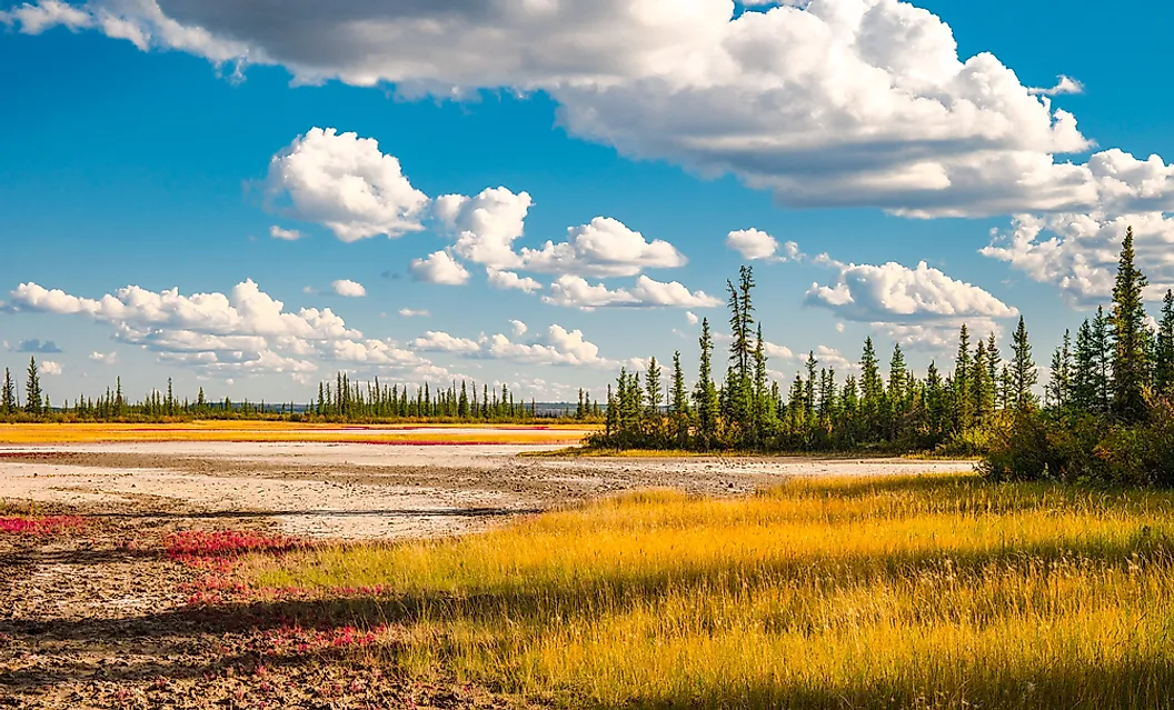
The Peace-Athabasca Delta lies deep inland and never reaches the sea, and the most honest published statement about it concerns where it stops. An international assessment of the surrounding park states plainly that what exactly constitutes this delta is not agreed upon. The same passage notes the general consensus that roughly 80% of it lies within the park boundary.
Three rivers make it. The Peace, the Athabasca, and the Birch arrive at the western end of Lake Athabasca. Their combined load builds a maze of channels, shallow lakes, marshes, and grassland. Canadian park managers give a figure of 3,900 square kilometers (1,506 square miles). The wetland recognized under the Ramsar Convention in 1982 again covers a smaller footprint, drawn to a different boundary for a different purpose.
Officials cannot settle on a superlative either, which is its own kind of evidence. One international listing calls it the world's largest inland delta. The wetland citation prefers the largest boreal delta in the world. The park's own literature hedges to one of the largest inland freshwater deltas anywhere. Wood Buffalo National Park, which contains most of it, is the only Canadian national park to contain two Ramsar wetlands.
Mackenzie River Delta, Northwest Territories
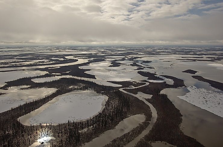
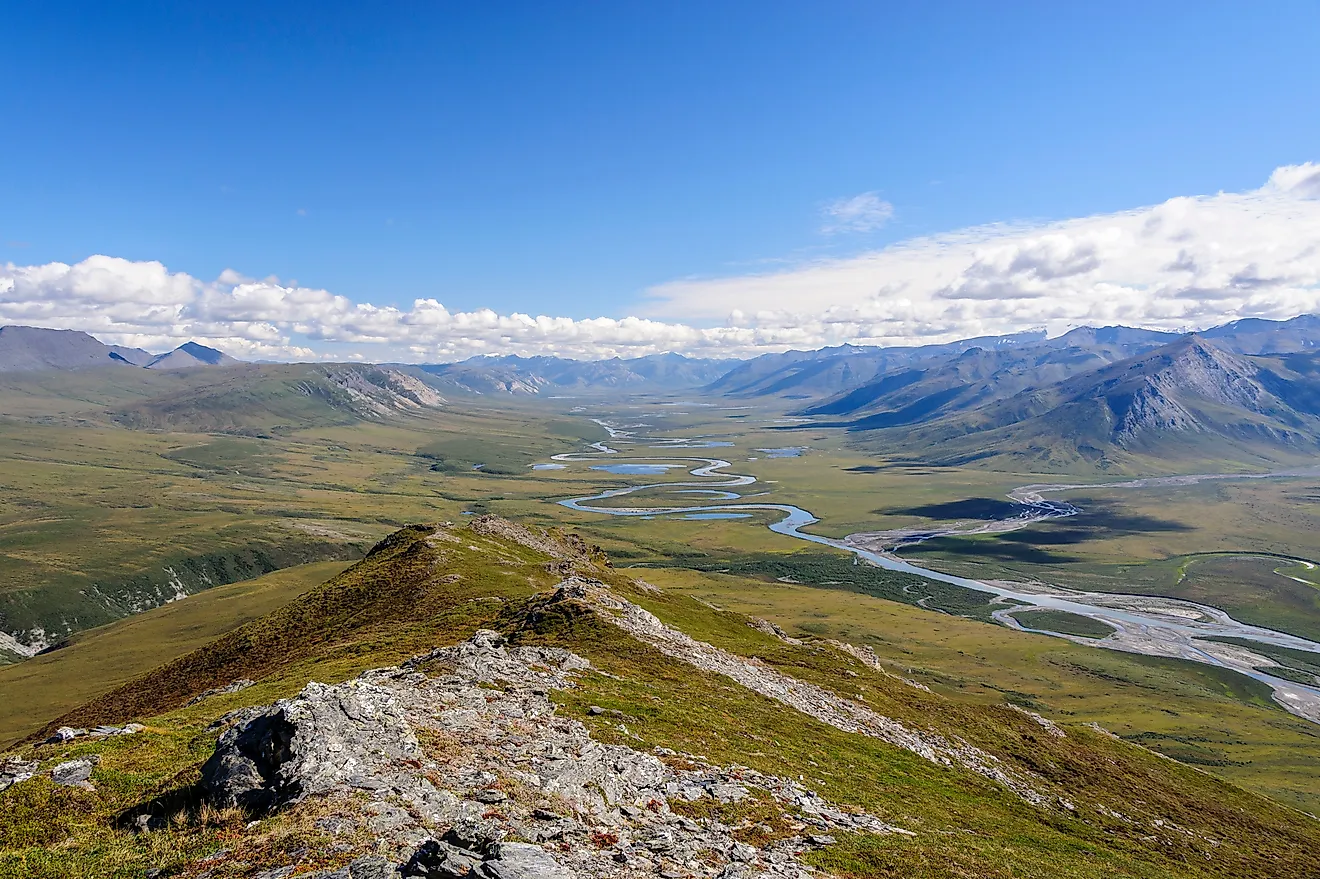
Point Separation marks where the Mackenzie River Delta opens. From there, the delta fans across roughly 12,170 square kilometers (4,700 square miles), a maze of branching channels, cutoff lakes, and circular ponds. The Richardson Mountains wall it to the west and the Caribou Hills to the east. Below Fort McPherson, the river divides into several major channels and hundreds of smaller ones. The Peel River joins the system inside the delta rather than above it. Almost all of this ground is permafrost, and pingos rise out of the flat tundra, ice-cored hills pushed up through the frozen soil. About 1,350 of them dot the region. Eight, including Ibyuk Pingo at 49 meters (161 feet) tall and 300 meters (984 feet) across its base, belong to the Pingo Canadian Landmark near Tuktoyaktuk.
The water arriving here has already built a delta once. The Peace and the Athabasca feed the Slave, the Slave empties into Great Slave Lake, and the Mackenzie carries the outflow north to the Beaufort Sea. Inuvialuit travelers have relied on pingos as navigational aids for centuries, using them as high ground to spot caribou inland or whales offshore.
Where North America's Deltas End
No single ranking encompasses the largest river deltas in North America because a birdfoot and a delta plain denote different features, as do a biosphere reserve and an ecoregion. The Mississippi's two federal figures, the Mobile-Tensaw's disputed acreage, and the Peace-Athabasca's unsettled edge suggest that a delta's size is a boundary somebody drew for a purpose. That purpose might have been mapping sediment or protecting habitat, so the measure listed beside each number is the figure to read, and the rivers keep building regardless.