The US Aquifers Being Drained Fastest
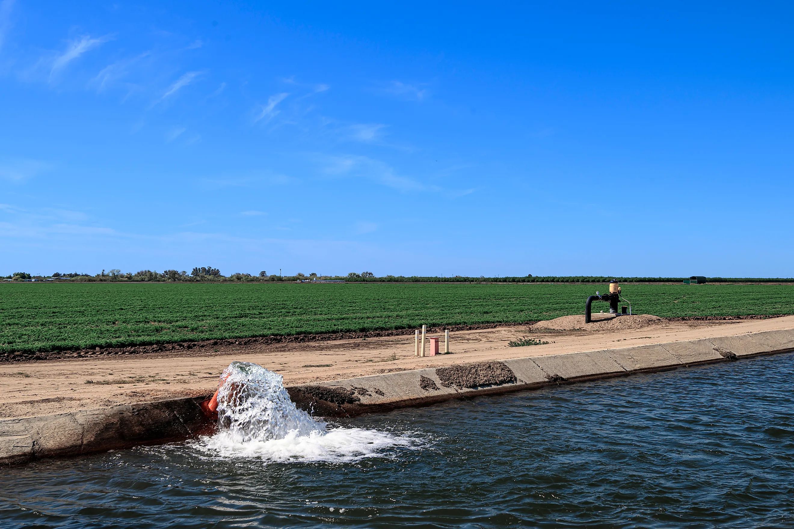
Much of the water that grows America’s food comes from underground. An aquifer is a layer of sand, gravel, or porous rock that holds water in its gaps, something like a buried sponge. Farms pump from it when rivers and rain fall short. When pumping outpaces the rain and snowmelt that refill it, the water table drops. Wells go dry or have to be drilled deeper. In some places the ground above sinks as the emptied layers compress, and canals and roads sink with it.
That is already happening in California, where part of a major irrigation canal had to be rebuilt after the land beneath it settled. In one Arizona farming valley, a marked utility pole shows how far the ground has dropped in a single lifetime. On the Great Plains, a well can still hold water and yet fail to keep up with a hot summer. The aquifers losing water fastest are not all in the desert, either. One of them lies under rice fields in rainy Arkansas, and a few farm districts there and in Kansas have found ways to slow the loss.
Central Valley Aquifer System, California

The Friant-Kern Canal carries irrigation water along the eastern side of the San Joaquin Valley. Beneath it, heavy groundwater pumping has compacted buried sediments and lowered sections of the canal. A critical 10-mile stretch lost more than half its original carrying capacity before a reconstruction project completed in 2024.
During the 2019 to 2021 drought period, the wider Central Valley lost groundwater at an estimated 8.6 cubic kilometers annually, about 2.3 trillion gallons a year. Farmers turn more heavily to wells when deliveries of river and reservoir water shrink. Orchards keep needing irrigation through those shortages, increasing pressure on the underground supply.
Wetter years have provided some relief: California reported statewide groundwater storage gains in 2023 through 2025. Recovery of water levels, however, cannot necessarily reverse the compression of clay layers. In the San Joaquin Valley, pumping has permanently reduced some of the underground space available to hold water.
Cuyama Valley Aquifer, California

Cuyama Valley has no imported water supply to replace declining groundwater. Wells provide water for farms and households around New Cuyama in this basin between the Caliente Range and the Sierra Madre Mountains. By 2013, parts of the valley had recorded long-term water-level declines of 1 to 7 feet annually. The valley lost an estimated average of 20,400 acre-feet of stored groundwater annually during water years 1998 through 2023. Storage decreased in 23 of those 26 years, although the wet year of 2023 brought a small gain. Faults and differences in the buried sediments affect how water moves between parts of the valley. Pumping and recharge affect these groundwater compartments differently; replenishment in one area does not necessarily restore supplies beneath another.
Ranegras Plain Aquifer System, Arizona

The Central Arizona Project aqueduct crosses the Ranegras Plain, about 100 miles west of Phoenix, while farms below it draw heavily on groundwater. Around the small communities of Bouse and Vicksburg, water occupies sediments deposited between desert mountain ranges. Bouse Wash drains the valley toward the northwest and flows intermittently after rain.
By 2025, six monitoring wells showed groundwater declines exceeding 200 feet over roughly 40 years. Arizona's water department estimated about 42,000 acre-feet of annual outflow against only about 4,500 acre-feet entering the aquifer system. Even leakage from the aqueduct, counted among those inflows, leaves a large shortfall. Agricultural pumping accounts for most of the demand. Falling groundwater has also caused the land to sink, threatening wells and infrastructure. In January 2026, Arizona ordered the basin's designation as an Active Management Area, bringing groundwater-use reporting requirements for most large wells and limits on new irrigated acreage.
Gila Bend Basin Aquifer, Arizona

Farther southeast, the Gila Bend basin receives irrigation water through canals supplied at Gillespie Dam. The Gila River carries treated wastewater from the Phoenix area and occasional releases from upstream dams. Agriculture accounts for most of the basin's water demand. Some irrigation water replenishes the aquifer as it soaks below the fields.
Despite these inflows, water levels across monitored wells fell an average of about 77 feet between water years 2000 and 2020. That amounts to nearly 3.9 feet annually. Beneath the town of Gila Bend, the basin's sediment fill extends thousands of feet down. The town itself lies within an area of measured land subsidence.
Willcox Basin Aquifer, Arizona

At Old Fort Grant Road and Ranch House Road in the Willcox basin, a marked utility pole records 9.7 feet of land subsidence between 1969 and 2018. Pumping has compressed the sediments below this southeastern Arizona farming area, where wells supply irrigation and homes.
Water levels in monitored wells fell an average of about 56 feet between water years 2000 and 2020, roughly 2.8 feet annually. The basin's water budget helps explain the continued pressure. Arizona estimates about 247,000 acre-feet leaving the aquifer annually, including pumping and natural losses, against about 70,000 acre-feet of recharge. That incoming water already includes irrigation water seeping back into the ground.
Dry wells have been documented in the basin. Arizona ordered the creation of the Willcox Active Management Area in December 2024; the designation took effect in January 2025.
High Plains Aquifer, Central And Southern Great Plains

An irrigation well can become inadequate while water remains beneath the field. As the saturated layer thins, the well may deliver too little during peak summer demand. This is a growing constraint across the High Plains, where the Ogallala Formation forms the largest part of the regional aquifer. Depletion is especially severe in its central and southern portions. Recharge generally arrives more slowly there than in the northern High Plains.
Southwest Kansas illustrates that long decline. Its groundwater management district averaged a loss of 1.66 feet annually between 1996 and 2025. Even during the wetter conditions of 2025, when Kansas recorded an overall groundwater increase across its High Plains regions, the southwest district lost another 0.62 feet. Across parts of western Kansas, the water-saturated thickness has fallen to less than 30 feet in areas that once supported extensive flood irrigation.
Mississippi Embayment Aquifer System, Especially The Alluvial Aquifer

Rice farming on Arkansas's Grand Prairie relies heavily on water pumped from the Mississippi River Valley alluvial aquifer. Rain falls across this agricultural lowland, yet clay-rich layers near the surface can slow its passage into the aquifer. The broader Mississippi Embayment aquifer system lost an estimated 8 cubic kilometers of stored groundwater annually during 2001 through 2008, about 2.1 trillion gallons a year. Much of the region's depletion occurs in the shallow alluvial aquifer used for irrigation. Long-term records in parts of northeastern Arkansas have shown water-level losses averaging about a foot annually.
Groundwater depressions caused by pumping persisted into spring 2024. Around these low spots, groundwater moves inward toward the depleted areas. On the Grand Prairie, farmers have built reservoirs to store winter and spring rainfall for summer irrigation. Recovery ditches also collect water running off fields so it can be pumped back into storage and used again, reducing demand on wells.
In northwestern Kansas, farmers in the Sheridan-6 conservation area have already slowed the loss beneath their fields. The local pumping-reduction plan took effect in 2013 across 99 square miles of Sheridan and Thomas counties. Average annual water-level declines measured 0.5 feet during 2013 through 2022, compared with 2 feet during 2002 through 2012. Rainfall also affects the pace of groundwater change in Sheridan-6. The Sheridan-6 plan began with local water-right holders agreeing to reduce use by 20%, with state oversight to enforce the limits. In California's San Joaquin Valley, permanently compressed sediments create an additional problem: restoring groundwater levels cannot reopen all the pore space already lost beneath the farms.