Fraser River
The Fraser River is the longest river flowing entirely within British Columbia and Canada’s 11th longest river, extending 1,375 km from the Canadian Rockies to the Strait of Georgia. The river, also known as the Salmon River, contains millions of salmons, which swim into the ocean and back to the river to spawn. The Fraser was named after explorer Simon Fraser who led the 1808 North West Company expedition from Prince George to the river’s mouth. It was an important food source and transportation route for the indigenous people before the Europeans arrived. The Fraser River caused a devastating flood in Vancouver in 1948, killing ten people and cutting off the city almost completely from the rest of the country.

At 1,375 km the Fraser River is the 4th longest river in British Columbia and the longest river flowing entirely within the province. It originates in the Canadian Rockies at the Fraser Pass in the Mount Robson Provincial Park and empties into the Strait of Georgia south of Vancouver. The river drains a huge scenic region of about 220,000 square kilometers, of which 70% is located over 900 meters above sea level. The Fraser discharges 112 cubic kilometers of water annually at its mouth or an average of 3,550 cubic meters per second. The river has numerous tributaries, of which most originate from the mountain lakes. The tributaries include the Thompson, Bowron, Quesnel, Willow, Morkill, Bridge, and Harrison Rivers.
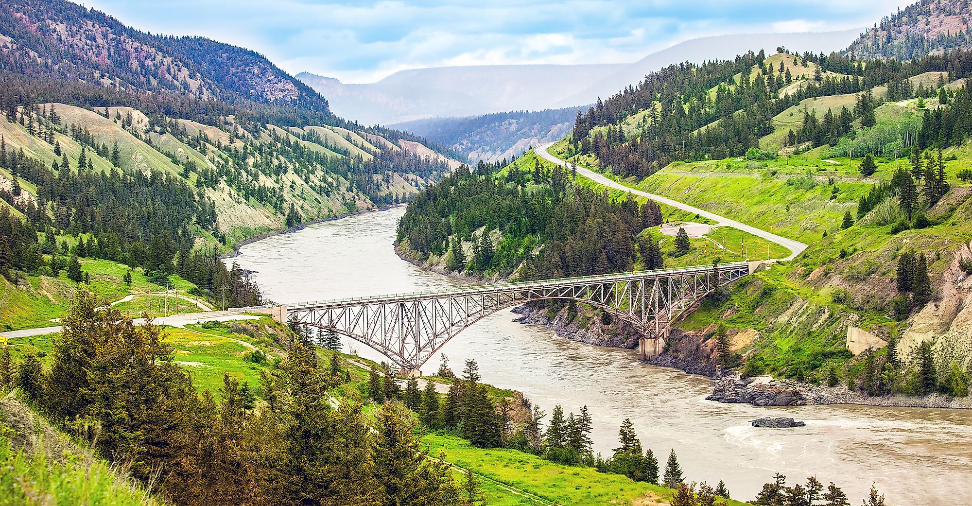
Course

The Fraser River begins at the Fraser Pass in the British Columbia’s Rockies, located some 2,145 meters above sea level. The river flows north from the mountain source to the Yellowhead Highway and receives the Yellowhead Creek, which originates from the Yellowhead Lake (also located in Mount Robson Provincial Park). It turns west to the Robson Valley and Rocky Mountain Trench, then northwestwards past Latitude 54 degrees north. At Giscome Portage, the Fraser Rivers turn southwards and receives the Nechako River at Prince George. Then it continues its southward journey through the Fraser Plateau, forming the Fraser Canyon at its confluence with the Chilcotin River in William Lake. The Seton and Bridge Rivers join Fraser at Lillooet, and the Thomson River joins at Lytton. From Lytton, the river flows between the Cascade and Lilloote to Yale. At Hope, the Fraser turns west, then southwest, where it splits into North and South Arms and forms a delta as it drains into the Strait of Georgia.
Brief History
In June 1792, Spanish explorers Cayetano Valdes and Dionisio Galiano became the first Europeans to discover and enter the river’s North Arm. Two years later, Sir Alexander Mackenzie explored Fraser’s upper reaches and confirmed that Fraser was not linked to the Columbia River. George Simpson explored the river in 1828 during his visit to Fort Langley to determine the fort’s suitability as a Pacific depot for the Hudson Bay Company. In the 1860s, the Fraser River basin was the site for the Cariboo gold rush. The river was designated as one of the Canadian Heritage Rivers in 1998.
Economic Significance

The Fraser River is one of the most important rivers in BC because it supports several economic activities in the province. The coniferous forest cover supports forest in the river basin, with the pulp mills using the water from the river to process timber and other products. The river banks are also fertile farmlands that support a variety of crops. The Fraser is also a popular fishing ground for Pacific salmon, white sturgeons, and steelhead trout. It holds Canada’s largest sturgeon population and is the world’s largest sockeye salmon producer.


