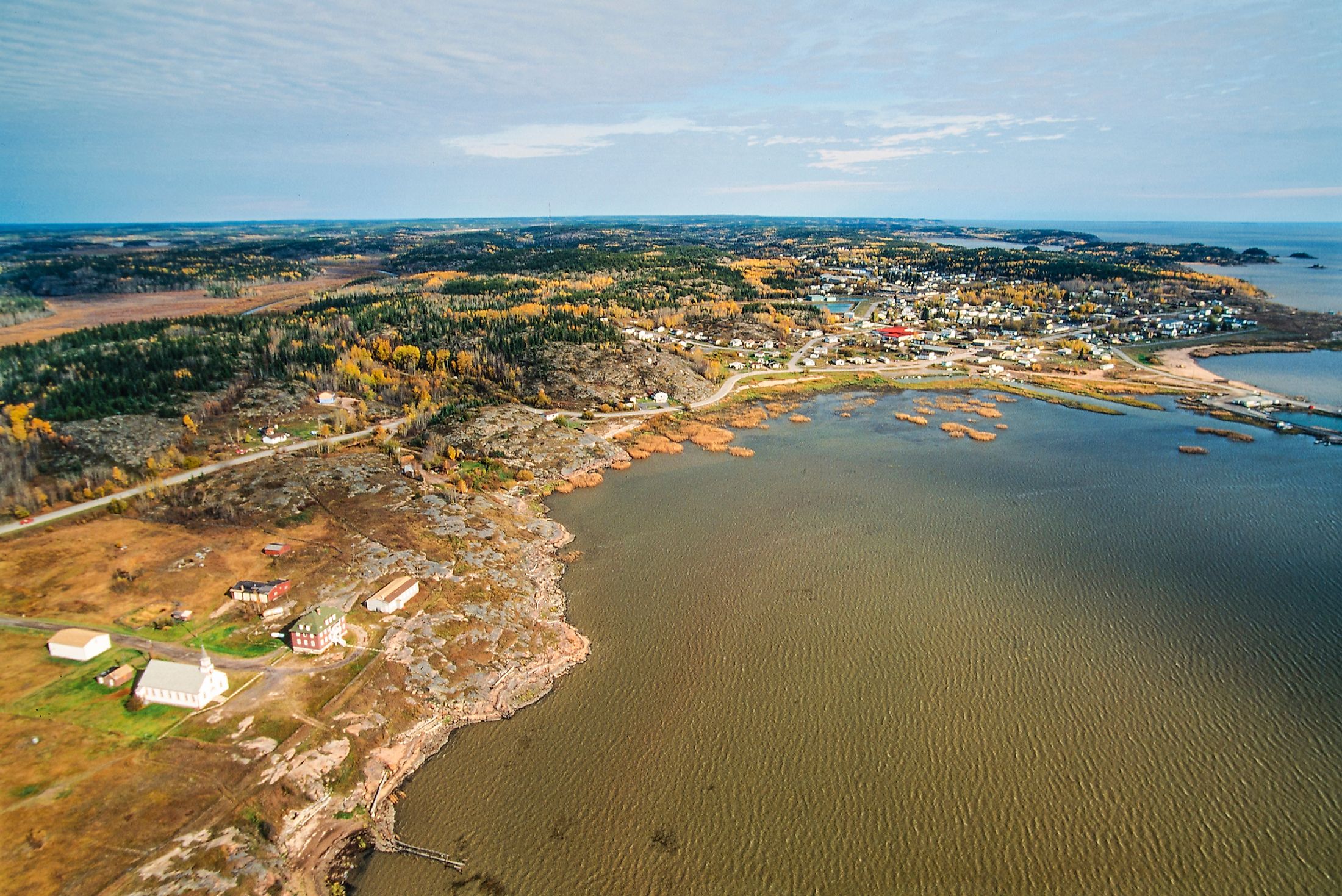
Lake Athabasca
Lake Athabasca is a glacial lake in Canada straddling the Saskatchewan-Alberta border, just south of the Northwest Territories. The lake, occupying approximately 7,935 square kilometers, is the 4th largest lake located entirely in Canada. About 74% of the lake’s surface area lies within Saskatchewan, while the rest of the surface area is within the Alberta territory. In Saskatchewan, the lake is located within Division No. 18 in Northern Saskatchewan Administration District. Uranium City occupies the lake’s northern shore near the Northwest Territories. In Alberta, Lake Athabasca is part of the Regional Municipality of Wood Buffalo. Fort Chipewyan is one of Alberta’s oldest European settlements located on Lake Athabasca’s western tip.
Lake Athabasca is fed by several rivers, including Peace and Athabasca Rivers. However, its primary outflow is the Slave River, which empties into the Arctic Ocean. The name “Athabasca” is a Cree Indian term for “where there are reeds.”
Geography Of Lake Athabasca

With a surface area of approximately 7,935 square kilometers, Lake Athabasca is Canada’s 8th largest lake and the 4th largest lake located entirely in the country. However, Athabasca is the deepest and the largest lake in Saskatchewan and Alberta. The lake, 283 kilometers long and 50 kilometers wide, has a maximum depth of 124 meters and a volume of 204 cubic meters. The side of the lake in the Alberta territory is much shallower, reaching a maximum depth of 16 meters. It is located at an elevation of 213 meters above sea level and has a shoreline of about 1,900 kilometers. Lake Athabasca drains an area of approximately 271,000 square kilometers.
The lake’s north shore is rugged and lined with crystalline Archean rocks, while the southern shore comprises dunes and pristine beaches. The dunes around and near the lake were designated as Provincial Wilderness Park in 1992. The lake’s eastern section, reaching a width of 1 kilometer near the Fond du Lac community. The streams and rivers feeding into Lake Athabasca include Fond du Lac River, Peace River, Archibald River, Athabasca River, William River, Dumville, Helmer, Jackfish, and Claussen Creeks, among others. The lake’s primary outflow is Riviere des Rochers, which joins the Peace River to form the Slave River.
History Of Lake Athabasca
Lake Athabasca is one of the remnants of the vast Lake McConnell. Other lakes that formed the enormous proglacial lake include Great Slave Lake and the Great Bear Lake. Samuel Hearne, an English explorer, was the first European to discover the lake in 1771 and named it the Lake of the Hills. The name “Athabasca” was adopted seven years later (in 1778) when the North West Company built Fort Chipewyan on the western shore.
The goldfields around the lake resulted in the development of most settlements on the northern shore in the 1930s and 1940s, including Goldfield and Eldorado. Uranium City developed in the 1950s on the north shore following uranium discovery in the area. Although the last mine closed down in 1980, the effects of mining activities on the north shore are still felt today.


