5-Letter Countries
Twenty-four sovereign countries have names spelled with exactly five letters in English. The list is geographically scattered: eight in Africa (Benin, Egypt, Gabon, Ghana, Kenya, Libya, Niger, Sudan), seven in Asia and the Middle East (China, India, Japan, Nepal, Qatar, Syria, Yemen), four in the Pacific (Nauru, Palau, Samoa, Tonga), three in Europe (Italy, Malta, Spain), and two in the Americas (Chile, Haiti). Their names come from a similarly wide range of sources: Phoenician traders, Quechua and Mapuche speakers, the Qin dynasty, a Berber tribe, a sacred Hindu sage, a hooded Portuguese cloak, and a 1957 reach back into the medieval Sahel. What follows is a short profile of each, alphabetical, with the etymology of each name.
Benin
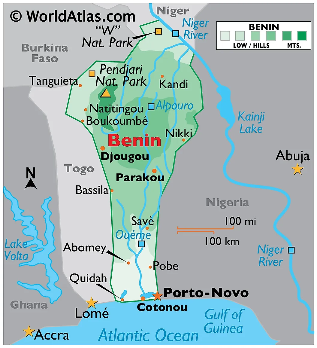
The name is borrowed, twice. It comes from the Bight of Benin, the West African bay, which itself was named by European traders after the Kingdom of Benin, an old and powerful state located not in modern Benin but in what is now southern Nigeria. The country adopted the name in 1975, replacing the colonial-era "Dahomey." Roughly 14 million people live in Benin today. The official capital is Porto-Novo on the southern coast; the larger city and economic center is Cotonou. Benin is the historical homeland of the Vodun religion, which traveled with the transatlantic slave trade to the Caribbean.
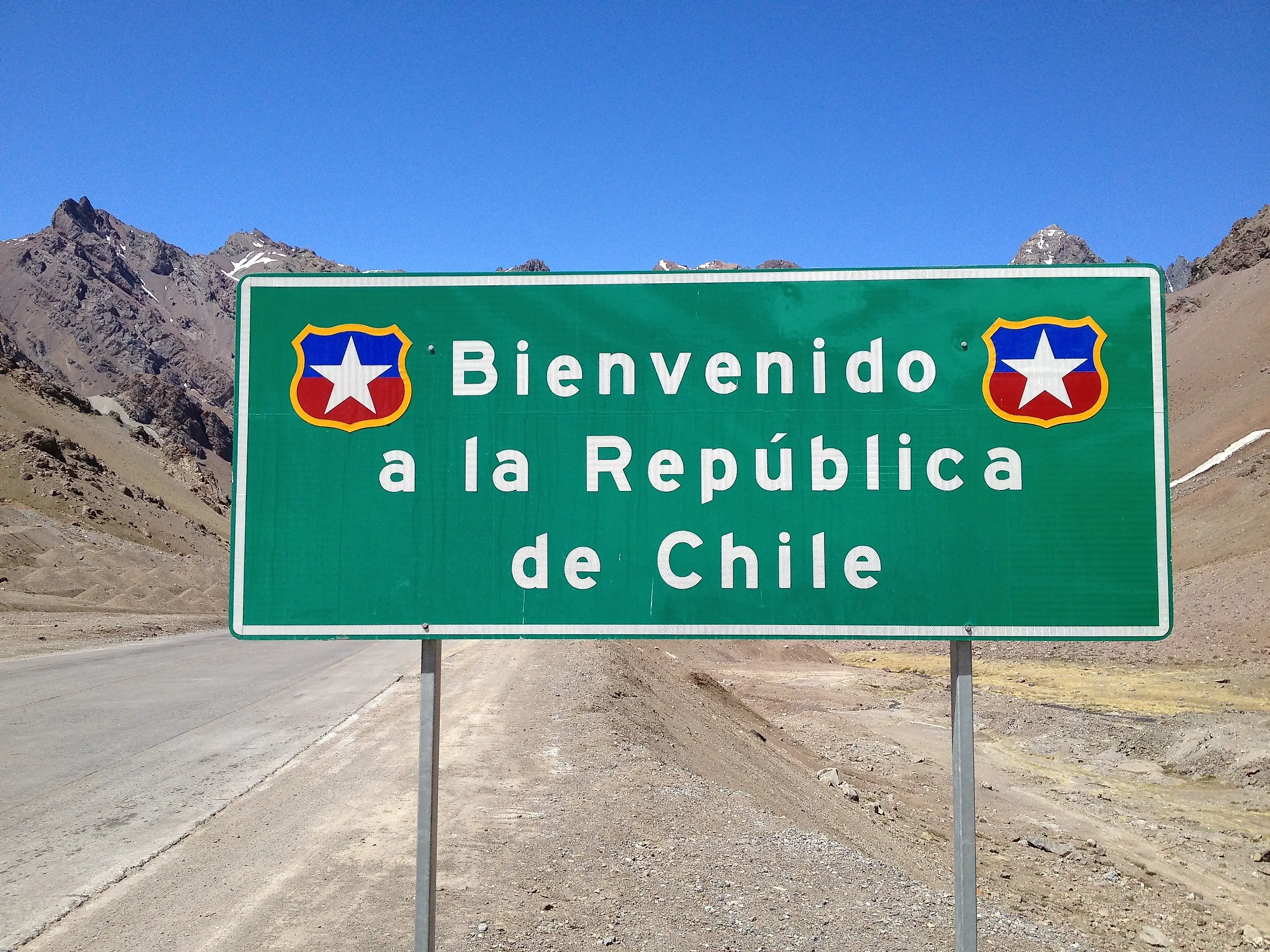
Chile
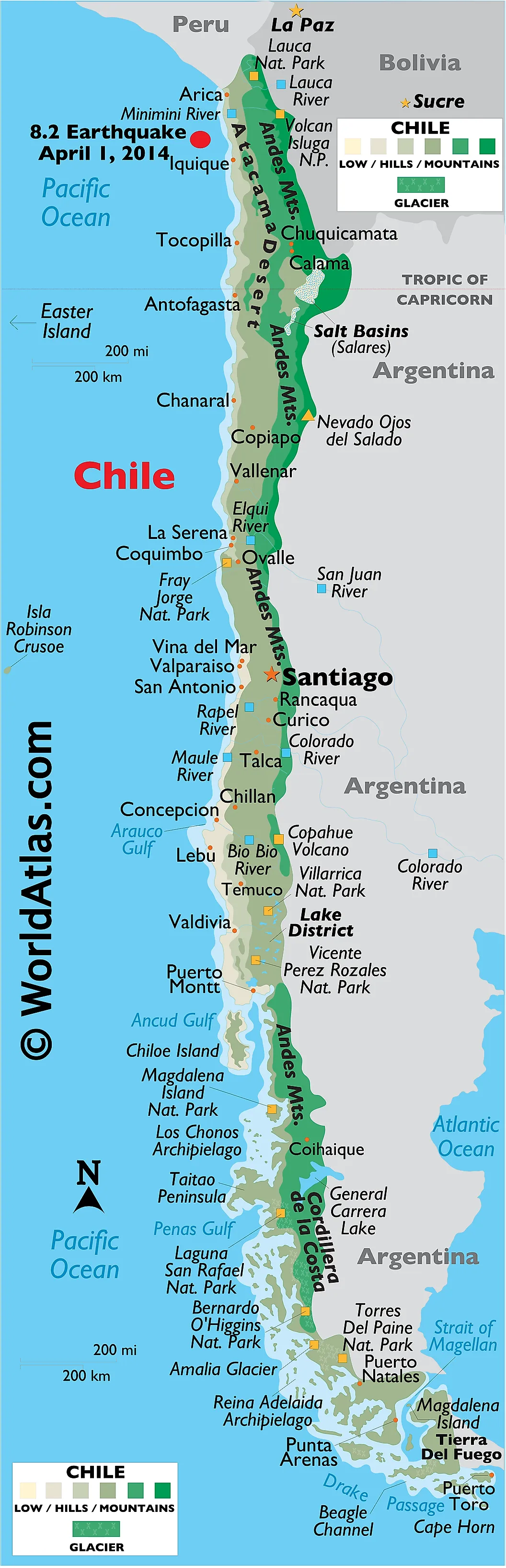
The origin is debated. The most-cited theory traces "Chile" to the Mapuche word "chilli," interpreted as "where the land ends," reasonable for a country that runs more than 2,600 miles north-south along the Pacific edge of the continent. A competing theory links it to Quechua "chiri" (cold) or "tchili" (snow). A third theory points to a regional bird called the "trihue" or "chille." Chile has roughly 19.5 million residents and the capital is Santiago. The country contains the Atacama Desert (the driest non-polar place on Earth), much of the southern Andes, and Easter Island in the Pacific.
China
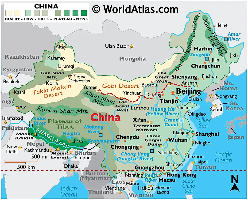
The English "China" comes from the Qin dynasty (秦, pronounced roughly "Chin"), which unified the country in 221 BCE under Qin Shi Huang. The name traveled through Sanskrit "Cīna" and Persian "Chīn" before reaching European languages. In Mandarin the country is called Zhōngguó (中国), meaning "Middle Kingdom" or "Central State." With roughly 1.41 billion people, China is the second-most populous country on Earth, narrowly behind India since 2023. Its capital is Beijing; Shanghai is the largest city by population.
Egypt
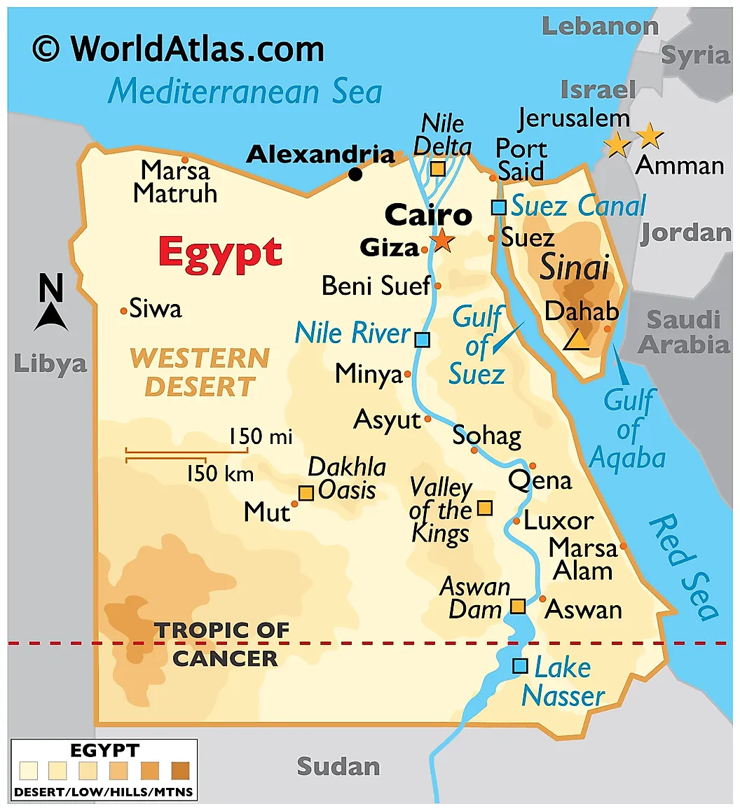
"Egypt" descends from the Greek "Aigyptos," which is itself a Greek rendering of an Ancient Egyptian phrase, "Hwt-ka-Ptah," meaning "House of the Spirit of Ptah." The phrase was originally the name of Memphis, an ancient capital. Modern Arabic-speaking Egyptians call the country "Misr." Roughly 118 million people live in Egypt today, making it Africa's third-most populous country after Nigeria and Ethiopia. The capital is Cairo. Egypt is one of the few countries that lies on two continents at once: most of the country is in Africa, but the Sinai Peninsula sits in Asia.
Gabon
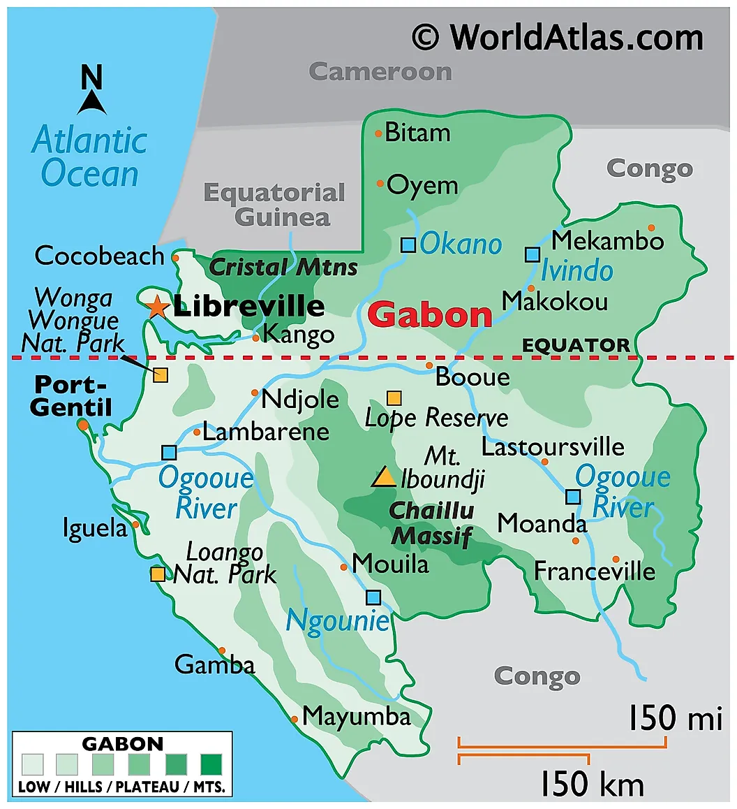
From the Portuguese word "gabão," meaning a hooded cloak. Early Portuguese explorers thought the shape of the Komo River estuary resembled the cloak's hood. The country sits directly on the equator in central Africa, with a small population of about 2.5 million and one of the highest per-capita incomes in sub-Saharan Africa thanks to oil reserves. The capital, Libreville, was founded in 1849 by freed slaves and named accordingly ("Free-town"). Around 88 percent of the country is forested, much of it primary rainforest in the Congo Basin.
Ghana
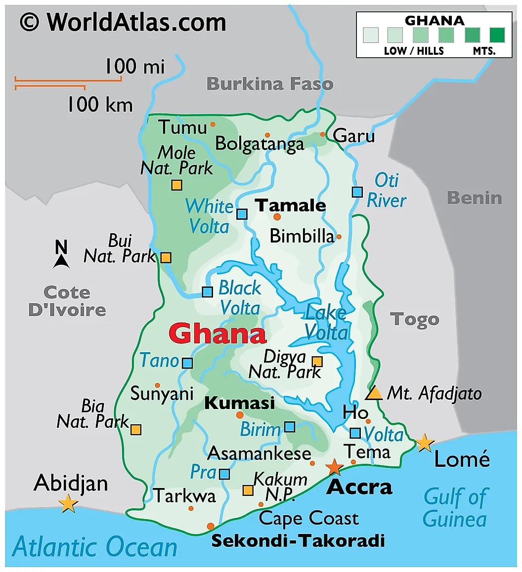
The name was borrowed long-distance. The medieval Ghana Empire (roughly 300 to 1200 CE) was located not in modern Ghana but in the territory of present-day Mauritania and Mali, far to the northwest. When the Gold Coast became independent from British rule in 1957, Kwame Nkrumah's government adopted the medieval empire's name as a statement of pan-African historical continuity. The Mande word "Ghana" referred to the title of the empire's ruler, often translated as "Warrior King." Roughly 35 million people live in Ghana today. The capital is Accra, and the country is one of Africa's largest cocoa producers.
Haiti
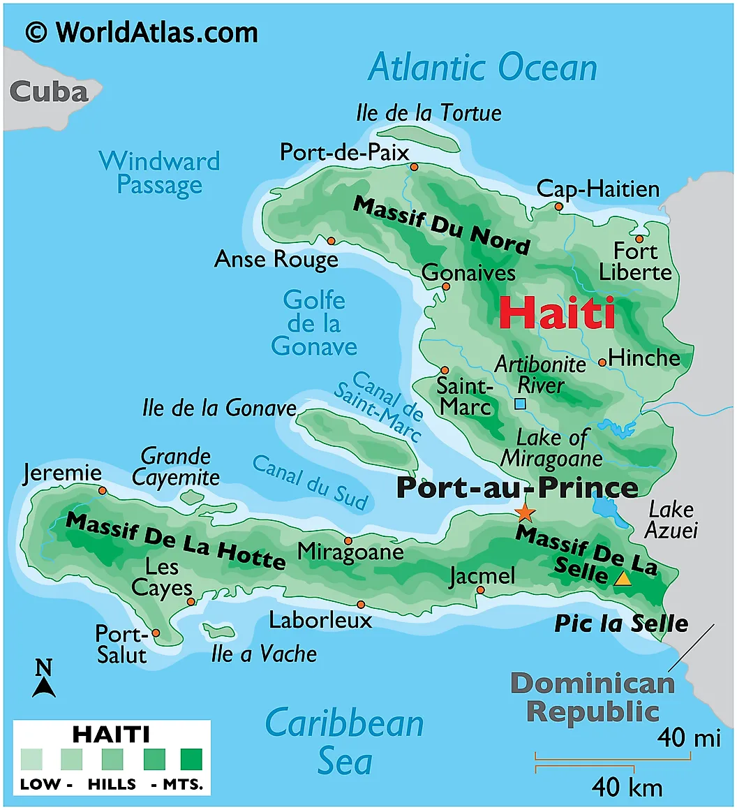
The name comes from the Taíno indigenous language: "Ayiti" (sometimes written "Hayti") meant "land of high mountains," fitting for the most mountainous country in the Caribbean. The Taíno had inhabited the island of Hispaniola for centuries before Christopher Columbus arrived in 1492. Haiti occupies the western third of Hispaniola; the Dominican Republic occupies the rest. After a long revolution against French rule, Haiti declared independence on January 1, 1804, becoming the first independent Black republic in the Americas and the second independent nation in the Western Hemisphere. The capital is Port-au-Prince. Population is roughly 11.5 million.
India
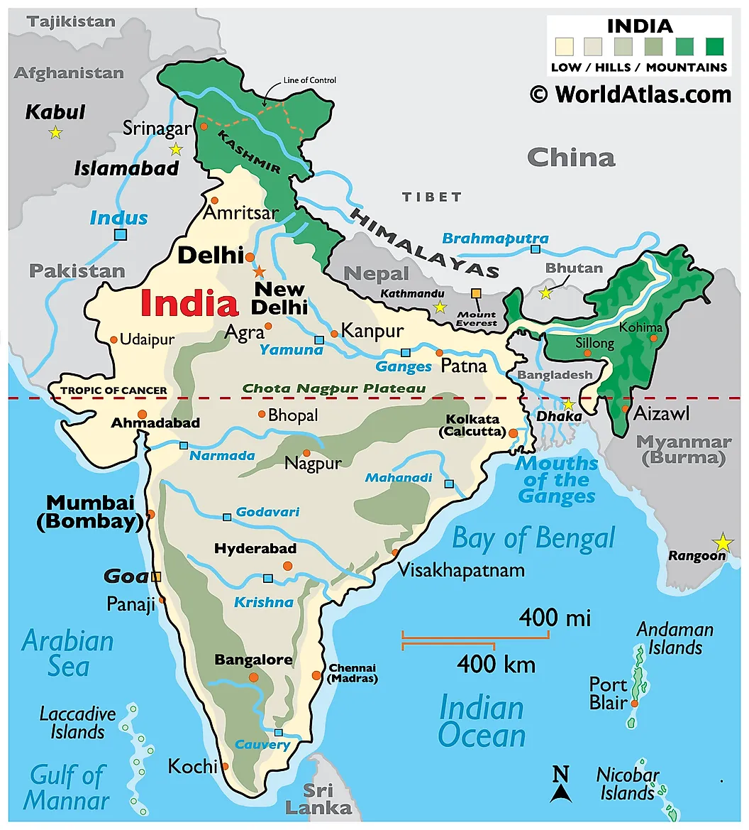
"India" derives from the Indus River, called Sindhu in Sanskrit. Persian speakers softened the initial "S" to "H" (Hindu), and the name passed via Greek "Indos" into Latin and later European languages. The Indian Constitution recognizes two official names: "India" and "Bharat," the latter from the Sanskrit "Bhārata," after a legendary ancestor king. With about 1.45 billion people, India overtook China as the world's most populous country in 2023, according to United Nations estimates. The capital is New Delhi; Mumbai is the largest city by population and the financial center.
Italy
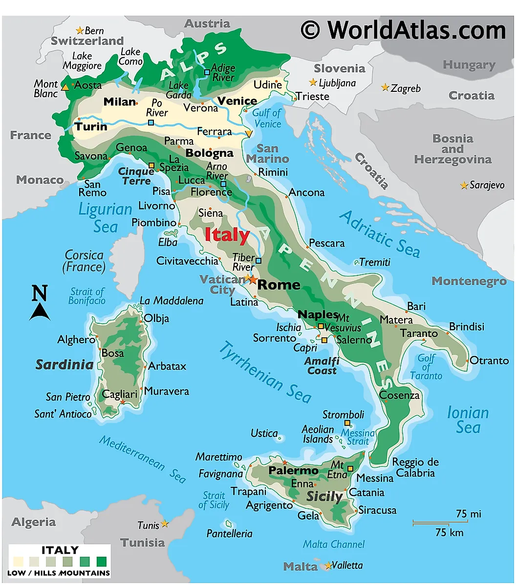
The Greek "Italía" most likely traces back to the Oscan word "Víteliú," meaning "land of young cattle," related to the Latin "vitulus" (calf). The name originally referred only to the southern tip of the peninsula and gradually expanded over centuries to cover the whole boot. Italy has about 59 million residents and is one of the European Union's founding members. The capital is Rome, which contains Vatican City, an independent enclave that is the smallest sovereign state in the world by both area and population. Italy unified as a single nation-state relatively recently, in 1861, after centuries of regional kingdoms and city-states.
Japan
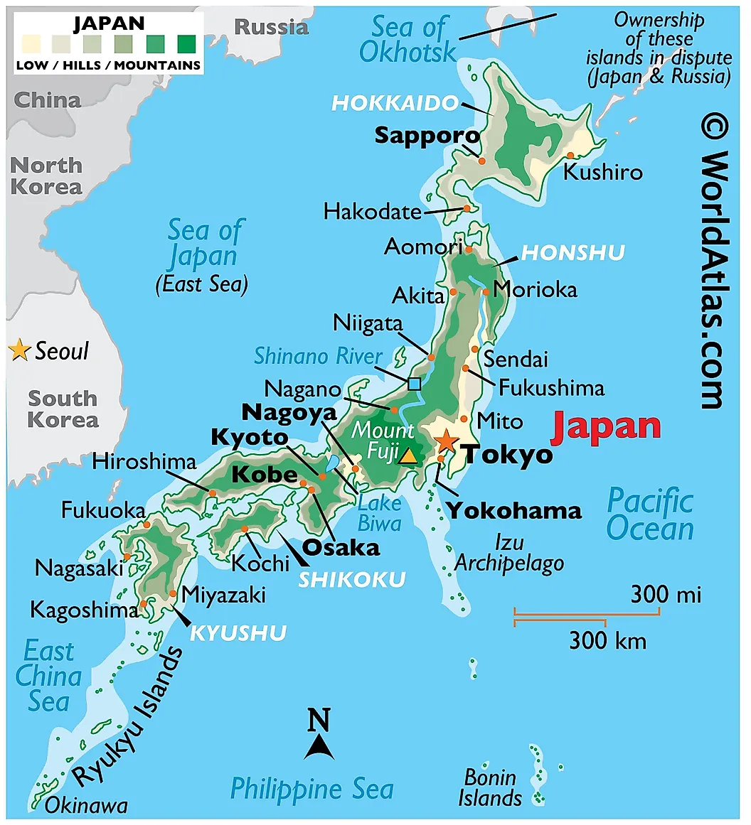
The English name reached Europe through Marco Polo, who recorded it as "Cipangu" in the 13th century. Polo's version came from Old Mandarin pronunciation of 日本 (rìběn), which means "origin of the sun" or "sun source," a reference to Japan's position east of China. In Japanese the country is called Nippon or Nihon, the same two characters read in two valid pronunciations. Japan has roughly 122 million residents on an archipelago of more than 14,000 islands; the four main ones are Hokkaido, Honshu, Shikoku, and Kyushu. The capital, Tokyo, anchors the largest metropolitan area in the world.
Kenya
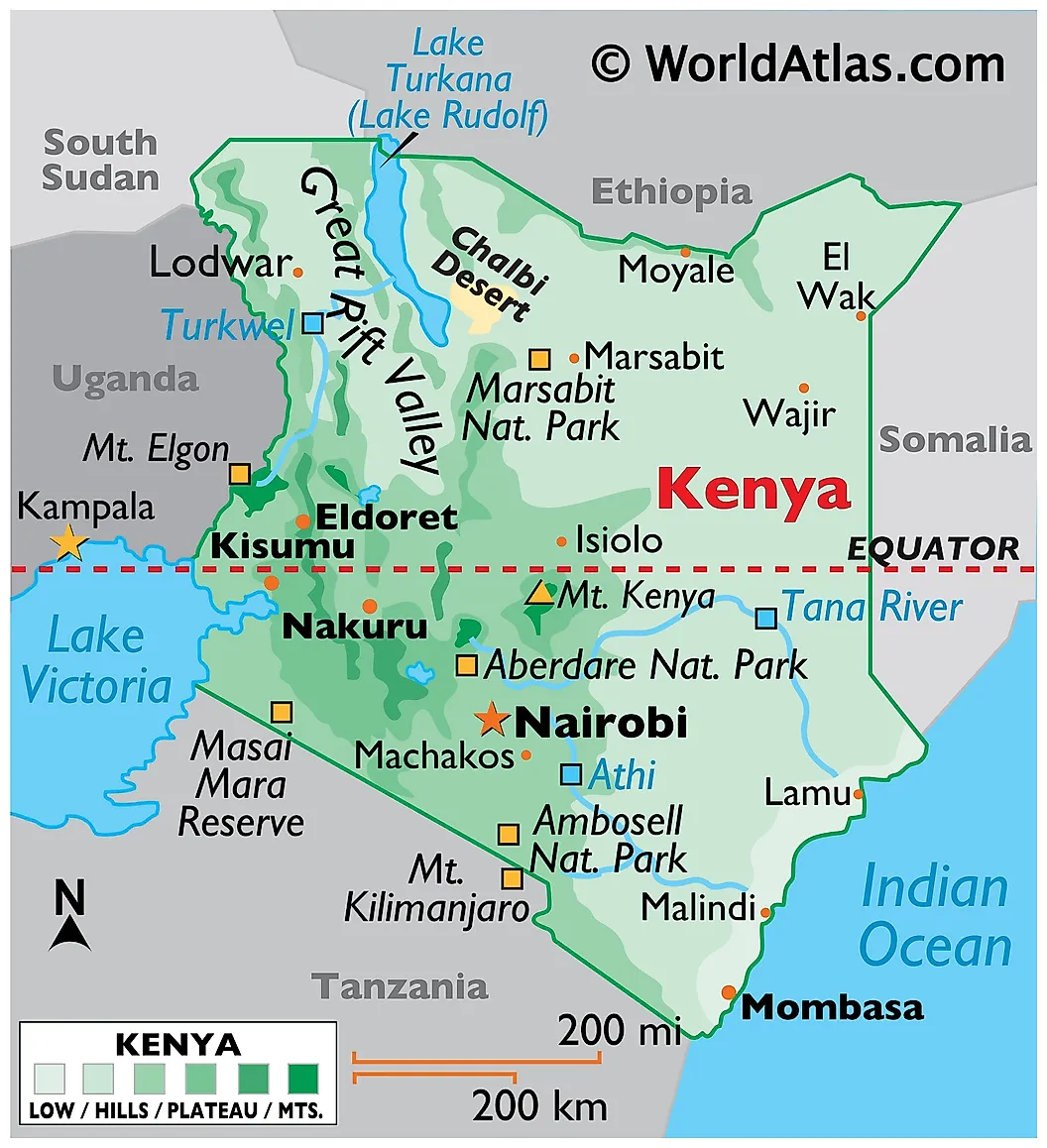
The country is named after Mount Kenya, the second-tallest mountain in Africa at 17,057 feet. The Kikuyu name for the mountain is "Kĩrĩnyaga," meaning "place of brightness" or "place where God dwells," and the Kamba called it "Kĩĩnyaa." British settlers shortened the local name to "Kenya," and that form was adopted at independence in 1963. Kenya has roughly 56 million residents. The capital is Nairobi. The country sits on the equator and includes Lake Victoria's eastern shore, the Great Rift Valley, and a coast on the Indian Ocean.
Libya
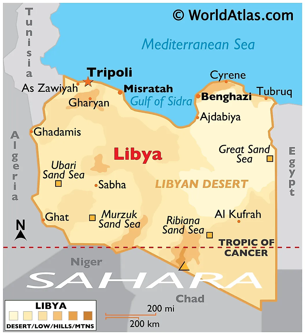
"Libya" comes from the Greek "Libýē" (Λιβύη), which the Greeks adapted from an Ancient Egyptian word for the Berber tribe living west of Egypt, called the Libu. Ancient Greek writers used "Libya" loosely to mean all of North Africa west of the Nile. The modern country, with the same name, gained independence from Italy in 1951. Libya has roughly 7 million residents, most along the Mediterranean coast; the country's interior is dominated by the Sahara. The capital is Tripoli. Libya holds Africa's largest proven oil reserves.
Malta
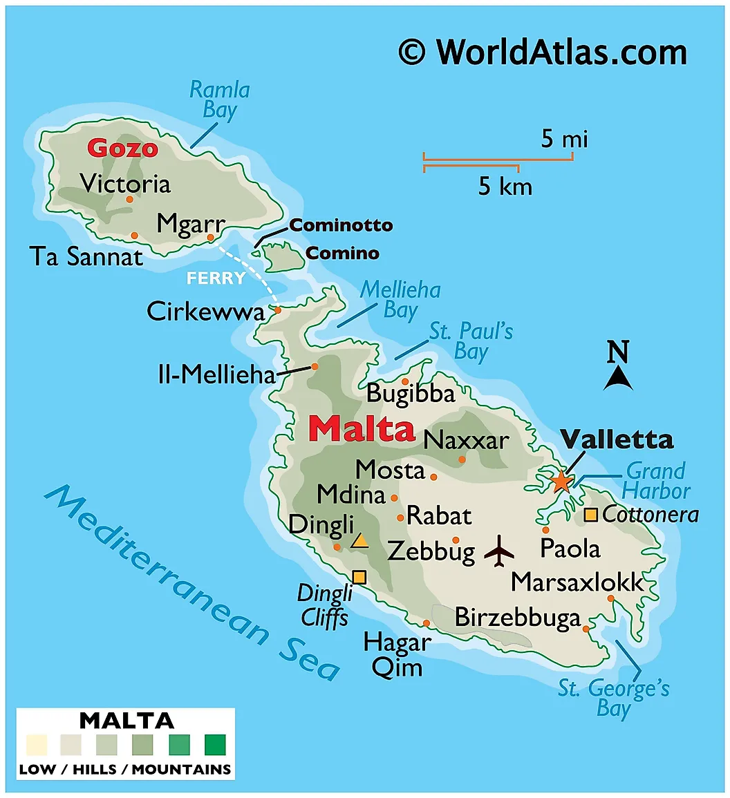
Two theories compete. The Greek "Melítē" (μελίτη), meaning "honey-sweet," may reflect the islands' once-famous honey production. The Phoenician "Maleth," meaning "haven" or "port," may reflect Malta's role in Mediterranean shipping. Both peoples colonized the islands. Malta consists of three inhabited islands (Malta, Gozo, Comino), has roughly 550,000 residents, and is the European Union's smallest member state. The capital is Valletta. Malta's Azure Window, a natural limestone arch on Gozo that featured in Game of Thrones, collapsed into the sea during a storm on March 8, 2017, and is no longer a tourist attraction; the megalithic Hagar Qim and the medieval city of Mdina remain the country's most visited sites.
Nauru
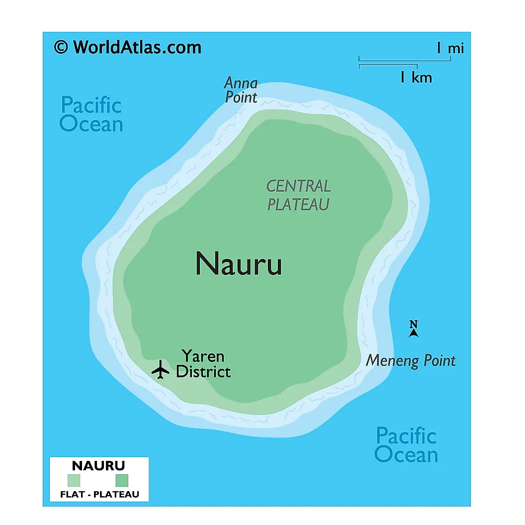
The name comes from the local Nauruan word "Anáoero" or "Naoero," translated as "I go to the beach." A British whaling captain, John Fearn, called the island "Pleasant Island" when he sighted it in 1798, but the local name persisted. Nauru is the world's third-smallest sovereign state by area (after Vatican City and Monaco), a single coral island of about 8 square miles. Population is roughly 12,000. The country has no official capital, but most government functions operate from the district of Yaren. Decades of phosphate mining have left much of the interior environmentally degraded.
Nepal
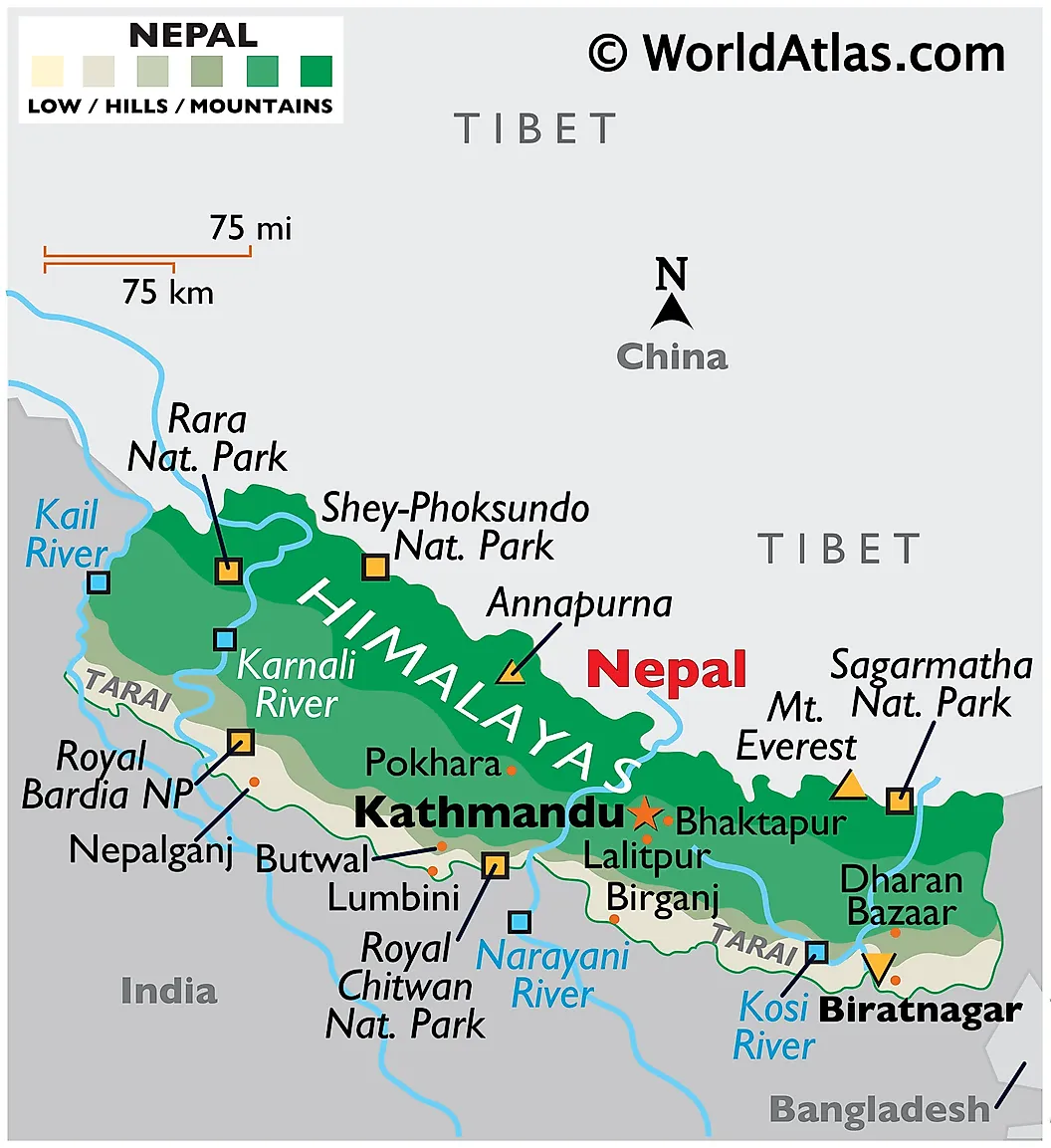
The etymology is contested. The Sanskrit-based explanation traces "Nepāla" to a legendary Hindu sage named Ne Muni, with "pāla" meaning "protector," so "the place protected by Ne." A competing Tibeto-Burman explanation reads "Ne" and "pa" as "middle" and "country," reading the name as "middle country" between India and Tibet. Nepal contains eight of the world's ten highest mountains, including Mount Everest on its northern border with China. Population is roughly 30 million. The capital is Kathmandu. Nepal was historically the world's only Hindu monarchy until it transitioned to a federal democratic republic in 2008.
Niger
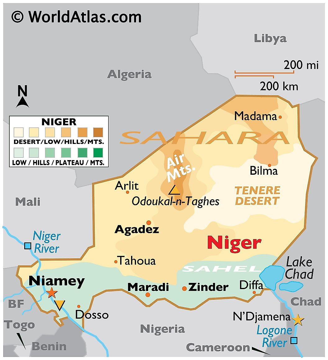
The country, like its neighbor Nigeria, takes its name from the Niger River. The river's name is contested: one widely-cited theory traces it to Tuareg "ghir n ghiren" or "egerew n-igerewen" ("river of rivers"). The Latin word "niger" (black) is a folk etymology that European mapmakers may have grafted onto the local original. Niger is landlocked, sits mostly within the Sahara and the Sahel, and has a population of roughly 27 million with one of the world's highest fertility rates. The capital is Niamey. The country contains uranium reserves that have been historically important to French nuclear power.
Palau
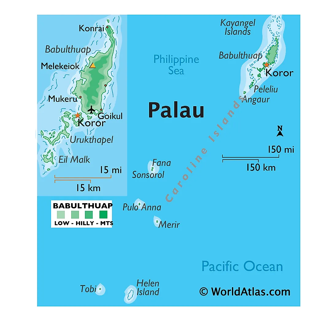
From the Palauan word "Belau," which in turn is widely thought to derive from "beluu" meaning "village." Spanish colonizers called the islands "Los Palaos" in the 16th century, and the spelling stuck. Palau consists of more than 340 islands totaling about 180 square miles in the western Pacific. Population is roughly 18,000. The capital is Ngerulmud, built specifically for the role on the island of Babeldaob in 2006; before that, Koror was the de facto capital. Palau was the first country in the world to ban many sunscreen chemicals harmful to coral reefs, in 2020.
Qatar
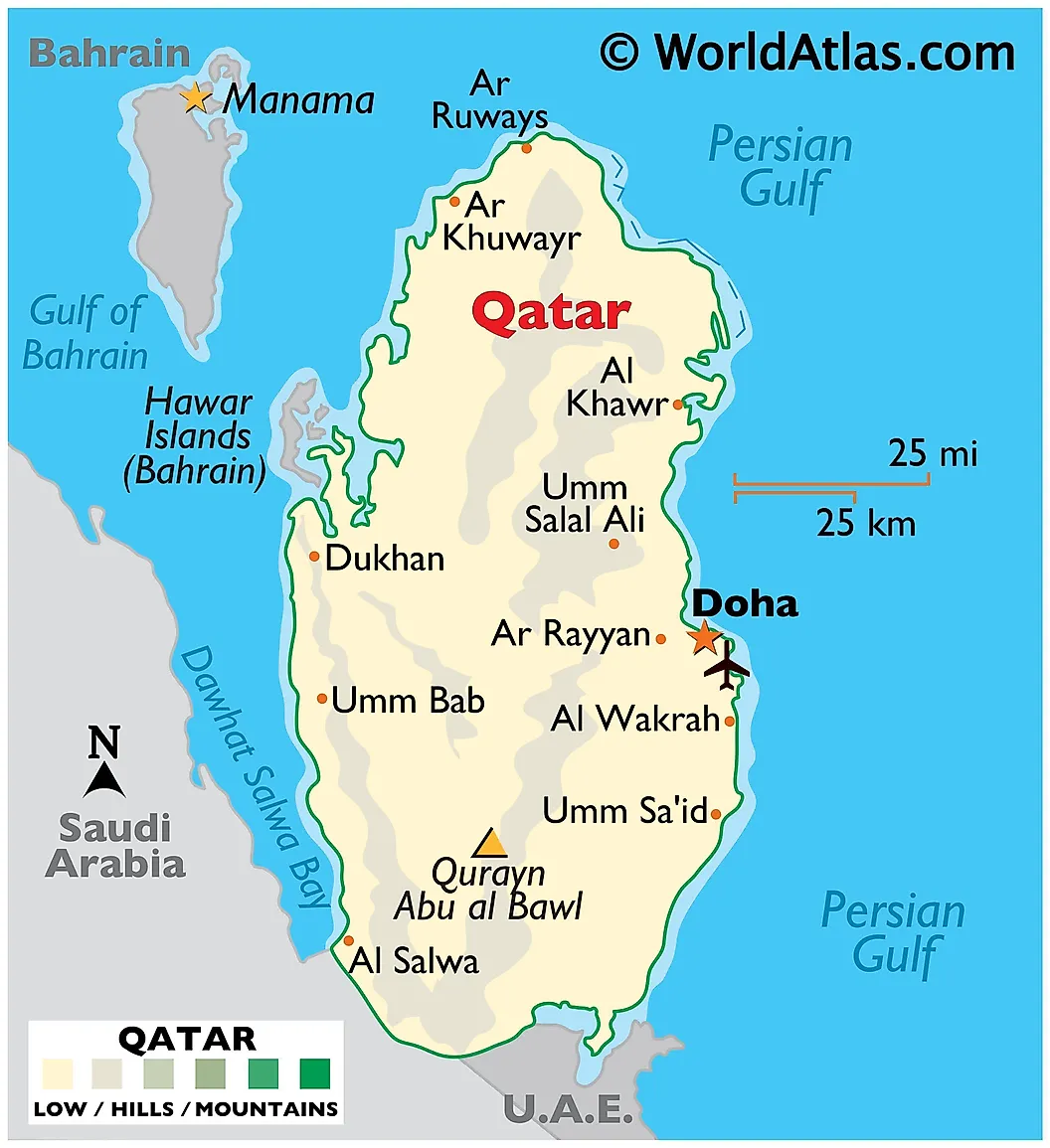
The first surviving mention of "Catara" comes from the Roman writer Pliny the Elder in the 1st century CE, referring to a settlement on the peninsula's coast. Arabic "Qaṭar" may relate to the Arabic word for "raindrop" or to an ancient regional placename; the link is not certain. Qatar juts north from the Arabian Peninsula into the Persian Gulf. Population is roughly 3 million, the great majority of whom are foreign migrant workers; native Qatari citizens number around 380,000. The capital is Doha. The country has the world's third-largest natural gas reserves and hosted the 2022 FIFA World Cup, the first held in the Arab world.
Samoa
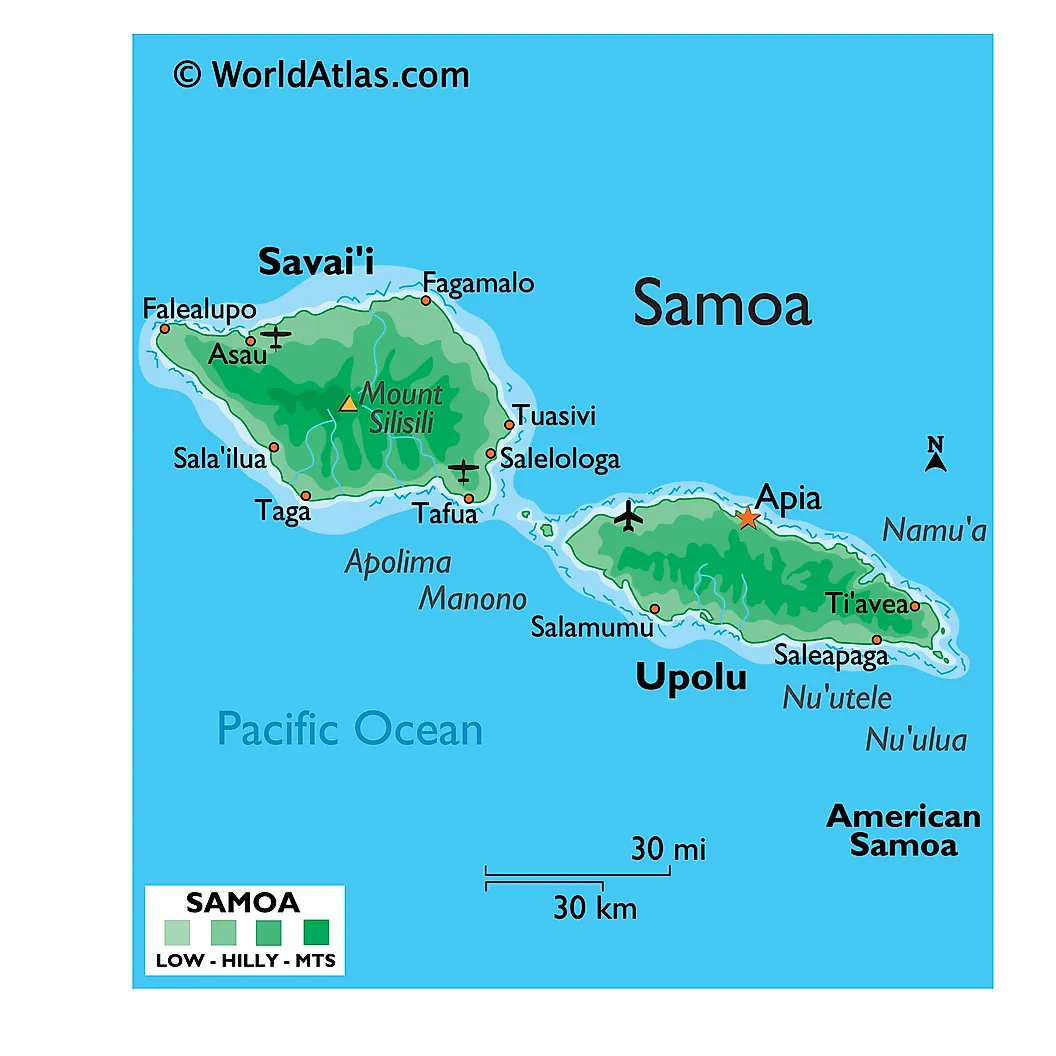
Multiple oral traditions explain the name. The most common: "Sa" (sacred) combined with "Moa" (a central or sacred place, or the chicken that was sacred to the god Tagaloa). Another tradition reads "Samoa" as "place of the moa" (the wild jungle fowl). Samoa comprises two large islands (Upolu and Savai'i) and several smaller ones in the South Pacific, with a population of roughly 220,000. The capital is Apia. American Samoa, just east, is a separate United States territory. Samoa skipped December 30, 2011, when it switched sides of the International Date Line to better match its trade partners' calendars.
Spain
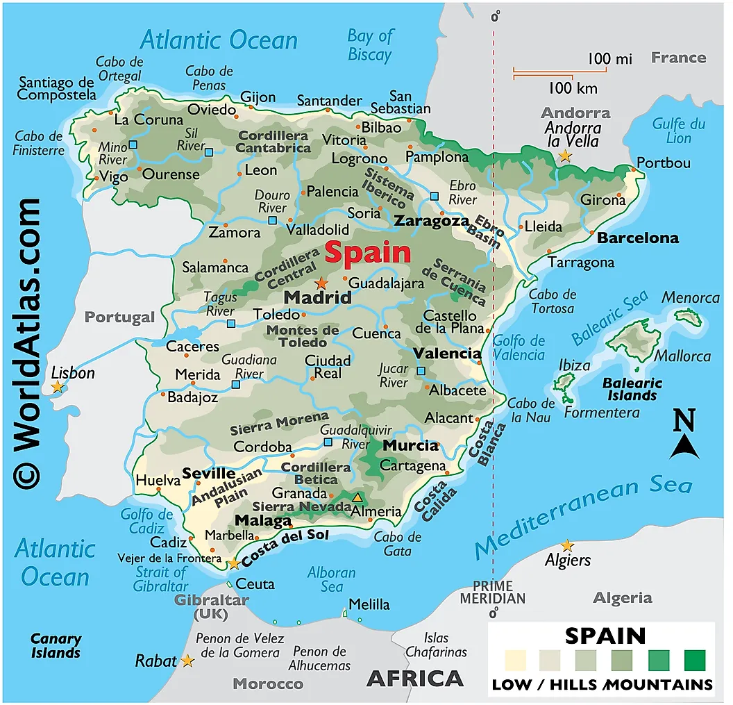
The Latin "Hispania" has a debated origin. One widely-cited theory traces it to a Phoenician phrase, "i-shepan-ha," meaning "land of rabbits" or "island of hyraxes," after the abundant small mammals the Phoenicians found on the peninsula. Another links the name to a Punic word for a metal-bearing region. In modern Spanish the country is "España." Spain has roughly 48 million residents and a constitutional monarchy headed since 2014 by King Felipe VI. The capital is Madrid. Spanish, descended from medieval Castilian, is now the world's second-most-spoken first language, behind Mandarin.
Sudan
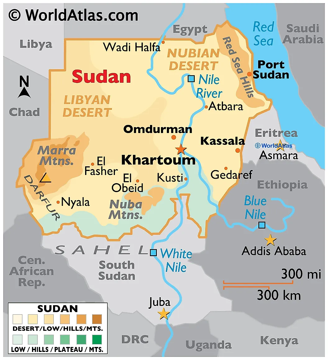
The name is a shortening of the medieval Arabic phrase "Bilad al-Sudan" (بلاد السودان), "the land of the Blacks," used by Arab geographers from the 8th century onward to describe the broad belt of African land south of the Sahara inhabited by darker-skinned peoples. The phrase originally covered a vast region; the modern state, much smaller, kept the name when it gained independence in 1956. Sudan has a population of roughly 50 million. The capital is Khartoum, located where the Blue Nile and White Nile meet. The country has been in a destructive civil war since April 2023.
Syria
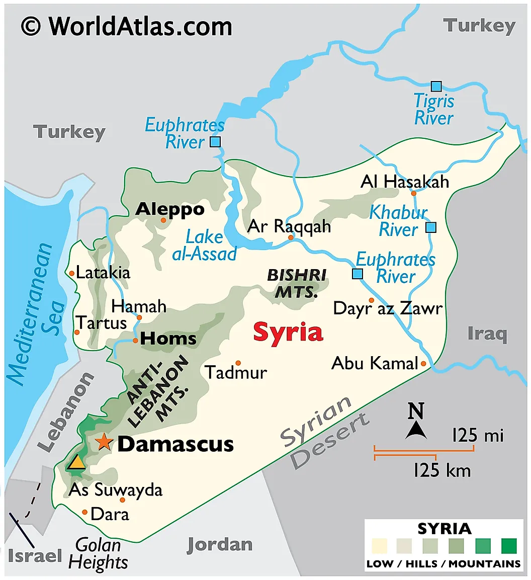
From the Greek "Suría" (Συρία), which derived from the older Assyrian-named region. The name was extended by Greek writers to mean a much broader area than the original Assyrian heartland (which lay further east, in modern Iraq), and the broader sense stuck. The modern country took the name on independence from France in 1946. Syria has a population of roughly 23 million, reduced by years of war and large-scale displacement. The capital is Damascus, one of the oldest continuously inhabited cities on Earth. The Bashar al-Assad government was overthrown in December 2024 after more than half a century of rule by the Assad family.
Tonga
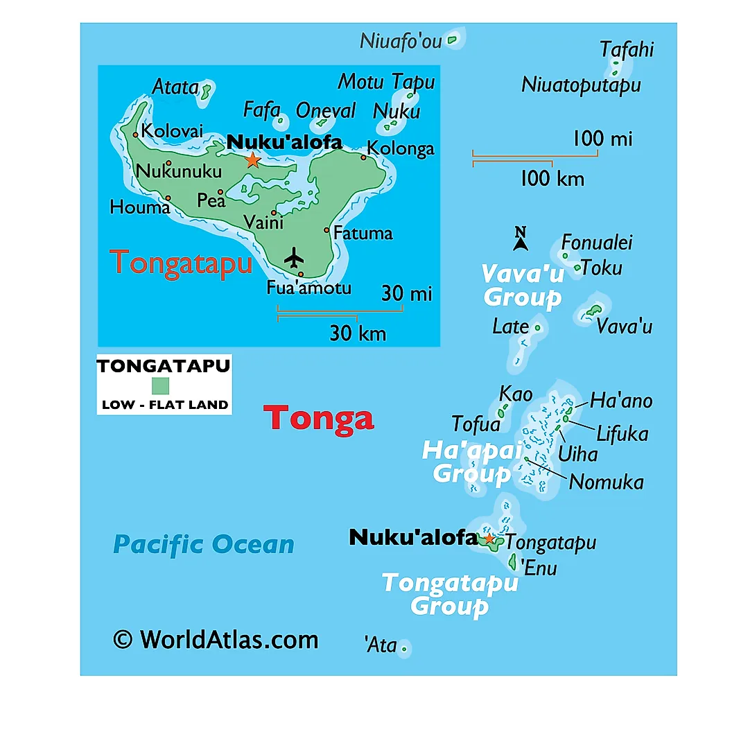
In Polynesian languages, "tonga" means "south," reflecting the country's position south of Samoa and other older-settled Polynesian island groups. Tonga consists of 169 islands (about 36 inhabited) scattered across the South Pacific. Population is roughly 105,000. The capital is Nuku'alofa on the main island of Tongatapu. Tonga is the only Pacific country that was never formally colonized by a European power, though it was a British protectorate from 1900 to 1970. It is a constitutional monarchy and remains one of the few sovereign monarchies in the Pacific.
Yemen
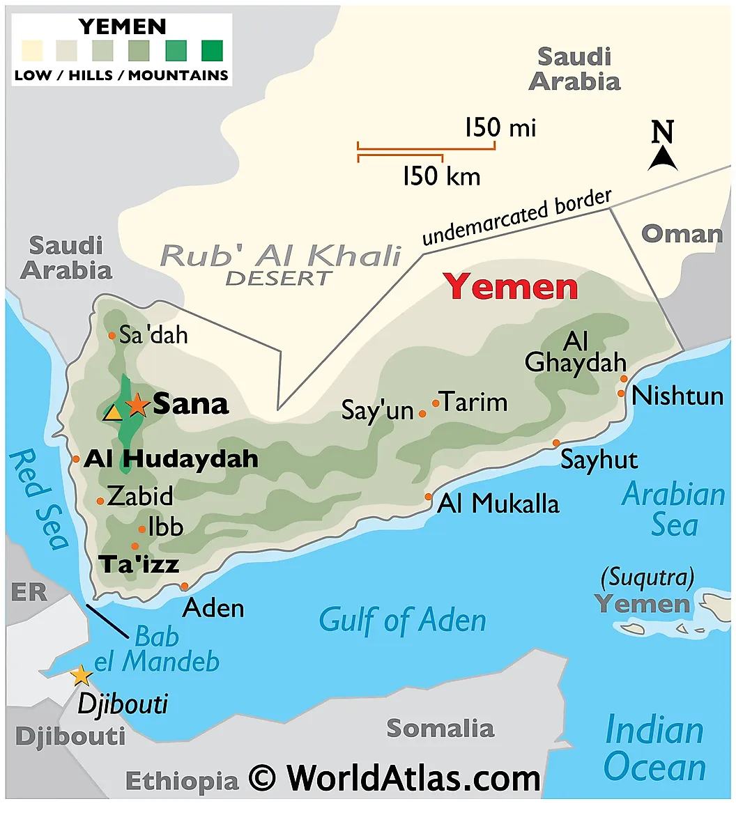
"Yemen" comes from the Arabic "al-Yaman" (اليمن). Two interpretations are common: "yaman" can mean "right-hand side" (because if you face the rising sun from Mecca, Yemen is on your right), and it can mean "south," with the same geographical logic. A folk etymology relates the name to "yumn" (blessing or prosperity), which is why the Romans called the region "Arabia Felix" (Happy Arabia). Yemen has a population of roughly 39 million. The internationally recognized capital is Sanaa, but the city has been held by Houthi forces since 2014; the recognized government operates from Aden. Yemen has been in a multi-sided civil war since 2014.
What The List Adds Up To
Twenty-four countries with five-letter names, taken together, contain about 2.9 billion people, more than a third of the global population, almost entirely because two of them (India and China) sit at the top of the world population ranking. At the other extreme, five of the twenty-four (Nauru, Palau, Tonga, Samoa, Malta) are micro-states with combined populations smaller than a single mid-sized American city. The etymologies cluster into a few rough categories: rivers and mountains (India, Niger, Kenya), dynasties and empires (China, Ghana), Phoenician trading-language placenames (Spain, Malta), Greek borrowings via Egyptian or Berber sources (Egypt, Libya), Arabic geographic shorthand (Sudan, Yemen), and indigenous-language self-names that survived European contact intact (Haiti, Nauru, Tonga, Palau, Samoa).
| Country | Capital | Population |
|---|---|---|
| Benin | Porto-Novo | 14 million |
| Chile | Santiago | 19.5 million |
| China | Beijing | 1.41 billion |
| Egypt | Cairo | 118 million |
| Gabon | Libreville | 2.5 million |
| Ghana | Accra | 35 million |
| Haiti | Port-au-Prince | 11.5 million |
| India | New Delhi | 1.45 billion |
| Italy | Rome | 59 million |
| Japan | Tokyo | 122 million |
| Kenya | Nairobi | 56 million |
| Libya | Tripoli | 7 million |
| Malta | Valletta | 550,000 |
| Nauru | (Yaren district) | 12,000 |
| Nepal | Kathmandu | 30 million |
| Niger | Niamey | 27 million |
| Palau | Ngerulmud | 18,000 |
| Qatar | Doha | 3 million |
| Samoa | Apia | 220,000 |
| Spain | Madrid | 48 million |
| Sudan | Khartoum | 50 million |
| Syria | Damascus | 23 million |
| Tonga | Nuku'alofa | 105,000 |
| Yemen | Sanaa / Aden | 39 million |


