Maps of Libya

Libya, located in North Africa, borders the Mediterranean Sea to the north, Egypt to the east, Sudan to the southeast, Chad to the south, Niger to the southwest, Algeria to the west, and Tunisia to the northwest. It covers an area of about 1,676,198 km2 (647,184 mi2). Tripoli is the capital, and it sits in the Tripolitania region. Last, it is worth noting that Libya has one of the largest oil reserves in Africa and is a significant oil-producing country, and it contains considerable other resources.The country is divisible into three geographical regions: Cyrenaica, Tripolitania, and Fezzan.
Cyrenaica: In the eastern part of Libya lies the region of Cyrenaica. Dominated by the Jebel Akhdar, or Green Mountains, this region rises from the Mediterranean coast inland. The range's name derives from its relatively fertile land, which stands in contrast to much of Libya's arid landscape. In Cyrenaica, one can find Libya's highest point: Bikku Bitti, which stands at 2,267 meters (about 7,436 feet) above sea level.
Tripolitania: To the west of Cyrenaica lies Tripolitania, another of Libya's three historic regions. Tripolitania features a coastal plain that extends southward into rolling hills and plateaus. The region's coastline consists mainly of rocky and sandy shores. It also encompasses the Nafusa Mountains, which stretch near the western border of Libya and form a significant part of its natural landscapes.
Fezzan: The southernmost part of Libya is occupied by the region of Fezzan, characterized primarily by its Saharan desert landscapes. Sand dunes, rocky plateaus, and vast stretches of arid land dominate this region. The Ubari Sand Sea, one of the remarkable features of Fezzan, presents an expanse of dunes and ergs. Within this desert terrain, however, one can find the Sabkhat Ghuzayyil, which is Libya's lowest point, lying at 47 meters (about 154 feet) below sea level.
Bodies of Water and Rivers: Libya's position along the Mediterranean Sea influences its climate and geographical features. While the country's coastline spans about 1,770 kilometers (1,100 miles), Libya has no permanent rivers, given its predominantly desert landscape. The most significant among its temporary rivers is the Wadi Al Hayat, which flows through the Fezzan region around October in the rainy season. Additionally, there are numerous oases scattered across Libya, acting as vital water sources in the desert. Some of the prominent oases include the Ghat, Sabha, and Al Kufrah oases.
Regarding irrigation, a remarkable feature of Libya is the Great Man-Made River, which is a network of pipes that supplies water from the Sahara Desert to coastal cities. This project is one of the world's largest irrigation projects and is essential for Libya's water supply.
Governorates of Libya Map

As per the CIA World Factbook, Libya has 22 governorates. In alphabetical order, these are: Al Butnan, Al Jabal al Akhdar, Al Jabal al Gharbi, Al Jafarah, Al Jufrah, Al Kufrah, Al Marj, Al Marqab, Al Wahat, An Nuqat al Khams, Az Zawiyah, Banghazi (Benghazi), Darnah, Ghat, Misratah, Murzuq, Nalut, Sabha, Surt, Tarabulus (Tripoli), Wadi al Hayat, Wadi ash Shati.
Tripoli is the capital of the country.
Where is Libya?

Libya is a country located in the Maghreb region of North Africa. It is bordered by five countries. These are Egypt, Sudan, Chad, Niger, Algeria, and Tunisia to the east, southeast, south, southwest, west, and northwest, respectively. The country also has a coastline on the Mediterranean Sea to the north. Libya is located in the Northern and Eastern Hemispheres of the Earth.
Libya Bordering Countries: Egypt, The Sudan, Chad, Tunisia, The Niger, Algeria.
Regional Maps: Map of Africa
Outline Map of Libya


Key Facts
| Legal Name | State of Libya |
|---|---|
| Flag |
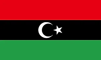
|
| Capital City | Tripoli (Tarabulus) |
| 32 53 N, 13 10 E | |
| Total Area | 1,759,540.00 km2 |
| Land Area | 1,759,540.00 km2 |
| Water Area | N/A |
| Population | 6,777,452 |
| Major Cities |
|
| Currency | Libyan dinars (LYD) |
| GDP | $52.08 Billion |
| GDP Per Capita | $7,683.75 |
This page was last updated on October 23, 2023