Maps of Tonga

Covering a total area of 750 sq.km (289 sq mi), Tonga is an archipelago composed of 169 islands, of which only 36 islands are inhabited and is located in the South Pacific Ocean. The three largest islands are Tongatapu, Ha'apai, and Vava'u, with Tongatapu being the most populated. Due to its location within the Pacific Ring of Fire, Tonga experiences relatively frequent volcanic activity, with its last eruption occurring in 2009, near the island of Hunga Tonga - approximately 6.8 miles (11 km) north of the capital city.
Tonga's western islands make up the Volcanic Arch, and are therefore volcanic in origin, having been formed from heated materials that rose to the surface of the ocean. The eastern Tongan islands sit above the Tonga ridge, running parallel to the Volcanic Arch, and were formed from elevated limestone and uplifted coral formations. These islands are not volcanic. Located east of Tonga, in the depths of the ocean, is the Tonga Trench - one of the deepest parts of the Pacific.
Its deepest point, known as the Horizon Deep, plunges 35,702 ft. (10,882 m) below the surface of the water. There are no significant rivers within the Tonga archipelago, however the largest lake is located on the island of Tofua, and is a steaming hot volcano crater with a depth of 1,600 ft. (500 m).
The highest point of the country is an unnamed elevation on Kao Island that peaks at 3,389 ft. (1,033 m); the lowest point is the Pacific Ocean (0m).
Divisions of Tonga Map

Tonga, a Polynesian country, comprises over 170 islands in the South Pacific Ocean. Its maritime boundaries include established and provisional borders with neighboring states: an official boundary with Fiji, and provisional boundaries with Niue, Samoa, and the United States of America. Additionally, Tonga has a gazetted and enforced treaty with France concerning Wallis and Futuna, which was established on 11 January 1980. The total area of Tonga is approximately 650 km2 (251 mi2).
The waters around Tonga are known for their deep-sea trenches, including the Tonga Trench, one of the deepest parts of the ocean. The lowest point in Tonga is the Pacific Ocean's surface, at sea level. Elsewise, the Tongan archipelago is divided into three main geographical regions: Tongatapu, Haʻapai, and Vavaʻu. Tongatapu, the southernmost group of islands, is the most populous and hosts the country's capital, Nuku'alofa. It features flat terrain with limestone and coral formations. The highest point in this region, and also in Tonga, is an unnamed location on Kao Island in the Haʻapai group, reaching 1,030 meters (3,379 feet) above sea level.
Haʻapai, located north of Tongatapu, consists of a series of islands and islets, characterized by coral reefs and sand banks. The topography is generally low-lying, with a few volcanic islands like Tofua. This region's significant bodies of water include lagoons and coral reefs that are important for marine life and local navigation.
The Vavaʻu group to the north of Haʻapai is known for its hilly terrain, sheltered bays, and deepwater harbor. The region's geography makes it a popular destination for yachting and whale watching. The islands here are formed from volcanic activity, with lush, fertile soils supporting diverse vegetation.
Where is Tonga?

The Kingdom of Tonga is a sovereign country in Polynesia, composed of an archipelago of 169 islands located in the South Pacific Ocean. It is geographically positioned both in the Southern and Eastern hemispheres of the Earth. Tonga is surrounded by Fiji, Wallis and Futuna to the northwest; Samoa to the northeast; Niue to the east; Kermadec to the southwest; New Caledonia and Vanatu to the farther west. Tonga is completely surrounded by the Pacific Ocean.
Regional Maps: Map of Oceania
Outline Map of Tonga

The above blank map represents the Kingdom of Tonga – a sovereign country in Polynesia, composed of an archipelago of 169 islands located in the South Pacific Ocean. The above map can be downloaded, printed and used for geography education purposes like map-pointing and coloring activities.

The above outline map represents the Kingdom of Tonga – a sovereign country in Polynesia, composed of an archipelago of 169 islands located in the South Pacific Ocean. It is often affectionately called the “Friendly Islands”.
Key Facts
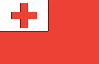
| Legal Name | Kingdom of Tonga |
|---|---|
| Flag |
|
| Capital City | Nuku'alofa |
| 21 08 S, 175 12 W | |
| Total Area | 747.00 km2 |
| Land Area | 717.00 km2 |
| Water Area | 30.00 km2 |
| Population | 104,494 |
| Currency | Pa'anga (TOP) |
| GDP | $450.35 Million |
| GDP Per Capita | $4,364.02 |
This page was last updated on November 13, 2023