Countries With The Highest Average Elevations
A country's average elevation measures the mean height of all its land above sea level, not the altitude of its tallest peak, and by that measure the world as a whole averages about 2,756 feet (840 meters). The nations that sit highest above that line cluster in two regions, the Himalayas and the mountain belts of Central Asia, though the full ranking reaches into Africa, Europe, and South America as well. The entries below profile the highest-ranking countries from the top down, pause to note one continent that outdoes them all, and finish with a table of the 30 countries with the highest average elevation. The figures come from the country averages compiled in the CIA World Factbook.
1. Bhutan (10,761 feet)

Bhutan has the highest average elevation of any country in the world. Its northern third is dominated by the sharp peaks of the Greater Himalayas, crowned by Gangkhar Puensum, which rises to 24,840 feet (7,570 meters) and is widely regarded as the highest unclimbed mountain on Earth, since Bhutan has banned ascents of its tallest summits. The high country suits the herding of yaks, pictured here, alongside other crops and livestock adapted to the thin mountain air. Most Bhutanese, however, live farther south, in the hills, highlands, and valleys that step down from the peaks.
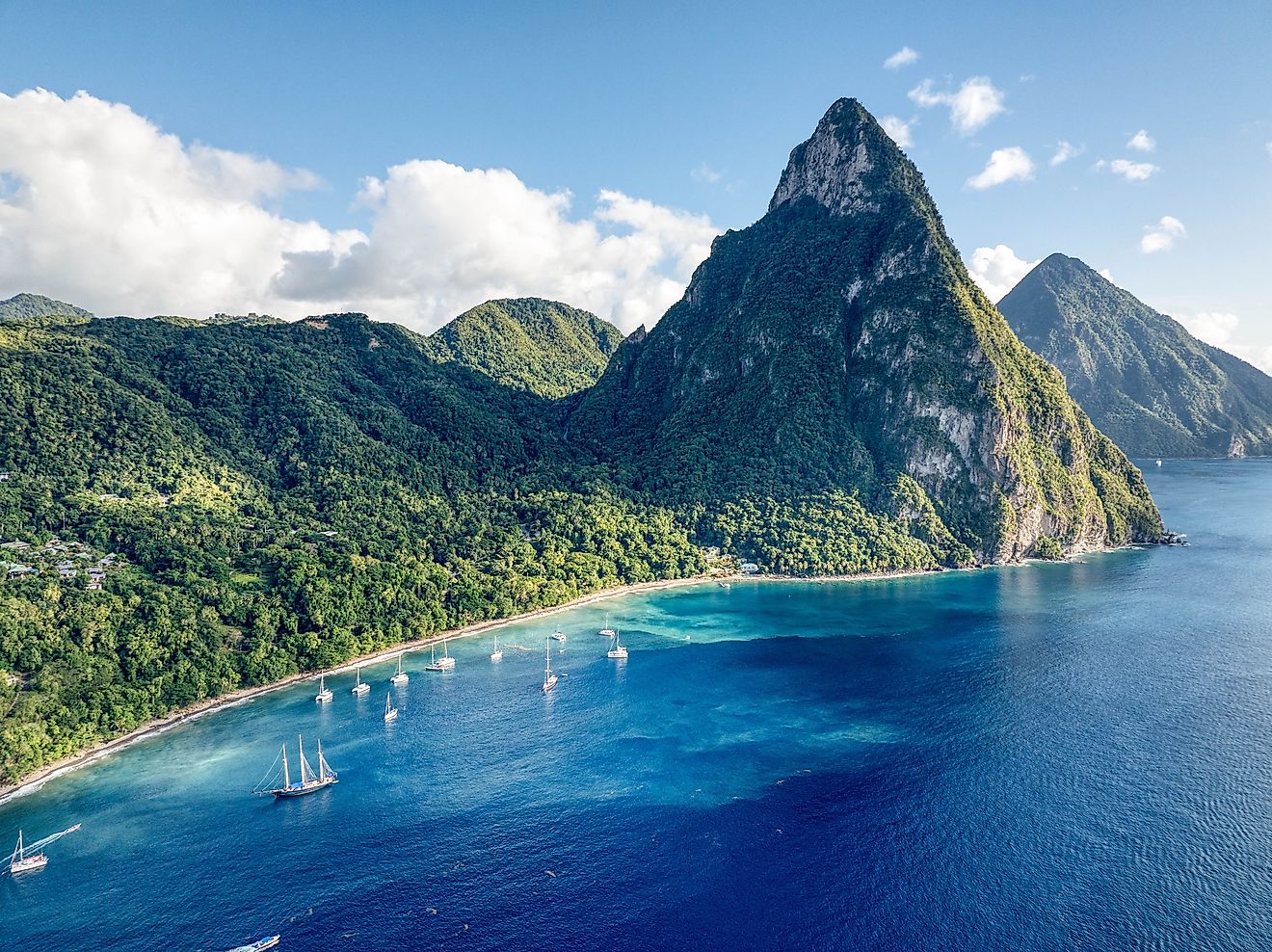
2. Nepal (10,712 feet)

Second in the world by average elevation, Nepal packs three landscapes into one country: the flat Gangetic plain along its southern border, a hilly central belt, and a northern wall of high Himalaya that holds eight of the world's fourteen peaks above 8,000 meters. The tallest of them, Mount Everest, reaches 29,032 feet (8,849 meters) on the border with China, making it the highest point on the planet. The mountain pictured is Ama Dablam, one of the most recognizable peaks in the Everest region.
3. Tajikistan (10,453 feet)

More than nine-tenths of Tajikistan is mountainous, ruled by the Pamir and Tian Shan ranges, with the highest summit, Ismoil Somoni Peak, reaching 24,590 feet (7,495 meters). The image shows one of the country's lower-lying areas, the Fergana Valley in the north. The Turkestan Range in the west rises to 18,077 feet. Because the country sits within an active seismic belt, earthquakes are a regular hazard across the region.
4. Kyrgyzstan (9,803 feet)

The terrain of Kyrgyzstan is built from comparatively young mountain ranges with tall, sharp peaks divided by deep valleys. The Tian Shan and Pamir systems cover roughly two-thirds of the land, and the high country feeds large glaciers, the longest of which is the Engilchek, pictured here. The result is a national average elevation of close to 9,800 feet above sea level.
A Note on Antarctica

Antarctica is not a country, so it does not belong in the ranking, but it is worth pausing on because it outdoes every nation on Earth. Averaging about 7,546 feet (2,300 meters), it is the highest continent on the planet, lifted by the immense thickness of its ice sheet. The surface at the South Pole sits near 9,300 feet, and the continent's tallest summit, the Vinson Massif pictured here, reaches 16,050 feet (4,892 meters).
5. Lesotho (7,090 feet)

The Drakensberg and Maloti ranges cover most of Lesotho, and Thabana Ntlenyana, the highest peak in southern Africa, rises in the east. The mountains run north to south, with the land easing downward toward the west, where most of the population farms the lower ground. Lesotho holds a distinction no other nation can claim: its entire territory lies above 1,000 meters (3,281 feet), which has earned it the nickname the Kingdom in the Sky.
6. Andorra (6,549 feet)

One of the world's smallest countries, Andorra sits in the Pyrenees between France and Spain, its territory made up almost entirely of mountains threaded by narrow valleys. The highest point, Pic de Coma Pedrosa, reaches 9,652 feet (2,942 meters). Spread across that rugged ground, the country averages 6,549 feet above sea level, the highest in Europe outside the continent-spanning cases.
7. Afghanistan (6,181 feet)

The landlocked country of Afghanistan is roughly three-quarters mountainous. The Hindu Kush, considered an extension of the Himalayas, runs across the country from the northeast to the southwest, and its highest peaks rise in the Wakhan Corridor, pictured here, where Noshaq tops out above 24,500 feet. Much of the remaining land is high plateau and rugged upland, lifting the national average past 6,000 feet.
8. Chile (6,138 feet)

Chile carries high ground along almost its entire length, set between the towering Andean cordillera in the east and lower coastal mountains in the west. Peaks in the Chilean Andes commonly stand around 15,000 feet, and the country shares Ojos del Salado, pictured here, the highest active volcano in the world at 22,615 feet. That elevated spine gives Chile an average of more than 6,100 feet.
9. China (6,037 feet)

The Tibetan Plateau, often called the Roof of the World, does most of the work in lifting China onto this list, averaging well over 14,000 feet across its vast expanse. The world's highest peak, Mount Everest, pictured here, stands on the country's border with Nepal. Spread over so much high terrain alongside its lowland east, China averages just over 6,000 feet, ninth highest among the world's countries.
Measured by Average, Not by Peak
What unites this list is breadth of high ground rather than a single famous summit. The ranking rewards countries whose whole territory rides high, which is why a small Pyrenean state like Andorra finishes ahead of China even though China shares the tallest mountain on the planet, and why several nations known for famous peaks rank lower once their large lowlands are counted in. The figures are national averages drawn from the CIA World Factbook and shift slightly from one source to the next, but the order at the top stays remarkably stable. The full top 30 appears below.
The 30 Countries With The Highest Average Elevation
| Rank | Country | Average elevation (feet) | Average elevation (meters) |
|---|---|---|---|
| 1 | Bhutan | 10,761 | 3,280 |
| 2 | Nepal | 10,712 | 3,265 |
| 3 | Tajikistan | 10,453 | 3,186 |
| 4 | Kyrgyzstan | 9,803 | 2,988 |
| 5 | Lesotho | 7,090 | 2,161 |
| 6 | Andorra | 6,549 | 1,996 |
| 7 | Afghanistan | 6,181 | 1,884 |
| 8 | Chile | 6,138 | 1,871 |
| 9 | China | 6,037 | 1,840 |
| 10 | Armenia | 5,879 | 1,792 |
| 11 | Rwanda | 5,243 | 1,598 |
| 12 | Mongolia | 5,184 | 1,580 |
| 13 | Peru | 5,102 | 1,555 |
| 14 | Burundi | 4,934 | 1,504 |
| 15 | Georgia | 4,698 | 1,432 |
| 16 | Switzerland | 4,429 | 1,350 |
| 17 | Ethiopia | 4,364 | 1,330 |
| 18 | Iran | 4,281 | 1,305 |
| 19 | Lebanon | 4,101 | 1,250 |
| 20 | Bolivia | 3,911 | 1,192 |
| 21 | Taiwan | 3,773 | 1,150 |
| 22 | Namibia | 3,743 | 1,141 |
| 23 | Turkey | 3,743 | 1,141 |
| 24 | Zambia | 3,734 | 1,138 |
| 25 | Ecuador | 3,665 | 1,117 |
| 26 | Angola | 3,648 | 1,112 |
| 27 | Mexico | 3,645 | 1,111 |
| 28 | Uganda | 3,609 | 1,100 |
| 29 | Montenegro | 3,563 | 1,086 |
| 30 | South Africa | 3,392 | 1,034 |
Figures are national averages from the CIA World Factbook and are approximate. Namibia and Turkey share the same average elevation and are effectively tied. The continent of Antarctica and dependent territories such as Greenland would rank among the highest but are excluded here because they are not sovereign countries.