Maps of Niger

Niger is a landlocked nation located in West Africa. It occupies an area of 1,267,000 sq. km and is split almost in half by the Sahara Desert. Niger shares a border with seven separate nations. Libya, Algeria, Burkina Faso, Benin, Nigeria, Mali, and Chad all surround Niger. The climate of Niger is quite arid with the wetter more arable regions being found in the south.
The Air Mountains, found in the north of the nation, punctuate the Sahara Desert in a north-south direction with a series of nine massifs. The highest point of the country, Mont Idoukal-n-Taghes at 2,022 m (marked on the map), is located in the south-central region of the Air Mountains. Another highland region is found to the northeast and comprises a series of high plateaus including Djado, Mangueni, and Tchigaï in the west-to-east direction. The Tenere Desert (shown on the map), part of the Sahara, is covered by an erg and a reg.
The Sahel region dominates the southern geography of Niger, This biome extends from the southwestern border with Burkina Faso to Lake Chad in the southeast. This region is a transition zone between the Sahara desert in the north and the more lush grasslands and jungle that can be found in Sub Sahara Africa.
The Niger River is the main river of the country and has the lowest point of the nation at 200 m. Running along its western border many of the large cities and urban centers in Niger can be found along the river including the capital city of Niamey. The Niger River basin and Lake Chad basin are the major drainage basins in Niger.
Regions of Niger Map

Niger has seven major administrative divisions called regions. They are Agadez, Diffa, Dosso, Maradi, Tahoua, Tillaberi, and Zinder. The country also has a capital district called Niamey which serves as the national capital.
The regions of Niger are further subdivided into Departments and communes. Several other smaller divisions make governance more convenient.With an area of 667,799 sq. km, Agadez is the largest region of Niger by area while Zinder is the most populous one.
Where is Niger?

Niger is West Africa's largest country. It is a landlocked nation located in the Northern and Eastern Hemispheres of the Earth. Seven countries border Niger. These include Libya, Chad, and Nigeria to the northeast, east, and south, respectively. Algeria and Mali bound the country to the northwest while Benin and Burkina Faso form its southwestern borders.
Niger Bordering Countries: Nigeria, Libya, Chad, Mali, Algeria, Burkina Faso, Benin.
Regional Maps: Map of Africa
Outline Map of Niger


Key Facts
| Legal Name | Republic of Niger |
|---|---|
| Flag |
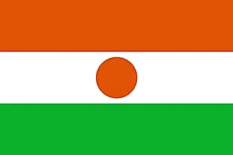
|
| Capital City | Niamey |
| 13 31 N, 2 07 E | |
| Total Area | 1,000,000.00 km2 |
| Land Area | 1,266,700.00 km2 |
| Water Area | 300.00 km2 |
| Population | 23,310,715 |
| Major Cities |
|
| Currency | Communaute Financiere Africaine francs (XOF) |
| GDP | $12.93 Billion |
| GDP Per Capita | $554.60 |
This page was last updated on December 9, 2023