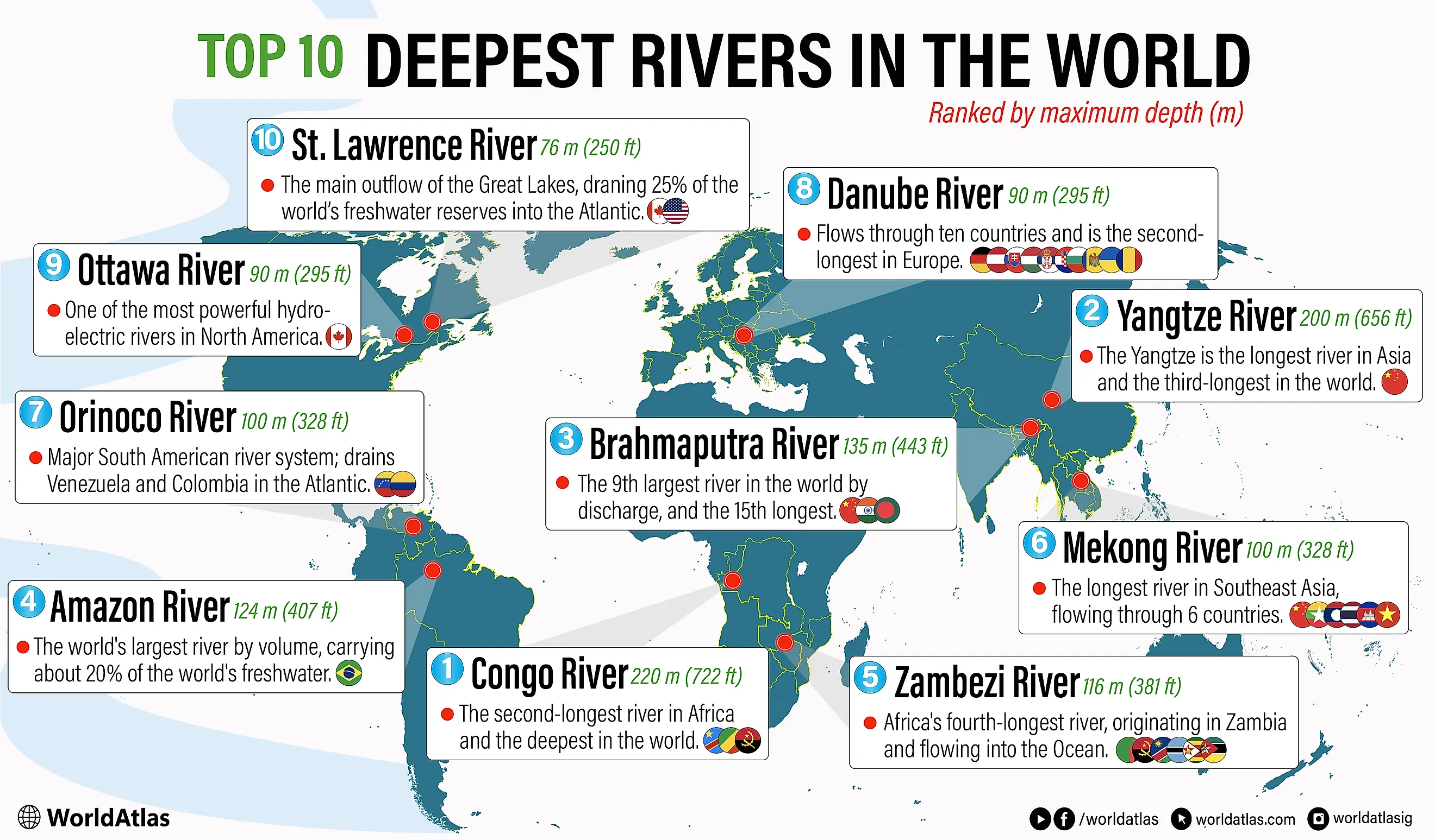
10 Deepest Rivers in the World
The deepest river in the world is the Congo River, with a maximum measured depth of about 220 m (722 ft), followed by China's Yangtze at 200 m (656 ft) and the Brahmaputra at 135 m (443 ft). Ranked by known maximum depth, this top 10 list spans five continents and includes giants like the Amazon, Zambezi, Mekong, Orinoco, Danube, Ottawa, and St. Lawrence.
Depth shapes how these rivers move sediment, carve canyons, generate hydropower, and sustain unique life in dark, high-pressure channels. Deep gorges such as the Congo's underwater canyons, the Yangtze's Three Gorges, and the Iron Gates of the Danube concentrate extreme currents and energy. At the same time, these rivers feed megacities, irrigate fertile floodplains, underpin global trade routes, and anchor rainforests, wetlands, and deltas.
The 10 Deepest Rivers In The World
| Rank | River | Main region(s) | Maximum depth |
|---|---|---|---|
| 1 | Congo River | DR Congo, Rep. of the Congo, Angola | 220 m (722 ft) |
| 2 | Yangtze River | China | 200 m (656 ft) |
| 3 | Brahmaputra River | China (Tibet), India, Bangladesh | 135 m (443 ft) |
| 4 | Amazon River | Brazil | 124 m (407 ft) |
| 5 | Zambezi River | Zambia, Angola, Namibia, Botswana, Zimbabwe, Mozambique | 116 m (381 ft) |
| 6 | Mekong River | China, Myanmar, Laos, Thailand, Cambodia, Vietnam | 100 m (328 ft) |
| 7 | Orinoco River | Venezuela, Colombia | 100 m (328 ft) |
| 8 | Danube River | Serbia, Romania | 90 m (295 ft) |
| 9 | Ottawa River | Canada (Ontario / Quebec) | 90 m (295 ft) |
| 10 | St. Lawrence River | Canada / USA | 76 m (250 ft) |
1. Congo River

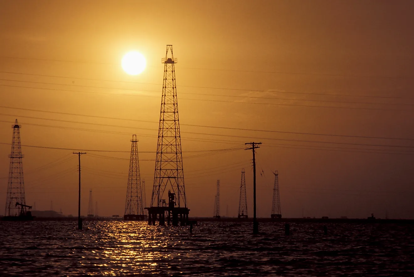
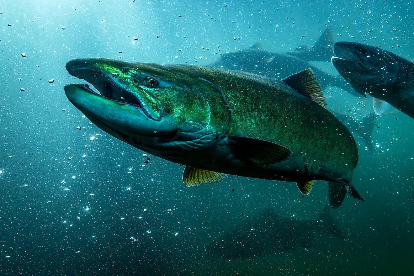
The Congo River is the world's deepest river, with measured depths reaching about 220 m (720 ft), earning it first place on this list. Flowing through today's Democratic Republic of the Congo, Republic of the Congo, and Angola, it forms a 4,700 km (2,900 mi) system draining the vast Congo Basin, Africa's second-largest rainforest region. The Congo is also Africa's second-longest river and the world's third-largest by discharge, sending enormous volumes of freshwater and sediment into the Atlantic. Remarkably, it is the only major river to cross the Equator twice, which helps keep its flow relatively stable year-round. Its turbulent canyons and cataracts, including the famous Livingstone Falls, create extreme depths and hydropower potential that could theoretically supply much of sub-Saharan Africa's electricity demand and supports extraordinarily rich aquatic biodiversity.
2. Yangtze River

The Yangtze River in China is the world's third-longest river and ranks second here, with depths reaching around 200 m (656 ft) in its dramatic Three Gorges section. Rising on the Tibetan Plateau and flowing more than 6,300 km (3,900 mi) to the East China Sea near Shanghai, it drains about a fifth of China's land area and supports nearly a third of its population. For millennia, the Yangtze has been central to Chinese history, culture, transport, and warfare. Today, its basin generates a huge share of China's GDP, anchored by megacities such as Chongqing, Wuhan, Nanjing, and Shanghai. The river is heavily engineered, most notably by the Three Gorges Dam, the world's largest hydroelectric plant, which underscores the Yangtze's immense economic importance and growing ecological pressures on its basin.
3. Brahmaputra River
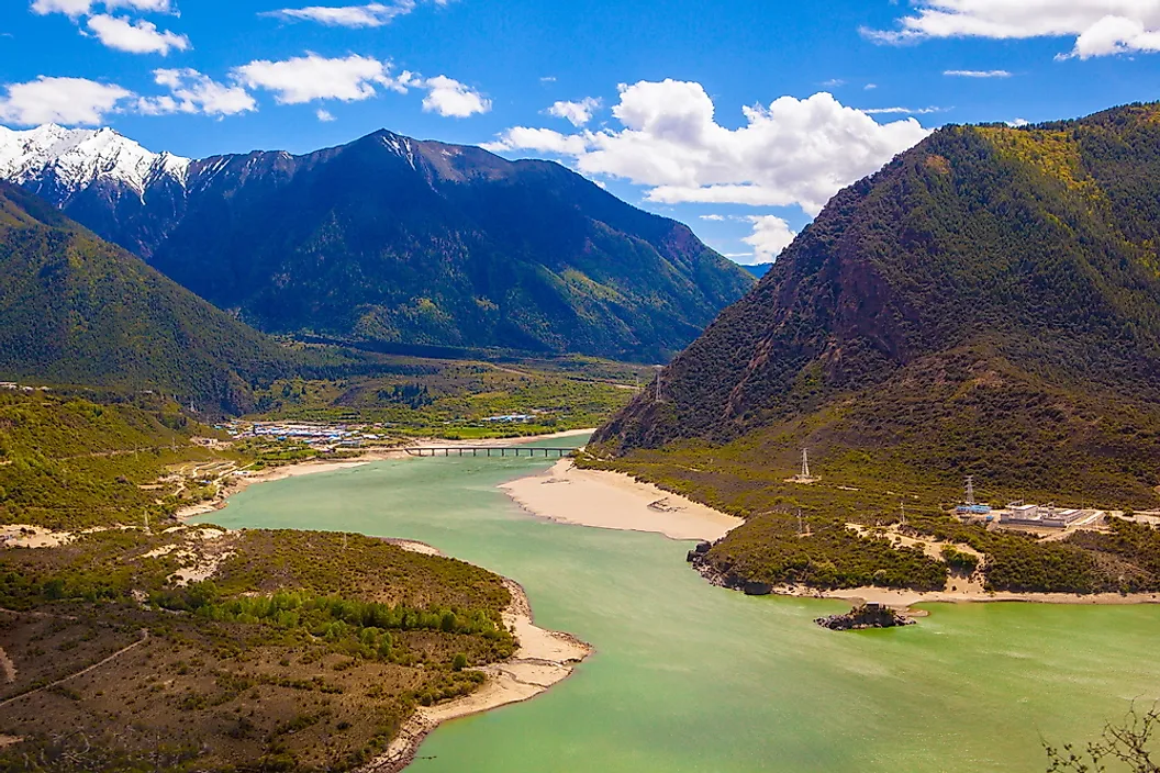
The Brahmaputra River ranks third among the world's deepest rivers, plunging to around 135 m (443 ft) near Sadiya in India. Rising as the Yarlung Tsangpo on the northern side of the Himalayas, it curves through Tibet, then sweeps into India's Assam Valley before fanning across Bangladesh to join the Ganges and reach the Bay of Bengal. A classic braided river, the Brahmaputra is notorious for powerful monsoon floods and dramatic channel shifts, yet its annual overflows also renew some of South Asia's most fertile floodplains. With one of the highest discharges of any river on Earth, it underpins irrigation, inland navigation, fisheries, and dense rural populations and regional economies along its banks, while upstream hydropower projects and climate-driven glacier melt are reshaping the river's long-term flow and flood risks.
4. Amazon River

The Amazon River ranks fourth among the world's deepest rivers, reaching around 124 m (407 ft) in Brazil's lower Amazon near Itacoatiara and Óbidos. Better known for its sheer scale, the Amazon carries more water than any other river on Earth, releasing about one-fifth of all freshwater that flows into the oceans. Fed by thousands of tributaries across Peru, Colombia, and Brazil, it drains the planet's largest river basin and supports the immense Amazon rainforest. Seasonal floods raise water levels by metres, inundating várzea floodplain forests and driving spectacular variations in flow. This depth and volume also underpin major navigation routes linking inland cities like Manaus to the Atlantic, while dam building on tributaries, climate-linked droughts, and record-low river levels are emerging threats to this vast but vulnerable river system.
5. Zambezi River

Ranking fifth among the world's deepest rivers, the Zambezi reaches depths of around 116 m (381 ft) as it cuts through gorges between Zambia and Zimbabwe. Rising in north-western Zambia and flowing 2,574 km to the Indian Ocean, it drains a vast south-central African basin and forms iconic features including Victoria Falls and the Barotse floodplain. The river underpins regional power generation through the Kariba and Cahora Bassa dams, which supply electricity to several countries but have reshaped natural flood pulses downstream. Its waters support rich fisheries, hippos, crocodiles, and large herds of elephants and buffalo along protected stretches like Lower Zambezi and Mana Pools. At the same time, overfishing, pollution, and altered flows threaten delta wetlands, highlighting the tension between hydropower development and safeguarding one of Africa's great rivers.
6. Mekong River
Ranking sixth among the world's deepest rivers, the Mekong reaches depths of 100 m (328 ft) as it carves through steep gorges in China and Laos. Rising on the Tibetan Plateau and flowing 4,350 km through six countries to the South China Sea, it is a crucial trade artery and the lifeblood of mainland Southeast Asia. The Mekong's vast basin supports some of the planet's richest freshwater biodiversity and one of the world's largest inland fisheries, feeding tens of millions in Laos, Cambodia, Thailand, and Vietnam. Yet cascades of hydroelectric dams, sand mining, pollution, and climate-driven droughts are altering flows, reducing sediment delivery, and threatening migratory fish. As pressure mounts, the Mekong has become a test case for balancing energy needs with food security and the health of a river system.
7. Orinoco River
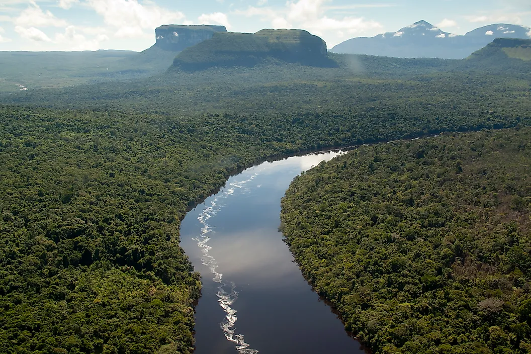
Ranking seventh among the world's deepest rivers, the Orinoco reaches around 100 m (328 ft) at peak depth as it sweeps in a great arc around the Guiana Shield. Rising in Venezuela's Parima Mountains and flowing 2,140 km to a vast Atlantic delta, it drains over one million square kilometres of rainforest, savanna, and wetlands across Venezuela and Colombia. The Orinoco is the fourth-largest river on Earth by discharge, its immense, sediment-rich flow driving a navigation corridor deep into the continent. Its basin shelters pink river dolphins, giant otters, and one of the rarest crocodiles, the Orinoco crocodile, plus over a thousand fish species. Iron ore, oil sands, shipping, and dams bring major economic benefits but also heavy pollution, habitat loss, and intensifying pressure on this powerhouse river system today.
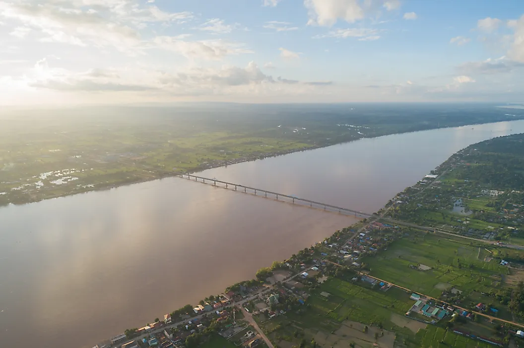
8. Danube River

Ranking eighth on this list, the Danube reaches a maximum depth of about 90 m (295 ft) in the Iron Gates Gorge between Serbia and Romania. Europe's second-longest river flows 2,850 km from Germany's Black Forest to the Black Sea, crossing or bordering ten countries and linking four capitals: Vienna, Bratislava, Budapest, and Belgrade. Historically a Roman frontier, it is now a key inland waterway, connected to the North Sea via the Rhine-Main-Danube Canal and heavily engineered with dams such as Iron Gate I and II for hydropower and navigation. The Danube also supplies drinking water to millions. Ecologically, its floodplains and the UNESCO-listed Danube Delta support rich birdlife and once-great sturgeon runs, but pollution, channelization, and dams have sharply reduced migratory fish and transformed this iconic European river.
9. Ottawa River

Ranked ninth among the world's deepest rivers, Canada's Ottawa River reaches a maximum depth of about 90 m (295 ft) at the Carillon Reservoir. Stretching 1,271 km through Quebec and Ontario, it forms much of the boundary between the two provinces before joining the St. Lawrence near Montreal. Known in Algonquin as Kichi-Sìbì, "Great River," it long served as a vital Indigenous travel and trade corridor, later becoming a key route for French fur traders and the booming 19th-century timber industry. Today, Ottawa is heavily regulated by hydroelectric dams that generate power but disrupt wetlands and fish such as the once-abundant American eel. Its shores still support extensive forests, biologically rich wetlands, and protected parks, making this deep, cold river both an energy artery and an important conservation landscape.
10. St. Lawrence River

Ranking tenth among the world's deepest rivers, the St. Lawrence reaches around 76 m (250 ft) as it carries the waters of the Great Lakes 500 km northeast from Lake Ontario to the Atlantic. Forming part of the Canada-US border between Ontario/Quebec and New York, it is North America's second-largest river by discharge and the main outlet of the Great Lakes Basin. Long used as a travel corridor by Indigenous peoples, it later became France's gateway into the continent and the hinge of British-French rivalry. Today the river is the backbone of the St. Lawrence Seaway, allowing oceangoing ships to reach deep into inland North America. Its vast estuary and gulf host rich biodiversity, from migratory birds to belugas, blue whales, and other marine mammals, and supports major coastal cities.
From the Congo's 220-meter trenches to the St. Lawrence's 76-meter shipping channel, these ten rivers show how depth concentrates energy, biodiversity, and economic power. Their submerged canyons shape global trade, hydropower grids, fisheries, and floodplains that feed hundreds of millions of people. Understanding where and why rivers run deepest helps explain erosion, navigation limits, infrastructure risk, and which aquatic ecosystems face the greatest pressure from development and climate change worldwide.