Maps of Brazil

Brazil occupies the eastern part of South America and, with an area of 3,286,470 square miles (8,511,965 square kilometers), is the fifth largest country in the world. It borders every South American country except Chile and Ecuador. To the north, it shares a boundary with Colombia, Venezuela, Guyana, Suriname, and the French overseas department of French Guiana. To the northwest, it meets Peru and Bolivia, to the west Argentina and Paraguay, to the southwest Uruguay, and to the south it is bounded by the Atlantic Ocean.
Brazil's vast territory comprises several geographical regions with distinct characteristics. The Brazilian Highlands, or the Brazilian Plateau, occupies the eastern, central, and southern portions of the country. This region, characterized by plateaus and low mountain ranges, hosts Brazil's largest city, São Paulo, and the political capital, Brasília. In contrast to the rugged terrain of the highlands, the Pantanal, one of the world's largest freshwater wetland ecosystems, covers the western parts of Brazil and extends into Bolivia and Paraguay.
Brazil's Northern Region holds the Amazon Rainforest, which occupies nearly half of the country. This region includes the states of Acre, Amapá, Amazonas, Pará, Rondônia, Roraima, and Tocantins. The dense rainforest and the immense network of rivers, including the Amazon River, the world's second-longest, play a crucial role in the global climate system and are rich with biodiversity. Also situated in the north is Brazil's highest point : Pico da Neblina at 9,823ft (2,999m) (marked on the map by a yellow upright triangle).
The northeastern region of Brazil, often referred to as Nordeste, includes nine states and features a mix of landscapes from coastal areas to semi-arid regions known as the Sertão. The region is bound by the Atlantic Ocean on the east and north and incorporates the São Francisco River, the longest entirely within Brazil.
Brazil's southeastern region, home to the cities of São Paulo and Rio de Janeiro, showcases a blend of mountains, valleys, and the expansive coastal areas. The region, consisting of the states of Espírito Santo, Minas Gerais, Rio de Janeiro, and São Paulo, contains the Paraná River, part of the second-largest river system in South America.
The southernmost region of Brazil includes the states of Paraná, Santa Catarina, and Rio Grande do Sul. This area displays a subtropical climate and houses significant hydroelectric power infrastructure along the Iguaçu River, such as the Itaipu Dam. Also found in the south is the Pampas lowland, a fertile area with a temperate climate.
Brazil also has an extensive coastline stretching approximately 4,650 miles (7,491 kilometers) along the Atlantic Ocean. It includes numerous islands and archipelagos, such as Fernando de Noronha, Saint Peter and Saint Paul Archipelago, Trindade and Martim Vaz, and the Abrolhos Islands. The coastal area, interspersed with beaches, bays, and inlets, forms a significant part of Brazil's geographical identity.
States of Brazil Map

Brazil (officially, the Federative Republic of Brazil) comprises of the union of 26 states (estados, singular - estado) and 1 Federal District (distrito federal). In alphabetical order, the states are: Acre, Alagoas, Amapa, Amazonas, Bahia, Ceara, Espirito Santo, Goias, Maranhao, Mato Grosso, Mato Grosso do Sul, Minas Gerais, Para, Paraiba, Parana, Pernambuco, Piaui, Rio de Janeiro, Rio Grande do Norte, Rio Grande do Sul, Rondonia, Roraima, Santa Catarina, Sao Paulo, Sergipe and Tocantins. These states are further subdivided into a total of 5,570 municipalities. The Federal District has no municipalities but is divided into 31 administrative regions.
Covering an area of 8.5 million sq.km, Brazil is the world's 5th largest country as well as the largest country in South America and in the Southern hemisphere. It is also the 6th most populous country in the world. Located in the central--west region of the country, at the top of the Brazilian Highlands is, Brasilia - the federal capital city of Brazil. Situated on a plateau of the Brazilian Highlands in southeastern Brazil is Sao Paulo - the largest and the most populous city in Brazil, as well as in the Americas and in the Western and Southern hemispheres. Sao Paulo is the major cultural, financial, economic and industrial center of Brazil and the world's largest Portuguese-speaking city. Rio de Janeiro is Brazil's most famous city.
Where is Brazil?

Brazil is a large country located in the central-eastern part of South America, bordering the Atlantic Ocean. It occupies almost half of the continent's landmass and is dissected by both the Equator and the Tropic of Capricorn. It is hence geographically positioned in the Northern, Southern and Western hemispheres of the Earth, with its major portion lying in the south of the Equator. Brazil shares its borders with all South American countries except Chile and Ecuador. Brazil is bordered by Uruguay to the south; by Argentina, Paraguay and Bolivia to the southwest; by Peru to the west; by Columbia to the northwest; by Venezuela, Guyana, Suriname and French Guiana to the north.
Brazil Bordering Countries: Guyana, Argentina, Bolivia, Paraguay, Peru, Uruguay, Colombia, Suriname, Venezuela.
Regional Maps: Map of South America
Outline Map of Brazil

The above blank map represents Brazil, the largest country in South America. The above map can be downloaded, printed and used for geography educational purposes like map-pointing and coloring activities.

The above outline map represents Brazil, the largest country in South America. It occupies almost 50% of landmass of the continent of South America.
Key Facts
| Legal Name | Federative Republic of Brazil |
|---|---|
| Flag |
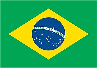
|
| Capital City | Brasilia |
| 15 47 S, 47 55 W | |
| Total Area | 8,515,770.00 km2 |
| Land Area | 8,358,140.00 km2 |
| Water Area | 157,630.00 km2 |
| Population | 211,049,527 |
| Major Cities |
|
| Currency | Reals (BRL) |
| GDP | $1.84 Trillion |
| GDP Per Capita | $8,717.19 |
This page was last updated on June 27, 2023