Maps of Angola

Angola, located on the western coast of Southern Africa, covers a total area of 1,246,700 sq km (481,400 sq mi square miles) and has a population of 34,031,000. The official language is Portuguese, and several Bantu languages are also widely spoken. In terms of size, Angola is slightly larger than South Africa and roughly twice as large as Texas. It shares borders with several countries: Namibia to the south, Zambia to the east, the Democratic Republic of the Congo to the north-east, and the Republic of Congo to the north. The Atlantic Ocean, providing a 1,600 kilometers (994 miles) coastline, shapes the country's western edge. The province of Cabinda, located to the north of the main country, is separated from the rest of Angola by a strip of land belonging to the Democratic Republic of Congo.
The geography of Angola is composed of three major regions: the coastal lowlands, the interior hills and mountains, and the eastern high plateau.
The coastal lowlands region stretches along the Atlantic Ocean. The coastline, which varies between flat sandy beaches and rocky cliffs, gives way to a narrow strip of low-lying land. This strip includes the country's capital and major ports such as Lobito and Namibe. Luanda, the capital and largest city, is home to over 8 million inhabitants, comprising around a fourth of Angola's total population. Beyond the capital, Angola also hosts major regional airports at Huambo, Luena, and Uìge. The region also features the Namib Desert that stretches into Namibia to the south.
Beyond the coastal lowlands, the terrain ascends to interior hills and mountains, forming a series of escarpments. These escarpments create dramatic landscapes characterized by steep slopes and deep valleys. One of these ranges, the Serra da Leba, is renowned for its scenic hairpin bends. This region serves as a critical watershed, giving rise to several rivers that flow either west to the Atlantic Ocean or east towards the interior highlands.
The eastern high plateau region, also known as the Planalto, is the most extensive geographical region of Angola. The high plateau region boasts elevations typically between 1,200 and 1,800 meters (4,000 to 6,000 feet), and the country's highest point, Morro de Moco, reaches an impressive height of 2,620 meters (8,592 feet). The region hosts extensive savannahs and is substantially cooler and drier than the coastal areas. The fertile soils here have traditionally supported the country's agricultural activities.
The River Kwanza (Cuanza) is the most notable water body in Angola. It originates from the country's highlands and flows over 960 kilometers (597 miles) westward, emptying into the Atlantic Ocean. The Kwanza River is a vital water source for the nation's capital, Luanda, and its lower course has been harnessed for hydroelectric power.
Another significant river, the Zambezi, forms part of Angola's eastern border with Zambia. Although most of the Zambezi’s course lies outside Angola, its upper reaches wind through the country’s eastern highlands. The river provides a critical water source for both people and wildlife in this region.
In terms of bodies of water, the largest is the Calandula Waterfalls (also known as the Kalandula Falls) on the Lucala River. These waterfalls are among the largest in Africa by volume of water.
Provinces of Angola Map

The political map of Angola shows the 18 provinces and their capital cities. The most populated province is Luanda which contains its capital city. Its largest province by area is Cuando Cubango located in the south-east at 204,000 km² followed closely by its northern neighbor Moxico at 201,000 km². Cabinda is an exclave that is separated from the rest of Angola by a narrow strip of territory that belongs to the Democratic Republic of the Congo
18 provinces of Angola; Bengo, Benguela, Bie, Cabinda, Cuando Cubango, Cuanza-Norte, Cuanza-Sul, Cunene, Huambo, Huila, Luanda, Lunda-Norte, Lunda-Sul, Malanje, Moxico, Namibe, Uige, and Zaire.
Where is Angola?

Angola is located on the southwestern Atlantic Coast of Africa between Namibia and the Republic of the Congo. It also is bordered by the Democratic Republic of the Congo and Zambia to the east.
Angola Bordering Countries: Namibia, Zambia, The Congo, The Democratic Republic Of The Congo.
Regional Maps: Map of Africa
Outline Map of Angola


Key Facts
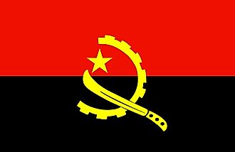
| Legal Name | Republic of Angola |
|---|---|
| Flag |
|
| Capital City | Luanda |
| 8 50 S, 13 13 E | |
| Total Area | 1,246,700.00 km2 |
| Land Area | 1,246,700.00 km2 |
| Water Area | N/A |
| Population | 31,825,295 |
| Major Cities |
|
| Currency | Kwanza (AOA) |
| GDP | $94.64 Billion |
| GDP Per Capita | $2,973.59 |
This page was last updated on May 25, 2023