How Many Dams Hold Back America's Largest Lakes?
Some of America's largest lakes are not natural lakes at all. They are reservoirs created when enormous dams were built across rivers, transforming valleys and river channels into broad bodies of water used for drinking water, irrigation, flood control, hydropower, recreation, and wildlife habitat.
The United States has hundreds of major reservoirs, but only a relatively small group rank among its largest by surface area. They occur exclusively on large US reservoirs created and held back by major dams, rather than natural lakes whose water levels may be influenced by dams elsewhere in their watersheds. Seven of the largest are each held back by a single major dam.
Lake Oahe and Oahe Dam

Lake Oahe is about 370,000 acres (578 mi² or 1,497 km²) and stretches over 200 miles (322 km) along the Missouri River through South Dakota and North Dakota. The reservoir was created by the Oahe Dam, a large earth-fill dam near Pierre, South Dakota.
Oahe was part of the Missouri River Basin development program that began after the devastating floods of the 1940s. Today, Lake Oahe provides flood control, hydroelectric power, water supply, navigation, and irrigation. With its winding shoreline, bays, points and coves, it is a popular place for fishing, boating, and other outdoor recreation.
Lake Sakakawea and Garrison Dam

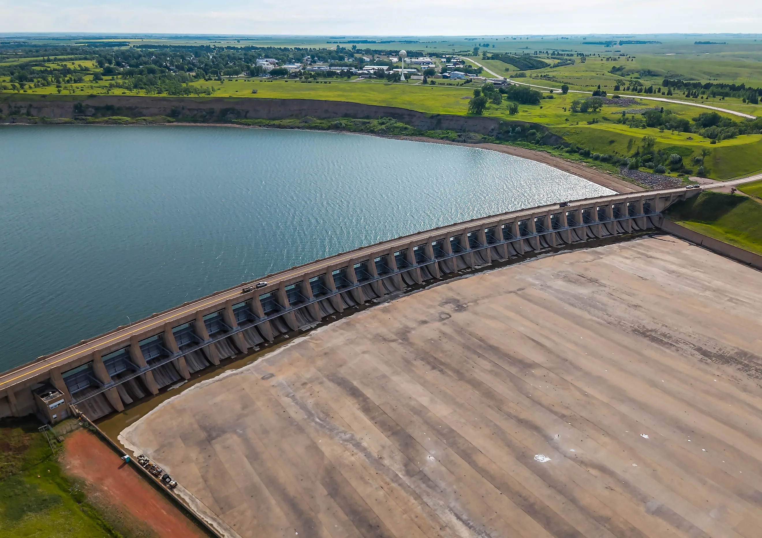
Lake Sakakawea is a huge reservoir on the Missouri River that covers around 307,000 acres (480 mi² or 1,243 km²). The reservoir was created by the Garrison Dam near Riverdale, North Dakota. The reservoir has hundreds of miles of shoreline and is about 178 miles (286 km) long.
It also is an important water source for the state and is used for irrigation, hydroelectric power, wildlife habitat, boating, fishing, and camping. Like Lake Oahe, Lake Sakakawea was built as part of the larger plan to control floods and manage water on the Missouri River, demonstrating how much dams have altered the river and the land around it.
Lake Powell and Glen Canyon Dam

Lake Powell covers approximately 161,390 acres (252 mi² or 653 km²) at full pool, and stretches for approximately 186 miles (299 km) along the Colorado River between Arizona and Utah. The reservoir was created when Glen Canyon Dam was finished in 1966, flooding parts of Glen Canyon, which now snakes through a dramatic landscape of red-rock cliffs, narrow canyons, beaches and hundreds of side canyons.
Glen Canyon Dam generates hydroelectric power and manages water deliveries throughout the Colorado River Basin. As water levels fluctuate, Lake Powell's surface area can become significantly smaller than its maximum size during periods of drought.
Lake Mead and Hoover Dam

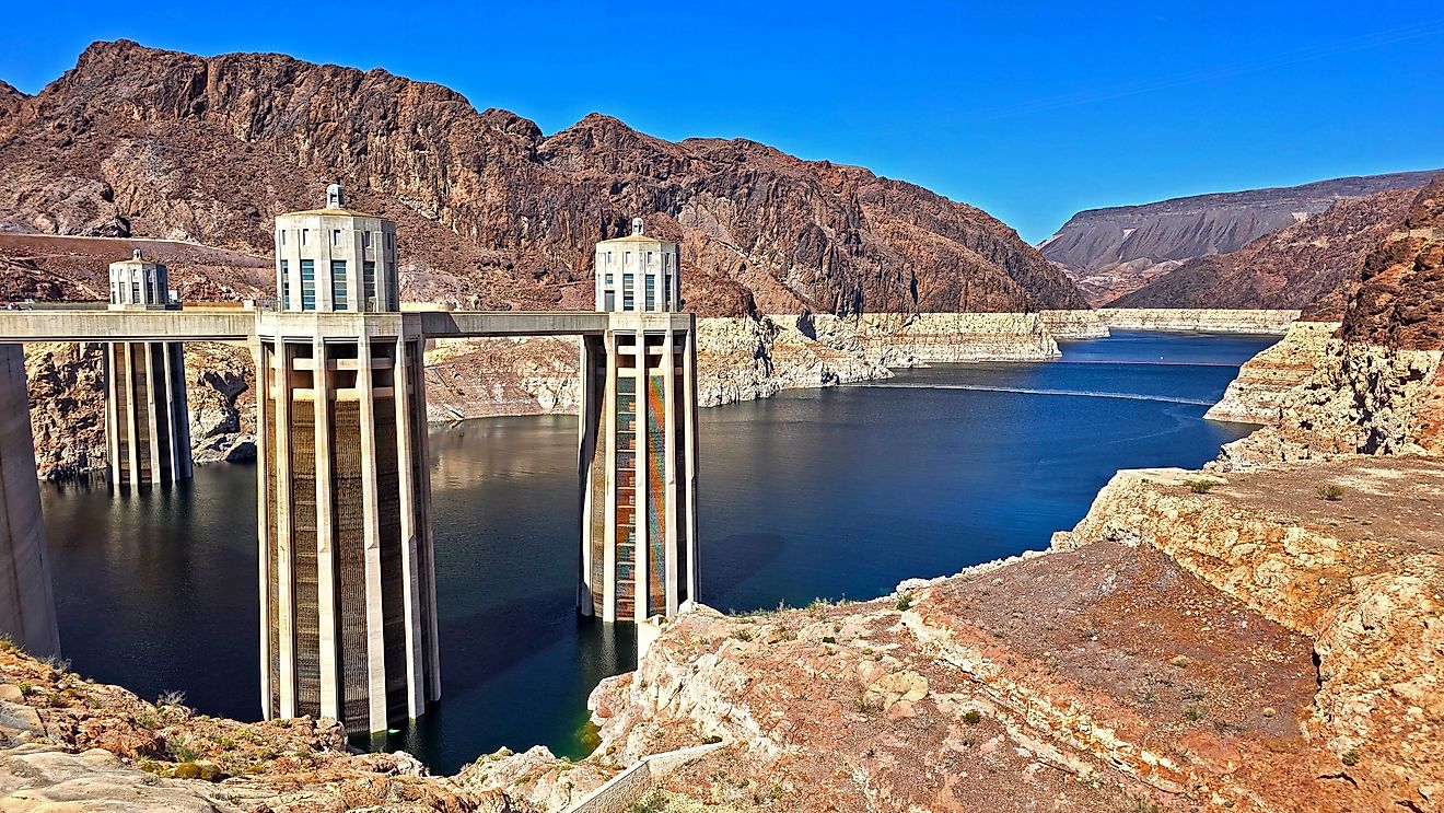
The Hoover Dam created Lake Mead, one of America's most famous man-made lakes. When full, Lake Mead covers about 157,000 acres (245 mi² or 634 km²). The reservoir, formed when Hoover Dam was completed in the 1930s, extends some 110 miles (177 km) along the Colorado River between Arizona and Nevada.
Lake Mead offers critical water storage for communities and agricultural users throughout the Southwest, and Hoover Dam provides hydroelectric power. The reservoir is one of the largest in the United States in maximum size. That figure is a ceiling, though, because the surface area of the reservoir changes dramatically with changes in the water levels of the Colorado River.
Fort Peck Lake and Fort Peck Dam

Fort Peck Lake is one of the largest reservoirs in the United States and the largest reservoir in Montana, covering about 245,000 acres (383 mi² or 992 km²). Created by Fort Peck Dam across the Missouri River in northeastern Montana, the reservoir extends more than 130 miles (209 km) and has a highly irregular shoreline.
Constructed by the US Army Corps of Engineers during the 1930s, the dam was one of the era's major public works projects. Today, Fort Peck Lake provides flood control, hydroelectric power, water storage and recreation. Its remote setting supports diverse fish and wildlife habitats.
Lake Cumberland and Wolf Creek Dam

Lake Cumberland is about 65,530 acres (102 mi² or 264 km²) at maximum pool. Wolf Creek Dam was built across the Cumberland River in south-central Kentucky. It doesn't have the vast surface area of the Missouri River reservoirs, but its long shoreline and deep, twisting arms make it one of the nation's top reservoirs.
Originally created for flood control and to provide hydroelectric power, Lake Cumberland today is a popular destination for boating, fishing and other recreational activities. Its slender arms follow the paths of the original river valleys and create the reservoir's characteristic labyrinthine form.
Lake Texoma and Denison Dam

Lake Texoma is on the Texas-Oklahoma border where the Red River is dammed by the Denison Dam and encompasses about 89,000 acres (139 mi² or 361 km²). The reservoir is one of the largest man-made lakes in the region and is well known for boating, fishing, marinas, and waterfront recreation. Built for flood control, hydroelectric power, and water conservation, Denison Dam created a reservoir jointly managed by Texas and Oklahoma.
Today Lake Texoma is a major recreation and tourism destination in the southern Great Plains because of its large surface area and long shoreline.
The Dams Behind America's Biggest Lakes
The sheer size of America's largest reservoirs is mostly a result of the locations and purposes for which their dams were built. The biggest projects in the country were built on the great rivers like the Missouri and Colorado where dams could hold vast quantities of water and provide flood control and power as well.
The result is a one-of-a-kind American landscape of man-made lakes that snake for hundreds of miles through ancient river valleys. Some, such as Lake Powell and Lake Mead, are important for water management in the arid Southwest. Others, including Lake Oahe, Lake Sakakawea, and Fort Peck Lake, form parts of the Missouri River reservoir system.
On a map, these reservoirs may resemble natural lakes, but their very existence is predicated upon the massive dams that contain their waters.