Red River of the South
The Red River of the South, named “Rio Rojo” by the Spanish, is a principal river in the Southern United States and one of the several rivers that go by the same name. Other rivers by the same name include the Red River in India, the Red River of the North in the United States and Canada, and the Red River in Vietnam and China. The Red River of the South, once a tributary of the Mississippi River, is 2,190 km long. It rises in eastern New Mexico and empties into the Atchafalaya River, which empties its water into the Gulf of Mexico. However, it is linked to the Mississippi River via the Old River Control Structure. The Red River drains an area of approximately 169,890 square kilometers.
Course

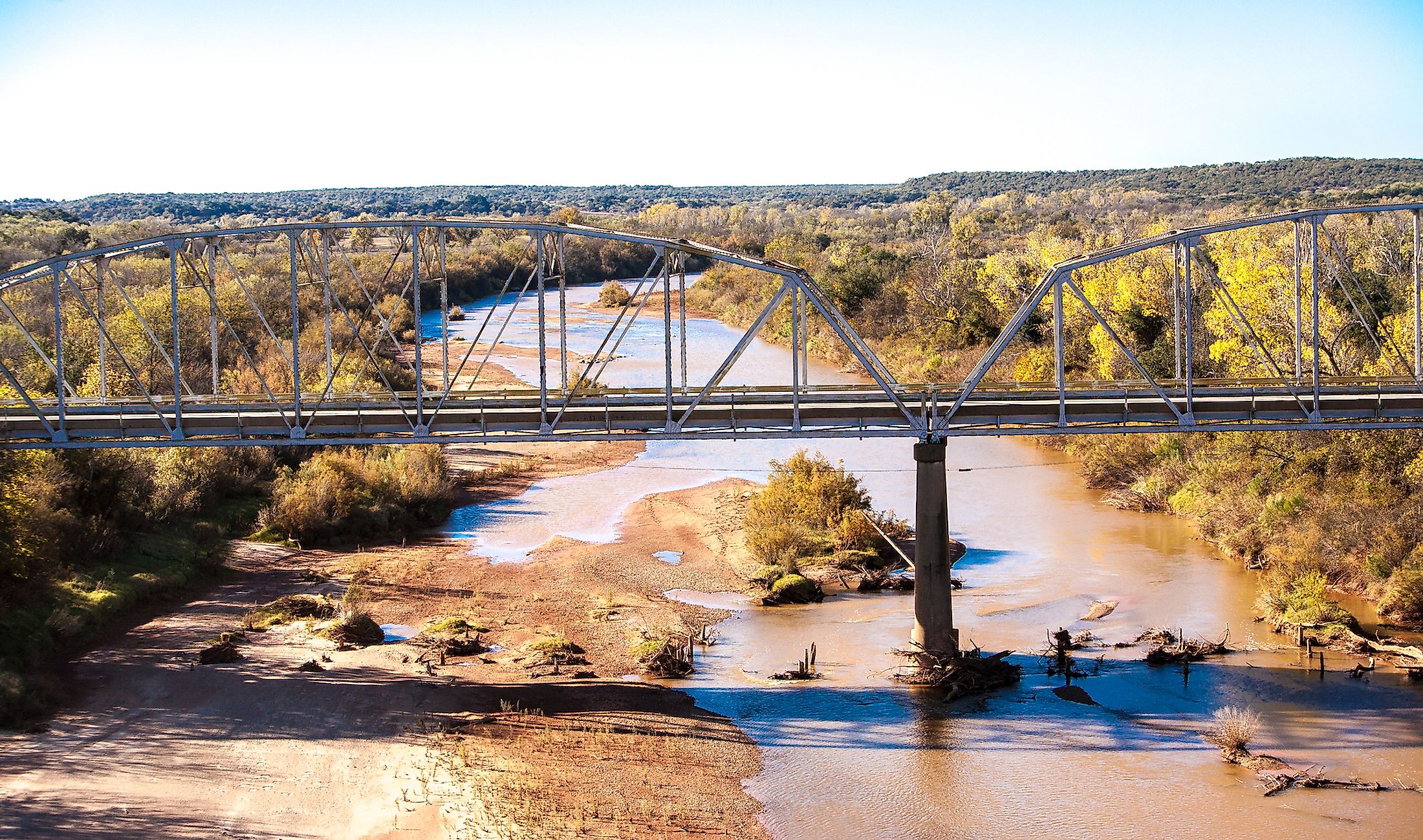
The Red River of the South is formed by two branches; Prairie Dog Town Folk (the main branch) and North Folk Red River. The Prairie Dog Town Folk or the southern branch is a 190 kilometers long sandy stream originating from Randall County in Texas. It is formed by the confluence of Palo Duro Creek and Tierra Blanca Creek. From Randall County, the Prairie Dog Town Folk cuts through the Paulo Duro Canyon a few kilometers from Amarillo in the Texas Panhandle. It turns southeast to cross the 100th meridian, then turns south and flows through Newlin, from where it crosses into Oklahoma. In Oklahoma, the stream flows through the counties of Jackson, Tillman, and Harmon. The Folk is joined by the Salt Folk Red River about 3 kilometers off Elmer’s South, with the North Folk Red River joining the combined river in Fredrick, Oklahoma, forming the Red River.
The Red River continues east through the Great Plains and into Lake Texoma. The river exits the Texamo on the eastern end, then flows eastwards to Arkansas, where it receives the Muddy Boggy Creek. At Texarkana, the Red River turns southwards and crosses into Louisiana. About 2.5 kilometers south of Acme, the Black River joins the Red River. The combined river broadens into a complex marshland before joining the Atchafalaya River, which flows into the Gulf of Mexico. Major tributaries of the Red River include Prairie Dong Folk Town, North Folk, Salt Folk, Washita, Wichita, Sulphur, Black, and Loggy Bayou.
Brief History
The Red River of the South accommodated diverse Native American cultures before the European arrival, including the various tribes belonging to the Caddo Confederacy. These tribes, who mainly dominated the Piney Wood’s eastern side, depended on the lake for fish and nearby land for game. The Tonkawa and Wichita dominated the river’s middle section, where they constructed temporary and portable houses and practiced agriculture and hunting. The Lipan Apache settled mainly around the river’s western part.
The early navigation of the Red River was impeded by a collection of tree logs, referred to as the “Great Raft.” The log jam was over 260 kilometers long and was not cleared until the 1870s, though Captain Miller Shreve started removing the logs in 1839. The Red River was also a tributary of the Mississippi River until around the mid-1900s. However, a flood control system constructed along the Old River diverted the river, ceasing to be a Mississippi’s tributary. The area around the Red River hosted the Red River Campaign during the American Civil War.