Cumberland River
The Cumberland River is a river in the Southern United States formed in Harlan County, Kentucky, at the confluence of Clover, Martin's, and Poor Forks. The river flows from southeastern Kentucky and loops through northern Tennessee, then curves back to western Kentucky and joins the Ohio River at Smithland.
Major Features

The Cumberland is approximately 1,107 kilometers long and drains 46,000 square kilometers. It is the country’s 21st longest river and the third-longest river flowing through Kentucky. Although the river basin is in rural areas, several large cities are located along the river, including Carthage, Clarksville, and Nashville. The river and some of its tributaries have been dammed extensively to control floods.
The Cumberland River flows for approximately 1,107 kilometers from the confluence of the Clover, Martins, and Poor Forks in Harlan County, Kentucky, to its mouth at the Ohio River in Smithland. It rises at an elevation of 353 meters above sea level and falls by about 262 meters on its journey to Smithland, located at an elevation of 92 meters. The river has a drainage area of about 46,000 square kilometers and drains southern Kentucky and northern Tennessee. It discharges an average of 1,055 cubic meters of water per second and a maximum of 5,900 cubic meters per second. The Cumberland has several tributaries, including Martin Fork, Big South Fork, Clear Fork, Clover Fork, Little, and Red Rivers.
Course
The Cumberland River begins in Baxter, Kentucky, at the point of confluence forks: Martin’s, Clover, and Poor Forks. The Martin’s Fork originates from the Cumberland Mountains in Bell County and flows east and north to Baxter. The Clover Fork rises from the Black Mountain in Harlan and flows west to Harlan, while the Poor Fork originates on the Pine Mountain near Flat Gap in Letcher County and flows southwestwards to Baxter.

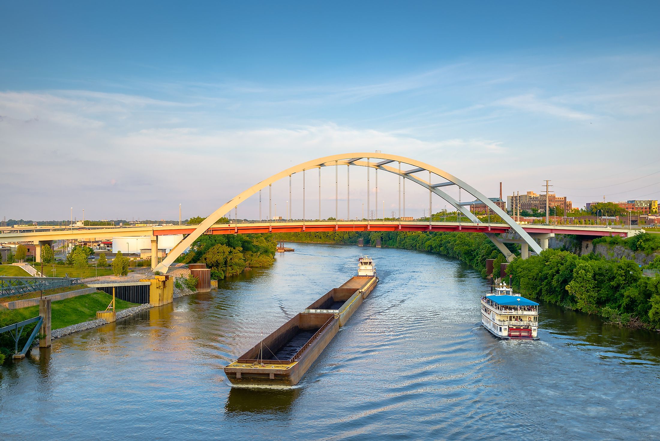
From Baxter, the Cumberland River continues westwards through the Kentucky mountains, then turns northwards to Cumberland Falls. Shortly after the falls, the river turns west and receives other streams and creeks, including Rockcastle, Laurel, and Big South Fork, towards Lake Cumberland. The river slopes southwestwards from the artificial reservoir, then turn south and cross into Tennessee near Celina, and receives waters from Caney Fork and Obey River. The Cumberland flows through northeastern Nashville, where the river is dammed to form Old Hickory Lake and Cordell Hull Lake. It picks the Stone River and turns northwestwards to Clarksville, where it receives the Red River. Then it crosses back to Kentucky and flows on the land between Lake Barkley and Kentucky Lake. Finally, the Cumberland River turns north and joins the Ohio River at Smithland.
Brief History
The Shawnee Native Americans living along the river referred to the Cumberland as “Wasioto. When the French traders arrived in the area called the river “Riviere des Chaouanons,” meaning “the River of the Shawnees.” In 1758, Thomas Walker named it “Cumberland River.” However, it is not clear whether Walker named the river after Cumberland County or Duke of Cumberland. The river was later known as the Shawnee River.
The Cumberland River was an important route for settlers. The damming of the river began in the mid-1900s under the Tennessee Valley Authority System. The Center Hill Dam in southeast Carthage in 1951, followed by the Wolf Creek Dam in 1952, which created Lake Cumberland. The Old Hickory Dam was constructed between 1952 and 1957, while Barkley Dam has been operating since 1966.