How Many US Lakes Are Actually Reservoirs?
According to the U.S. Environmental Protection Agency's 2012 National Lakes Assessment, an estimated 48% of the roughly 111,119 lakes across the lower 48 states are reservoirs, meaning water impounded behind a dam rather than a basin that filled on its own. So when you paddle out onto an American "lake," the odds are close to a coin flip that you are floating over a flooded river valley, a dammed canyon, or a drowned town. The bigger and more famous the "lake," the better those odds get, because most of the largest bodies of water in the country were poured behind concrete in the 20th century.
The Numbers Behind The Split

For the 2012 National Lakes Assessment, EPA analysts reviewed satellite imagery, field visits, and historical records to sort each sampled water body into natural or manmade. Of the 111,119 qualifying lakes they estimated across the lower 48 states, about 58,700 (52%) formed naturally and about 53,119 (48%) were built as reservoirs. Those figures leave out the Great Lakes, the Great Salt Lake, brackish coastal lakes, treatment ponds, and anything smaller than 2.47 acres (1 hectare) or shallower than 3.3 feet (1 meter), so the true reservoir share among the country's tiniest ponds and largest lakes may run higher or lower.
Size is where the two types part ways. The assessment found that 40% of reservoirs cover less than 10 acres (4 hectares), against just 22% of natural lakes that small. Farm ponds, municipal water-supply impoundments, and stock tanks account for much of the reservoir count at the bottom of the scale, while natural lakes fall more evenly across every size. That pattern flips at the top, though. Once you get to the giants, the household names with marinas and state parks, the reservoirs take over almost completely.
Lake Mead: The Largest Reservoir In The Country
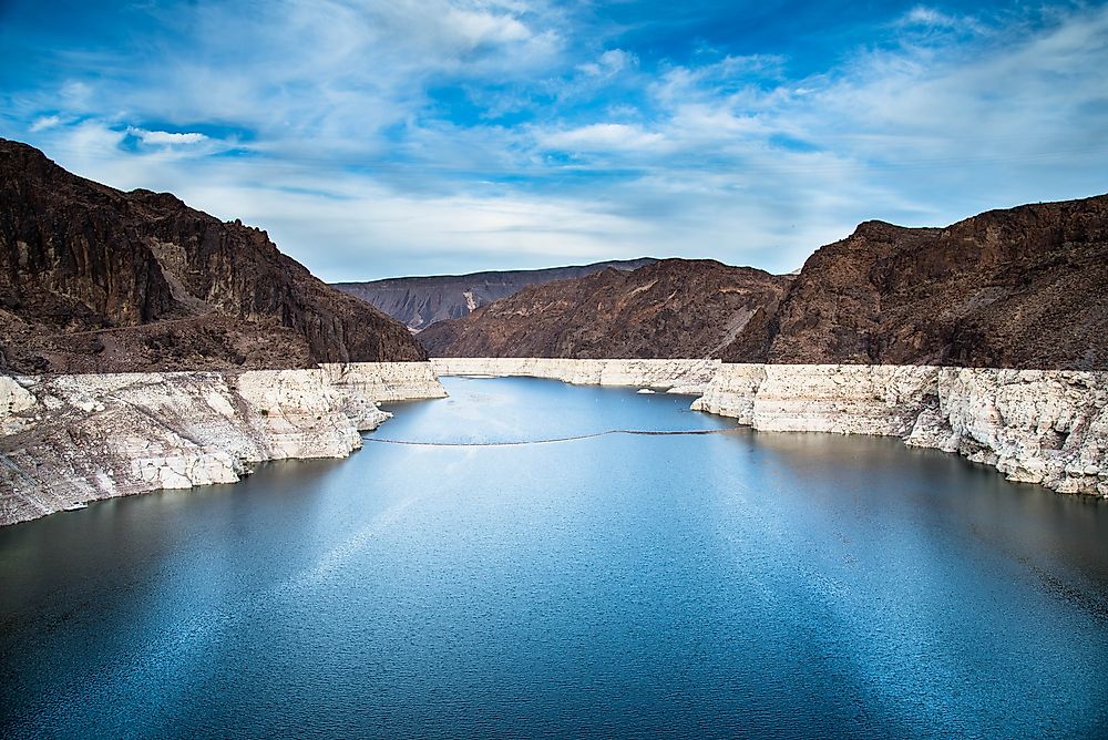
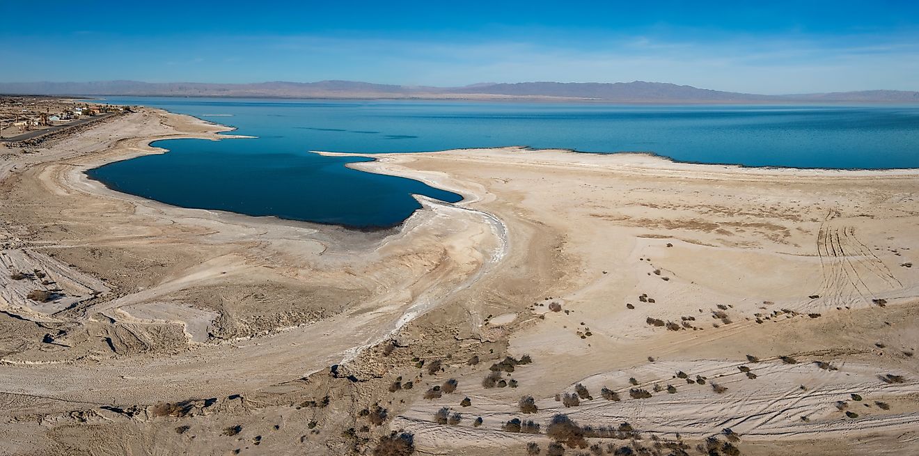
No American reservoir holds more water than Lake Mead, and none makes the point better. When the Bureau of Reclamation finished Hoover Dam across the Colorado River in 1936, the river pooled at the edge of the Mojave Desert into a body of water that now supplies roughly 20 million people across Arizona, California, Nevada, and northern Mexico. At full pool it holds around 26 million acre-feet, though it has not been anywhere near full since 1983. A multi-decade drought dropped Lake Mead to about a quarter of capacity by August 2026, its lowest level since the reservoir first filled in the 1930s, exposing bathtub rings of pale mineral deposit hundreds of feet up the canyon walls. You would not guess a dam from the name, but the pale rings on the rock show exactly where the water once stood.
Lake Powell: A Drowned Canyon On The Same River

Three hundred river miles upstream sits the country's second-largest reservoir, and its origin is written into the landscape even more plainly. Glen Canyon Dam closed its gates in 1963, and the Colorado backed up into the side canyons of Glen Canyon to form Lake Powell. It took 17 years for the water to reach its full-pool mark in 1980, drowning nearly 200 miles of red-rock canyon in the process. The result is a reservoir with more than 1,900 miles of jagged shoreline when full, threaded through slot canyons and sandstone arches. Together, Lake Mead and Lake Powell store the working capital of the entire Colorado River system, which is why federal operators manage them as a linked pair, shifting water between the two to protect hydropower and downstream deliveries.
The Missouri River Giants

The dam-building boom was not confined to the arid West. Beginning in the 1930s, the U.S. Army Corps of Engineers strung a chain of massive dams along the Missouri River under the Pick-Sloan program, creating some of the largest reservoirs east of the Rockies. Lake Sakakawea, impounded behind Garrison Dam in 1953, is the country's third-largest reservoir by volume and the largest artificial lake sitting entirely inside a single state. Its roughly 1,320 miles of shoreline exceed the length of California's Pacific coast. Just downstream in South Dakota, Lake Oahe stretches even farther in surface area. Visitors who did not grow up on the Great Plains routinely take both for natural prairie lakes, an easy mistake to make when a reservoir runs 180 miles up a river valley with no dam in sight for most of its length.
Lake Lanier: A City's Water Supply

Reservoirs built as urban water supplies rarely look the part. Lake Lanier, the largest lake in Georgia and the main water source for metropolitan Atlanta, began forming in 1956 when the Army Corps of Engineers closed Buford Dam on the Chattahoochee River. The valley took two and a half years to fill, reaching full pool in 1958, and the rising water covered farms, roads, and cemeteries. During a drought the following year, the stored supply kept Atlanta's taps running when the Chattahoochee below the dam would otherwise have nearly dried up. Today Lanier draws millions of visitors to its 690-plus miles of shoreline, few of whom think of it as a piece of municipal infrastructure, which is exactly what it is.
Lake Of The Ozarks: Power First, Playground Later

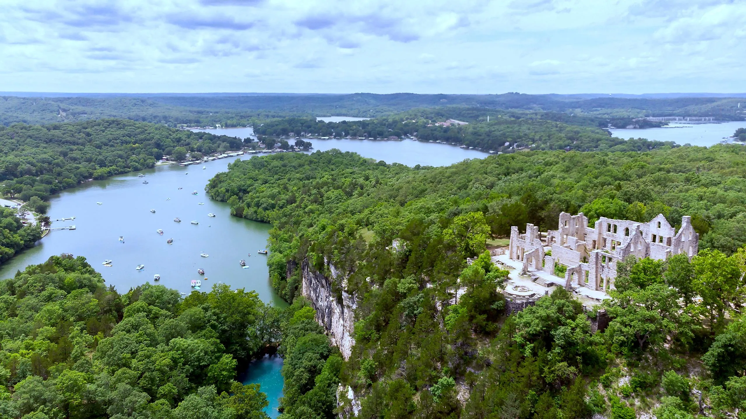
Some reservoirs began as private power projects and grew into tourist economies almost by accident. In 1931, the Union Electric Company completed Bagnell Dam across the Osage River in central Missouri to generate hydroelectric power, and the water backing up behind it became Lake of the Ozarks. Flooding the winding river valley produced a serpentine outline with roughly 1,150 miles of shoreline, more than most people expect from a single lake, and over the following decades developers turned that endlessly indented shore into one of the Midwest's busiest resort destinations. North Carolina's largest lake, Lake Norman, followed a similar path a generation later, when Duke Power raised Cowans Ford Dam on the Catawba River between 1959 and 1963. Both are household names in their regions, and both owe their existence entirely to a utility's balance sheet.
Where Natural Lakes And Reservoirs Concentrate

Reservoirs and natural lakes are not spread evenly across the country, and the pattern maps almost perfectly onto glacial history. The National Lakes Assessment found that most natural lakes cluster in five ecoregions: the Upper Midwest, the Northern Appalachians, the Temperate Plains, the Coastal Plains, and the Western Mountains, all shaped by glaciation or other basin-forming processes long ago. Minnesota and Wisconsin, scoured by ice sheets that retreated roughly 10,000 years ago, count more than 11,000 and 15,000 natural lakes respectively.
Reservoirs, by contrast, turn up nearly anywhere, because a dam needs only a river, the right terrain, and funding, not an ice age. That is why states the glaciers never reached can still show dozens or hundreds of lakes on a map, almost all of them impounded. Maryland is the extreme case: it is one of only three states, along with West Virginia and Oklahoma, with no documented natural lakes at all. Every body of water in Maryland that carries the word "lake," including Deep Creek Lake, sits behind a dam, because the state lies south of where the last ice age's glaciers stopped.
What This Means For Lake-Goers Today
The next time you look up a lake for a weekend trip, it is worth checking whether "lake" really means dam. Agencies raise and lower reservoirs for irrigation, power generation, and flood control, which can make the boating season more predictable but also brings periodic drawdowns that strand docks and close boat ramps. Natural lakes rise and fall with rainfall and snowmelt alone. Neither type is better for recreation as a rule, but knowing which one you are dealing with explains a lot: why a favorite lake drops on a strangely regular schedule, or why a state that no glacier ever touched still seems to be dotted with them.
Reservoir Or Not, America's Lakes Add Up

Whether a basin took thousands of years of glacial retreat to form or filled in a matter of months behind a new concrete dam, every American lake now plays a part in how the country stores water, generates power, and spends its weekends. With reservoirs making up close to half the nation's lakes and outright majorities in some regions, "lake" often turns out to be shorthand for engineered water space. That distinction rarely shows up on a map, yet it shapes almost everything about how a given lake behaves, from its shifting water levels to its buried history to the wildlife found in and around it.