Why The East Has Almost No Big Reservoirs
Every one of the ten largest reservoirs in the United States is west of the Mississippi. Lake Mead holds about 28.9 million acre-feet, Lake Powell around 24.3 million, and Sakakawea, Oahe and Fort Peck are all in the same class. The largest reservoirs east of the river are an order of magnitude smaller, and Quabbin, which supplies most of metropolitan Boston, holds roughly 412,000 acre-feet. That is not an accident of geology or of engineering ambition. It is the combined result of rainfall patterns, canyon shapes, land prices and a single piece of 1902 legislation that drew a line down the middle of the country and put the reservoir-building agency on one side of it.
Four reasons explain the entire imbalance, and only the first one is about water.
The East Does Not Need To Store Water
This is the fundamental answer and everything else follows from it. A reservoir exists to move water through time, holding it from the season when it arrives to the season when it is needed. Parts of Nevada see fewer than five inches of rain a year, and most of what the interior West does receive falls as winter snow that melts over a few weeks in spring. Without storage there is simply no water in August.
The East gets 40 to 60 inches a year and gets it more or less continuously. Rain in July, rain in November, rivers that run all summer. When the supply arrives on the same schedule as the demand, there is nothing to smooth out, and a giant reservoir solves a problem the region does not have.
The Reclamation Act Only Applied To The West
Here is the institutional reason, and it is more decisive than most people realize. The Reclamation Act of June 17, 1902 authorized the federal government to build dams, reservoirs and canals to irrigate arid land, and it applied to 17 conterminous states west of the Mississippi. The agency it created, now the Bureau of Reclamation, exists to build exactly the kind of enormous storage project this article is about, and it was legally confined to the western half of the country from its first day.
The scale of what that authority produced is easy to underestimate. Reclamation facilities now store up to 140 million acre-feet of water, serve more than 10 million acres of farmland and supply 31 million municipal and industrial customers. It is the largest wholesaler of water in the country. None of that machinery was ever pointed east.
The Deal That Made It Happen
The geographic split was not an oversight, it was the price of passage. Eastern and Midwestern members of Congress opposed the Reclamation Act, reasonably enough, on the grounds that it was federal money for one region. Western senators broke the deadlock by filibustering and killing a rivers and harbors bill that the opponents wanted.
Senator Francis Warren of Wyoming made the argument explicitly, complaining that as things stood the Rivers and Harbors Bill favored one half of the country. That is the trade in a sentence. The East got federal money for navigation, dredging and harbors, and the West got federal money for irrigation storage. Both halves were subsidized, just for entirely different things, and the physical evidence of that bargain is still sitting on the landscape.
The Corps Built The East, And Built Different Things

Eastern water projects overwhelmingly belong to the US Army Corps of Engineers rather than to Reclamation, and the Corps builds for different purposes. Its eastern portfolio is dominated by flood control, navigation and hydropower, and a flood control reservoir is designed to be partly empty most of the time so it has room to absorb a storm. That is close to the opposite of a storage reservoir, which is designed to be as full as possible.
Raystown Lake in Pennsylvania, Summersville in West Virginia and most of the Tennessee Valley Authority system all follow that pattern. They are substantial pieces of infrastructure. They were simply never asked to hold a year's water supply, because nobody in those watersheds needed them to.
The Topography Does Not Cooperate
Even if the East had wanted Lake Mead, it does not have anywhere to put one. The ideal reservoir site is a deep narrow gorge with a wide basin behind it, which lets a relatively small dam impound an enormous volume. Hoover Dam sits in Black Canyon and Glen Canyon Dam sits in a sandstone slot, and both plug a gap a few hundred feet wide to hold back millions of acre-feet.
Eastern rivers mostly run through broad, gently sloping valleys worn down by a far longer history of erosion, with no comparable narrows. Damming one floods a very large area to gain a comparatively modest volume of water, which is the worst possible ratio. The Appalachians offer the closest thing to western topography in the East, which is precisely why the TVA reservoirs are concentrated there.
Flooding An Eastern Valley Costs More

The last reason is arithmetic rather than hydrology. Glen Canyon Dam flooded a spectacular canyon that almost nobody lived in. An equivalent eastern reservoir would flood farms, towns, roads, railways and several centuries of settlement, and the acquisition cost and political resistance scale with all of it.
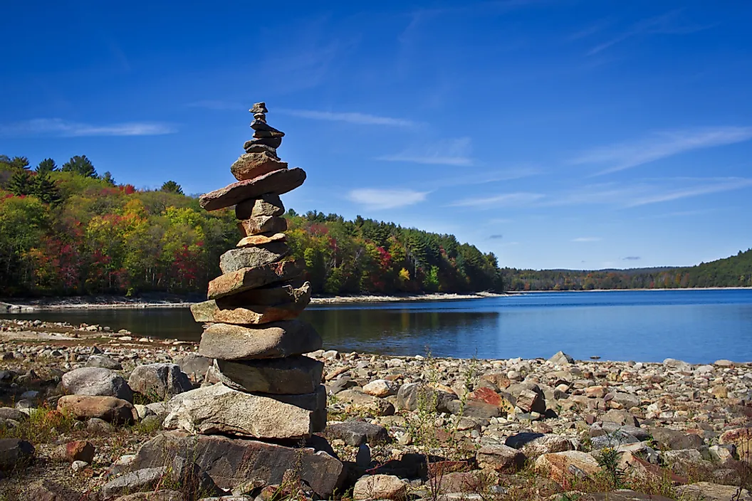
Quabbin is the illustration. Massachusetts disincorporated four entire towns in the 1930s to build it, and the resulting reservoir is still less than two percent the size of Lake Mead. That is the eastern exchange rate: four towns for 412,000 acre-feet.
What The East Built Instead

The East did not go without water infrastructure, it built a different kind. Navigation was the priority, and the result is a network of locks and dams on the Ohio, the Tennessee and the upper Mississippi designed to maintain a channel deep enough for barges rather than to store anything.
The Tennessee Valley Authority, created in 1933, is the closest the East came to a Reclamation-scale program, and its mandate tells you the difference: flood control, navigation, electricity and regional development. Kentucky Lake, the largest reservoir in the TVA system, holds a small fraction of what Mead does, and it was never meant to do the same job.
The Exceptions Prove The Rule
The East's largest reservoirs cluster around specific, identifiable needs rather than general water supply. Quabbin and Scituate exist because Boston and Providence needed drinking water. Lake Lanier exists partly because Atlanta did. The Santee Cooper lakes in South Carolina were built for hydropower and rural electrification.
Every one of those is a municipal or industrial project with a defined customer, not a regional agricultural water bank. The East has never needed the latter, and the projects it did build are sized accordingly.
Why It Matters Now

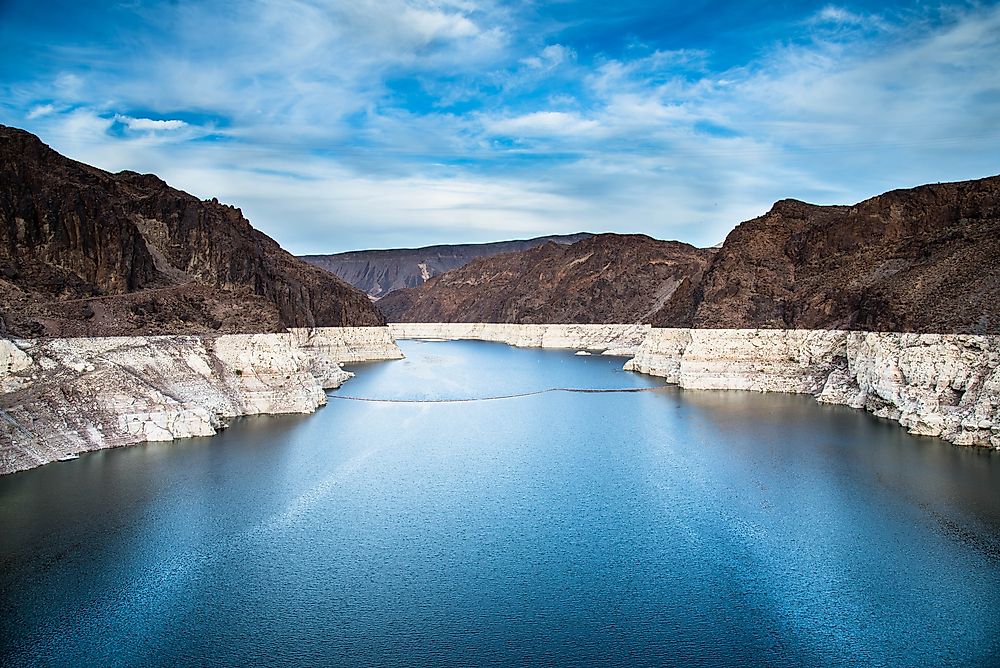
The asymmetry has a consequence that is becoming more visible. The West's dependence on enormous storage means a multi-year drought registers as a slow, measurable, highly public decline in reservoir elevation, which is why Lake Mead's bathtub ring became a national symbol.
The East has no equivalent buffer and no equivalent gauge. An eastern drought shows up in stream levels and well depths within weeks rather than in a reservoir elevation over years, and there is far less stored water to draw down while waiting for rain. Atlanta, Georgia, discovered this in 2007 when Lake Lanier fell low enough to trigger a genuine crisis and a three-state legal fight that has run ever since.
The region built for a climate that delivered water reliably. That was the correct decision for a century, and it assumes a pattern that is now less dependable than it was.