10 Longest Rivers In Africa
Africa is surprisingly rife with gargantuan and interconnected rivers. These nourishing systems bring agricultural viability and vital biodiversity to regions that are often foreboding. From above, one can see green basins teeming with activity that holds the line against vast desert landscapes. These seemingly divine interventions fostered the cradle of civilization millennia ago and continue to sustain many nations today. Here are Africa's longest and most revered rivers:
- Nile River - 6,650 km
- Congo River - 4,700 km
- Niger River - 4,180 km
- Zambezi River - 2,574 km
- Ubangi-Uele Rivers - 2,270 km
- Orange River - 2,200 km
- Kasai River - 2,153 km
- Shebelle River -1,820 km
- Limpopo River - 1,750 km
- Okavango River - 1,600 km
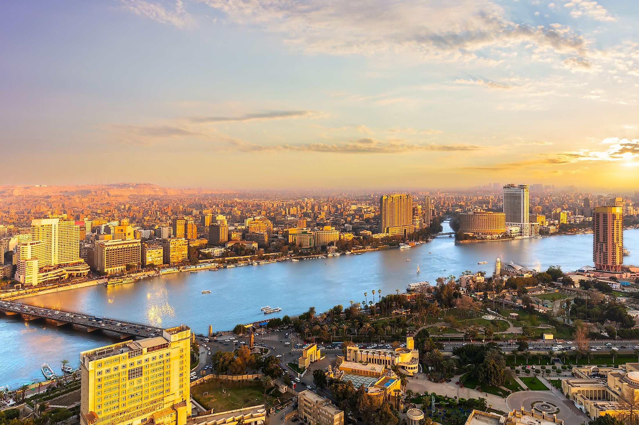
1. Nile River - 6,650 km (4,132 miles)

The Nile River is not only the longest river in Africa but also in the world. It flows South to North, beginning near Lake Victoria and emptying into the Mediterranean Sea – crossing eleven East African countries en route (Burundi, Tanzania, Rwanda, the Democratic Republic of the Congo, Kenya, Uganda, Sudan, Ethiopia, South Sudan, and Egypt) and discharging an average of 99,941 cubic feet of water per second.
A benevolent source of fertile soil that rebels against the surrounding sands, and a crucial trade channel, the Nile famously allowed the ancient Egyptians to establish one of the earliest advanced civilizations. Even today, 95% of Egyptians live within a stone's throw of their continent's longest river, which still acts as a vital mode of transportation, and more recently, as a source of hydroelectric power (ex. the Aswân High Dam). Humans are not the only benficiaries of this aquatic lifeline. Everything from the Nile crocodile, which can be found throughout many of its stretches, to the highly versatile papyrus plant are stables of the Nile River.
2. Congo River - 4,700 km (2,920 miles)

The Congo River (formerly known as the Zaire River) is the second-longest river in Africa, the ninth-longest in the world, and the deepest river on the planet, both in terms of maximum and average depth. Its point of origin can be considered to be in the highlands of Northeastern Zambia and/or the Katanga Plateau in the Southeastern corner of the Democratic Republic of the Congo. In either case, the river flows in a counter-clockwise arc, twice crossing the equator, and discharging 1,454,964 cubic feet of water per second on its way to the Atlantic Ocean at a seaport called Banana (or Banane) in the Democratic Republic of the Congo.
Along the way, the river's three parts (Upper, Middle, and Lower), and its massive basin, encompass nine countries in West-Central Africa (the Democratic Republic of the Congo, the Republic of the Congo, the Central African Republic, Zambia, Angola, Cameroon, Tanzania, Gabon, and Equatorial Guinea). This impressive breadth accounts for 13% of the continent's landmass, and at 1.3 million square miles, it is the world's second-largest river basin (after the Amazon). This impressive region fosters the second-largest tropical rainforest in the world (after, you guessed it, the Amazon). Approximately 75-million-people are situated along the Congo, including 150 distinct ethnic groups, ranging in lifestyles from the traditional, hunter-gather Ba’Aka people, to the fast-paced, densely-populated streets of Kinshasa (the capital city of the Democratic Republic of the Congo). Some 10,000 species of tropical plants, 1,000 species of birds, 700 species of fish, and 400 species of mammals can be found throughout the region - many of which live only in the Congo Basin.
3. Niger River - 4,180 km (2,548 miles)

The third longest river in Africa (fourteenth in the world) draws a large arc across Western Africa as it runs from Guinea to the Gulf of Guinea (via the Oil Rivers), with the main tributary being the Benue River. Along the way, the Niger River also visits Mali, Niger (right near the border of Benin), and Nigeria - discharging approximately 197,374 cubic feet of water per second. The curious shape and direction of flow (the Niger begins near the Atlantic Ocean but flows away from it and into the Sahara Desert) baffled early explorers but is now generally thought to be the product of two ancient rivers joining together.
Nowadays, over 75% of the Niger River is used for commercial shipping, and Mali, Niger, and Nigeria have all built dams to capitalize on this renewable source of electricity, as well as the fishing and irrigation opportunities that stem from the ensuing artifical lakes. In terms of animals, the Nile Crocodile and the colossal Nile perch are evidently impartial to their human-given titles.
4. Zambezi River - 2,574 km (1,599 miles)

The "Great River" is a source of life for such iconic African animals as elephants, buffalo, hippos, antelope, and crocodiles, as well the human beings living between its humble origin in the uplands of Zambia, all the way to the Indian Ocean (passing through parts of Angola, Namibia, Botswana, and Zimbabwe).
The Zambezi picks up steam as it chugs Eastward, providing abundant electricity for many of its basin communities. The Kariba Dam supplies power to Zambia and Zimbabwe, and the Cahora Bassa Dam lights up Mozambique and South Africa. These are two of Africa's largest hydroelectric projects. But Zambezi's most notable feature is easily Victoria Falls (which also has a small power station). This Natural Wonder of the World is over one mile wide (1.7 km) and 360 feet high (108 meters), making it the largest on the planet by those metrics. The Zambezi discharges around 120,069 cubic feet of water per second.
5. Ubangi-Uele Rivers - 2,270 km (1,411 miles)

Central Africa's Ubangi River (or Oubangui) and Uele River round out the continent's top five waterways. The Uele begins at the confluence of the Dungu and Kibali rivers in the Democratic Republic of the Congo. It then flows into the Ubangi (of which the Uele is the largest tributary) at the confluence of the Mbomou River, which defines part of the boundary between the Central African Republic and the Democratic Republic of the Congo. The Ubangi then flows Southwest, helping to define part of the boundary between the Democratic Republic of the Congo and the Republic of the Congo before joining the mighty Congo River at Liranga District. Like many of the rivers on this list, the Ubangi is not only a vital source of freshwater for all living things near its shores, but a major vessel for everyday transportation for the people of this region.
6. Orange River - 2,200 km (1,367 miles)

The Orange River, which got its name in 1779 from a Dutch official in reference to the Dutch Royal House of Orange, starts its journey in the Drakensberg Mountains and travels West to the South Atlantic Ocean, defining a large portion of the boundary between Namibia and South Africa. This waterway also separates distinct environments. To the North, the sand dunes of the lower Namib Desert loom large. To the South, the Martian-Esque landscape of Northwestern Namaqualand eventually transitions into a bright mosaic of desert flowers. The Vanderkloof Dam was South Africa's first underground hydroelectric station, while the nationa's largest dam goes to the Gariep Dam. These help to harness the power of the Orange River, which averages a discharge of 12,890 cubic feet of water per second.
7. Kasai River - 2,153 km (1,338 miles)

The Kasai River, like the Ubangi, is a massive tributary of the Congo River. It is born in central Angola (in Southwestern Africa), runs East and then North, partly distinguishing Angola from the Democratic Republic of the Congo, and then heads West at the town of Llebo. Before emptying into the Congo River on the border of the Democratic Republic of the Congo and the Republic of the Congo, the lower stretch of this river is actually referred to as the Kwa. The Kasai produces an average discharge of 42,378 cubic feet of water per second.
8. Shebelle River -1,820 km (1,130 miles)
This East African river rises in the Ethiopian Highlands, from where it flows southeast through the Ogaden Plateau into Somalia. When there is enough rain, the Shebelle joins the Jubba River to empty into the Indian Ocean. However, the river disappears into marshlands and sand flats when conditions are dry. The river supports agriculture along its shores, especially banana plantations in Somalia. Oromo, Bantu-speaking people and Somalis are some of the main communities living along the Shebelle River's banks.
9. Limpopo River - 1,750 km (1,087 miles)

At the ninth position is the Limpopo River in South-Central Africa. It flows Eastward across South Africa, Botswana, Zimbabwe, and Mozambique before syncing up with the Indian Ocean. The river partitions part of South Africa and Botswana, as well as Botswana and Zimbabwe. Helping to conserve some of the spectacular ecosystems throughout Limpopo's basin is the Great Limpopo Transfrontier Park, a peace park linking several national parks and private and/or state-owned conservation areas across these four nations. Eye-catching animals such as Nile crocodiles, hippopatamus, and elephants can be spotted along the river's edge. The average discharge of the Limpopo is around 6,003 cubic feet of water per second.
10. Okavango River - 1,600 km (994 miles)

The Okavango River, flowing in Southwest Africa, runs in a Southeastward direction with an average discharge of approximately 16,774 cubic feet per second. Its origin is in the highlands of Angola at an elevation of 1,300 meters (4,265 feet). It then flows towards the Angola-Namibia border and into Botswana. The Okavango does not drain into the sea but forms the inland Okavango Delta, a massive wetland area of about 15,000 square kilometers (5,792 square miles) in the Kalahari Desert. This biodiverse region is both a UNESCO World Heritage Site and one of Africa's Seven Natural Wonders. This area not only preserves thousands of species of animals, but also tens of thousands of residents and a prosperous ecotourism industry.
The generous waters of these freshwater giants are invaluable assets for many African nations and swaths of flora and fauna. These waterways snake their way across the continent for astonishing distances, drawing geographical and political borders along the way, providing power, transportation, and sustenance to all who dwell within their basins.