Maps of Somalia
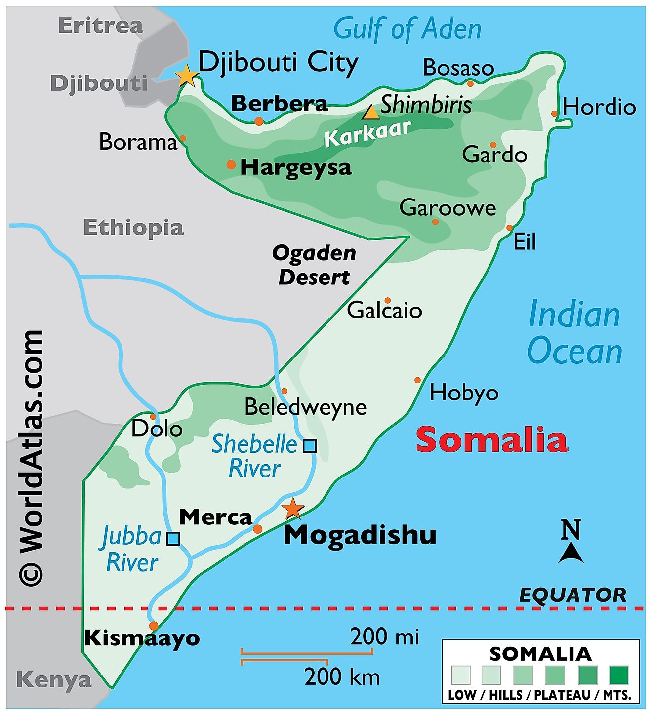
Located on the easternmost tip of Africa, Somalia occupies an area of 637,657 sq. km. Somalia borders the three nations of, Kenya, Ethiopia, and Djibouti. Somalia sits along the Horn of Africa, this region is known for being particularly hilly and mountainous. As observed on the physical map above, the terrain of the country features plenty of plateaus and highlands.
Arid plains and hills make up large swaths of northern Somalia. To the extreme north, a narrow semidesert coastal plain that varies in width from around 12 km in the west to only 2 km in the east, borders the Gulf of Aden. It is called Guban. Beyond this plain is the maritime mountain range of the Karkaar Mountains (marked on the map) hosting the highest point in the country, the 2,460 m tall Mount Shimbiris. The range extends from the country's border with Ethiopia in the west up to the tip of the Horn of Africa.
Broad plateaus can be found in the south. Alluvial plains are located further south and separated from the southern coast by a massive belt of ancient sand dunes that extend from Kismaayoto to Hobyo. Most of the plateaus of Somalia are dissected by deep river valleys that have rivers flowing in the wet season but remain dry at other times of the year. These rivers drain into the Indian Ocean. The only perennial rivers of the country are the Jubba and the Shabeelle to the south of the country. Both have been marked on the map.
The Indian Ocean lies to the east of Somalia. With little in the way of lakes or rivers, Somalia relies on the ocean as an easy modern of transportation from one place to another when travel overland if not possible. Somalia receives some of the least amounts of rainfall in all of Africa, especially in the north. Many of the large urban centers, including the capital city of Mogadishu can be found in the much more livable and fertile south.
States of Somalia Map
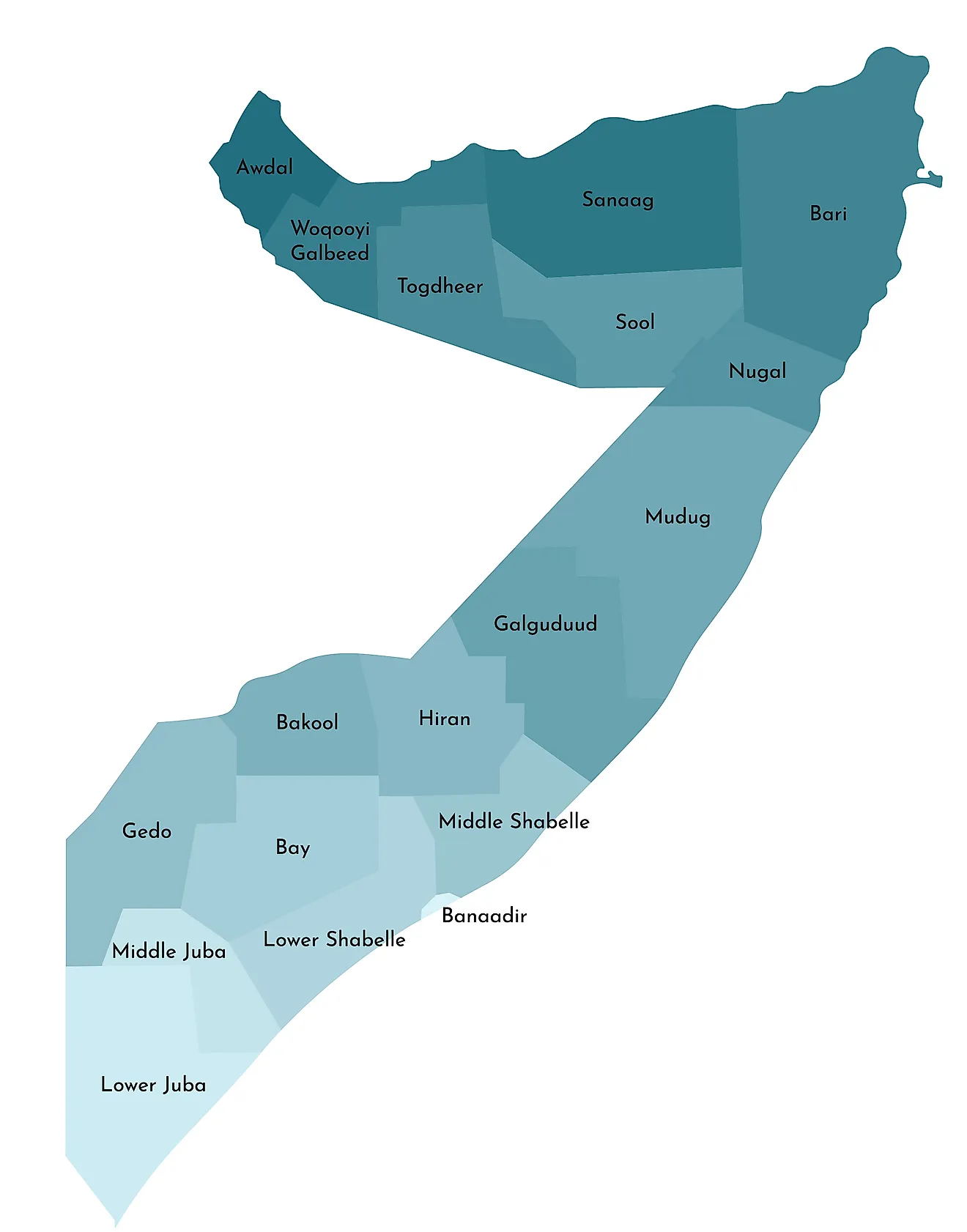
The ongoing Civil War in Somalia has resulted in the country going through great turmoil. As such, the political divisions of the country have gone through several changes in recent times and possibly will undergo further changes in the future until the war dies down and a permanent solution is devised.
As of 2016, the Republic of Somalia was made up of the five federal member states of Galmudug, Hirshabelle, Jubaland, Puntland, and South West.
These states are divided into eighteen administrative divisions called regions or gobolka as shown in the map above. In alphabetical order, these are Awdal, Bakool, Banaadir, Bari, Bay, Galguduud, Gedo, Hiiraan, Jubbada Dhexe (Middle Jubba), Jubbada Hoose (Lower Jubba), Mudug, Nugaal, Sanaag, Shabeellaha Dhexe (Middle Shabeelle), Shabeellaha Hoose (Lower Shabeelle), Sool, Togdheer, Woqooyi Galbeed.
These regions are further subdivided into districts.
Mogadishu is the capital of Somalia and is located in the Banaadir Region of the country.
Where is Somalia?
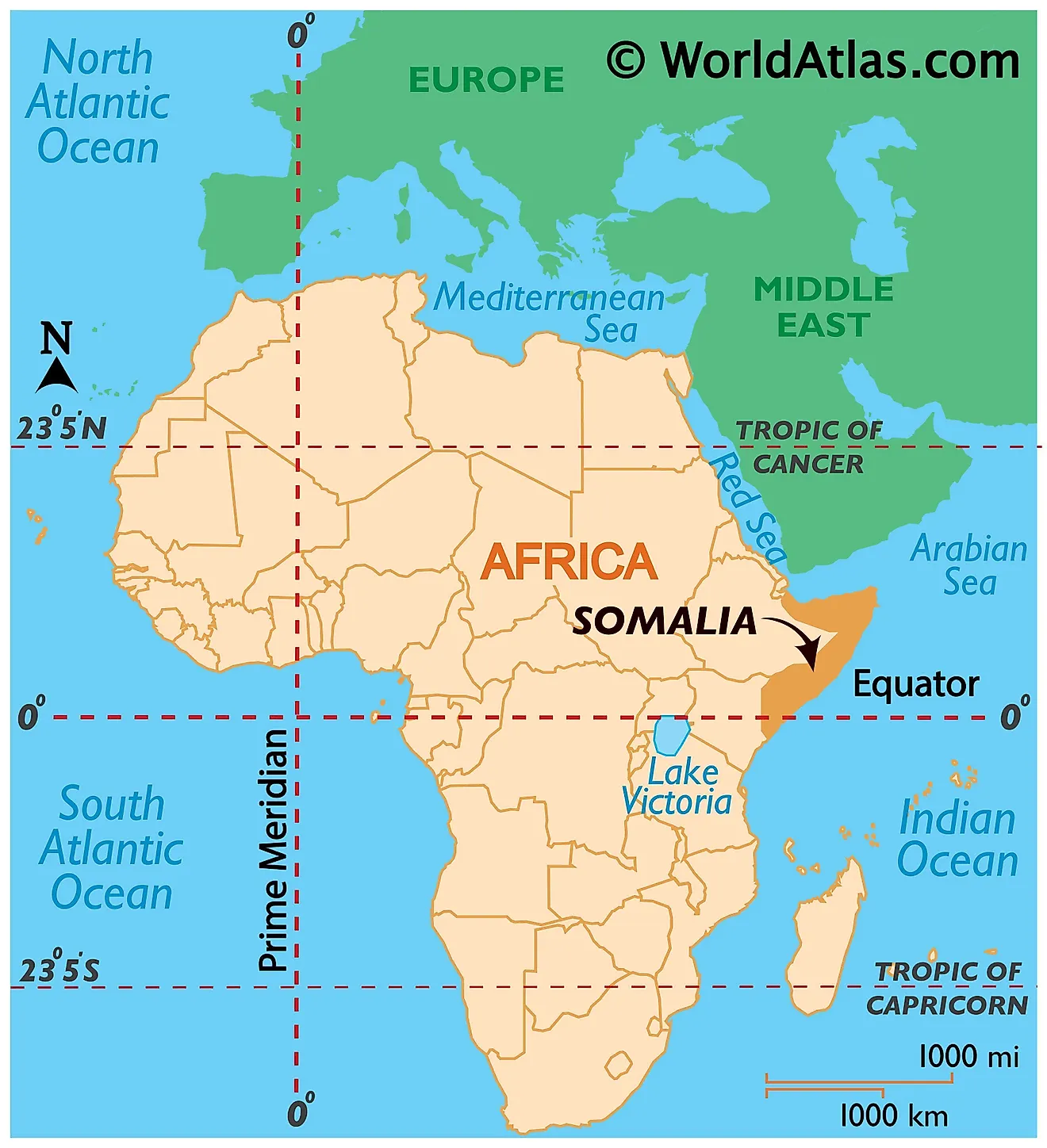
Somalia is an African country located in the Horn of Africa (a peninsula forming the easternmost projection of Africa). The Equator passes through southern Somalia. So while most of Somalia lies in the Northern Hemisphere, a small part stretches into the Southern Hemisphere. Longitudinally, Somalia is located entirely in the Eastern Hemisphere.
It has land borders with only two countries; Kenya to the southwest and Ethiopia to the west. The Gulf of Aden forms Somalia's northern borders and the Somali Sea and Guardafui Channel bound it to the east.
Somalia Bordering Countries: Kenya, Ethiopia.
Regional Maps: Map of Africa
Outline Map of Somalia
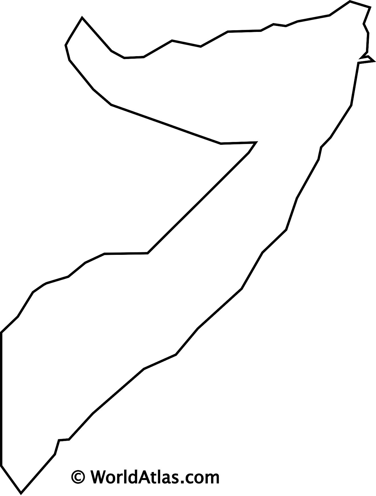
The blank outline map respresents mainland Somalia. The country also has several oceanic islands which cannot be observed on this map.The country is said to be shaped like a tilted number seven. The above map can be downloaded for free, and used for educational purposes like map-pointing activities.
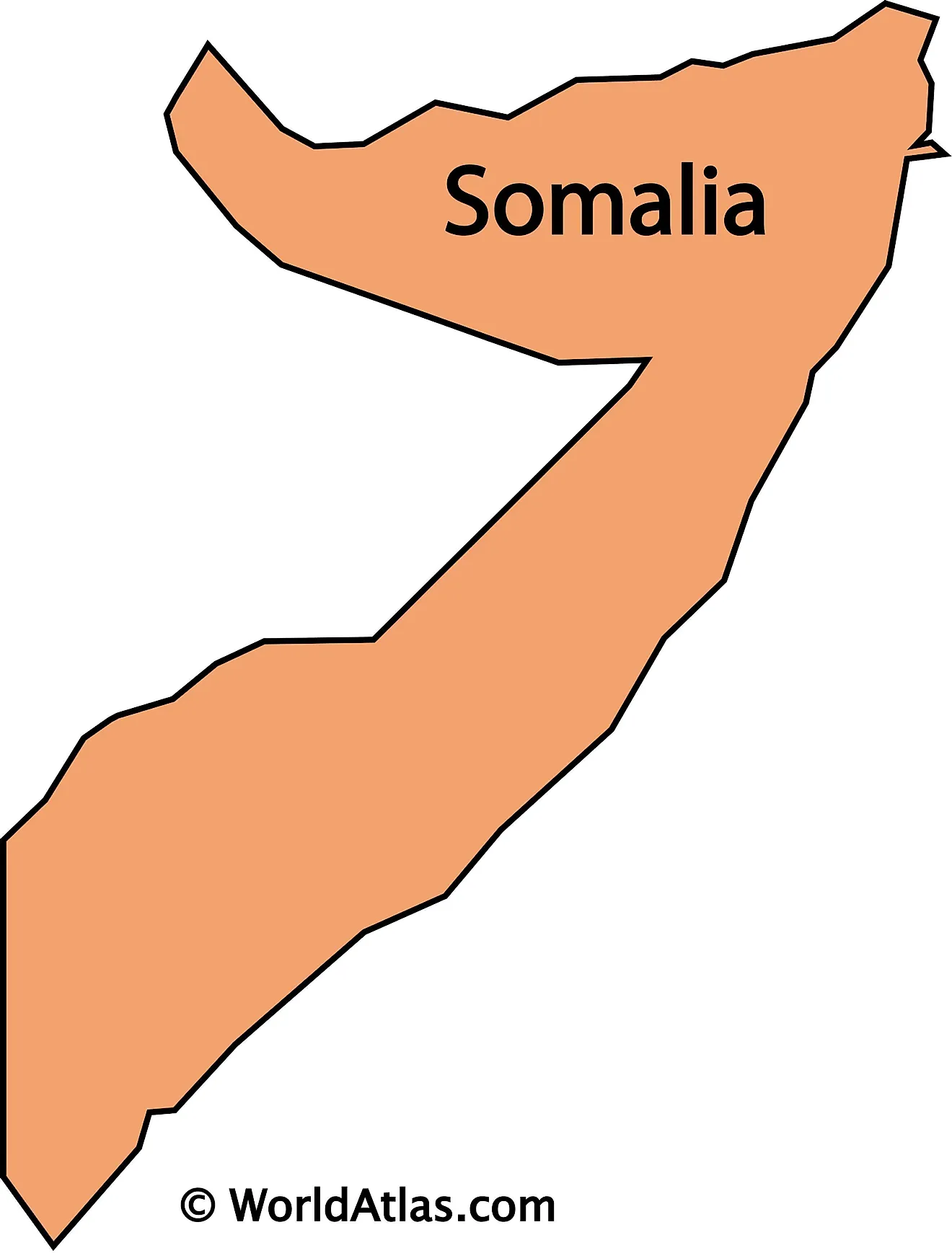
The outline map represents the mainland territory of Somalia. Its shape appears like a tilted number 7. Somalia also has several oceanic islands.
Key Facts
| Legal Name | Federal Republic of Somalia |
|---|---|
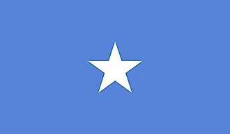
| Flag |
|
| Capital City | Mogadishu |
| 2 04 N, 45 20 E | |
| Total Area | 637,657.00 km2 |
| Land Area | 627,337.00 km2 |
| Water Area | 10,320.00 km2 |
| Population | 15,442,905 |
| Major Cities |
|
| Currency | Somali shillings (SOS) |
This page was last updated on December 16, 2023
