The US Rivers With The Most Rattlesnakes Along Their Banks
Rattlesnakes are decent swimmers, and on more than one American river, rafters have watched one cross the current in front of them. Still, most encounters happen on the banks, where riverside trails and campsites run through the same dry, sun-facing rock that snakes prefer.
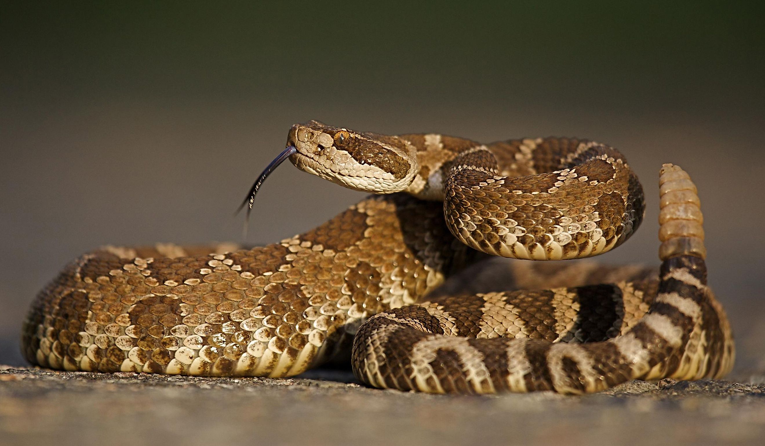
The species depends on the river. Along the Rio Grande in Big Bend National Park, you could meet any of four rattlesnakes, including a rock rattlesnake that seldom rattles. In Sacramento, the capital of California, northern Pacific rattlesnakes turn up along the American River Parkway, where a cyclist spotted his first one of 2026 in mid-February. On the lower Deschutes in Oregon, you can camp at Rattlesnake Canyon Campground, and the Bureau of Land Management confirms the name fits. These are the US rivers with the most rattlesnakes along their banks, and the snakes you are likely to meet on each.
Rio Grande in Big Bend, Texas

The Rio Grande forms the southern boundary of Big Bend National Park for 118 miles, cutting through Santa Elena, Mariscal, and Boquillas canyons on the way. The river marks the border between the United States and Mexico for more than 1,000 miles, and the park administers roughly a quarter of that line. Canoe, kayak, and raft trips float all three canyons.

The park beside the river is home to four rattlesnake species. The quiet one is the rock rattlesnake, which seldom rattles unless provoked and is grayish in the low desert but maroon up in the Chisos Mountains. The western diamondback is the most common, while black-tailed rattlesnakes are common in both the mountains and the desert, and the Mojave rattlesnake is the one visitors meet least often. All four may be more active after the summer rains.
Green River in Dinosaur National Monument, Utah and Colorado

Far north of Big Bend, the Green River enters the steep-walled Canyon of Lodore in Dinosaur National Monument, on the Utah and Colorado line. Downstream, it meets its largest tributary, the Yampa River, at Steamboat Rock in Echo Park, then runs on through Whirlpool Canyon and Split Mountain Gorge. Flaming Gorge Dam, 47 miles upstream of the monument, has regulated the river's flow since 1962.

The rattlesnakes here run smaller. The monument's rattlesnake is mostly the midget faded rattlesnake, a smaller subspecies of the western rattlesnake that lives in the high, cold sagebrush desert of the Green and Colorado River basins. Rattlesnakes are the only highly venomous snakes anywhere in the monument. Females give birth to live young in late summer or early fall, so the year's smallest rattlesnakes may appear around August and September.
Colorado River Below Hoover Dam, Nevada and Arizona

The Green River's water ends up in the Colorado, and below Hoover Dam that river runs cold. The Black Canyon Water Trail starts at the base of the dam and follows about 30 miles of the Colorado through Black Canyon in Lake Mead National Recreation Area. In a 2009 account, the water below the dam was about 52°F, cold enough to change how anything swimming in it behaves.

The Park Service lists rattlesnakes among the reptiles of Black Canyon, and the recreation area is home to four rattlesnake species, all of them dangerously venomous: the sidewinder, the Mojave rattlesnake, the southwestern speckled rattlesnake, and the western diamondback. They hibernate from about November through February and are busiest feeding and mating in April and May. The Park Service warns that even newborn rattlesnakes can deliver a potentially dangerous bite.
American River, California

Rafters on the American River in Sacramento watched a rattlesnake swim past them in July 2018, when it crossed the channel between Howe and Watt avenues, a stretch where families go to cool off. The American River Parkway, a strip of trails and parkland, follows the river through the city, and a cyclist on its trail in Rancho Cordova saw his first rattlesnake of 2026 in mid-February.

The venomous species in the Sacramento region is the northern Pacific rattlesnake. A local rattlesnake wrangler told CBS Sacramento that they are excellent swimmers and turn up in the river now and then, as well as in Folsom Lake. The American River Parkway Foundation warns that they become more active as the weather heats up, including at night.
Deschutes River, Oregon

Oregon's version of that shared ground is a desert canyon, where through August a steady convoy of rafters floats the lower Deschutes between Maupin and Sherars Falls. Below Sherars Falls, 19 miles of river lead down to Macks Canyon Campground. Along the Lower Deschutes River Back Country Byway, Rattlesnake Canyon Campground sits at the mouth of its namesake canyon, and several of its campsites reach the river through riparian brush.

The western rattlesnake is the only rattlesnake native to the region, and it lives on dry, rocky ground in sagebrush country, especially south-facing ledges and talus slopes. Asked about the campground's name, the Bureau of Land Management answers with a plain yes. The snakes emerge on sunny April days, return to their dens in late September and early October, and move after dark on warm July and August nights.
Snake River in Hells Canyon, Idaho and Oregon

Farther east, the Snake River runs through Hells Canyon along the border of eastern Oregon and western Idaho. The Forest Service calls it the deepest river-carved gorge in North America, and about 67.5 miles of the river in Hells Canyon National Recreation Area were designated Wild and Scenic in 1975. The canyon's downstream entrance sits on the southern edge of Lewiston, Idaho, near the boat launch at Hells Gate State Park.

The Forest Service's own Hells Canyon guide calls rattlesnakes common in the canyon. Backpackers on the river trail saw one in the spring of 2016, when, as The Spokesman-Review put it, canyon wrens are singing, and rattlesnakes are getting frisky. In late August, a sportswriter jogging at dusk south of the Hells Gate boat launch felt a sting on his ankle from a snake he never saw or heard rattle.
Yellowstone River in Yellowstone National Park

The Yellowstone River drains Yellowstone Lake to the north and leaves Yellowstone National Park near Gardiner, Montana, and the park takes its name from the river. Its lower stretch inside the park, around Reese Creek, Stephens Creek, and Rattlesnake Butte, is drier and warmer than anywhere else in Yellowstone. Reese Creek, at 5,282 feet, is the lowest point in the park.

That lower stretch is the only part of the park where its prairie rattlesnakes live. The prairie rattlesnake is the park's only dangerously venomous snake and one of its six reptile species. It sometimes grows more than 48 inches long and mates between late July and early September. Even so, Yellowstone has recorded only two snakebites in its entire history.
Missouri River Breaks, Montana

Farther north in Montana, the Missouri River flows through the Upper Missouri River Breaks National Monument, which spans 149 miles of the river east of Fort Benton. Congress designated that stretch a National Wild and Scenic River in 1976; the monument followed in 2001, and Lewis and Clark traveled it in 1805. Paddlers camp at designated campgrounds along the river or wherever dispersed camping is permitted.

Yellowstone's rattlesnake is also the only venomous snake in Montana, and the Bureau of Land Management tells paddlers here to watch for it. The state's field guide calls the prairie rattlesnake relatively common within suitable habitat. Prairie rattlesnakes den together over the winter and range up to 7 miles from their dens in summer, so a snake near a river camp in July may be miles from where it spent the winter.
Upper Mississippi River Bluffs, Minnesota

East of the plains, the Mississippi River runs past the bluff prairies of southeastern Minnesota, where more than 9,000 rocky limestone bluffs line the river. Great River Bluffs State Park, in Winona County, overlooks the water from the top of those bluffs. In 2025, the state's Department of Natural Resources announced plans to survey more than 300 of the bluff sites by the end of 2026.

The bluffs belong to the timber rattlesnake. Pregnant females spend the summer on open south- and west-facing slopes, where temperatures can climb well over 100 degrees, and give birth there in September, while other adults move into the forest by June. Bounty records show the decline, with Houston County turning in nearly 6,000 in the 1940s and fewer than 200 in 1987, and the species has been listed as threatened in Minnesota since 1996.
Apalachicola River, Florida

The last river bluffs on this list rise far to the south, above the Apalachicola River in the Florida Panhandle. The river basin has the highest species diversity of reptiles and amphibians in the United States and Canada, according to the Florida Natural Areas Inventory. Visitors reach the bluffs at the Nature Conservancy's 6,430-acre Apalachicola Bluffs and Ravines Preserve on the Garden of Eden Trail, a 3.75-mile round trip with a spur along Kelley Branch beside Alum Bluff.

Eastern diamondback rattlesnakes live on the preserve along with the Florida pine snake and the copperhead. The eastern diamondback is North America's longest and heaviest venomous snake, with adults averaging 3 to 6 feet, and some reaching 8 feet, and it lives only in the southeastern United States. In Florida, it is found in dry habitats such as pinelands and scrub.
Sharing US Riverbanks With Rattlesnakes
The overlap on these banks runs for most of the year. Around Sacramento, calls to poison control about rattlesnakes peak between April and October, and across the Mississippi from Minnesota's bluffs, Wisconsin's timber rattlesnakes can come out of hibernation as early as April 1 and stay active until mid-October. On some of these rivers, the snake beside the trail is also a protected animal. Every snake in Big Bend National Park is protected, and the Park Service asks visitors not to harm or handle them. Wisconsin lists its timber rattlesnake as a protected species of special concern, and a female there typically gives birth only once every three to four years.