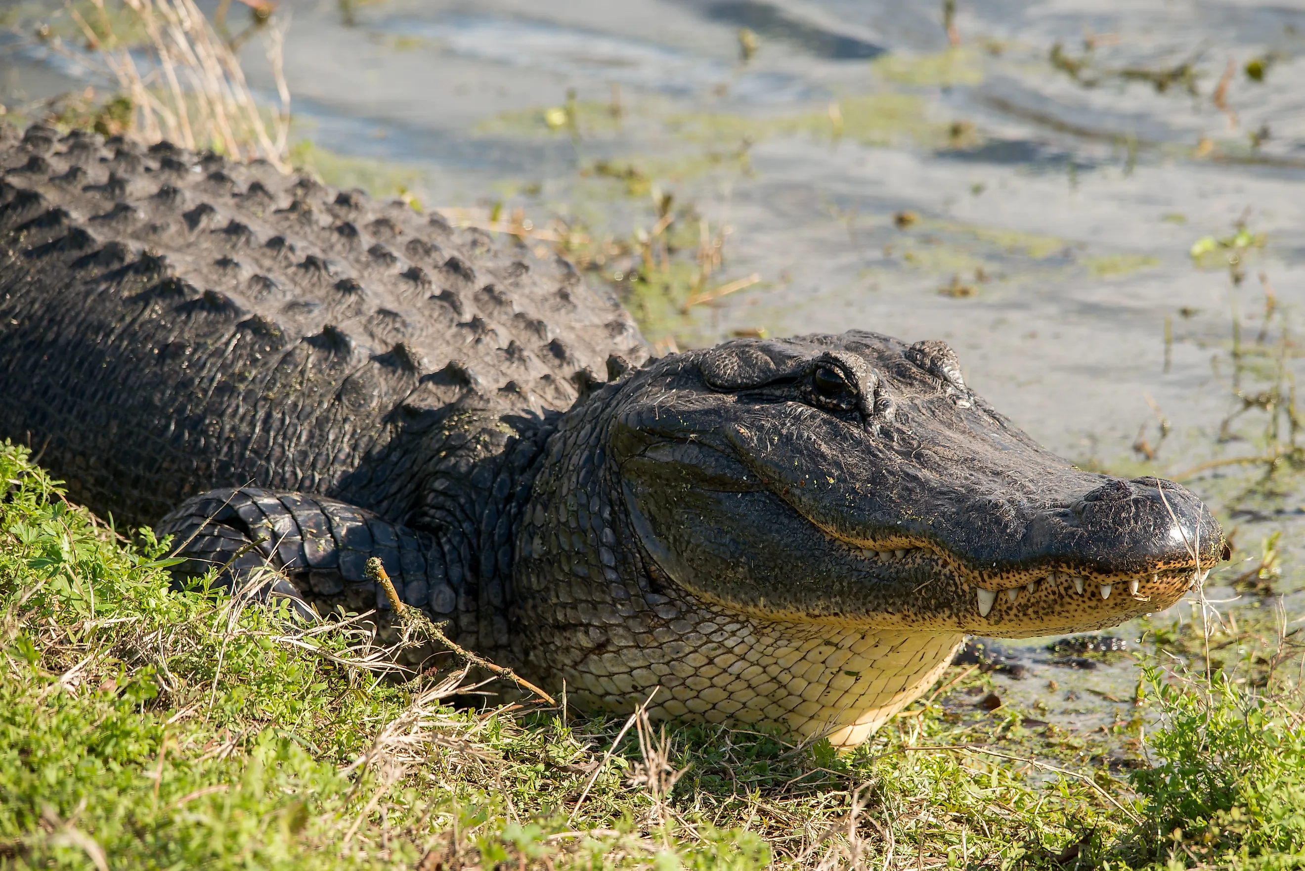
Most Alligator Filled Rivers In Georgia
If you are near a river or pond in Georgia and wonder whether alligators might be in it, there is one sure-fire way to find out. Simply reach down and touch the water; if it's wet, there's a chance there's a gator lurking below the surface.
Although their habitat spans into northeastern North Carolina, in Georgia they typically live south of the Fall Line, which is where the upland meets the lowland coastal plain. On a map, this line connects Columbus, Macon, and Augusta.
American alligators are found anywhere there is water and have been known to make themselves comfortable in swimming pools, on golf courses, and in drainage canals. However, there are some areas where they are more prevalent.
If you want to spot one of these prehistoric creatures, the banks of these five rivers are a good place to start.
Altamaha River

The Altamaha River is one of Georgia's most important alligator habitats. Located in southeast Georgia, it flows about 137 miles from the confluence of the Ocmulgee and Oconee rivers to the Atlantic Ocean near Darien.
Its extensive bottomland forests, marshes, swamps, and slow-moving channels provide excellent habitat for American alligators. The river system also supports turtles, otters, beavers, wading birds, numerous fish species, and at least 125 rare or endangered plants and animals.
The Altamaha's network of wetlands and coastal islands makes it particularly suitable for alligator nesting and feeding. Although no reliable public ranking establishes that it has more alligators than any other river in Georgia, its size and extensive wetlands make it one of the state's strongest candidates for a high alligator population.

People exploring the lower river near Darien or its adjoining waterways may spot alligators along muddy banks or in quiet backwaters, particularly during warm weather.
The best place to spot the gators is on the water, but if you're wary about boating with them, hike the trails at the Altamaha Waterfowl Area, where you might be able to spot them alongside the egrets and osprey.
Satilla River

The Satilla River is a blackwater river in southeast Georgia that flows about 235 miles from its headwaters in Ben Hill County toward the Atlantic Ocean near St. Andrews Sound. Its dark, tea-colored water comes largely from organic material released by surrounding forests and wetlands.
The river's sandy banks, cypress-lined channels, and swampy tributaries provide suitable habitat for gators, which use those areas for shelter, feeding, and nesting.

The river and its banks are teeming with wildlife, including several rare, threatened and endangered species such as the swallow-tailed kite, the gopher tortoise, indigo snake, and the southern leopard frog. Because the Satilla passes through relatively undeveloped areas, some stretches retain a distinctly wild character.
Its slow-moving curves provide resting spots out of the main current, while the secluded blackwater offers cover for hunting, making it a prime habitat for observing alligators, although the dark water can make them difficult to see.
One of the more reliable areas to spot a gator from the land is from the trails at the Satilla Waterfront Park in Woodbine.
St. Marys River

The St. Marys River forms much of the boundary between southeastern Georgia and northeastern Florida. It stretches about 126 miles before dumping into the Atlantic Ocean. Its headwaters originate in the Okefenokee Swamp, one of the largest intact freshwater wetland ecosystems in the United States. This connection to extensive swamp habitat makes the river an important environment for American alligators.
The river's blackwater channels, wooded banks, marshes, and secluded tributaries provide places for alligators to hunt, rest, and reproduce.

From the Okefenokee, the river winds through forests and swampland before becoming broader and more tidal downstream. More than 40 percent of its watershed consists of wetlands providing suitable habitat for gators and other wildlife, including river otters, turtles, wading birds, and numerous freshwater fish.
The upper river, where swamp habitat influences the landscape, is particularly interesting for wildlife enthusiasts. If you're looking for alligators, you might get lucky to spot one on the ferry from downtown St. Marys to the Cumberland Island National Seashore. The best time is early morning or late evening, April through August.
Suwannee River
Beginning in Georgia's Okefenokee Swamp, the Suwannee River flows 246 miles southwest through Florida before emptying into the Gulf of Mexico. Although most of the river is in Florida, its Georgia headwaters are part of an important alligator habitat.
There are an estimated 12,000 to 15,000 gators living there. The Okefenokee covers roughly 401,000 acres and contains extensive marshes, cypress forests, shallow lakes, and winding water channels. In addition to the American alligator, this habitat supports turtles, river otters, and water moccasins.

The Suwannee's freshwater, diverse ecosystem, abundant food sources, and warm temperature make it an ideal environment for alligators. The Suwannee River Sill Recreation Area is an ideal place to spot or photograph alligators.
The sill, a water control structure built to hold water in the swamp during times of drought, is right where the river flows out from the swamp.
Ogeechee River

The Ogeechee River is one of the most alligator-populated rivers in the state, but it also has the distinction of having one of the largest to be caught in a Georgia river. In September 2011, it took hunters two hours to pull a 13-foot, 800-pound alligator into their boat.
The Ogeechee River begins and ends in Georgia. Its headwaters are in the Piedmont Province; from there it flows about 250 miles southeast through eastern and coastal Georgia before reaching the Atlantic near Ossabaw Sound.
Its watershed includes wooded floodplains, freshwater wetlands, and tidal environments that create suitable habitat for American alligators, particularly in the warmer, low-lying portions of the river system.

Alligators use quiet river bends, marsh edges, and connected waterways for shelter, feeding, and nesting. Other wildlife includes river otters, turtles, fish, wading birds, and bald eagles.
The lower Ogeechee is especially interesting because freshwater river habitats gradually transition toward the coastal marshes and estuaries near the Atlantic. Fort McAllister State Park in Richmond Hill is an ideal place for spotting alligators as it sits right on the Ogeechee River.
Putting The Rivers In Perspective
Georgia's alligator population has commonly been estimated at 225,000 to 250,000 statewide. They are concentrated primarily in the southern part of the state below the Fall Line, where warmer temperatures and wetland habitats are more favorable.
The Altamaha, Satilla, St. Marys, Suwannee, and Ogeechee all provide suitable habitat. However, the Altamaha stands out for its extensive river and wetland system, whereas the Satilla is notable for its blackwater habitat and the St. Marys and Suwannee for their connections to the Okefenokee Swamp.
For someone hoping to see an alligator, the most promising locations are generally quiet, warm-water areas with marshes, backwaters, and vegetated banks. Alligators should always be observed from a safe distance.