Why Some Rivers Cut Straight Through Mountains
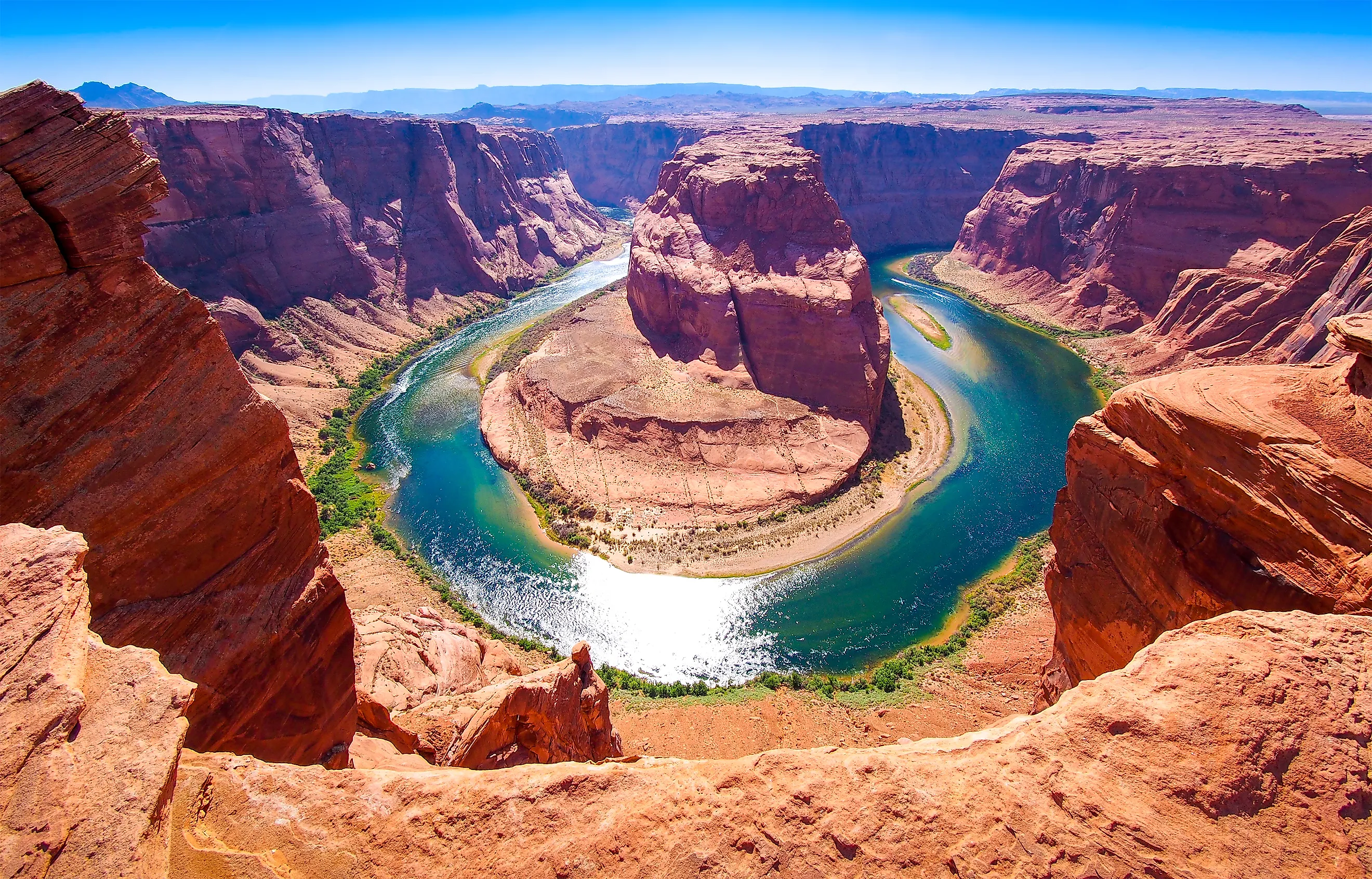
The Susquehanna River cuts through six major Appalachian ridges within a 50-mile stretch upstream of Harrisburg, Pennsylvania, despite having broad valleys on either side. Similar formations appear throughout the United States, where rivers carve deep gorges through mountains instead of following seemingly easier routes around them. These openings, known as water gaps, can result from several geological processes that unfold over millions of years. The three principal explanations are antecedence, superimposition, and stream capture.
Some Rivers Are Older Than The Mountains They Cross

Antecedence occurs when a river establishes its course before the surrounding mountains rise. As tectonic forces gradually lift the landscape, the river continues eroding downward, maintaining its original path through the rising rock.
This process depends on the relationship between mountain uplift and river erosion. Mountain ranges can rise at rates of just a few millimeters annually, giving rivers time to cut deeper into their channels. As long as the river can erode downward quickly enough relative to the rising landscape, it may maintain its course rather than being diverted around the developing mountains.
The result can be a narrow gorge through a ridge that towers thousands of feet above the river. Although the water appears to have cut straight through an enormous obstacle, the mountain did not necessarily exist in its present form when the river first began flowing.
The Wasatch Range

Utah's Wasatch Range provides examples of antecedent drainage. According to the Utah Geological Survey, the Provo, Weber, and Ogden rivers have maintained courses across portions of the rising mountain range. Their canyons record the long relationship between tectonic uplift and erosion.
The process also fascinated geologist John Wesley Powell during his 1869 expedition along the Green and Colorado rivers. Powell proposed that the Green River had existed before the Uinta Mountains rose, allowing it to cut through the range as the landscape developed. He coined the term "antecedent valley" to describe this relationship.
Rivers Can Cut Into Buried Mountain Ranges

Superimposition offers another explanation for rivers that appear to ignore mountain barriers. Unlike antecedence, this process does not require the river to exist before the mountains formed. Instead, the river develops its course across a landscape that conceals older geological structures beneath the surface.
Over millions of years, mountains may become worn down and covered by younger sedimentary deposits. A river establishes its channel across the relatively even surface without following the arrangement of the harder rock below.
As the river erodes downward, it eventually reaches the older bedrock. By this stage, its channel may already be deeply established, allowing it to continue cutting through resistant ridges rather than changing direction. Erosion also removes surrounding material, exposing the older geological structures and leaving the river flowing through a mountain gap.
The Susquehanna River in Pennsylvania is a particularly striking example. According to the US Geological Survey, the river crosses six major ridges within approximately 50 miles upstream of Harrisburg. These Appalachian ridges consist of folded rock layers that have experienced hundreds of millions of years of geological change.
Some Rivers Capture Water From Neighboring Streams

Stream capture, also called river piracy, occurs when one river diverts water that previously flowed into another drainage system. This can happen through headward erosion, a process in which a river gradually extends its channel upstream toward a neighboring watershed.
Consider two rivers separated by a mountain ridge. One flows through a steep valley toward a much lower elevation, while the other moves more gently across higher ground. Over time, erosion may allow the steeper river to extend its drainage network toward the divide separating the two watersheds.
If erosion breaches the divide, water from the neighboring drainage can be redirected into the lower channel. The capturing river gains additional water, potentially increasing its ability to transport sediment and erode bedrock. The former drainage may be reduced to a smaller stream, while abandoned portions of its valley remain visible in the landscape.
Weaknesses In Mountain Rock Can Guide Rivers

Rivers do not erode every type of rock equally. Fractures, faults, and differences in rock resistance can influence where water cuts through a mountain ridge.
The Delaware Water Gap, located along the border between Pennsylvania and New Jersey, illustrates how these geological weaknesses can shape a river's course. Here, the Delaware River passes through a gap approximately one mile wide and 1,200 feet deep, separating Mount Minsi in Pennsylvania from Mount Tammany in New Jersey.
According to the National Park Service, the gap developed through headward erosion and stream capture concentrated along a zone of weakened bedrock. Ancient mountain-building forces had folded and fractured the rocks, creating structural weaknesses that later erosion could exploit.
As erosion progressed, the river developed a passage through the resistant mountain ridge. The surrounding landscape continued wearing away, leaving the deep opening visible today.
The geological history of the Delaware Water Gap shows why the hardest-looking part of a mountain is not necessarily the greatest obstacle to a river. A fractured section of rock may provide a route through a ridge that would otherwise redirect the water elsewhere.
Why Rivers Sometimes Cross Mountains
An antecedent river may preserve a course established before a mountain rose. A superimposed river can maintain a channel created across younger deposits that once concealed older ridges. Stream capture can redirect water across drainage divides, while fractures and weaker rock help determine where erosion becomes concentrated.
These processes can also operate together, making the origins of some famous gorges difficult to reconstruct. The Green River's passage through Utah's Uinta Mountains remains an example of how complex that history can be.
What appears today as a river cutting through an enormous wall of rock may record millions of years of uplift, erosion, and changing drainage patterns. The mountains and rivers have shaped one another, leaving behind some of the most remarkable canyons and water gaps in the United States.