The Largest Bay In The United States
The United States has thousands of bays, coves, and inlets carved into its tens of thousands of miles of shoreline, but when people ask which one is the largest, the same name keeps surfacing: the Chesapeake Bay. Sprawling down the mid-Atlantic coast between Maryland and Virginia, it is the largest estuary in the entire country and, by almost everyone's reckoning, the largest bay as well. The honest answer does come with a small asterisk, though, because exactly how you measure "largest" can quietly change the winner. For the most part, however, the title clearly belongs to the Chesapeake, and for very good reason. Here is the full story of America's biggest bay, how it came to be so enormous, and the surprising Alaskan rival that complicates the crown.
The Answer: Chesapeake Bay
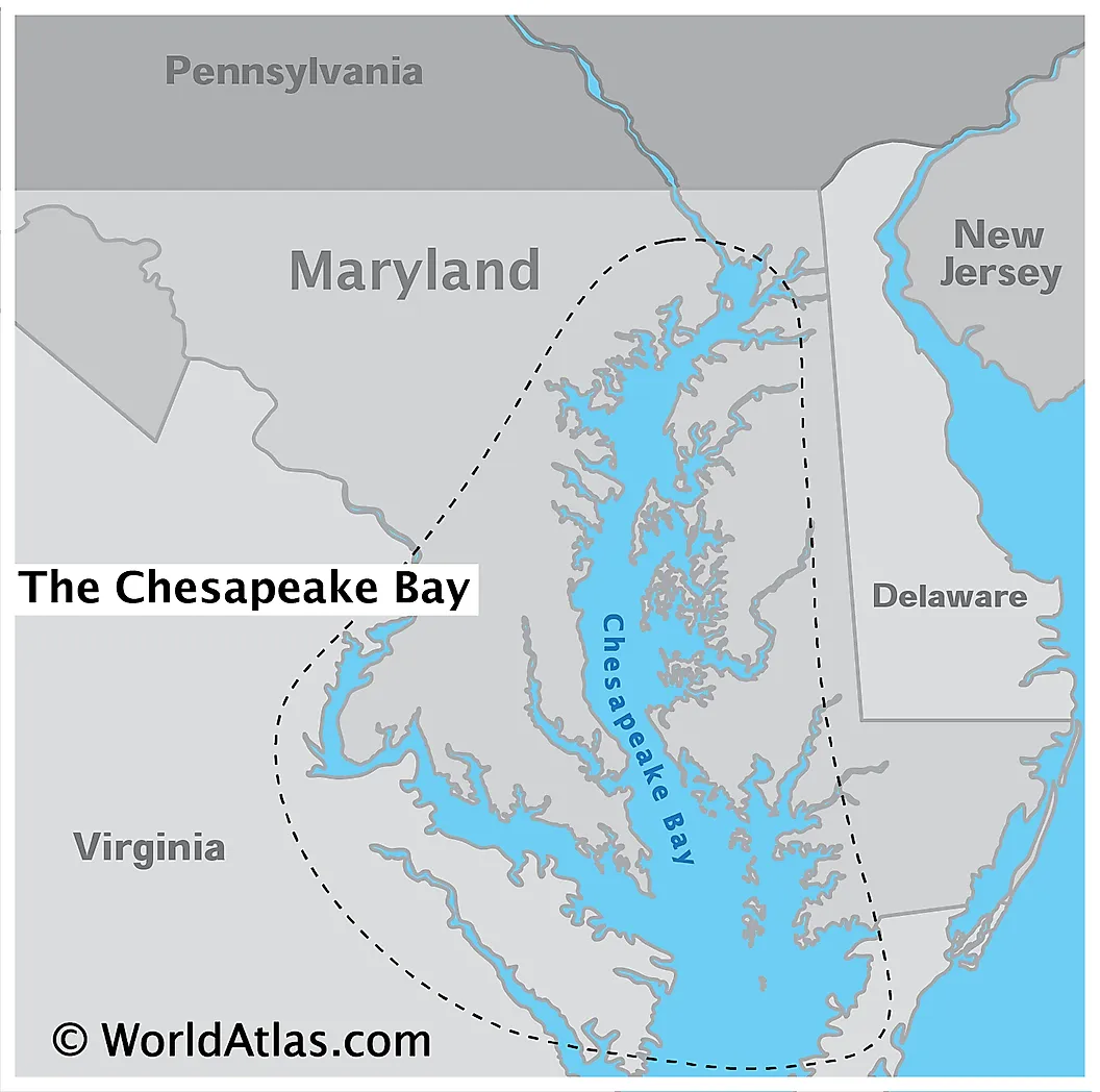
The Chesapeake Bay stretches roughly 200 miles from Havre de Grace, Maryland, in the north down to its mouth on the Atlantic in Virginia, covering a surface area of about 4,480 square miles. That alone makes it the largest estuary in the US and the third largest on Earth. But the truly staggering number is its shoreline: counting every one of its tidal rivers and creeks, the bay has some 11,684 miles of shoreline, which is actually more than the entire US West Coast. Its watershed is just as vast, draining around 64,000 square miles across six states and Washington, DC, and it is fed by more than 150 rivers and streams.
How It Got So Big

The Chesapeake is not a bay that was gouged out by glaciers; it is a river valley that the sea simply moved into. It is what geologists call a ria, or drowned river valley: the ancient course of the Susquehanna River, flooded by rising seas roughly 10,000 years ago as the last ice age came to an end. That is why so many large rivers, the Potomac, the James, and the Rappahannock among them, open into it through broad, bay-like mouths of their own. There is an even deeper origin story, too, because the shape of the lower bay was partly set by a massive meteorite impact around 35 million years ago. In essence, the Chesapeake is a drowned landscape, which is exactly why it is so sprawling, so shallow, and so wonderfully intricate.
A Powerhouse of Life

Size is only part of what makes the Chesapeake remarkable. It is one of the most productive bodies of water on the planet, serving as the spawning and nursery grounds for roughly two-thirds of the commercial fish and shellfish species found along the US Atlantic coast. It is world-famous for its blue crabs, oysters, and striped bass, and its marshes and open water draw enormous flocks of migratory birds along the Atlantic Flyway. Remarkably, it manages all of this while being extraordinarily shallow, averaging just 21 feet deep, with nearly a quarter of it less than six feet deep. It is less a deep basin than a vast, sun-warmed, life-filled shallows.
But Alaska Has a Bigger Claim

Here is that asterisk. If you define "largest" strictly by surface area, the Chesapeake actually loses to a body of water most people overlook entirely: Alaska's Cook Inlet, which reaches inland from the Gulf of Alaska past the city of Anchorage. Bathymetric surveys put Cook Inlet at around 7,930 square miles, which is nearly double the Chesapeake. The Salish Sea off Washington State, at roughly 6,590 square miles, is larger by area too. The Chesapeake keeps its crown mainly because it is considered the largest classic estuary, and because those enormous Alaskan and Pacific waters are usually classified as inlets or seas rather than a single "bay." By the everyday meaning of the word, the Chesapeake still comes out on top.
A Bay That Built a Region

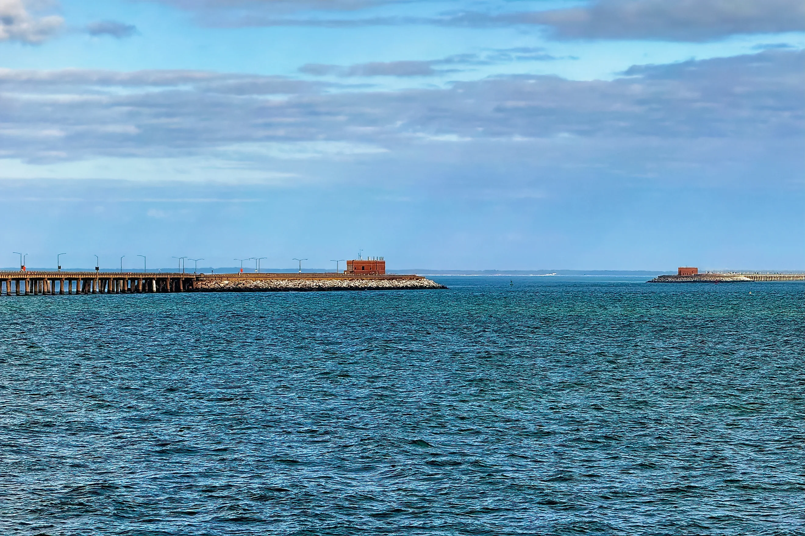
Few bodies of water have shaped American life as deeply as the Chesapeake. It cradled Jamestown, the first permanent English settlement in America, founded in 1607 on the bay's James River. Today its shores host some of the country's great ports, from Baltimore's Inner Harbor to the sprawling naval complex at Norfolk and Hampton Roads. It sustains a storied seafood industry and the watermen who still work it by hand, is spanned by the engineering feat of the Chesapeake Bay Bridge, and shelters timeless island communities like Smith and Tangier. Largest bay, largest estuary, or something neatly in between, the Chesapeake is beyond question one of the most important stretches of water anywhere in the United States.