Green River
The Green River is a 1,170km long river that serves as the principal tributary of the mighty Colorado River. The Green River’s watershed covers parts of Wyoming, Utah, and Colorado in the western United States, draining an area of 125,000 sq. km. A significant portion of the course of the Green River lies in Utah, where the river drains the entire northeastern part of the state. The Green River flows through the arid Colorado Plateau region, carving some of the most magnificent canyons in the country.
Course Of the Green River
The headwaters of the Green River originate on the western side of the Continental Divide in the Wind River Range and the Bridger-Teton National Forest in the west-central part of the US State of Wyoming. The river then flows southward through Sublette County in the western part of the state in an area referred to as the Upper Green River Valley. The river flows in the southwest direction in the west part of Sweetwater County, where the Big Sandy River joins it. Close to the town of La Barge, the Green River flows into the Fontenelle Reservoir that has been impounded by the Fontenelle Dam. From here, the river passes through the open sage-covered rolling prairies where it is crossed by some emigration trails such as the California Trail, Mormon Trail, and the Oregon Trail.

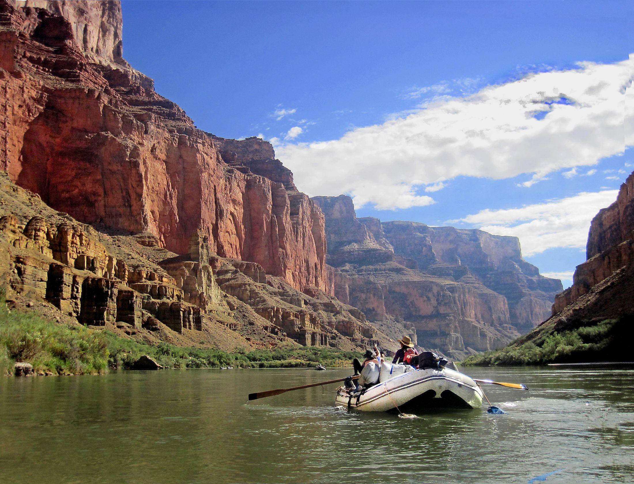
The river then flows further southwards past the Green River City, flowing through the Flaming Gorge National Recreation Area, into the Flaming Gorge Reservoir that has been impounded by the Flaming Gorge Dam. The Green River then continues through the eastern part of Utah, looping around the eastern edge of the Uinta Mountains. The river then passes from Utah into the northwestern part of Colorado, meandering through the Gates of Lodore in the Dinosaur National Monument, and flows back into Utah in the middle of Whirlpool Canyon. The river then flows in the southwest direction, across the Yampa Plateau, passing through the Ouray National Wildlife Refuge and the Uintah and Ouray Indian Reservation. From here, the river flows southwards through the Roan Cliffs and the Desolation and Gray canyons. After flowing past the Green River City, the Green River meanders in the southeast direction flowing through the Labyrinth and Stillwater canyons. Finally, the Green River drains into the Colorado River at the end of Stillwater Canyon in the Canyonlands National Park. Throughout its course, the Green River drops from an elevation of approximately 1828.8m above sea level at Flaming Gorge Reservoir to about 914.4m at its confluence with the Colorado River.
The Green River carries a relatively large load of silt and discharges an average of 173.3 cubic meters per second. The Green River also provides water for irrigation of several acres of ranch land and offers excellent trout fishing opportunities for visitors. Some of the Green River tributaries include Big Sandy River, Blacks Fork River, Duchesne River, Henrys Fork, New York River, Price River, San Rafael River, White River, and the Yampa River. The width of the Green River ranges from 30 to 100m in the upper course and from 91 to 457m in the lower course. The Green River has a depth of 0.91 to 15.24m and is navigable only by small crafts throughout its course and by large motorboats upstream to the Flaming Gorge Dam. The Green River Basin contains the largest known deposit of trona ore globally. It is also estimated that about 500 billion to 1.1 trillion barrels of recoverable oil are found in the Green River Basin.
Brief History

Archaeological studies have revealed that the canyons and sheltered areas in the river valley were initially inhabited by the Fremont people from the 7th century to the 13th century. In the later years, the river basin was occupied by the Shoshone and Ute tribes, and the river was referred to as “Seeds-kee-dee-Agie” by the Shoshone people. The Franciscan priests Francisco Atanasio Dominguez and Silvestre Velez de Escalante crossed the river in 1776 and named it as “Rio de San Buenaventura.” In later years, the Mexican and the Spanish explorers chose the name “Rio Verde,” which meant “Green River.” However, in 1811, the river was named “Spanish River” by Wilson Hunt of the Pacific Fur Company. The river was rechristened as the “Green River” in 1824. The American explorer John Charles Fremont explored the region in 1840. The Green River was surveyed and mapped by the American geologist John Wesley Powell in 1869. A group of Mormons founded the first permanent settlement in the river valley in 1878. Currently, the federal government controls significant portions of land in the Green River Basin.


