7 Great Road Trips to Take in The United States
Since the advent of the automobile in the early 20th century, American tourism has been largely defined by the idea of the open road. Following WWII, the golden age of the automobile industry and the expansion of the interstate highway system made road-tripping the predominant mode of leisure travel. The format became a key component of American culture. Roadtrips let you experience the Americana of the 1950s and 60s on Route 66. Or explore the rocky coastlines of California on the Pacific Coast Highway, or traverse the Atlantic coast of Florida on State Road A1A. With the largest road network in the world there are thousands of trips to take on US highways and byways, and these are some of the best.
US Route 66

One of the original roads in the numbered highway system, historic Route 66 ran from Chicago to Santa Monica, covered about 2,448 miles, and today survives as a road trip along preserved historic alignments, state and local roads, and bypassed segments. Today, most of Route 66 has been bypassed by interstate highways, but it is extensively represented in American pop culture and remains one of the most recognized roads in the country. Driving Route 66 transports you back to the heyday of American auto travel. You will drive through historic small towns and past bright neon motel signs and kitschy tourist attractions, while being treated to mile after mile of natural beauty. The Main Street of America celebrates its centennial this year (2026), which makes it a great time to travel this historic highway as several towns and preservation organizations are hosting events to commemorate the road's 100th birthday.

Just after leaving Chicago, you will pass through Springfield, Illinois, home of the Abraham Lincoln Presidential Library and Museum and his final resting place at Oak Ridge Cemetery. In Oklahoma City, remnants of the frontier spirit that drove westward expansion are preserved at the National Cowboy & Western Heritage Museum. Tucumcari, New Mexico, features quirky hotels like the Blue Swallow Motel, curio shops, and colorful murals. The Arizona stretch has several stops for nature lovers, including the colorful badlands of the Painted Desert at Petrified Forest National Park and the Grand Canyon, one of the 7 Natural Wonders of the World. The route ends at the Santa Monica Pier, where you can snap a photo at the End of Route 66 sign and watch the sunset over the Pacific Ocean to end your trip.
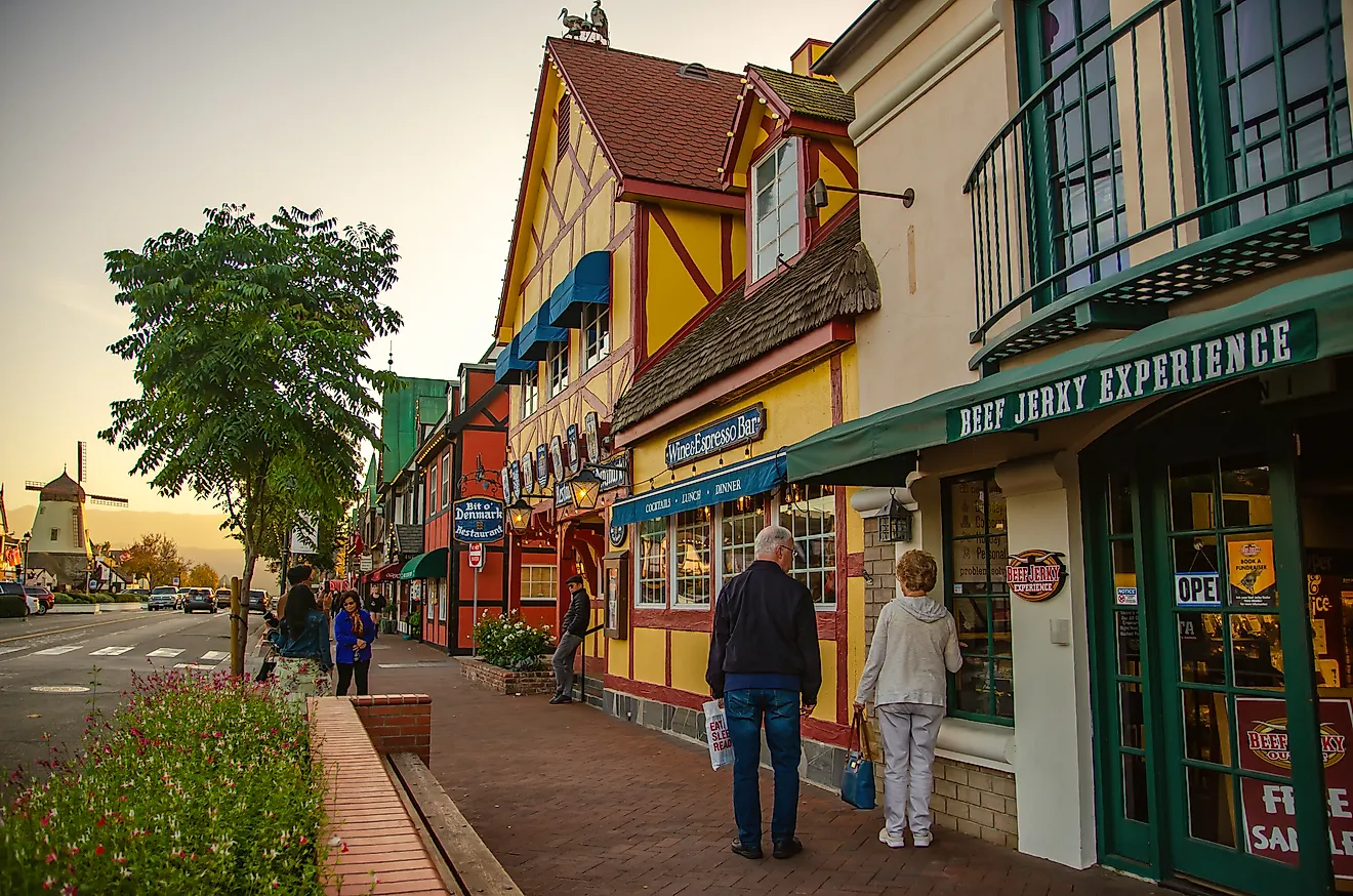
The Pacific Coast Highway (California State Route 1)

The Pacific Coast Highway is the longest of California's state highways. State Route 1 covers about 656 miles from Dana Point in Orange County to Leggett in Mendocino County and is one of the most scenic drives anywhere in the country. This road will take you past some of California's most memorable scenery, historic Spanish Missions, and untouched beaches, as well as several coastal towns to break up the drive. It's best to allow at least a week for this trip, given the sheer number of stops along the way.
As you drive north from Los Angeles, stop at Old Mission Santa Barbara, established in 1786 by Franciscan friars, to wander through the scenic gardens, or have a picnic overlooking the city of Santa Barbara and the Pacific Ocean. Explore the historic pier in Pismo Beach or, in late fall through winter, see thousands of monarch butterflies clustering in the Eucalyptus trees at Pismo Beach Monarch Butterfly Grove. Continuing north will take you through Big Sur, a rugged stretch of seaside cliffs at the foot of the Santa Lucia Mountains, where you can hike along the banks of the Big Sur River and explore coastal redwood groves.
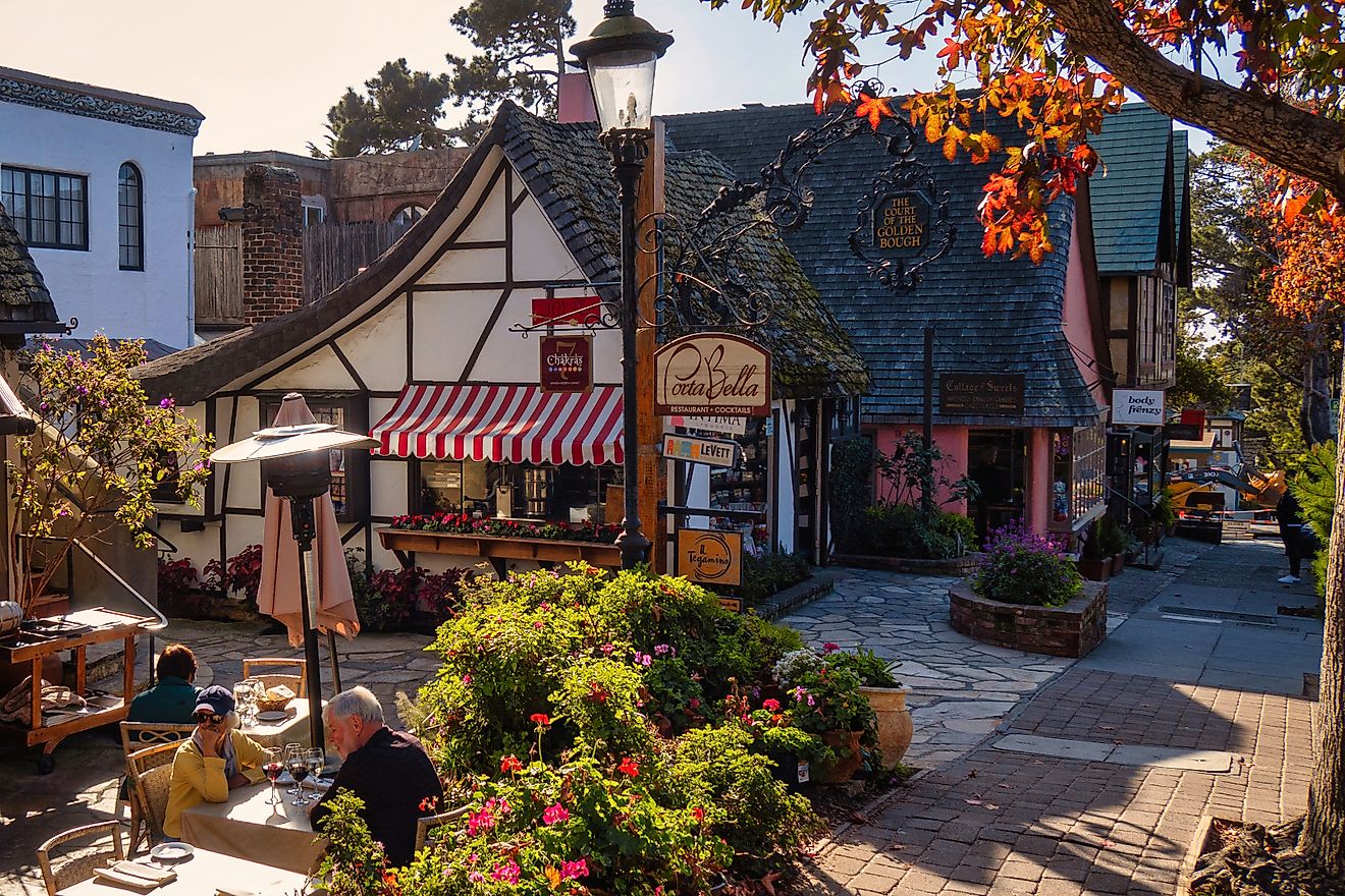
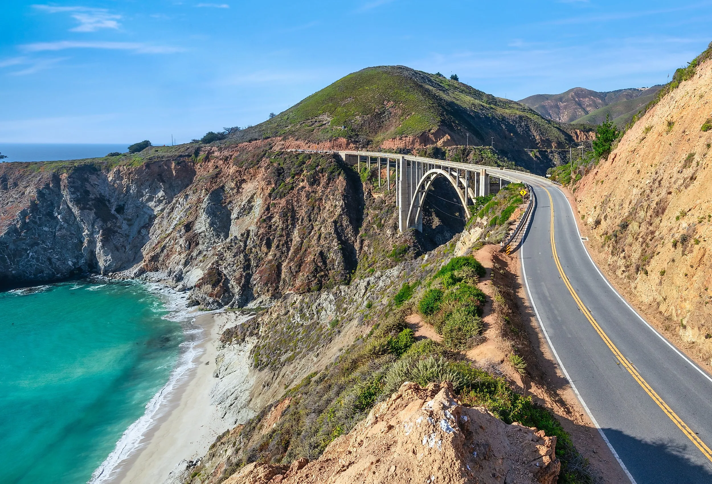
Just south of Notley's Landing, you will cross the well-known Bixby Bridge, one of the most photographed locations in the state, and then arrive in the small coastal town of Carmel-by-the-Sea, a great place to stop for delicious seafood or a glass of wine at one of more than a dozen tasting rooms downtown. After driving over the Golden Gate Bridge in San Francisco, you will wind your way through towering old-growth redwoods and end your journey in the town of Leggett, where you can drive your car through the giant Chandelier redwood tree at Drive-Thru Tree Park.
Jimmy Buffett Memorial Highway (Florida State Road A1A)

This north-south state road covers 338 miles along Florida's Atlantic coast. Comprised of seven sections from Fernandina Beach to Key West, the beach is never far away on this scenic drive along some of the state's most beautiful shoreline. Named in honor of singer-songwriter Jimmy Buffett in 2024, a Florida A1A road trip combines uncrowded beaches, historic coastal towns, and undisturbed nature preserves, and you will likely need several days to travel its entirety.
As you drive south from Fernandina Beach, you will pass through Big Talbot Island State Park and see Boneyard Beach, named for the bleached oak and cedar trees washed up on the shore. Further south, Mickler's Landing Beachfront Park offers another unique coastal attraction with its pink-tinted sand, formed from crushed coquina shells. Stop in St. Augustine, the oldest continually inhabited European settlement in the country (founded 1565), to visit historic landmarks like Castillo de San Marcos and Ponce de Leon's "Fountain of Youth," or explore the Lightner Museum, which contains an extensive collection of art and historical artifacts.
On the Halifax River south of Daytona Beach, climb to the top of Ponce de Leon Inlet Lighthouse, the tallest in Florida at 175 feet, and learn about the state's maritime history at the corresponding museum. Along the Space Coast, visit the Kennedy Space Center at Cape Canaveral, full of family-friendly immersive attractions like flight simulators, space shuttle displays, and talks with veteran astronauts. To get to the southernmost section of A1A, you will drive 113 miles on the Overseas Highway from mainland Florida and get wide views of the ocean, especially at sunset. The route ends at Bertha Street in Key West, right by the Key West Nature Preserve, where sharp-eyed visitors can spot anoles, iguanas, and black racer snakes in the shade of the mangrove forest.
The Blue Ridge Parkway

The Blue Ridge Parkway is managed by the National Park Service and comprises 469 miles of scenic roadway, traveling along the ridge of the Appalachian Mountains from Virginia to North Carolina. When fully open, driving the 469-mile Blue Ridge Parkway end-to-end requires at least twelve hours, but travelers should check NPS road status before attempting the full route because construction, weather, and storm-recovery closures can interrupt through travel. The road is not maintained in the winter, and high elevation passes may be closed due to heavy snowfall, so fall and spring are ideal times to plan your adventure.
Driving from the northern end of the parkway, you will start at Rockfish Gap at the southern edge of Shenandoah National Park. As you head south, you will have great views of the valley in both directions. Clearly marked scenic overlooks and short hiking trails line the route, providing ample opportunities to stretch your legs and observe the rugged mountain peaks and brilliant green landscape below. Mabry Mill, an early 20th-century Appalachian gristmill, is one of the most photographed stops along the route and offers cultural demonstrations and mountain music concerts during the summer and early fall. In North Carolina, you will drive across the Linn Cove Viaduct, an elevated bridge that hugs the slopes of Grandfather Mountain. The bridge was built this way to protect the fragile ecosystem of the region from the depredations of a traditional cut-and-fill roadway, and the resulting feat of engineering is one of the most memorable stretches of the road. Just a few miles south, stop at Linville Falls, a dramatic, multi-tiered cascade into a deep gorge known as "The Grand Canyon of the Southern Appalachia." The parkway ends in Cherokee, North Carolina, a small mountain town with several museums about the history and culture of the Cherokee Tribe, like the Oconaluftee Indian Village, where you can learn about how the Cherokee lived in the 18th century.
The Great River Road

The Great River Road follows the path of the Mississippi River from northern Minnesota to the Gulf of Mexico, passing through ten states and comprising over 2,000 miles of state and local roads. The ten-day journey along the entirety of this National Scenic Byway will take you through national parks, historic river towns, and archeologically significant Native American sites, as you explore the regions that have been shaped by the country's most economically and culturally significant waterway.
The journey begins in the 32,000-acre forest of Itasca State Park in Minnesota, which contains over 100 lakes, old-growth pine forests, and several historic sites and structures. Southeast of Minneapolis, you will enter the Driftless Area, a region defined by its limestone bluffs, karst geology, and steep hills. As you cross into Iowa, stop at Effigy Mounds National Monument to view over 200 burial mounds considered sacred by 20 separate Native American tribes. The 2,526 acres of forests, prairies, and wetlands in the monument comprise some of the most beautiful scenery in the Upper Mississippi River Valley and provide homes for 291 species of birds, and can be explored on 14 miles of maintained hiking trails. In Hannibal, Missouri, you can visit the childhood home of author Mark Twain, the preeminent chronicler of life on the Mississippi. Just a few miles downstream in St. Louis, stop by Gateway Arch National Park and learn about the role that the city played in westward expansion, and visit the Old Courthouse where Dred and Harriet Scott sued for their freedom in the landmark case, Dred Scott v. Sandford. The southern stretch of the route passes through Memphis and New Orleans, both of which are known for their rich musical traditions and a blend of cultures created by their proximity to the river. The road ends in Venice, the southernmost point in Louisiana reachable by car, as the Mississippi ends its 2,340-mile journey to the Gulf of Mexico.
The Utah Mighty 5

The journey through the stark, multicolored rock landscape of Utah is one of the most scenic drives in the country. Covering around 1,200 miles, this road trip visits every National Park in the state, taking around 7 to 10 days to complete (not hours), allowing for ample time at each location. The best route to minimize backtracking begins and ends in Salt Lake City, but you can also start in Las Vegas if you don't mind retracing your steps on your return. No matter where you start or end, this road trip will be packed with gorgeous rock formations, exceptional stargazing, and plenty of wilderness adventure.

From Salt Lake City, you will drive south to Arches National Park near Moab, where the park's scenic drive winds through a landscape full of over 2,000 stone arches as well as massive pinnacles and balanced rocks. Nearby at Canyonlands National Park, you will see a network of deep canyons and towering buttes created by the flow of the Colorado River and Green River. From Moab, you will drive west to Capitol Reef National Park, the least visited of the five National Parks in Utah, but with no shortage of scenery. You can learn about the history of the Indigenous Fremont People, explore homesteads occupied by early Mormon settlers, or hike through the multicolored tapestry of red Entrada and white Navajo sandstone cliffs and natural bridges. Drive south along Scenic Byway 12 to Bryce Canyon National Park, home to the largest collection of hoodoos anywhere in the world. The park's main road passes beautiful overlooks like Sunset and Sunrise Point, which provide fantastic views during sunrise and sunset. The last stop on the journey is Zion National Park in southwestern Utah, a diverse landscape of sandstone peaks and deep river canyons, full of lush green vegetation and cascading waterfalls. Popular hikes like Angels Landing and The Watchman Trail provide high elevation views, while wading up the Virgin River in The Narrows will allow you to see the unique microhabitats that thrive in the slickrock canyons.
The Natchez Trace Parkway

This 444-mile National Scenic Byway travels through Tennessee, Alabama, and Mississippi from just south of Nashville to the riverside town of Natchez. The road follows the path of a historic corridor used by Native Americans, pioneers, and other travelers for over 10,000 years. The parkway is maintained by the National Park Service and has over 50 entry points, making it easy to access from several urban centers. This road trip is best enjoyed over 3 to 5 days, allowing time to experience the variety of historical sites, scenic overlooks, and natural beauty along the way. (Check current NPS closures and detours before planning an end-to-end drive.)
Starting from the northern end, the parkway travels through cedar glades in the Central Basin of Tennessee. At milepost 404.7, you will see Jackson Falls, a popular 60-foot waterfall that cascades over limestone bluffs into the Duck River Valley. About twenty miles down the road, you can visit the Meriwether Lewis Monument, where the famous explorer was laid to rest in 1809. Rock Spring at milepost 330.2 features deep natural pools and wildflowers, and in the fall, the area attracts ruby-throated hummingbirds drawn to the jewelweed and other native blooms. In Alabama, you can tour one of Frank Lloyd Wright's designs at the Rosenbaum House in Florence. Built in 1939, this single-family home is one of the best preserved examples of Wright's Usonian design style. Once you reach Mississippi, wander through the cypress swamp at Milepost 122 near the Ross R. Barnett Reservoir. The park's half-mile scenic boardwalk wanders through giant cypress balds and tupelo trees, where you may be able to spot turtles and wading birds in the green waters below. Emerald Mound at milepost 10.3, just ten miles before the end of the parkway, was built between 1250 and 1600 CE and is the second-largest pre-Columbian ceremonial mound in the country (after Monks Mound at Cahokia, Illinois), covering eight acres and rising about 35 feet from a natural base. The parkway ends in Natchez on the Mississippi River, home to numerous historic structures and preserved plantation homes like the Dunleith Historic Inn and Longwood.
See America From the Open Road
It is not difficult to see why road trips are so popular in the US. With routes like the Utah Mighty 5 and the Blue Ridge Parkway providing access to scenic natural areas and the Natchez Trace Parkway and Great River Road allowing you to follow in the footsteps of generations of travelers that came before, these road trips represent just a fraction of the adventures waiting to be had on the country's scenic highways and remote backroads.