Maps of Mississippi
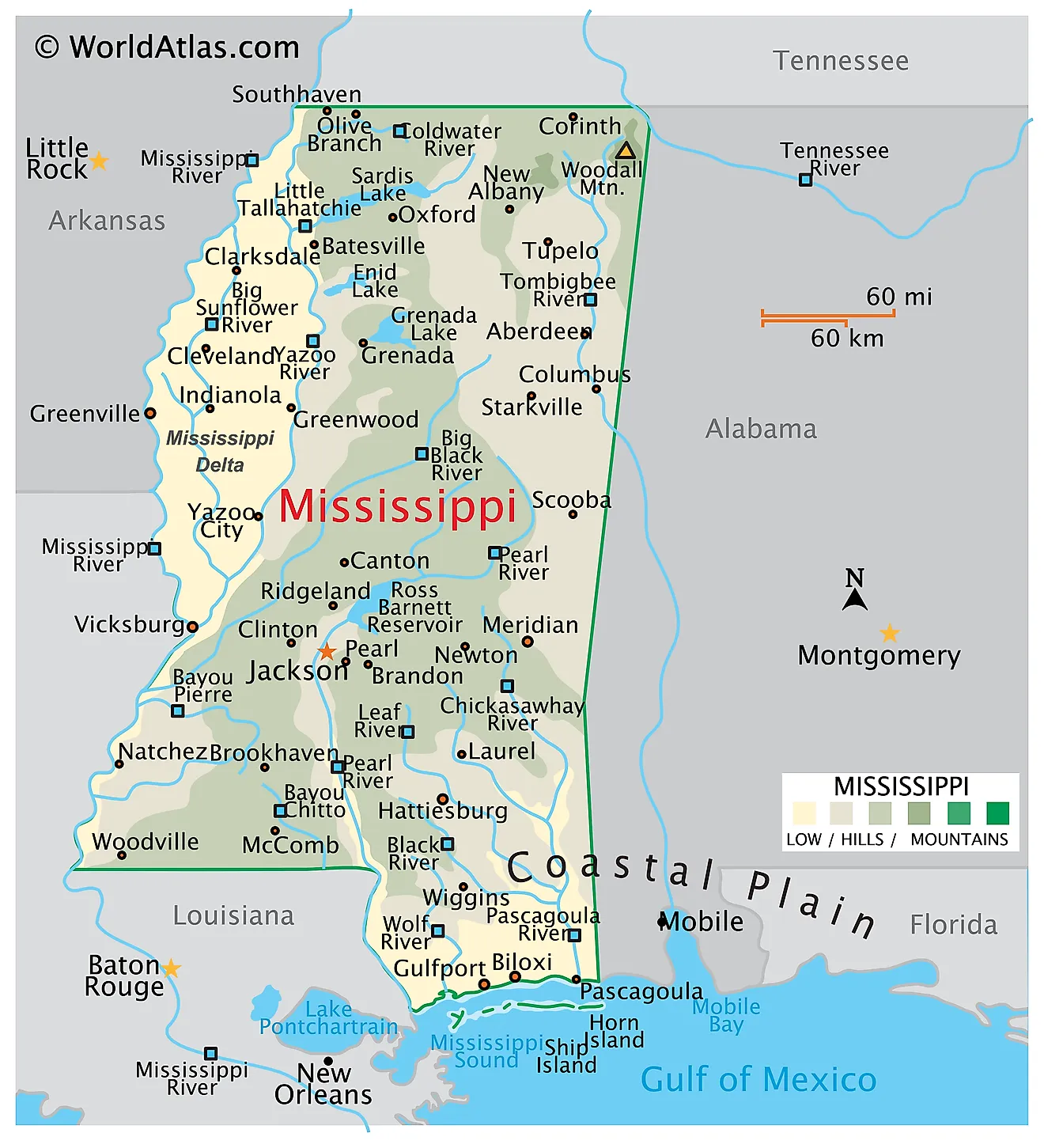
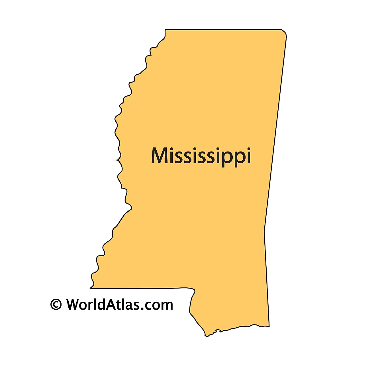
Mississippi, located in the southeastern United States, shares its borders with Tennessee to the north, Alabama to the east, the Gulf of Mexico to the south, and to the west there is Arkansas, Louisiana, and the Arkansas River. The state encompasses a total area of approximately 48,430 mi2 (125,438 km2).
From western Mississippi to eastern Mississippi, these are the 11 primary geographical regions that make up the state:
Alluvial Plain The Alluvial Plain, commonly known as the Mississippi Delta, is a flat, fertile region formed by the sediment deposition of the Mississippi River. This extensive plain features rich soil, making it ideal for agriculture, particularly cotton farming. The region extends from the northwest part of the state, following the Mississippi River down to the Gulf of Mexico.
Loess Hills Adjacent to the western edge of the Alluvial Plain are the Loess Hills. This area is characterized by its unique loess soil, a fine, wind-blown deposit that creates a gently rolling landscape. These hills are more prominent in the northern part of the state, gradually diminishing in height towards the south.
Southern Pine Hills The Southern Pine Hills, also known as the Piney Woods, occupy the southeastern part of Mississippi. This region is distinguished by its dense forests of longleaf and loblolly pines. The terrain is hilly, with numerous small streams and rivers cutting through the landscape.
Jackson Prairie The Jackson Prairie region, located in central Mississippi, is a belt of prairie land that interrupts the forested landscape. It is characterized by its flat to gently rolling terrain and prairie grasses. This area is underlain by limestone, which influences the soil composition and vegetation.
North Central Plateau The North Central Plateau, situated in the central part of the state, features a landscape of gently rolling hills and fertile valleys. This region transitions from the prairie lands in the south to more forested areas in the north and east.
Coastal Meadows Along the Gulf of Mexico lies the Coastal Meadows region. This area is marked by flat, open landscapes with expansive meadows and marshlands. The proximity to the Gulf influences the climate and vegetation, with salt-tolerant grasses and plants being predominant.
Flatwoods The Flatwoods region, found in the east-central part of Mississippi, is characterized by flat, poorly drained land covered with dense forests. The soil here is typically clay-based, supporting a unique ecosystem different from the surrounding areas.
Pontotoc Ridge Pontotoc Ridge, located in the northeastern part of the state, is a distinct elevated area. This ridge is characterized by its higher elevation and hilly terrain, contrasting with the surrounding flatter landscapes. The area is known for its hardwood forests and scenic beauty.
Black Prairie The Black Prairie region, extending along the eastern border of the state, is named for its dark, fertile soil. This area is primarily a grassland prairie, with scattered patches of woodland. The terrain is gently rolling, providing ideal conditions for agriculture.
Tombigbee and Tennessee River Hills This region includes the state's highest point, Woodall Mountain, at 806 feet (246 meters). The Tombigbee and Tennessee River Hills are characterized by their rugged, hilly terrain and are situated along the eastern border of the state. This area is marked by the presence of the Tombigbee and Tennessee Rivers, which carve through the landscape and play a significant role in shaping the region's geography.
Paleozoic Bottoms The Paleozoic Bottoms, located in the northeastern corner of Mississippi, feature a landscape shaped by the geological events of the Paleozoic era. This area consists of rolling hills and valleys, with rock formations that are distinct from other regions in the state.
Islands and Major Bodies of Water Mississippi's geography is significantly influenced by its major bodies of water, including the Mississippi River, which forms its western border. The state also contains numerous lakes and reservoirs, such as the Ross Barnett Reservoir and Sardis Lake. Along the Gulf Coast, barrier islands like Ship Island and Horn Island protect the shoreline and define the coastal environment. The Gulf of Mexico itself plays a crucial role in the state's climate and ecosystem.
Counties Map
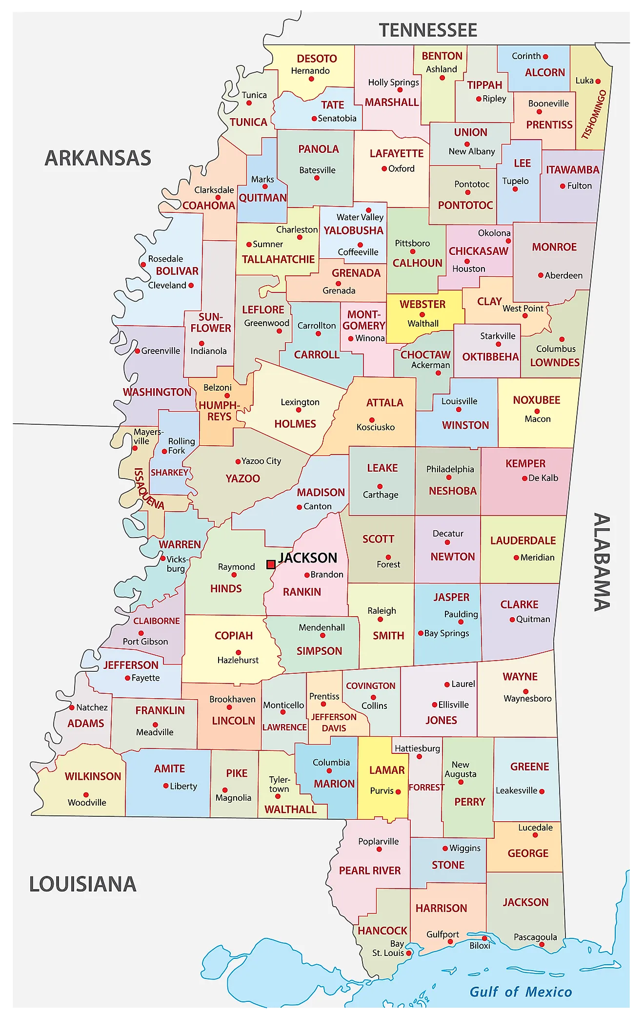
The State of Mississippi is divided into 82 counties. In alphabetical order, these counties are: Adams, Alcorn, Amite, Attala, Benton, Bolivar, Calhoun, Carroll, Chickasaw, Choctaw, Claiborne, Clarke, Clay, Coahoma, Copiah, Covington, DeSoto, Forrest, Franklin, George, Greene, Grenada, Hancock, Harrison, Hinds, Holmes, Humphreys, Issaquena, Itawamba, Jackson, Jasper, Jefferson, Jefferson Davis, Jones, Kemper, Lafayette, Lamar, Lauderdale, Lawrence, Leake, Lee, Leflore, Lincoln, Lowndes, Madison, Marion, Marshall, Monroe, Montgomery, Neshoba, Newton, Noxubee, Oktibbeha, Panola, Pearl River, Perry, Pike, Pontotoc, Prentiss, Quitman, Rankin, Scott, Sharkey, Simpson, Smith, Stone, Sunflower, Tallahatchie, Tate, Tippah, Tishomingo, Tunica, Union, Walthall, Warren, Washington, Wayne, Webster, Wilkinson, Winston, Yalobusha, and Yazoo.
With an area of 125,443 sq. km, the State of Mississippi is the 32nd largest and the 34th most populous state in the USA. Located in the northeastern part of Hinds County, along with small portions in Madison and Rankin counties is, Jackson (officially, the City of Jackson) is the capital, largest, and the most populous city of Mississippi. Jackson houses major manufacturing industries like food processing, metal products, and machinery among others. The capital city is situated on the top of an extinct volcano, that is found 2,900ft below the surface and is, therefore, the only US city with this feature.
Where is Mississippi?
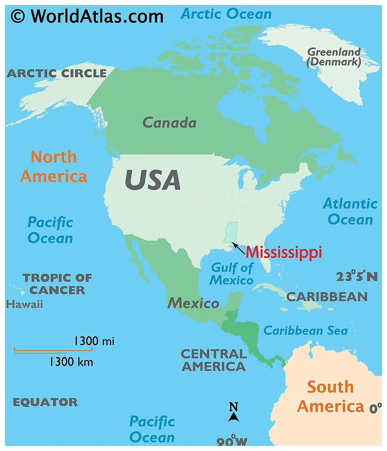
The State of Mississippi is located in the Gulf Coast region of the United States. Mississippi is bordered by the state of Tennessee in the north, by Arkansas in the northwest, by Alabama in the east, by Louisiana in the southwest, and by the Gulf of Mexico in the south. The Mississippi River flows along the state’s entire western border.
Regional Maps: Map of North America
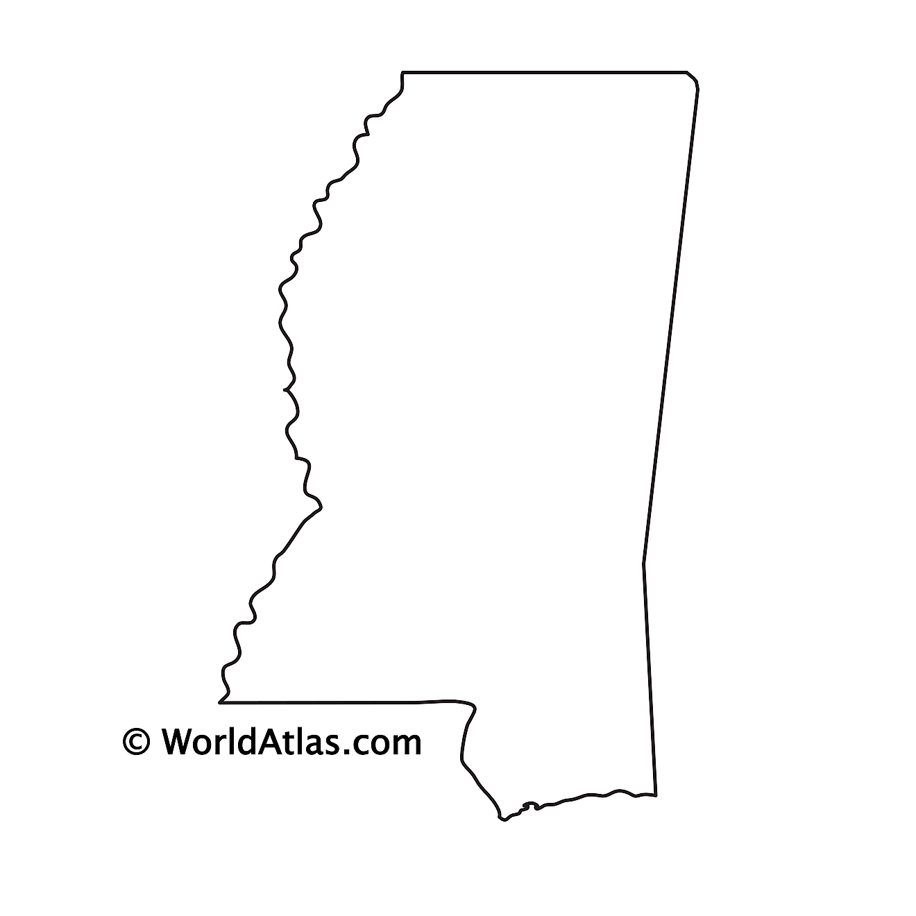
Outline Map of Mississippi
Key Facts
| Legal Name | State of Mississippi |
|---|---|
| ISO 3166 Code | US-MS |
| Capital City | Jackson |
| Largest City |
Jackson, Mississippi (436,024) |
This page was last updated on January 18, 2024
