The 10 Most Hurricane-Prone States in the US
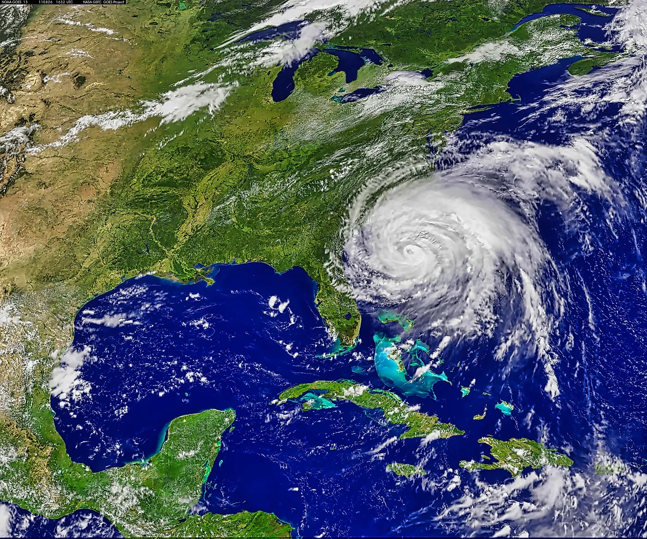
Hurricanes are among the most destructive natural hazards in the United States, capable of causing severe damage to buildings and infrastructure and, in the worst cases, loss of life. These storms follow a predictable calendar: the Atlantic Hurricane Season officially runs from June 1 through November 30. They are ranked on a scale from Category 1 (the least severe) to Category 5 (the most destructive). Only four Category 5 hurricanes have ever been recorded in the US, and three of them made landfall in Florida.
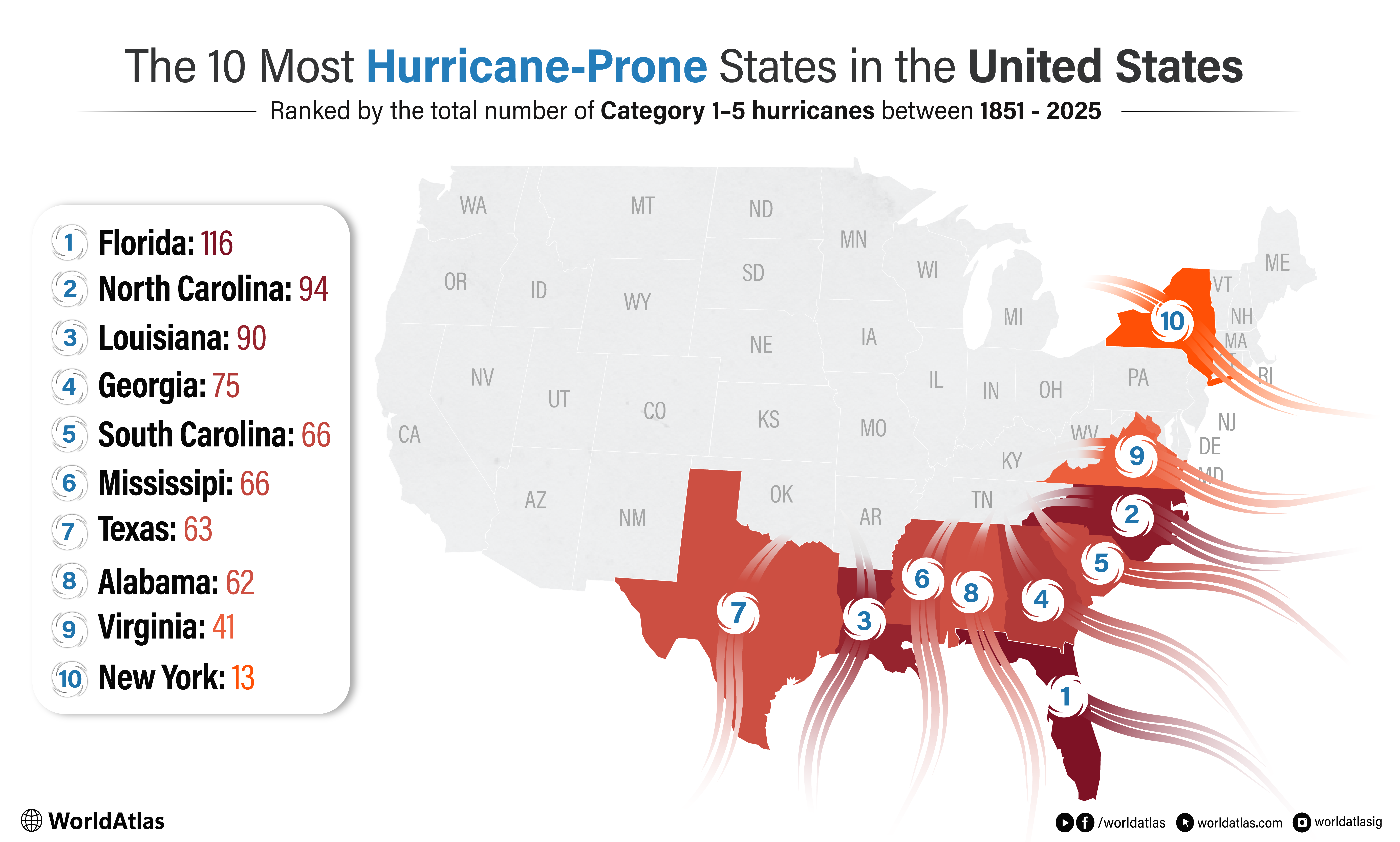
While hurricanes can affect inland states as they travel, coastal states face the greatest risk because these storms form over warm ocean waters. With hurricane season approaching, we looked at which states have historically experienced the most Category 1 through 5 hurricanes, based on NOAA's Historical Hurricane Tracker data from 1851 through 2025.
Florida

When people think of hurricanes, they usually think of Florida, and rightfully so. No other state has weathered more hurricanes than this southern state. Since 1851, this coastal region has experienced 116 hurricanes. One of the worst hurricanes to strike this region was Category 5 Hurricane Andrew. Making landfall in August 1992, Andrew is still one of the costliest storms to hit the southern state. According to NOAA, Andrew had sustained winds up to 125 mph and was responsible for 23 direct deaths while causing $27 billion in damages.
North Carolina

With 94 hurricanes making landfall between 1851 and 2025, North Carolina is the second most hurricane-prone state in the country. One of the most significant storms to affect the state was Hurricane Helene in 2024. A band of heavy rain and wind gusts swept through, causing widespread flooding, landslides, downed trees, and power lines. According to the North Carolina State Climate Office, the storm caused an estimated $61.2 billion in damage and killed more than 100 people.
Louisiana

Close behind North Carolina is Louisiana. Since 1851, this southern state has been hit by 90 hurricanes. Like Florida, Louisiana has a subtropical climate and sits along the Gulf of Mexico. New Orleans has struggled with drainage since its founding in 1718, prompting a series of engineered systems, including early‑1900s pumps at the ends of outfall canals. Despite these improvements, the city remains highly vulnerable to storm surge, as Hurricane Katrina demonstrated when a levee along Lake Pontchartrain failed, causing widespread loss of life and severe property damage. Katrina is said to be responsible for killing almost 1,600 residents, whether directly or indirectly, and causing approximately $38.8 billion in damage.
Georgia

Fourth on our list is the southern state of Georgia. While its coastline is relatively short, Georgia has experienced 75 hurricanes since 1851, many of which have caused flooding and tornado outbreaks. With a humid subtropical climate, Georgia lies right on the border with Florida and along the Atlantic Coast. A jet stream, which is a high-altitude river of air, can either steer storms away or pull them toward the coast, depending on its position. Based on its shape and location, Georgia can sometimes avoid a direct hit when steering patterns push storms northward, though that does not always spare the state from major impacts. Unfortunately, this is not always the case.
One of the most impactful cyclones to hit this region occurred in August 2025 when a tropical wave off the coast of Africa strengthened into a tropical storm and eventually became Category 5 Hurricane Erin. Hurricane Erin produced sustained winds up to 160 mph and produced 12-foot wave swells before weakening into a Category 4 storm a few days later. Massive flooding and several deaths occurred, resulting directly and indirectly from this cyclone.
South Carolina

South Carolina has experienced 66 recorded storms since 1851, ranking it fifth among the most impacted states. Of these, four made landfall as major hurricanes, including the devastating Hurricane Hugo. When Hugo struck just north of Charleston in 1989, it produced extreme storm tides and wind gusts reaching 135-140 mph, resulting in nearly $7 billion in damage to the region.
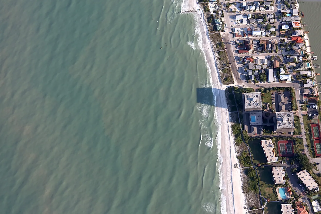
Like the other states, South Carolina sits along the Atlantic Ocean and has 187 miles of coastline. The majority of this coastline, known as the “Lowcountry,” has low elevation, sitting at just 270 feet above sea level. It’s also completely flat. The lack of a natural slope means water can’t drain as efficiently. The water table is also naturally high, leading the soil to remain saturated for much of the year. Both circumstances can lead to prolonged ponding and flooding, heightening the state’s risk for more damage.
Missississippi

Tied with South Carolina is Mississippi, which has also experienced 66 hurricanes since 1851. Mississippi experiences a humid subtropical climate with long, hot summers and rainfall evenly distributed throughout the year. Its southerly winds bring moisture, creating high humidity and increasing the chance of violent storms. It also has a low-lying coast, which makes it more vulnerable to storm surges, and a continued loss of wetlands and natural marshes reduces the natural buffer that once helped protect against wind.
Texas

Coming in seventh is Texas, with a total of 63 hurricanes across its northern, central, and southern coastal regions. One of the most memorable storms to hit Texas was Hurricane Harvey. It made landfall in 2017, causing around 87 deaths and about $125 billion in damage. It displaced over 30,000 people and destroyed more than 200,000 homes and businesses.
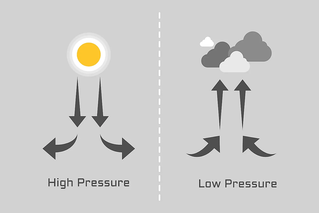
Texas sits on the Gulf of Mexico, which warms up even faster than the Atlantic Ocean due to its closer proximity to the equator and much shallower depths. These warm water temperatures create low-pressure tropical waves, which, in turn, increase the chance of hurricanes. Cities such as Corpus Christi, Galveston, and Houston are especially susceptible due to their positions along the Gulf Coast.
Alabama

Impacted by 62 hurricanes since 1851, and coming in at number eight is Alabama. According to the United States Environmental Protection Agency (EPA), sea levels are rising more rapidly in Alabama than in most coastal states because the land is sinking. Scientists predict that sea levels along the Alabama coast could rise by 18 inches to 4 feet over the next century. Rising sea levels flood out wetlands and dry land, erode beaches, and increase flooding. Add to that the state’s mild winters, hot summers, year-round precipitation, and 53 miles of land along the Gulf of Mexico, and you have a breeding ground for storms.
Virginia

Hit by 41 hurricanes since 1851, Virginia is the 9th most hurricane-prone state. While the mountain regions west of the Blue Ridge Mountains have a warm, humid continental climate, bringing cooler temperatures and seasonal changes, the areas east of the Blue Ridge Mountains have a humid subtropical climate. Combine that with being situated along the coast, and you have all the makings for catastrophic storms.
New York

The last state on our list, New York, is much further north than the rest. Not hit by as many storms as the southern states, this region still has unique characteristics that can lead to severe damage when a storm makes landfall. This is because the right-angle of the state and the gentle slope of the continental shelf in Western Long Island tend to generate higher storm-surge levels, while the hilly bedrock at the shoreline increases freshwater flooding.
Why These States Face Greater Hurricane Risk
Several key factors create ideal conditions for hurricane development, including warm atmospheric temperatures, high humidity, strong winds, and warm ocean waters. These elements are most common from May through November, when hurricane activity typically peaks. The ten states discussed above all have climates that support these conditions, making them more vulnerable not only to experiencing hurricanes but also to facing more intense and dangerous storm patterns.