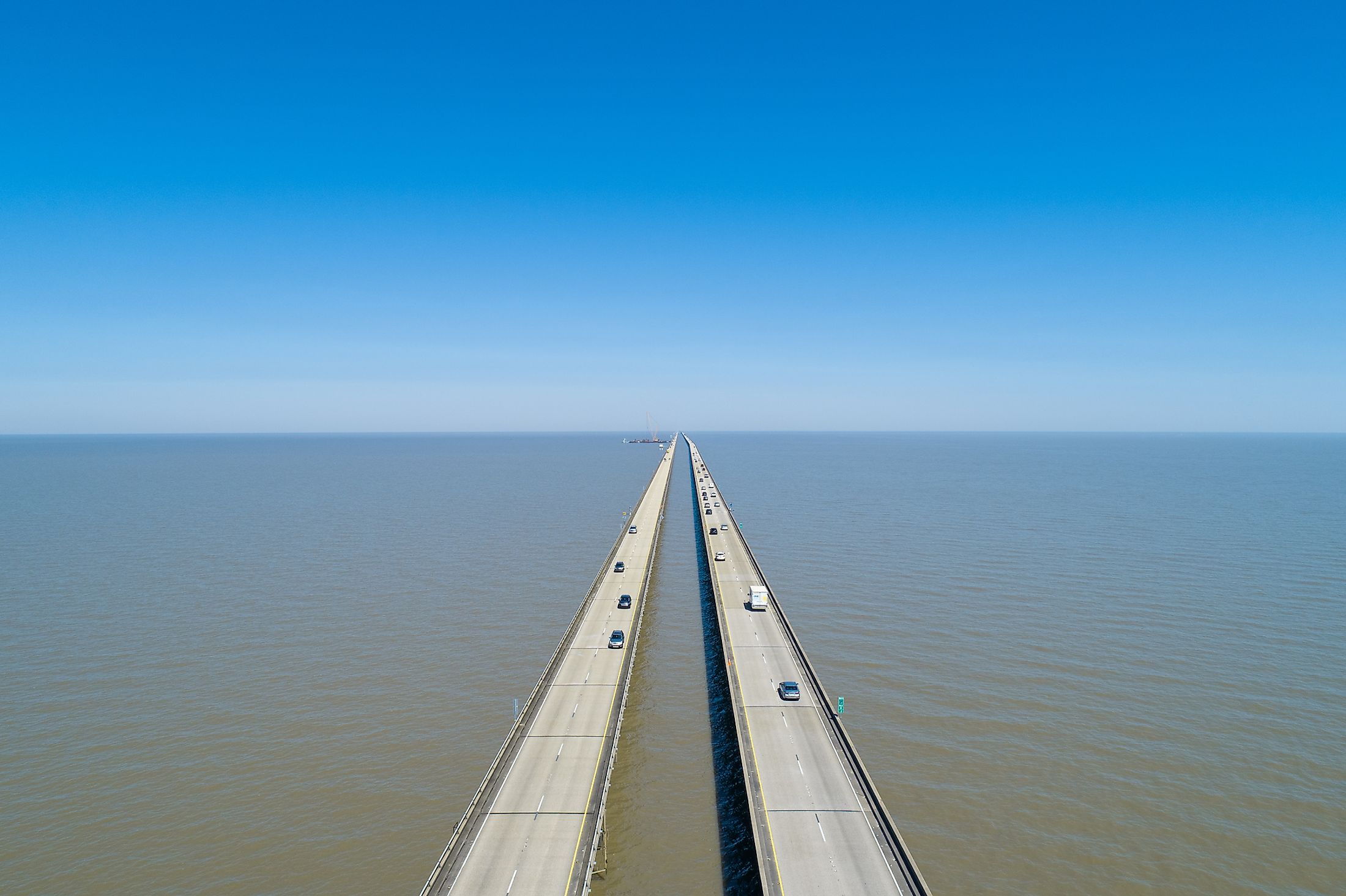
Lake Pontchartrain Causeway
The Lake Pontchartrain Causeway is a set of two parallel bridges which cross Lake Pontchartrain in southeastern Louisiana, United States. The longest of the two bridges measures 38.35 km. The south end of the bridge runs from Metairie, Louisiana, a south shore suburb of New Orleans, to Mandeville, Louisiana, its adjacent north shore suburb. Both bridges also include bascules which allow for taller ships to pass through the channel.

The causeway is considered the longest continuous bridge over water and has some 9,500 concrete pillar supports. There has been some debate about this claim since the Jiaozhou Bay Bridge in China, which was constructed in 2011, is actually longer, having a total length of 41.58 km. This pushed Guinness World Records to clarify their definition by creating the ‘longest continuous bridge over water’ and ‘longest aggregate bridge’ over water. The longest continuous segment of Jiaozhou Bay Bridge is 25.9 km.
History Of The Lake Pontchartrain Causeway

The original bridge causeway opened in 1956 and was a simple two-lane roadway that measured 38.4 kilometers in length. It cost 46 million dollars at the time, which is currently equivalent to roughly $340 million. The second parallel bridge, also two lanes, opened in 1969 and cost $30 million, or approximately $160 million in modern currency. Because of the cost, the bridge has been a toll road, with collections for both directions. In 1999, however, tolls were removed from the northbound span to reduce traffic buildup. Instead, the original $1.50 toll was doubled to $3.00. In 2017, the toll was raised to $5 to balance out the cost required for bridge improvements. The causeway is hugely beneficial for nearby communities. It allows commuters and travelers from the north shore to reach New Orleans almost an hour faster than they would have previously when taking traditional routes.

Hurricane Katrina hit New Orleans in August of 2005. Thankfully, very little damage was sustained to the causeway, as only 17 spans were lost, but the bridge’s integrity remained. Unfortunately, the nearby I-10 twin span bridge did sustain a large amount of damage and was not usable for some time. As a result, the Lake Pontchartrain Causeway became a vital transport line for the region. It was opened first for emergency services only, and allowed recovery and rescue teams to travel back and forth from the north and south shores with relative ease. This open pathway was significant in enabling aid to reach those in teams more quickly than it would have if the bridge had been damaged. The cause reopened to the general public roughly two and a half weeks after the storm hit. Due to the storm's severe trauma and financial toll, the bridge did not charge tolls for roughly the first month of its reopening, eventually reinstating them in mid-October. The storm, and the resulting use during the emergency reinforced the importance of the causeway, and its benefits to the communities on either side of it. It is a marker of the infrastructure advancements to note that this particular bridge, even as the longest, has shown no significant natural damage to date. However, repairs and continued improvements are inevitable over time.