Maps of South Carolina
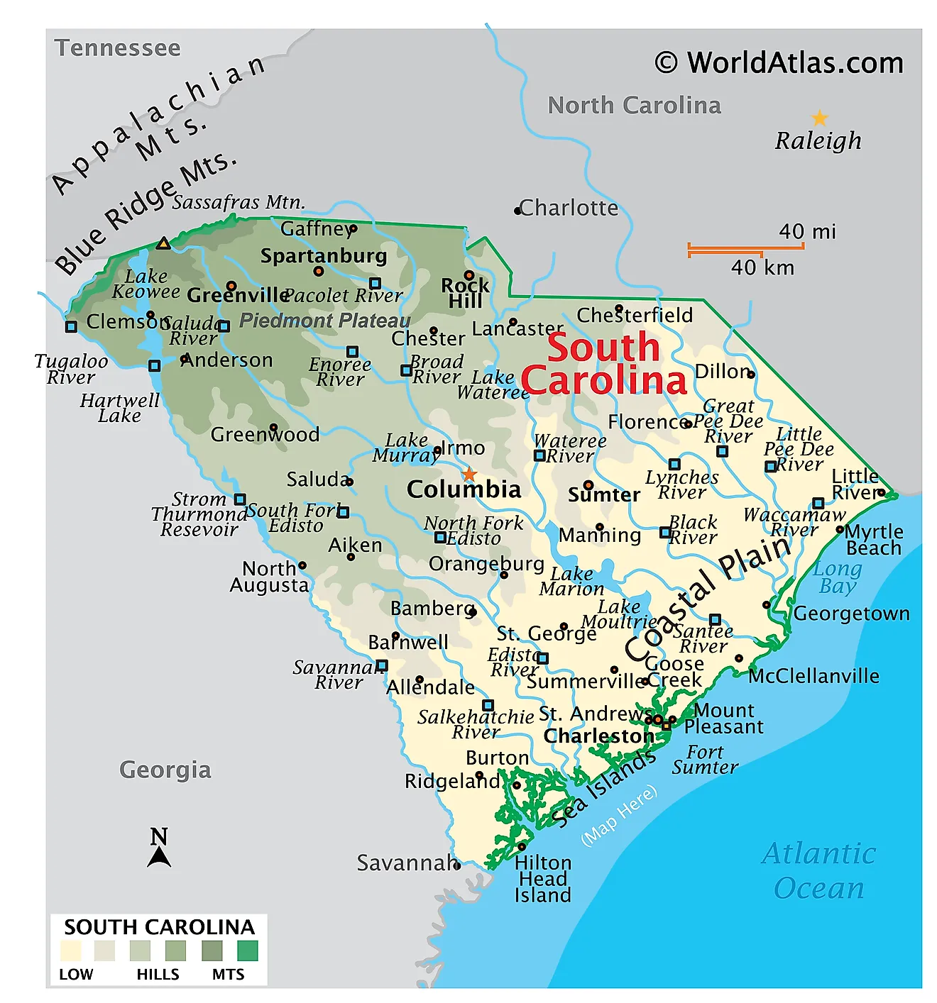
South Carolina, a state in the southeastern United States, shares its borders with North Carolina to the north, Georgia to the west and south, and the Atlantic Ocean to the east. The total area of South Carolina encompasses approximately 32,020 mi2 (82,932 km2).
South Carolina, from northwest to southeast, is divisible into four primary geographic regions:
Blue Ridge Mountain Region: This region, part of the larger Appalachian Mountains, occupies the northwestern corner of South Carolina. It is characterized by its rugged terrain, with numerous valleys and peaks. The highest point in South Carolina, Sassafras Mountain, which stands at 3,554 feet (1,083 meters), is located here. This area is marked by steep slopes and is the source of many streams and rivers that flow through the state.
Piedmont: South of the Blue Ridge Mountain Region lies the Piedmont, a plateau region that covers about a third of South Carolina. This area is characterized by its rolling hills and is significantly more urbanized compared to the Blue Ridge Mountain Region. The Piedmont is delineated from the coastal regions by the fall line, a geological boundary where rivers form waterfalls and rapids as they descend to the lower-lying coastal plains.
Upper Coastal Plain: Extending from Barnwell through Columbia to Marlboro, the Upper Coastal Plain is a region of transition between the hilly Piedmont and the flat Lower Coastal Plain. This area is primarily characterized by its gently sloping terrain. It is here that the Sandhills, remnants of ancient coastal dunes, are found, and the soil is sandy with xeric vegetation and pine trees dominating.
Lower Coastal Plain: The Lower Coastal Plain, stretching towards the Atlantic Ocean, is notably flatter than its upper counterpart. This region includes the extensive wetlands and marshes near the coast, particularly in areas like the ACE Basin, where the Ashepoo, Combahee, and Edisto Rivers converge. The region's elevation gradually decreases as it approaches the ocean, leading to the lowest point of the state at sea level along the coastline.
Islands and Major Bodies of Water: Significant rivers such as the Savannah, Saluda, and Pee Dee flow across the state, playing a crucial role in shaping the landscape. The state also features several large lakes, including Lake Marion and Lake Strom Thurmond. Along the Atlantic coast, barrier islands form a protective chain, creating a dynamic coastal environment. Several of these islands, like Hilton Head and Kiawah, are made up of salt marshes, tidal creeks, beachfront dunes, and dense woodlands.
Counties Map
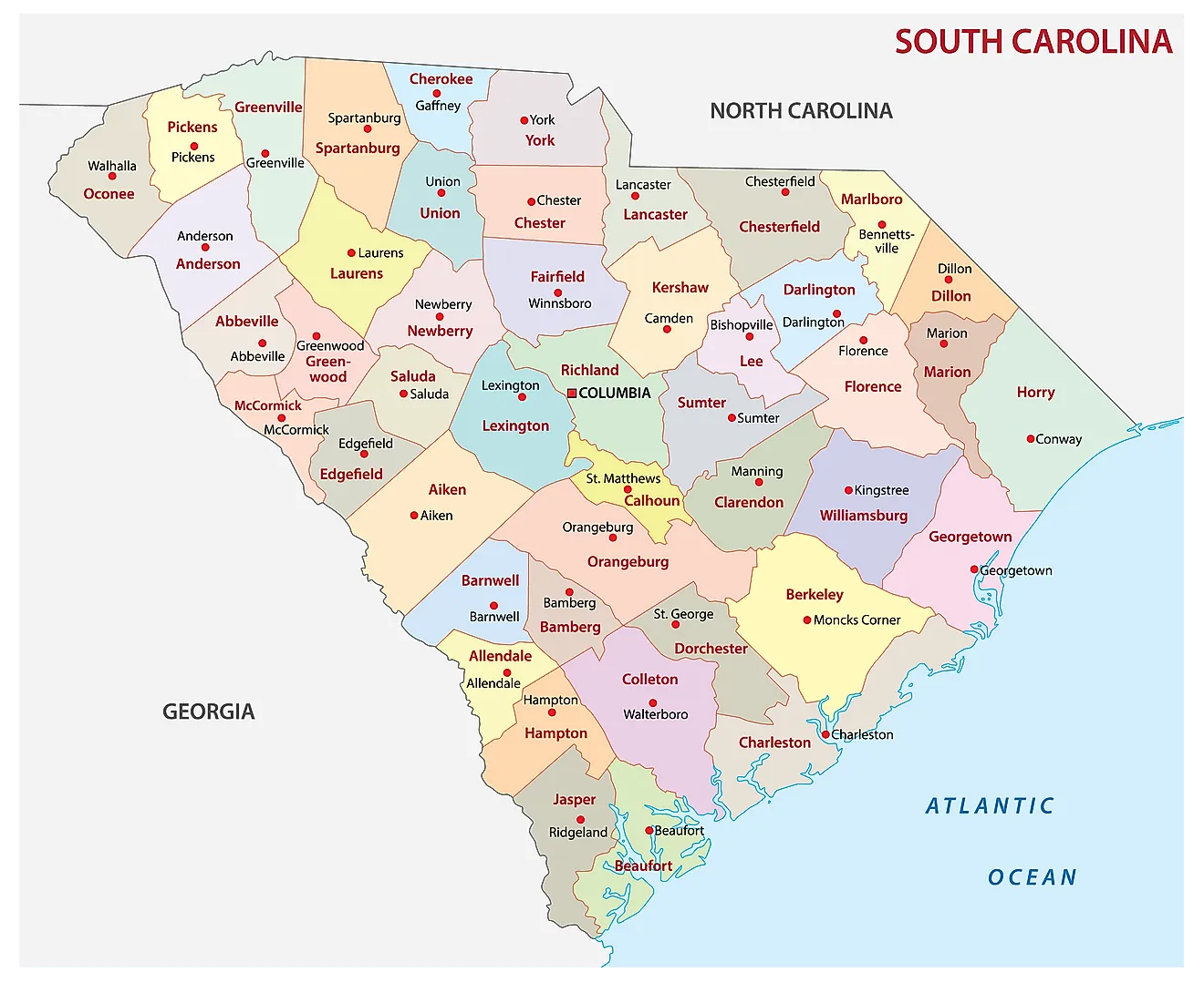
The State of South Carolina is divided into 46 counties. In alphabetical order, these counties are: Abbeville, Aiken, Allendale, Anderson, Bamberg, Barnwell, Beaufort, Berkeley, Calhoun, Charleston, Cherokee, Chester, Chesterfield, Clarendon, Colleton, Darlington, Dillon, Dorchester, Edgefield, Fairfield, Florence, Georgetown, Greenville, Greenwood, Hampton, Horry, Jasper, Kershaw, Lancaster, Laurens, Lee, Lexington, Marion, Marlboro, McCormick, Newberry, Oconee, Orangeburg, Pickens, Richland, Saluda, Spartanburg, Sumter, Union, Williamsburg, York.
With an area of 89,932 sq. km, the State of South Carolina is the 40th largest and the 23rd most populous state in the USA. Located in the state’s center at the confluence of three rivers (where the Saluda River and the Broad River merge to form the Congaree River) is Columbia – the capital and the 2nd largest city of South Carolina. It serves as the administrative, education, and commercial center of the state. It also hosts Fort Jackson – the largest US Army installation for Basic Combat Training. Situated in the southeastern part of the state on the Charleston Harbor is Charleston – the largest city in South Carolina. The city of Charleston serves as the chief port and cultural hub of the state.
Where is South Carolina?
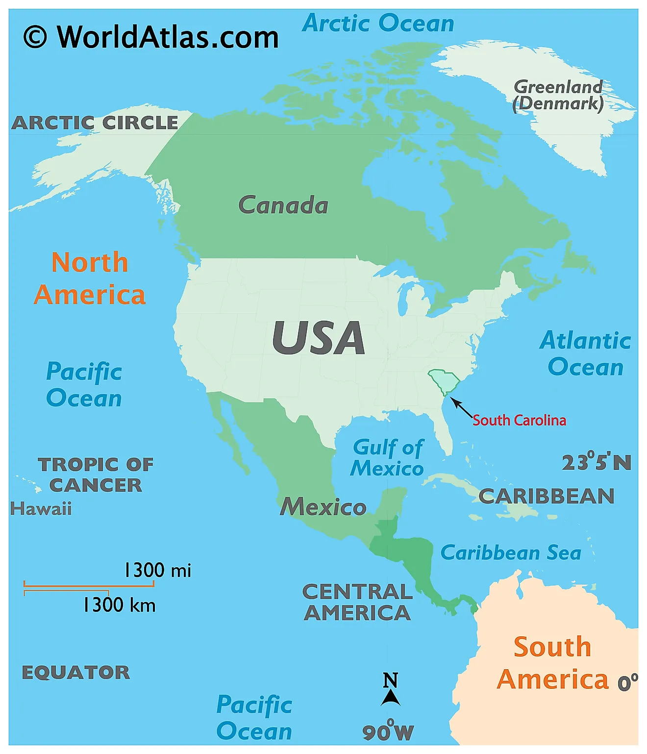
The State of South Carolina is located in the south-eastern region of the United States. South Carolina is bordered by the states of North Carolina in the north; and by Georgia in the southwest. It is bounded by the Atlantic Ocean in the southeast.
Regional Maps: Map of North America
Outline Map of South Carolina
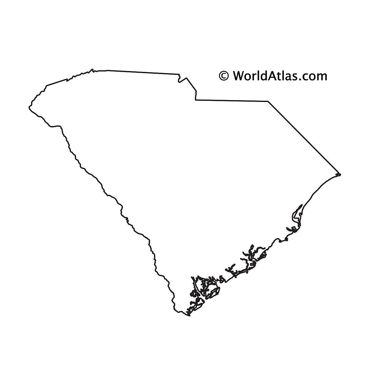
The above blank map represents the State of South Carolina, located in the south-eastern region of the United States. The above map can be downloaded, printed and used for geography education purposes like map-pointing and coloring activities.
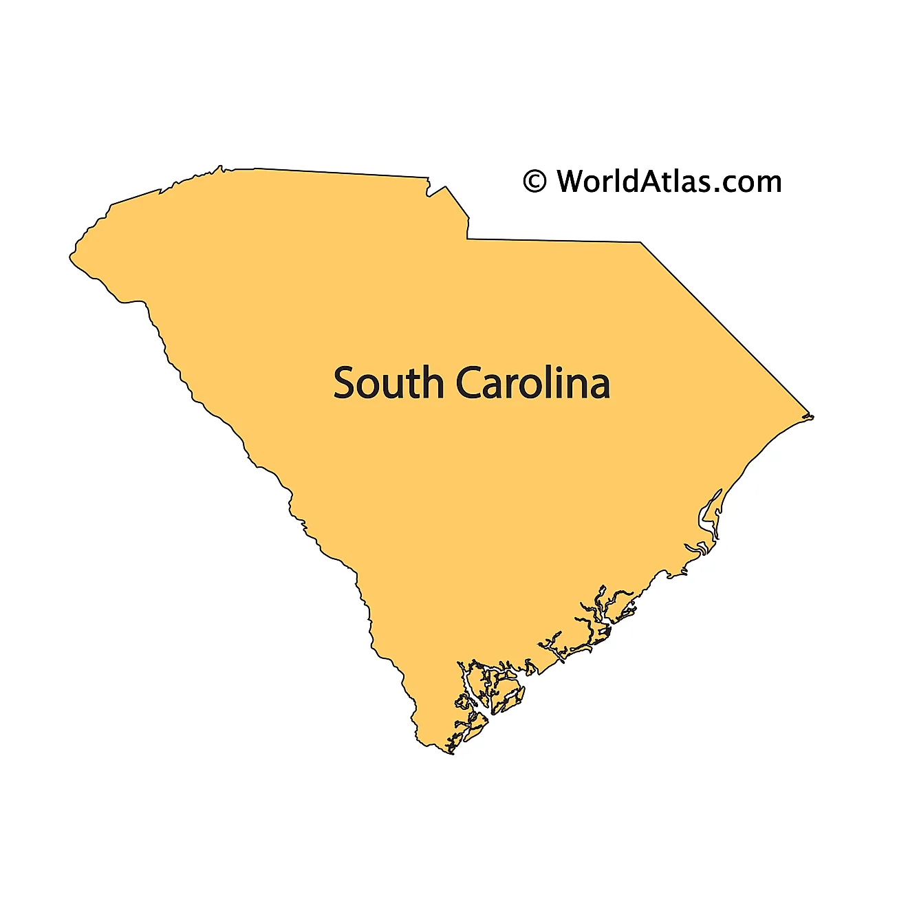
The above outline map represents the State of South Carolina, located in the south-eastern region of the United States. The state's shape resembles an inverted triangle.
Key Facts
| Legal Name | State of South Carolina |
|---|---|
| ISO 3166 Code | US-SC |
| Capital City | Columbia |
| Major Cities |
|
This page was last updated on January 18, 2024


