The Fastest Tidal Current In American Waters
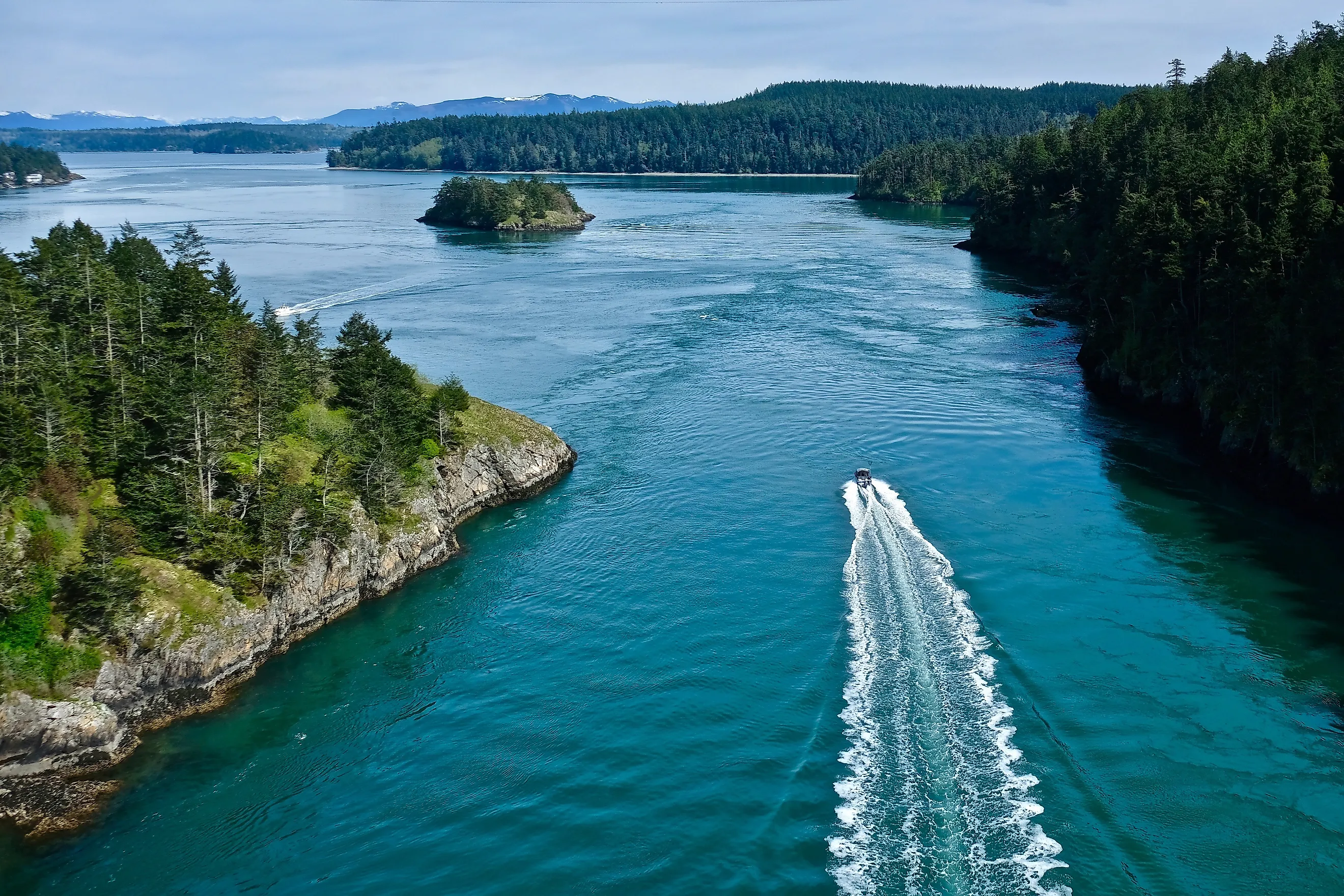
Beneath Washington's Deception Pass Bridge, saltwater races between Whidbey and Fidalgo Islands at speeds of eight to nine knots, or about 9.2 to 10.4 miles per hour. This narrow passage ranks among the fastest tidal waterways in the United States, with strong shoreline eddies that make the changing tide visible from above. The coves, cliffs, and fast-moving water make it one of the most-visited state parks in Washington State. Alaska's Sergius Narrows also reaches eight to nine knots at times, although its tides aren't consistently faster. Deception Pass is an exceptional place to see the forces behind the ocean in action.
Deception Pass's Claim to the Title

Deception Pass is a passage with exceptional tidal currents. NOAA lists 50 North American locations with fast tidal currents, and Deception Pass is the top-ranking location among the American entries. It has an average flood speed of 5.2 knots and an average ebb speed of 6.6 knots. At times, currents in the Deception Pass narrows reach highs of eight to nine knots.
Sergius Narrows in southeastern Alaska also reaches maximum velocities of eight to nine knots, although its average speeds are slightly lower when added together, at 6.3 knots on the flood and 4.9 knots on the ebb. Deception Pass edges Sergius Narrows out because it has better documentation and surveying, not to mention more visitors.
A Narrow Gateway Between Islands

Deception Pass separates the northern end of Whidbey Island from Fidalgo Island in northwestern Washington. NOAA describes it as a two-mile passage connecting northern Skagit Bay with southern Rosario Strait. Within the wider Salish Sea, this channel creates a relatively small opening between much larger bodies of water. The strongest flow develops in its narrows, where NOAA warns of powerful eddies along the shores.
The bridges over Deception Pass and Canoe Pass connect via Pass Island. Together, they form the best-known landmark in Deception Pass State Park. Since there are several islands and bridges, the park encompasses more than the central channel. Forest trails, rocky headlands, and sheltered shorelines are all different parts of the same coastal system.
Why the Current Moves so Quickly

A tide is the vertical rise and fall of seawater, and a tidal current is its horizontal movement. As water enters bays and other coastal waterways, the incoming flow is called the flood current. Water moving outward to the ocean is the ebb current. Between the flood and ebb phases, slack water marks a period of little or no horizontal movement. At Deception Pass, the relationship between water levels on opposite sides of the channel adds another layer to this cycle.
NOAA identifies Deception Pass as an example of a hydraulic tidal current. That means that differences in tidal height at its two ends drive water through the passage. The strongest flow occurs when that difference is greatest; slack water occurs when the levels are about equal. The channel's narrow dimensions concentrate the flow and make speeds more extreme.
Varying Water Speeds

Deception Pass does not maintain its maximum speed throughout the day. Instead, the current strengthens, weakens, and changes direction as the tidal cycle progresses. NOAA's Coast Pilot notes that velocities can exceed eight knots at times, but it doesn't maintain a constant eight-knot flow. The tidal height and current depend on local conditions.
The Washington Water Trails Association also warns of eddies, boils, and whirlpools in Deception Pass and neighboring Canoe Pass. These movements make the surface far more dangerous than a simple stream running between two shores. Thankfully, NOAA and other websites or marine tracking apps regularly publish current predictions.
Alaska's Powerful Tidal Passages

Southeastern Alaska's Sergius Narrows constricts the Peril Strait along a maritime route near Sitka. It's a difficult passage known for its narrowness and strong currents. Maximum velocities reach eight to nine knots, producing standing waves. Elsewhere in Peril Strait, there are much lower current velocities of approximately 1.4 to 2.5 knots, which illustrates just how much a localized bottleneck can intensify moving water.
Other Alaskan stations also appear prominently in NOAA's North American list, though none as high as Deception Pass. Turn Point in Kootznahoo Inlet has listed speeds of 6.9 knots on the flood and 6.1 on the ebb. Unalga Pass in the Aleutian Islands appears at 6.3 and 5.3 knots. Together, they establish Alaska as an essential addition to fast tidal current rankings.
The History of Deception Pass

Long before European chart makers named the passage, Coast Salish peoples lived throughout these shores and waterways. Washington State Parks identifies the area as traditional territory connected to several present-day tribal nations, including the Samish Indian Nation and Swinomish Indian Tribal Community. Salmon shaped food traditions, fishing practices, and cultural relationships with the water. That history remains visible at Rosario Beach through the Maiden of Deception Pass story pole, which depicts Ko-kwal-alwoot, a central figure in a Samish story.
The English name dates to George Vancouver's 1792 surveying expedition. Lieutenant Joseph Whidbey's work mapped out the geography of the island and its northern passage, correcting an earlier impression that the opening was an inlet. Vancouver recorded the narrow channel's rocks and rapid, irregular tidal movement before naming it "Deception Passage." More than a century later, the bridge transformed travel between the islands. Dedicated on July 31, 1935, it replaced the ferry connection with a permanent roadway across the turbulent channel.
Deception Pass State Park

The bridge crossing at Deception Pass State Park gives a broad overhead view of the waterway and the surrounding cliffs and churning water. From land, the channel's confined shape and moving surface are easier to appreciate without entering the current itself. Elsewhere in the park, Goose Rock adds an elevated view of the surrounding landscape, with access through the trail system.
Rosario Head tells a geological story about the area's history. Pillow basalt, chert, and shale record its origins as an ancient ocean floor, while rock that was polished and grooved by glaciers at Goose Rock reflects the later passage of ice. At Bowman Bay, a Civilian Conservation Corps bathhouse built in 1936 now houses a museum about the organization's history in Washington's parks. These landmarks connect the tidal spectacle to the rocks that frame it and the people who built access to its shores.
Deception Pass is not a casual paddling route. The Washington Water Trails Association warns that Deception Pass and Canoe Pass require expert skills and can be dangerous to all craft, and whitewater kayaking around the bridges should only be attempted by seasoned paddlers. The height of the tide alone should never be treated as evidence that a passage is safe. Strong currents, changing surface conditions, and shoreline eddies make watching from land a more suitable choice. For example, Rosario Beach features a designated tide-pool route. Sheltered habitats beside the tidal waterway show how much coastal life depends on the racing central channel.