San Juan Islands
The San Juan Islands are an archipelago situated in the Pacific Northwest between the US State of Washington and Canada’s Vancouver Island. The islands form a part of San Juan County in the extreme northwestern corner of the US State of Washington. The islands serve as a popular tourist destination offering many recreational activities such as orca whale-watching and sea kayaking.
Geography Of The San Juan Islands

The San Juan Islands form a part of a submerged mountain chain in the upper Puget Sound and are located to the north of the Strait of Juan de Fuca, to the west of the Rosario Strait, east of the Haro Strait, and south of the Boundary Pass. The islands are bounded on the north by the Strait of Georgia. All the water bodies surrounding the islands are collectively recognized as the Salish Sea.

Politically, the San Juan Islands form the core of San Juan County, which covers a total area of 1,610 sq. km, of which 1,160 sq. km is occupied by water, and 450 sq. km is occupied by land. The county features several mountains and over 769km of rugged, rocky shoreline. At mean high tide, the San Juan County is a collection of more than 400 islands and rocks, of which 134 islands and rocks are named. The four largest islands in the San Juan Island chain are Orcas Island, San Juan Island, Lopez Island, and Shaw Island. These four significant islands are linked via the Washington State Ferries system. With an area of 148.4 sq. km, the Orcas Island is the largest of the San Juan Islands. The neighboring San Juan Island, which covers an area of 142.59 sq. km, is the second-largest and the most populous of the San Juan Islands. Located on San Juan Island, the town of Friday Harbor serves as the chief commercial center of the entire archipelago.

Most of the San Juan Islands are hilly and contain some valleys and flat areas in between. The coastline of the islands features a mix of rocky and sandy beaches, many coves, reef-studded bays, deep harbors, and shallow inlets. A significant part of the shoreline is covered by ochre-colored madrona trees, while the inland areas are covered by evergreen fir and pine forests. Located on Orcas Island, Mount Constitution, which rises to an elevation of 734m, is the highest point in the San Juan Islands.
Climate
The San Juan Islands experience a sub-oceanic climate with mild, sunny summers and rainy winters. The islands are located in the rainshadow area produced by the Olympic Mountains to the southwest and therefore receive an average rainfall of 29 inches per year. The average temperature ranges from 21°C during summer to around 5°C in winter. The San Juan Islands has an average of 226 frost-free days, while the low-lying areas experience freezing during July. The islands face high winds, which usually blow from the west or northwest in winter and south or southeast during summer.
Ecology Of The San Juan Islands

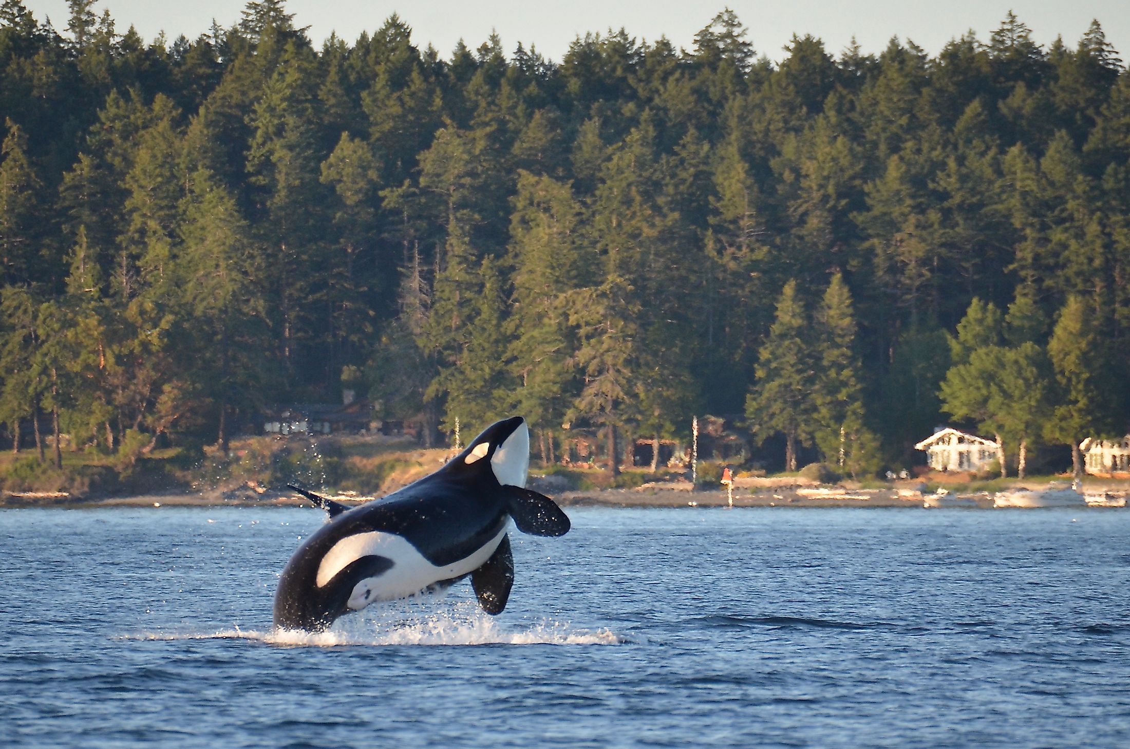
The San Juan Islands contain several floral and faunal species. Some of the notable plants found in these islands include Pacific madrone, bigleaf maple, red alder, coast Douglas fir, western redcedar, western hemlock, etc. Some of the significant faunal species found in the San Juan Islands include orcas, common minke whales, river otters, Steller sea lions, Dall’s porpoises, Columbia black-tailed deer, etc. Some of the notable avian species found in these islands include bald eagles, black oystercatchers, Great blue herons, Peregrine falcons, Canada geese, northern harriers, pigeon guillemots, marbled murrelets, etc. At present, the San Juan Islands serve as a popular tourist destination offering many recreational activities such as orca whale-watching and sea kayaking. Located on the western shore of the San Juan Island, the 0.169 sq. km Lime Kiln Point State Park is considered one of the world’s best places to watch wild orcas.
Brief History Of The San Juan Islands
It is believed that the San Juan Islands formed a part of the traditional area of various people belonging to the Coast Salish group. In 1791, the Spanish explorer Francisco de Eliza charted the islands and named them “Isla y Archiepelago de Sa Juan.” Several islands in the archipelago, including the San Juan Islands, Orcas Island, Guemes Island, were named by Eliza after the Viceroy of Mexico under whose authority the expedition took place. The Haro Strait was named after Gonzalo Lopez de Haro, who was one of the officers working under Eliza’s command. The Spanish naval officer Jose Maria Narvaez, who served as one of Eliza’s pilots, became the first European to explore the Strait of Georgia. In 1792, the area was explored by the British Vancouver Expedition under the leadership of Captain George Vancouver.
In 1841, the region was further explored by the United States Exploring Expedition under the supervision of the American naval officer Charles Wilkes. In 1843, Fort Camosun was established on Vancouver Island by the Hudson’s Bay Company. In 1852, the Island County was created by the Territory of Oregon to include the San Juan Islands. The Island Country became a part of the Washington Territory in 1853. On October 31, 1873, the San Juan Islands became a part of San Juan County. In due course, both the British and the United States laid claims over the San Juan Islands. The San Juan border dispute led to the Pig War between the US and the British in 1859. Emperor Wilhelm I of Germany finally resolved the border dispute in 1871, and in the next year, a border through the Haro Strait was established.


