The Counties Most At Risk Of Hurricanes
Hurricanes can hit almost anywhere along America's Atlantic and Gulf coasts, but the risk is nowhere near evenly distributed. FEMA's National Risk Index measures that unevenness directly. It weighs how often damaging hurricane conditions are expected against what people and property stand in their path, what has historically been lost, and how well a community can recover, then scores every county in the country. Very High is the top rating it assigns.
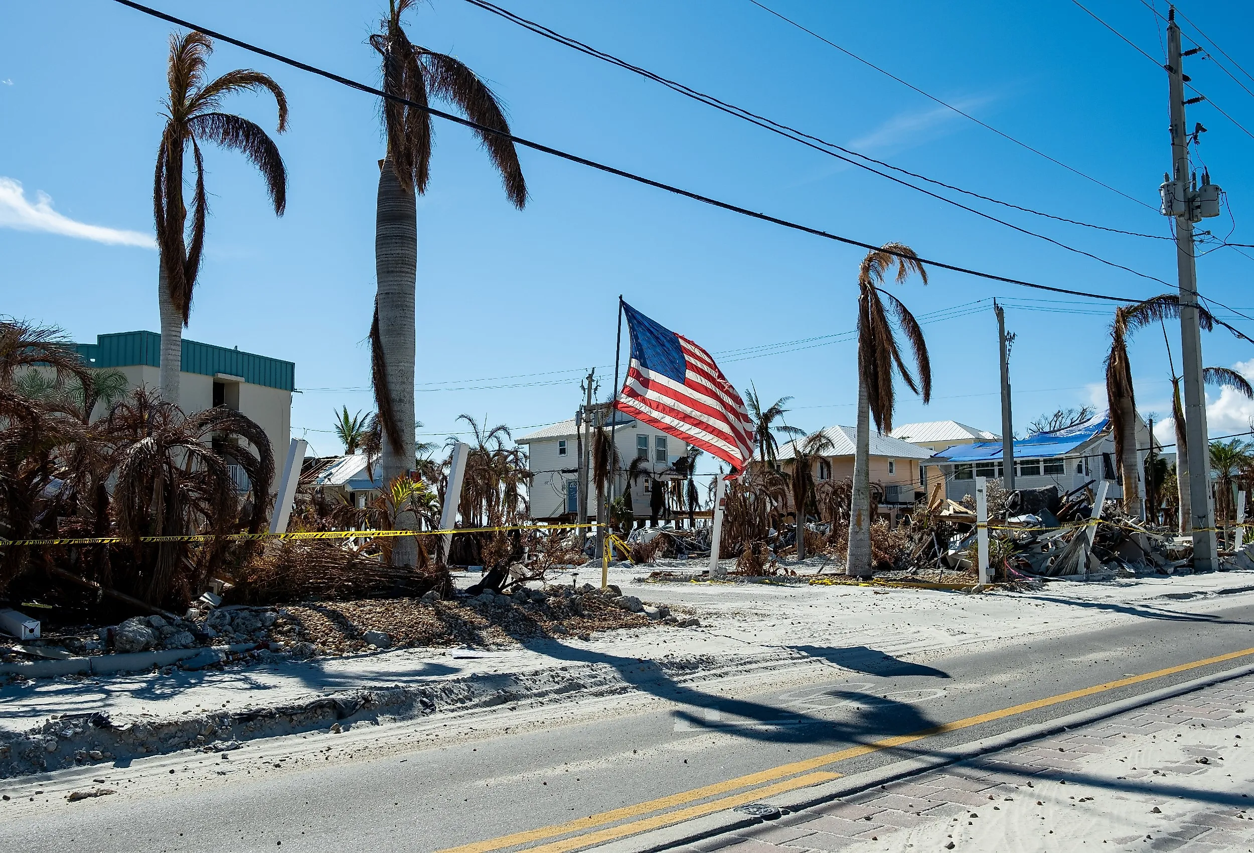
NOAA's storm history shows what those scores look like once they become weather. When Hurricane Ian came ashore in 2022, the water rose as high as 15 feet along parts of Florida's southwest coast, and more than 50,000 buildings were damaged in Lee County alone. Thirty years earlier, Hurricane Andrew destroyed more than 25,000 homes in what was then Dade County. Here are the US counties by state, along with Louisiana's parish equivalents, most at risk of hurricanes.
Florida
Florida has taken more direct hurricane hits than any other state, and its shape accounts for most of that. NOAA's records reaching back to 1851 credit the state with well over 100 hurricane strikes, roughly a third of them major, and about 40% of all US hurricanes have come ashore there. A peninsula with water on three sides can be approached from almost any direction, and Florida's 1,350 miles of general coastline unspool into more than 8,400 miles of tidal shoreline once every bay, sound, and inlet is counted. Seven Florida counties carry a Very High hurricane rating, more than any other state.
Miami-Dade County

Miami-Dade holds the highest hurricane risk score in the country, and Andrew demonstrated why in 1992, when 25,524 homes were destroyed, and another 101,241 were damaged. The disaster drove sweeping changes to South Florida's building codes. The county now maintains five storm-surge evacuation zones covering Miami Beach, Biscayne Bay, and Homestead.
Broward County

Broward County, immediately north, sits barely above sea level on porous limestone that lets water rise through the ground as readily as over it. Its evacuation plan is drawn as two lines rather than zones: everything east of the Intracoastal Waterway leaves for a Category 1 or 2 storm, everything east of U.S. 1 leaves for anything stronger. Wilma crossed the county as a Category 3 in 2005 and left parts of it without power for weeks. Broward and neighboring Miami-Dade together have more than 4.5 million residents, which turns their shared coastline into the country's largest concentration of hurricane exposure.
Palm Beach County

Palm Beach County carries the third-highest hurricane risk score in Florida, and the reason is inland. On September 16, 1928, a Category 4 hurricane came ashore near West Palm Beach with winds around 145 mph (233 km/h) and pushed Lake Okeechobee over the low mud levee at its southern rim. Water several feet deep swept Belle Glade, Pahokee, South Bay, and Chosen. At least 2,500 people drowned, most of them migrant farm workers, in the deadliest hurricane in Florida history. The 143-mile Herbert Hoover Dike was built around the lake in response, and the towns behind it still evacuate when a major storm approaches.
Charlotte County

Ian made its first Florida landfall at Cayo Costa in Charlotte County as a Category 4 hurricane in 2022, crossed Charlotte Harbor, then came ashore again just south of Punta Gorda. It ranks among the worst natural disasters in American history. More than 24,000 Charlotte County households were approved for federal individual assistance, receiving over $82 million in grants. The county's recovery plan blames low elevation, its long coastline, and the shallow offshore Gulf for how far surge travels inland here.
Lee County

Neighboring Lee County took the worse end of it, and its hurricane risk score of 99.9 trails only Miami-Dade within the state. Surge reached nearly 15 feet (4.6 m) near Fort Myers Beach, and more than 50,000 buildings were damaged countywide. Barrier islands including Sanibel and Captiva sit directly against the Gulf while Cape Coral extends behind an enormous network of canals. Before the storm arrived, the county had ordered evacuations across those islands and opened 15 general-population shelters.
Collier County
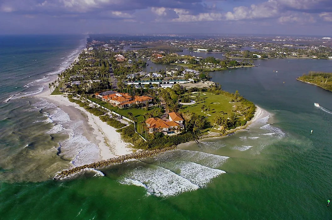
Collier County continues the same stretch of Gulf Coast south through Naples and Marco Island. The National Hurricane Center measured Ian's storm-surge inundation of roughly 7.1 feet at Naples Bay, 7.4 feet at Marco Island, and 7.3 feet at Everglades City, with a 112 mph (180 km/h) gust recorded at a Naples weather station.
Bay County

The Panhandle carries its own recent catastrophe. Hurricane Michael came ashore near Mexico Beach in Bay County in 2018 with 160 mph (257 km/h) winds, the strongest landfall on record in the Panhandle, driving roughly 14 feet of surge into normally dry ground. The county also contains Panama City and Tyndall Air Force Base, where a sensor measured a 139 mph (224 km/h) gust before it failed.
Louisiana
Louisiana replaces counties with 64 parishes, which the Census Bureau treats as county equivalents. Along the Gulf, risk concentrates where low ground meets open water, and there is less of that ground every year. USGS measured the state's coastal land loss at 2,006 square miles between 1932 and 2016, roughly a quarter of its wetlands and an area about the size of Delaware. Marsh that once absorbed a surge before it reached a town is now open water that delivers it there instead. The three parishes below all rate Very High.
Jefferson Parish

Jefferson Parish carries the state's highest hurricane risk score, and its problem is that most of it lies at or below sea level on ground that continues to sink. There is almost no gravity drainage, so water that falls has to be pumped out. The parish also splits into two very different situations: neighborhoods behind the federal levees, and the communities outside them at Barataria, Crown Point, Jean Lafitte, and Grand Isle, which face Gulf surge with far less between them and the water.
Ida tested that division in 2021. The West Closure Complex, a 225-foot navigable gate backed by eleven pumps at the mouth of the Gulf Intracoastal Waterway, held storm surge out of the protected west bank. Outside the system, temporary levees failed, and Jean Lafitte and Grand Isle were devastated.
Orleans Parish

Orleans Parish owes its risk to a dense concentration of people and infrastructure occupying a low bowl surrounded by water. Katrina demonstrated the consequences in 2005, when levee and floodwall failures flooded roughly 80% of New Orleans, still the costliest hurricane in American history. The protection system is far stronger today, but the geography that requires it has not changed.
Terrebonne Parish

There is less land standing between parts of Terrebonne Parish and the Gulf than there used to be. Louisiana's disappearing coastal wetlands have left Houma and the communities south of it increasingly exposed to water pushed inland by hurricanes. FEMA found that the loss of those barriers allows higher surges and larger waves to penetrate farther, raising some flood elevations about 2 feet above older estimates. And the storms have not let up. Ida devastated lower Terrebonne in 2021, followed three years later by Hurricane Francine, which made landfall in the parish with 100 mph (161 km/h) winds in September 2024.
Texas
Texas has hundreds of miles of Gulf coastline, but its most at-risk county has no beachfront at all. Several others rate Very High: Hidalgo County scores 99.5 inland in the Rio Grande Valley without touching the Gulf, coastal Cameron County around Brownsville sits just behind it, Nueces County takes in Corpus Christi and the Coastal Bend, and Jefferson County at the Louisiana line holds the US rainfall record for a tropical cyclone, where 60.58 inches fell near Nederland during Harvey. None of them comes close to Harris.
Harris County

Harris County sits at the very top of FEMA's national scale, with a hurricane risk score of 100 and an expected annual hurricane loss of roughly $458 million, the highest of any county in the United States. What it has instead of a shoreline is Houston, and a developed footprint that spreads across ground never built to absorb tropical rainfall.
The bayous and drainage systems crossing that footprint have to move water toward Galveston Bay, and FEMA's model counts exposed development and historical losses alongside storm frequency. Harvey showed how extreme the rainfall component can become. NOAA measured more than 40 inches of rain at several locations around Greater Houston in 2017, and 36 direct deaths in the county were attributed to the storm, the highest county total in Texas.
North Carolina
North Carolina reaches farther into the Atlantic than most of the East Coast, which places it in the path of storms tracking up the seaboard as well as those coming ashore directly. Its 301 miles of general coastline conceal more than 3,300 miles of tidal shoreline threaded through sounds, rivers, and inlets, so surge has routes far inland from the beach. The state's two highest-scoring counties sit at the southern end of that reach, on either side of the Cape Fear River, where the shoreline turns and meets the ocean nearly head-on.
New Hanover County

New Hanover has hurricane water coming at it from several directions: Wilmington along the Cape Fear River, Wrightsville Beach, and Carolina Beach facing the ocean directly. During Florence in 2018, the National Hurricane Center found 3 to 5 feet of surge inundation along the coast south of Wrightsville Beach, while rainfall exceeded 20 inches across much of southeastern North Carolina and topped 30 inches in a narrow band.
Brunswick County

Brunswick County occupies the state's southeastern corner, where beach communities, tidal waterways, and the lower Cape Fear all meet the Atlantic, and it scores within a fraction of New Hanover. FEMA has treated that exposure seriously enough to highlight the county's requirement that critical facilities be protected two feet above the 500-year flood elevation. Brunswick qualified for federal public assistance after both Hurricane Dorian in 2019 and Hurricane Isaias in 2020, adding two recent storms to a county already planning its infrastructure around unusually high flood standards.
South Carolina
South Carolina's hurricane risk concentrates along a coast cut by barrier islands, tidal rivers, marshes, and bays that give storm surge multiple routes inland. The state has fewer than 190 miles of general coastline but close to 3,000 miles of tidal shoreline, a ratio that shows how deeply salt water reaches into the land here. The Lowcountry behind that shoreline sits low and flat, drained by rivers that surge can climb rather than block. Hugo set the modern benchmark in 1989, and one county carries a Very High rating.
Charleston County

Charleston County has the Atlantic on one side and a web of tidal water on the other. Charleston Harbor, the Ashley and Cooper rivers, extensive marshes, and barrier islands place communities as far apart as Folly Beach and McClellanville within reach of hurricane-driven water, and NOAA notes that surge can travel up rivers and canals well beyond the shoreline. The Charleston tide gauge has recorded five of its eight highest water levels during tropical systems, led by Hurricane Hugo at 6.76 feet above mean higher high water in 1989. Storm tides reached 20 feet around nearby Cape Romain and Bulls Bay.
Mississippi
Mississippi has the shortest Gulf frontage of any coastal state, about 44 miles, and nearly all of the state's coastal population and infrastructure is packed into it. A chain of barrier islands lies several miles offshore, including Cat, Ship, Horn, and Petit Bois, and takes the first blow from an approaching storm. Those islands are not fixed defenses. Camille cut Ship Island in two in 1969, opening a breach that stayed open for decades. Behind them, the Mississippi Sound is shallow enough to stack surge against the mainland, and one county along that stretch rates Very High.
Harrison County

A beachfront highway runs through the heart of Harrison County, with Biloxi and Gulfport directly behind, leaving homes, casinos, hotels, ports, and other development exposed to water coming off the Mississippi Sound. Katrina produced 24 to 28 feet of storm surge across the western half of the county in 2005, including a maximum measured 27.8 feet at Pass Christian. Nothing about that geography has changed since.
Alabama
Alabama has roughly 53 miles of general Gulf coastline, but saltwater reaches much farther inland than that figure suggests. Mobile Bay opens about 30 miles north of the Gulf and feeds into the Mobile-Tensaw Delta, one of the largest river deltas in the country, and the state's tidal shoreline exceeds 600 miles once the bay and its tributaries are counted. That geometry means a storm does not have to strike the beach to flood places well removed from it. FEMA rates both of the counties sharing that coastline Very High.
Mobile County

Mobile County holds the higher score of the pair, largely because of the water it wraps around. Mobile Bay is wide and shallow, a shape that funnels surge inland rather than dissipating it, and Dauphin Island sits directly across its mouth. Hurricane Frederic came ashore there on September 12, 1979. USGS surveys afterward recorded winds near 145 mph (233 km/h) at Dauphin Island, tidal flooding across nearly all the surveyed mainland, the Dauphin Island Parkway Bridge almost entirely demolished, and Bayou La Batre extensively flooded. Storm-tide records for Mobile reach back to 1772.
Baldwin County

Baldwin County occupies the rest of that coastline, wrapping around the eastern side of the bay and reaching to the Florida line. Gulf beaches, Perdido Bay, rivers, and low-lying back bays expose different parts of it to both storm surge and freshwater flooding. Hurricane Sally made landfall at Gulf Shores in 2020 and then barely moved, dumping 15 to 30 inches of rain across the county. Ahead of the 2026 season, Baldwin finished a $2.7-million drainage project at Fort Morgan, installing roughly 5,500 feet of stormwater infrastructure and an outfall to Mobile Bay.
Georgia
Georgia has a much shorter coastline than Florida or the Carolinas, roughly 100 miles, but the water behaves differently here. The shoreline curves inland between North Carolina and Florida to form the South Atlantic Bight, and Georgia sits at the back of that funnel as the westernmost point on the Atlantic seaboard. Tides of 2 to 3 feet offshore build to between 6 and 9 feet along the Georgia shore. A surge arriving at high tide therefore starts from a much higher baseline, and Chatham County absorbs nearly all of the state's hurricane risk.
Chatham County

Savannah, Tybee Island, and the surrounding communities sit between the Atlantic, the Savannah River, and miles of tidal marsh. The county's 2025 hazard mitigation plan rates a tropical cyclone strike as likely and its potential impact as catastrophic, the only hazard it scores that severely. NOAA found Chatham took Georgia's worst storm-surge impacts, with a record surge measured at Fort Pulaski. The county established a dedicated resilience program in 2022 to address flooding and sea-level rise.
Exposure Is Not The Same As Risk
The next major hurricane will not affect every county in its path equally. A 15-foot surge means something different on a Florida barrier island than 30 inches of rain does around Houston, and FEMA's scoring reflects that. Because the index measures expected losses, an inland county with no beachfront can top the national scale while a stretch of open marsh with almost nothing left standing scores modestly. What drives the number is hurricane exposure colliding with factors such as dense development, ground at or below sea level, or a levee holding back water that used to have somewhere to go.