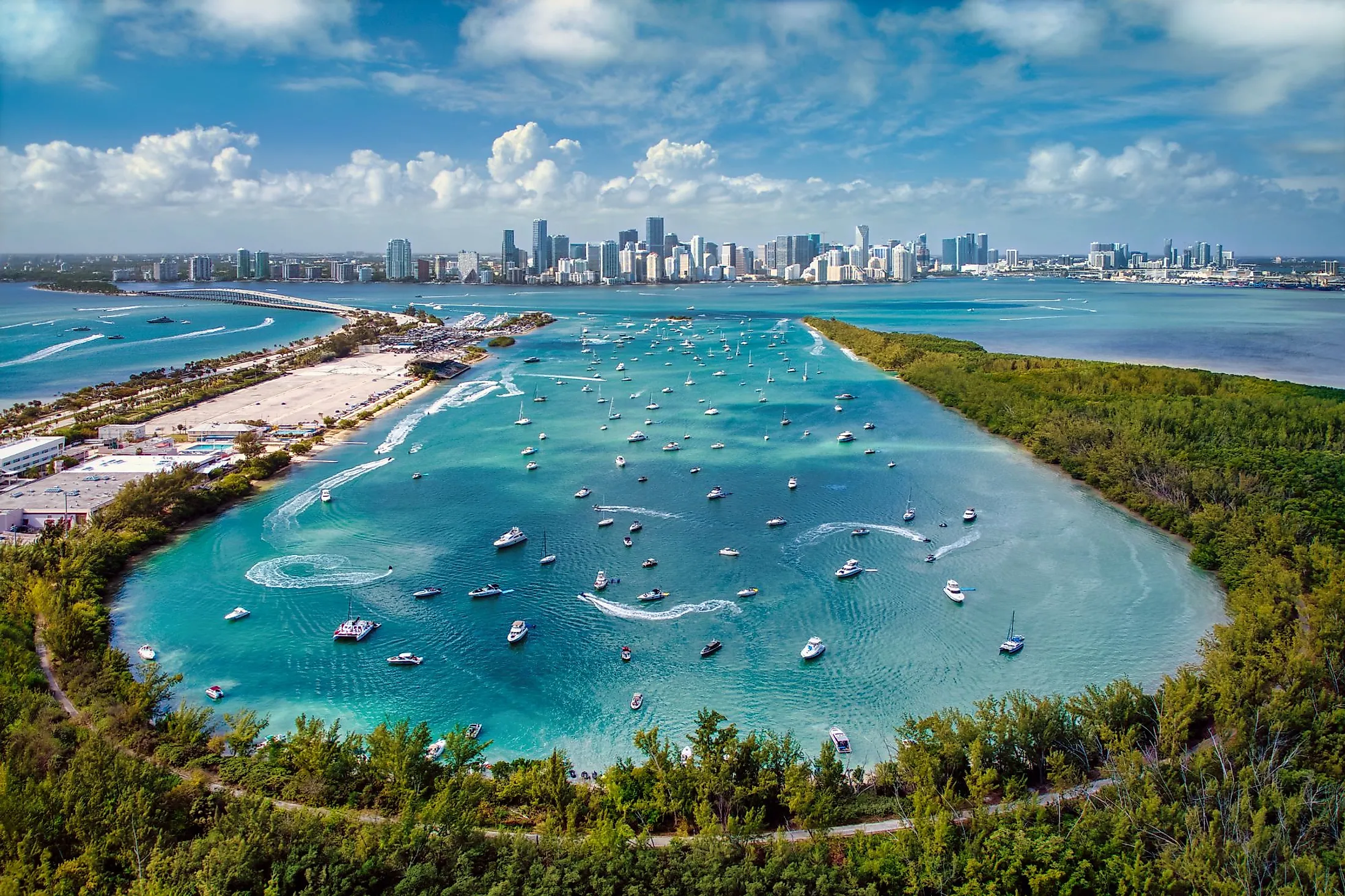
Biscayne Bay
Biscayne Bay is a lagoon having estuarine features situated on the Atlantic Coast of the US State of Florida. The heavily populated hub of the Miami metropolitan area surrounds the northern end of the lagoon, while the southern end is relatively undeveloped, with a substantial chunk of the lagoon included in Biscayne National Park.
Geography Of Biscayne Bay

The North Bay of Biscayne Bay is located between the barrier island of Miami Beach and the city of Miami on the mainland. Raw sewage spills, urban runoff, coastline bulkheading, dredging, artificial island construction, and the loss of natural freshwater flow into the bay have all had a significant impact on it during the past century. Water quality, on the other hand, has progressively improved since systematic monitoring began in 1979.

North Bay accounts for only 10% of the bay's water area. Central Bay is the bay's biggest section. The Safety Valve separates it from the Atlantic Ocean. Bulkheading, urban runoff dumped by canals, and the lack of natural freshwater flow have all had a negative impact on it. South Bay is nearly as vast as Central Bay and has been the least damaged by human activity, while it has also suffered from a loss of natural freshwater flow. The northernmost of the Florida Keys, Card Sound, and Barnes Sound, divide South Bay from the Straits of Florida. A couple of minor waterways link it to Florida Bay.
History Of Biscayne Bay

Biscayne Bay did not exist five thousand years ago when the sea level was around 20 feet lower than it is now. Between 5,000 and 2,400 years ago, the water level increased and filled a hole in the limestone, forming Biscayne Bay. Since then, sandy barrier islands, banks of carbonate sand and mud, and coastal wetland swamp and marsh deposits have developed and evolved to produce the bay's current structure. The comparatively slow rise in sea level over the last 2,400 years was especially concerning. Shallow sand and mud banks grew at the eastern edge of central Biscayne Bay and stretched well over northern, southcentral, and southern Biscayne Bay, dividing the bay into natural divisions. Biscayne Bay was a stunning natural, untouched shallow subtropical estuary with clear water and characterized by varied and productive bottom populations of seagrasses, hard bottom soft corals, and sponges. Mangrove marshes surrounded the bay's edge, with just a few spots where limestone reached the coast. The bay was formerly known for its freshwater springs, which ships would visit to acquire drinking water. The pure waters were kept clear by the sediment filtering and trapping activities of bottom plant and animal populations, as well as coastal wetlands. Biscayne Bay has evolved from a subtropical estuary to a pulsed system that alternates between marine conditions and extreme low salinity conditions close to canal discharge sites as a result of a century of hydrologic changes. Freshwater now enters the bay as a concentrated point source instead of as a diffused input throughout time and place.
Wildlife In Biscayne Bay

The bay was classified as a state aquatic preserve in 1975. The aquatic preserve encompasses Biscayne Bay from Oleta River in the north to Card Sound in the south, with the exclusion of Biscayne National Park in the center of the bay. A second preserve, the Cape Florida to Monroe County Line Preserve, was quickly created off of Cape Florida on Key Biscayne. The state of Florida currently manages these two preserves as the Biscayne Bay Aquatic Preserves. This National Park, founded in 1980, today includes the seven remaining dwellings of Biscayne Bay's Stiltsville community. In 1967, a large portion of Biscayne National Park was declared a National Monument. In terms of wildlife, the bay is home to bottlenose dolphins and Florida manatees.
Safety Valve

The Safety Valve is a network of shallow sand flats separated by tidal flow channels that stretches about 8 miles from Key Biscayne's south end to the Ragged Keys in the Florida Keys' north end. Ralph Munroe used the phrase "safety valve" to describe the tidal flats, arguing that building a causeway and bridges linking Key Biscayne to the Ragged Keys and beyond would obstruct the free passage of storm surges from the bay through the flats to the ocean. It is claimed that it helps to reduce the impact of storm surges on the bay. Longshore drift transport of sand along Florida's Atlantic Coast comes to a stop at the region of the Safety Valve. The Safety Valve structure has been steady for at least a century. Stiltsville is a group of piling-supported structures on multiple sand flats at the Safety Valve's northern end.
Biscayne National Park

Boating, snorkeling, camping, and wildlife viewing are popular activities at Biscayne National Park, which is located near downtown Miami. Biscayne National Park protects Biscayne Bay, one of the best scuba diving spots in the country. There is a vast mangrove forest along the coastline, a piece of the world's third-longest live coral reef, and the northernmost Florida Keys within the national park, which is over 90% water. The Biscayne National Park was mainly developed to preserve and tell the narrative of human history over 10,000 years. Almost every island in the park includes evidence of local peoples' use, and several shipwrecks lie beneath the water's surface. The park's Maritime Heritage Trail, which may be accessed by diving or snorkeling, provides an exciting chance to examine the remnants of six shipwrecks that span over a century and include a wide range of sizes and vessels types.


