The Largest Lakes In New England
New England's largest lakes reach across Vermont's border with Canada and deep into the forested interior of Maine. Surface area sets the order, counting each lake's entire extent even when it crosses a state or international boundary. Lake Champlain qualifies as the largest, although part of it extends into New York and Quebec. Moosehead Lake is the largest lake entirely within New England.
Natural lakes, dam-enlarged waters, and reservoirs all count, but connected basins with separate names are not included in the surface area of the main lake. Since water levels and reporting boundaries can differ, the lakes' dimensions are approximate.
Lake Champlain, Vermont

Lake Champlain occupies about 435 square miles (1,127 square kilometers), across Vermont, New York, and Quebec, making it the largest lake associated with New England and the 13th-largest in the United States. Its long, narrow basin forms much of the boundary between Vermont and New York before continuing into Quebec.
From its southern end, the lake extends northward for about 120 miles (193 kilometers), eventually draining into the Richelieu River. More than 70 islands interrupt its open water, and its deepest sections descend beyond 400 feet (122 meters). Champlain's watershed covers 8,234 square miles (21,326 square kilometers), gathering water from Vermont, New York, and Quebec. That shared drainage basin connects communities far from its actual shoreline.
Moosehead Lake, Maine

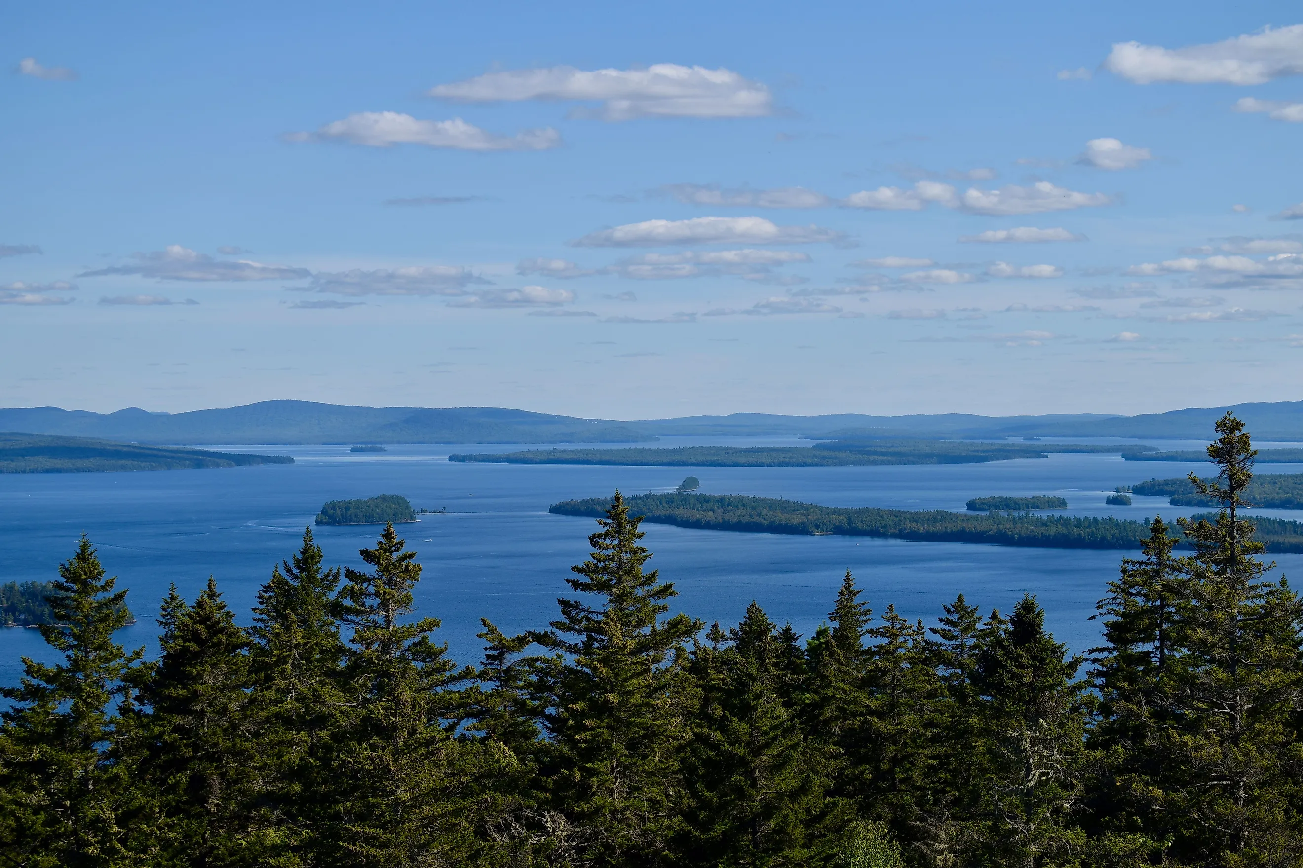
Moosehead Lake spreads across about 120 square miles (310 square kilometers) in Maine's forested interior. Unlike Lake Champlain, it is entirely within New England. Nearly 40 miles (64 kilometers) long, it is Maine's largest lake and a defining feature of the landscape around Greenville and Rockwood. State records give it a maximum depth of 246 feet (75 meters).
Mount Kineo, one of Maine's natural wonders, is the lake's most prominent landmark. Its sheer cliffs rise about 700 feet (213 meters) above the water, in sharp contrast with the surrounding wooded shoreline, and its summit reaches an elevation of 1,789 feet (545 meters). Lily Bay State Park is on Moosehead's eastern shore. Farm Island and Sugar Island are in the middle of the lake and are reachable by water alone.
Lake Winnipesaukee, New Hampshire

Lake Winnipesaukee is the largest lake in New Hampshire and the third-largest lake in New England. It stretches 69 square miles (179 square kilometers), although published totals vary. On the southwestern shore, Ellacoya State Park in Gilford has access to the lake.
Lake Winnipesaukee was formed around 13,000 years ago, carved by a glacier. It has a maximum depth of 180 feet (55 meters). It contains 260 islands. The smallest, called Becky's Garden, is 10 feet (3 meters) wide.
Sebago Lake, Maine

Sebago Lake covers 45 square miles (117 square kilometers), making it second among Maine's lakes by surface area. It is the state's deepest lake as well, at over 300 feet (91 meters) in some spots. Its basin is a living record of a long history. Ancient rivers helped shape the granite bedrock, and Ice Age glaciers scoured the depression the lake fills today.
Sebago Lake State Park occupies part of the northern shore in Casco and Naples and was opened in 1938 as one of Maine's five original state parks. Horseshoe Bog, a large wetland, is within Sebago Lake State Park.
Quabbin Reservoir, Massachusetts

Quabbin Reservoir is about 39 square miles (101 square kilometers) in central Massachusetts, making it the largest body of water in the state. Unlike the glacial lakes farther north, Quabbin was built. Workers blocked the Swift River with the Winsor Dam and the Goodnough Dike, and the valley began filling in 1939. By 1946, the reservoir had reached capacity. Its maximum depth is about 150 feet (46 meters).
The reservoir contains about 412 billion gallons of water and supplies drinking water to the Boston area. Like Flagstaff Lake, it covered entire communities. The towns of Dana, Enfield, Greenwich, and Prescott were disincorporated in 1938, and their populations moved away before the water rose over the valley floor.
Lake Memphremagog, Vermont

Lake Memphremagog covers about 37.5 square miles (97 square kilometers), but part of its surface lies in Vermont, and the rest extends into Quebec. Vermont and Quebec share an interest in protecting its water despite boundaries because it supplies drinking water to about 175,000 Canadians. Excess nutrients and cyanobacteria blooms have affected the lake in recent years, so both territories have had to work together to preserve it.
Its southern end is anchored by Newport, and around South Bay, the landscape reflects the work of local rivers. The Black, Barton, and Clyde rivers drain toward the lake, and sediments deposited by earlier stages of the Clyde River lie beneath parts of the city. Water ultimately flows north through Quebec's Magog River system toward the St. Lawrence River.
Chesuncook Lake, Maine

Chesuncook Lake belongs to a broad, connected impoundment in Maine's North Woods. On its own, Chesuncook is 36 square miles (93 square kilometers) with a depth of 150 feet (46 meters). When including Ripogenus Lake, Caribou Lake, and Moose Pond, the state survey gives the whole system an area of 26,200 acres, or about 41 square miles (106 square kilometers).
Ripogenus Dam transformed this area's landscape in 1916, joining formerly separate waters into one enlarged lake system. Its position on the West Branch of the Penobscot River links Chesuncook to one of Maine's best-known inland waterways. Chesuncook has scenic views of Mount Katahdin and access to Gero Island, an island largely protected as a state ecological reserve.
Flagstaff Lake, Maine

Flagstaff Lake occupies 20,300 acres, equivalent to about 32 square miles (82 square kilometers), in western Maine. Despite its broad surface, it is fairly shallow, with an average depth of 18 feet (5.5 meters) and a maximum of 50 feet (15 meters). Its present form was the result of the Long Falls Dam blocking the Dead River in 1949 to 1950.
Beneath the water lies a displaced community's history, since rising water covered the villages of Flagstaff and Dead River during the reservoir's creation. Place names such as Round Barn Campsites and Safford Brook Trail preserve connections to the farms, families, and buildings that once occupied the valley. Bigelow Preserve borders the lake's southern side and protects more than 36,000 acres (14,569 hectares), including seven mountain summits that are connected to the Appalachian Trail.
New England's Lakes
New England's largest lakes have widely different settings, including Lake Champlain's interstate and international shores, Moosehead's forested islands, and Flagstaff's mountain backdrop. Their surface areas and depths vary as well. Sebago has a deep basin, in contrast with the fairly shallow Flagstaff. These large lakes provide enough water to support local wildlife and communities, whose connections to the water extend beyond the shoreline. They help preserve the geography and history that make New England's landscapes distinctive.