Maps of New Hampshire
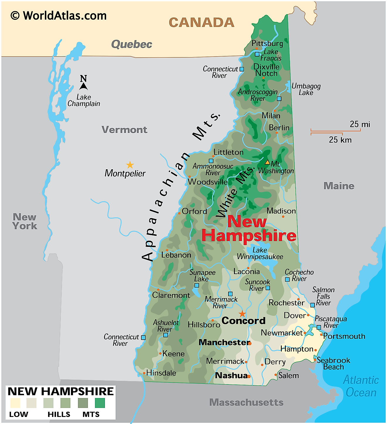
New Hampshire, also known as the “Granite State”, is a small state located in the northeastern United States. It shares its northern border with the Canadian province of Quebec, its eastern border with Maine, its southern border with Massachusets, and its western border with Vermont. It also has a short, 18-mile (29-kilometer) coastline along the Atlantic Ocean.
New Hampshire’s capital is Concord, located in the southern part of the state. The most populous city, however, is Manchester, located in the southeast, with a population of a little over 115,000 residents.
New Hampshire was first settled by the English in 1623, before being given its name in 1629. Although it was one of the original thirteen colonies, it officially became a state on June 21st, 1788, making it the ninth state to join the Union.
Area
The triangular-shaped state of New Hampshire has a total land area of 9,349 miles squared (24,214 kilometers squared), making it about four times smaller than South Korea. Compared to US states, it is roughly the same size as Vermont and seven times smaller than Florida.
Bodies of Water
New Hampshire boasts over 800 ponds and lakes and roughly 19,000 miles of streams and rivers. Some of the major rivers in the state include the Connecticut River, which flows from the northern part of New Hampshire down to the south; the Androscoggin River, which originates in Maine and traverses the northeastern part of the state; the Saco River, which also flows from Maine into New Hampshire; and the Merrimack River, which begins in central New Hampshire and flows into the Atlantic.
Geographical Regions
Generally speaking, New Hampshire has seven different geographical regions that characterize its landscape: The Great North Woods, Monadnock, Seacoast, Merrimack Valley, Lakes Region, Dartmouth-Lake Sunapee, and the White Mountains.
Great North Woods
The Great North Woods region is situated in the northernmost tip of New Hampshire and is characterized by expansive lakes, rivers, and tall forests. It attracts hikers and outdoor adventurers due to its abundance of places to hike, camp, hunt, fish, ski, and mountain bike.
Monadnock
The Monadnock region is located in the southwestern portion of New Hampshire and is spanned by rolling farmland and small towns. One of the most prominent features of this region is Mount Monadnock, which reaches an altitude of 3,165 feet. The Monadnock region is also home to seven state parks, two of the most notable being Gorge State Park and Pisgah State Park.
Seacoast
The Seacoast region is located in the southeastern part of the state, situated along New Hampshire’s 18 miles of coastline. The shoreline alternates between sandy shores and rockier, rougher areas. Hampton Beach and Portsmouth are two of the most prominent coastal towns in this area.
Merrimack Valley
The Merrimack Valley region, in southern New Hampshire, is rich in biodiversity and varying landscapes. It includes salt marshes closer to the coast and fields, forests, and farms further inland. New Hampshire’s most populous town, Manchester, is located within this region.
Lakes Region
The Lakes Region is situated in central New Hampshire and is home to several of the state’s most significant lakes. Some of the most recognizable lakes include Lake Winnipesaukee, Lake Waukewan, Squam Lake, Lake Winnisquam, and Newfound Lake, while Gilford and Wolfeboro are two of the region’s notable towns.
Dartmouth-Lake Sunapee
The Dartmouth-Lake Sunapee Region, in western New Hampshire, is named after two of the state’s most well-known attractions: Dartmouth College and Lake and Mount Sunapee. The Upper Valleys span this region and agricultural areas and tourist towns compose the majority of the land area. Lake Sunapee, New Hampshire’s third largest lake, occupies the remainder.
White Mountains
The White Mountains are in north central New Hampshire and are composed of dense forests filled with conifer trees and towering granite cliffs. Within this region, there are 733 named peaks, with the highest being Mount Washington at 6,288 feet (1,917 meters).
Counties Map
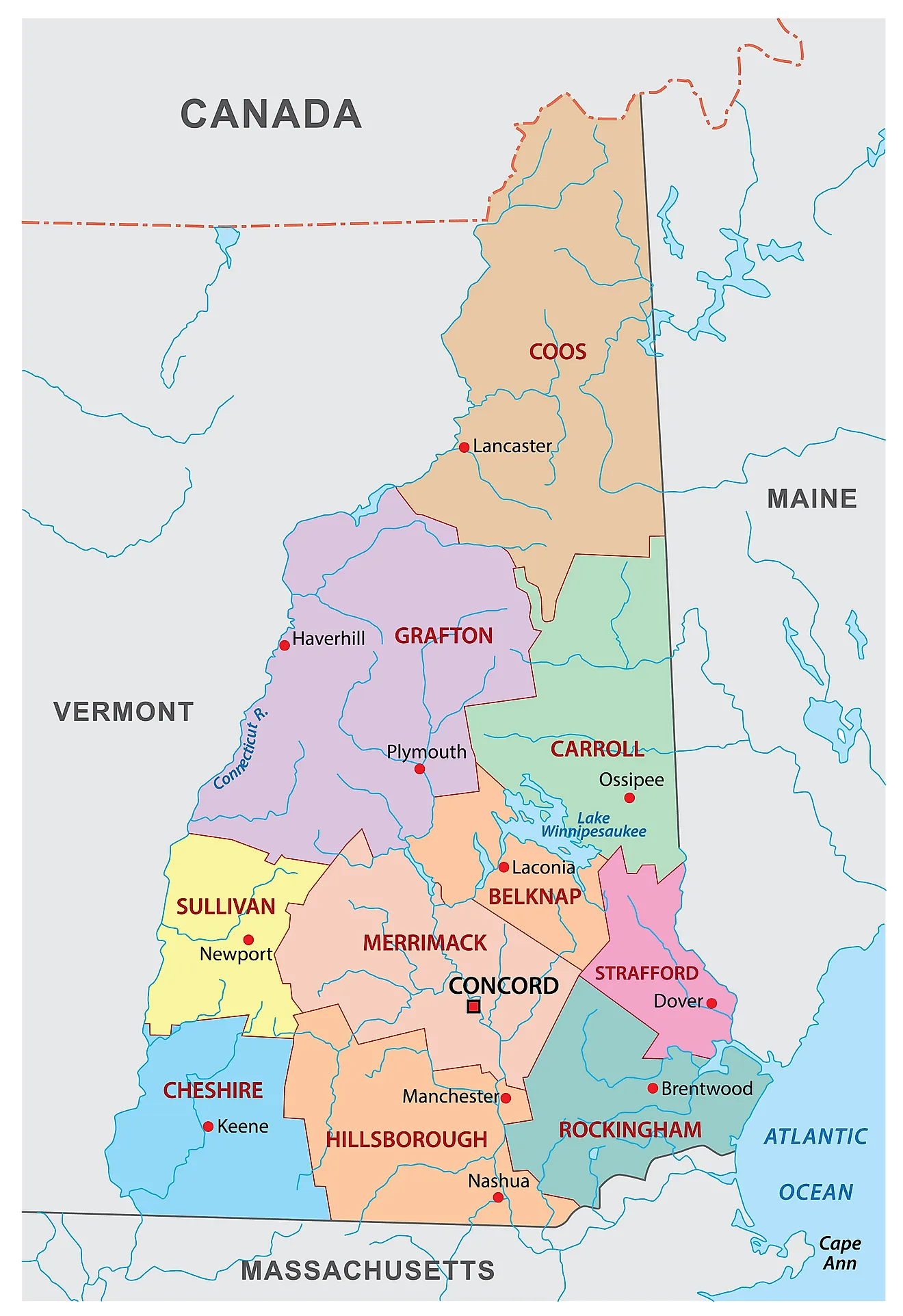
New Hampshire is divided into 10 counties. In alphabetical order, the counties are: Belknap, Carroll, Cheshire, Coos, Grafton, Hillsborough, Merrimack, Rockingham, Strafford, Sullivan.
With an area of 24,214 sq. km, New Hampshire is the 5th smallest and the 10th least populous state in the USA. Located in the south-central part of the state along the Merrimack River is Concord – the capital and the 3rd largest city of New Hampshire. It serves as a major distribution, industrial, and transportation hub. It also functions as the center for education, healthcare, and many insurance companies. Located along the banks of the Merrimack River is Manchester – the largest and the most populated city in New Hampshire. It is also northern New England’s biggest city and is considered to be one of the most affordable and liveable cities in the United States.
Where is New Hampshire?
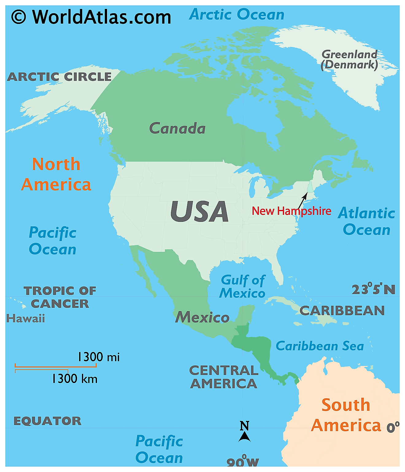
The State of New Hampshire is located in the north-eastern (New England) region of the United States. New Hampshire is bordered by the states of Vermont in the west, by Massachusetts in the south; by Maine and the Atlantic Ocean in the east. It is also bordered by the Canadian province of Quebec in the north.
Regional Maps: Map of North America
Outline Map of New Hampshire
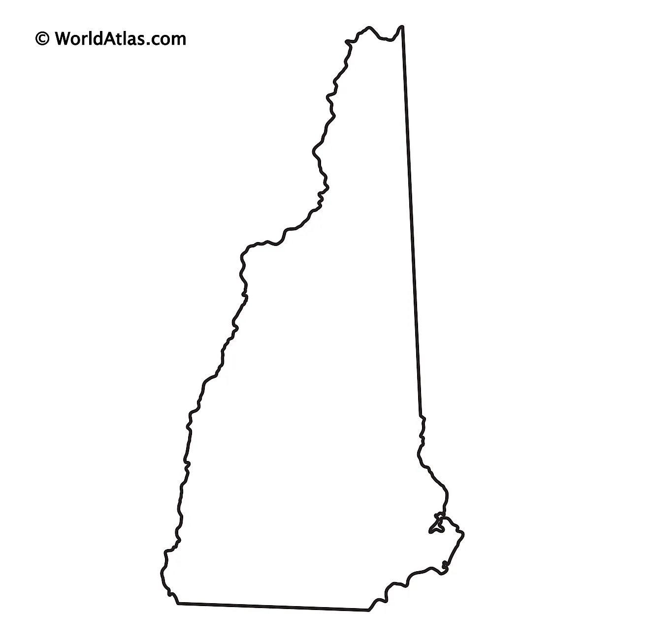
The above blank map represents the State of New Hampshire, located in the north-eastern (New England) region of the United States. The above map can be downloaded, printed and used for geography education purposes like map-pointing and coloring activities.
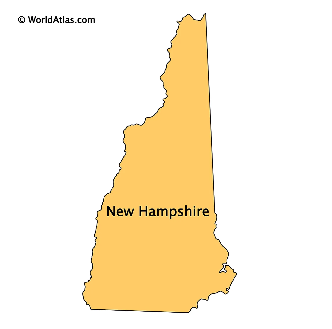
The above outline map represents the State of New Hampshire, located in the north-eastern (New England) region of the United States. The state is colloquially known as the “Granite State” – for its extensive quarries and granite formations.
Key Facts
| Legal Name | State of New Hampshire |
|---|---|
| ISO 3166 Code | US-NH |
| Capital City | Concord |
This page was last updated on July 19, 2024
