The 10 Wettest States In The US
When you picture America's rainiest places, you probably think "Seattle," not Hawaii or Connecticut, right? Yet, when you rank states by mean annual precipitation, a very different top 10 appears.
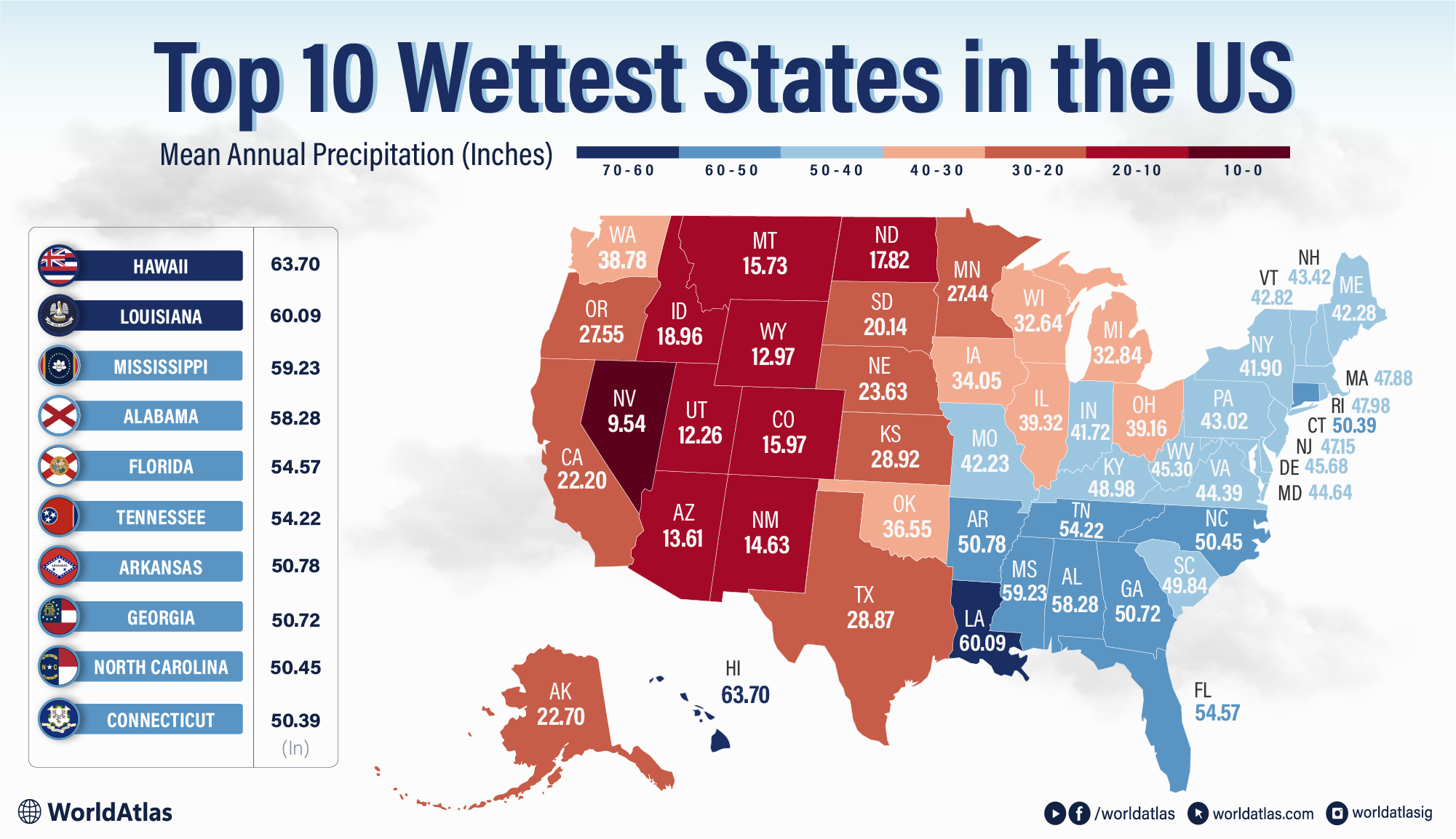
According to long-term climate normals, the 10 wettest states in the US are Hawaii, Louisiana, Mississippi, Alabama, Florida, Tennessee, Arkansas, Georgia, North Carolina, and Connecticut, a blend of Pacific volcanoes, Gulf Coast swamps, and surprisingly soggy New England.
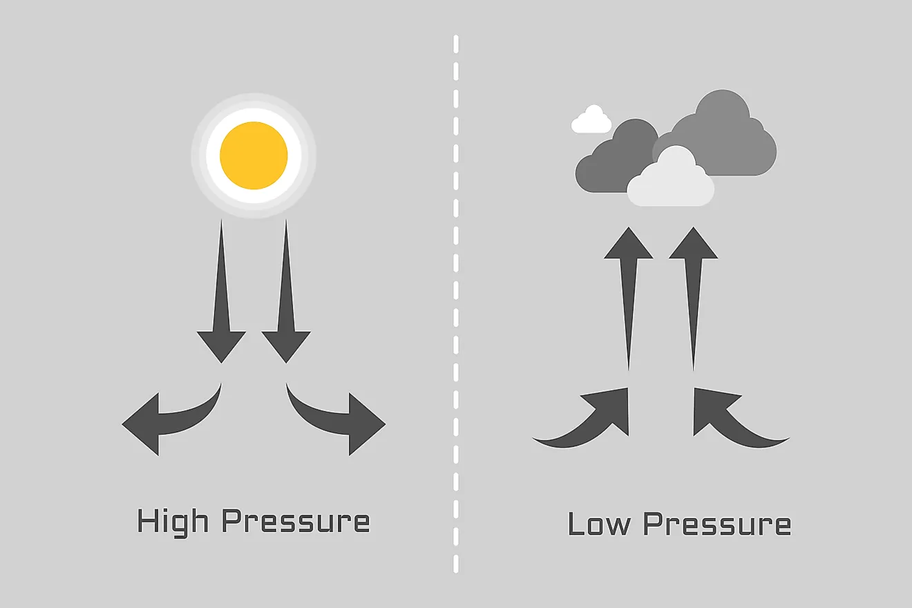
This list makes sense once you look at the mechanics of rain: warm oceans, moisture-rich air, and terrain that forces that air to rise and cool. Hawaii's towering volcanic slopes wring out staggering rainfall, while the Gulf and Southeast are hammered by humid summers, thunderstorms, and land-falling tropical systems. "Dry" states like Washington miss the cut because their epic mountain rainfalls are balanced by much drier interiors, whereas compact Connecticut scores high thanks to consistently wet seasons statewide.
10 Wettest States In The US
| Rank | State | Mean Annual Precipitation (inches) |
|---|---|---|
| 1 | Hawaii | 63.7 |
| 2 | Louisiana | 60.1 |
| 3 | Mississippi | 59.2 |
| 4 | Alabama | 58.3 |
| 5 | Florida | 54.6 |
| 6 | Tennessee | 54.2 |
| 7 | Arkansas | 50.8 |
| 8 | Georgia | 50.7 |
| 9 | North Carolina | 50.5 |
| 10 | Connecticut | 50.4 |
1. Hawaii - 63.7

Hawaii stands out as the nation's wettest state thanks to powerful trade winds and steep volcanic mountains that wring moisture from passing clouds. Orographic lift on the north and east, facing windward slopes, produces lush rainforests and world-class rainfall totals, while leeward coasts remain much drier. Big Bog on Maui averages over 400 inches of rain a year, among the highest measured anywhere in the United States, and Hāna has recorded more than 28 inches in just 24 hours. Most of Hawaii's rain falls between October and April, arriving as frequent light trade-wind showers punctuated by a handful of intense winter storms and occasional Kona lows that can soak all sides of the islands. Despite its reputation for perpetual showers and greenery, long-term records show the islands are gradually getting hotter and drier with climate change, squeezing already limited freshwater resources and stressing native ecosystems, and increasing the risk of severe drought.
2. Louisiana - 60.1

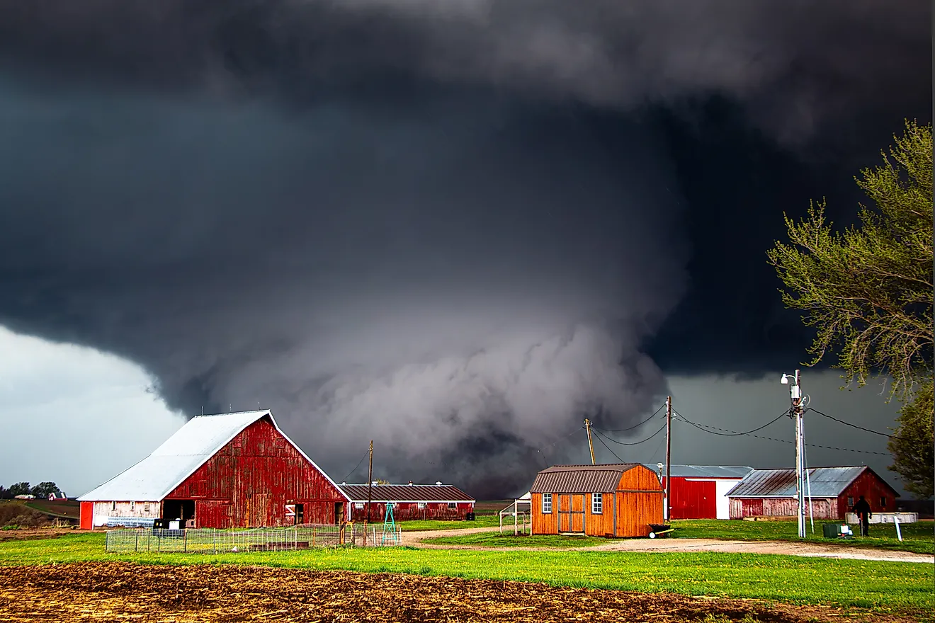
Louisiana's steamy subtropical climate helps make it America's second wettest state. Hot, humid summers along the Gulf of Mexico fuel near-daily afternoon thunderstorms, while mild winters still bring frequent rains. Average yearly precipitation climbs from about 45 inches in Shreveport to more than 56 inches in New Orleans, supporting long growing seasons of 220 to 320 days and lush vegetation from pine forests to cypress swamps and coastal marshes. Moisture also drives Louisiana's extreme weather. The state sits squarely in the six-month Atlantic hurricane season, from June through November, when tropical storms and hurricanes can deliver torrential downpours, storm surge, and catastrophic flooding, as seen dramatically with Hurricane Katrina. Even outside major landfalls, repeated heavy rain events, saturated soils, and high humidity shape everyday life, local agriculture, and infrastructure. Louisiana's climate is both a rich natural asset and a persistent flood and storm risk for communities across the bayous and lowlands.
3. Mississippi - 59.2

Mississippi's sultry, humid subtropical climate helps push it into the top tier of America's wettest states. Moist Gulf air feeds year-round rainfall, with totals climbing from roughly 50 inches annually in the north to more than 60 inches along the Gulf Coast and a statewide average of about 56 inches. Summer brings long, hot, steamy days punctuated by thunderstorms, while cooler months stay relatively mild but still wet. The state's position on the Gulf also makes it highly vulnerable to tropical systems: hurricanes such as Camille and Katrina delivered extreme storm surge and torrential rain to the coast. Inland, frequent heavy downpours, saturated soils, and a dense network of rivers create ongoing flood risk, especially in the low-lying Delta. Climate records show more rain arriving in intense bursts and sea levels rising along the coast, magnifying Mississippi's already high exposure to flooding, heat, and storm-driven rainfall statewide, straining drainage systems.
4. Alabama - 58.3

Alabama's humid subtropical climate helps lift it into the ranks of the nation's wettest states. Fueled by warm, moisture-laden air from the Gulf of Mexico, the state averages about 56 inches of rain each year, with totals exceeding 60 inches along the coast. Precipitation is spread across all seasons, supporting a growing season of up to 300 days in the south, but comes in many forms: summertime downpours, frequent thunderstorms, and occasional snow in the north. Central and northern Alabama are wettest from late fall through early spring, while the Gulf Coast sees peak rainfall in summer as daily storms bubble up over Mobile Bay. Tropical storms and hurricanes, such as Frederic and Ivan, often push ashore with torrential rain that can cause widespread inland flooding. The state also sits in "Dixie Alley," where violent, rain-wrapped tornadoes and severe spring squall lines regularly add to Alabama's already impressive precipitation totals.
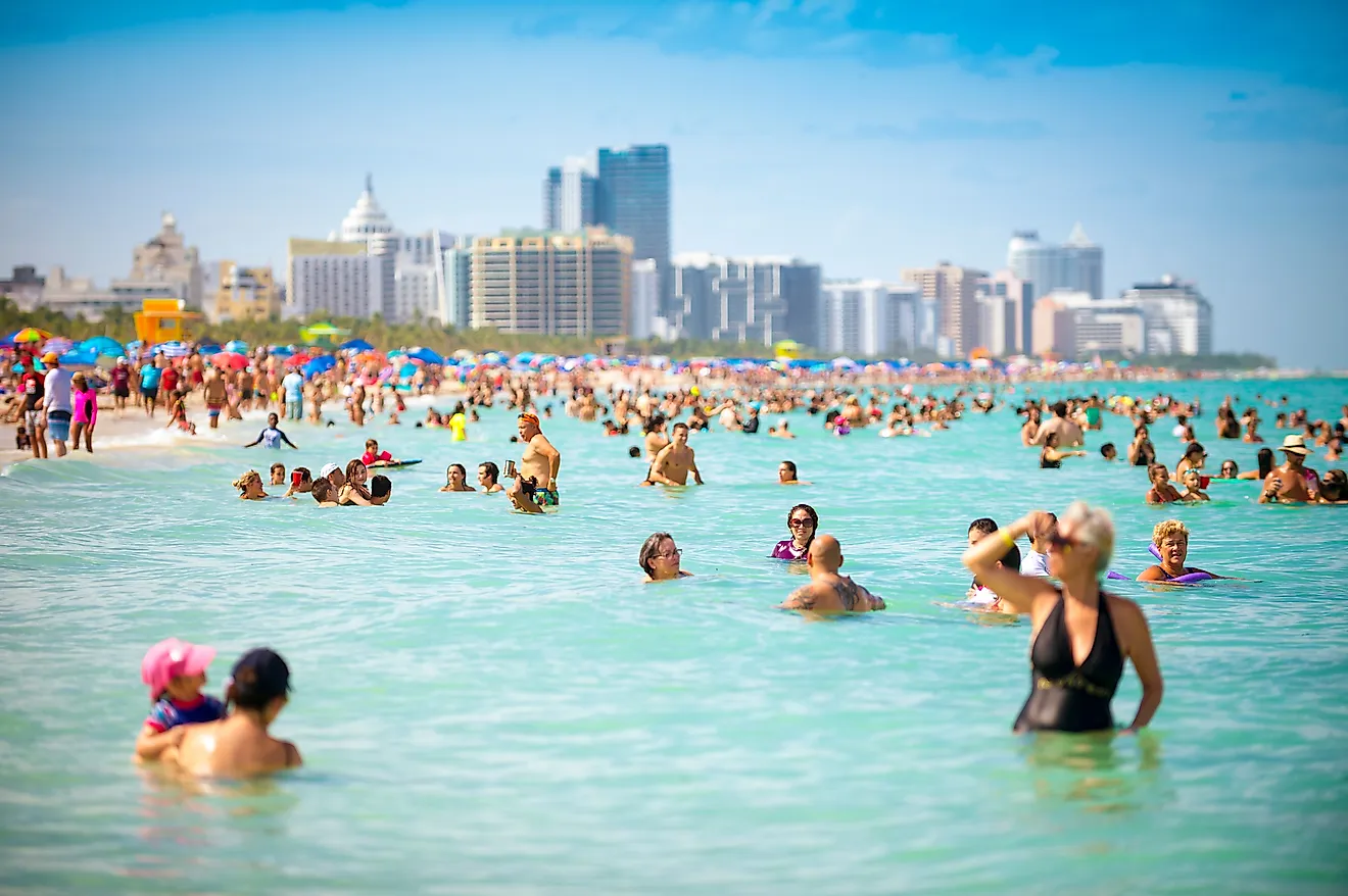
5. Florida - 54.6

Florida is America's fifth wettest state, with rainfall averaging 54 to 65 inches per year depending on location. Its humid subtropical north and tropical south combine to create a climate where summer storms are nearly daily events. The May-October wet season brings heavy, short-lived downpours driven by sea breezes and afternoon heat, while the winter dry season sees only occasional showers. Florida's Panhandle and Gulf Coast often record the state's heaviest totals, with Pensacola topping 70 inches in some years. Tropical cyclones frequently drench the peninsula. Hurricane Easy dumped more than 45 inches in 1950, still a record for the state. Florida also experiences more thunderstorms and lightning strikes than anywhere else in the U.S., contributing to its high precipitation levels. Though this abundance of rain sustains lush vegetation and wetlands, it also fuels flooding, erosion, and infrastructure challenges in a warming, storm-prone coastal environment.
6. Tennessee - 54.2

Tennessee ranks sixth among the wettest U.S. states, with about 54 inches of rain a year, but how that moisture falls varies dramatically across its long east-west span. Moist Gulf of Mexico air colliding with Appalachian ridges drenches East Tennessee; the Great Smoky Mountains capture over 80 inches of precipitation at higher elevations, feeding cool, misty hollows, lush forests, and spectacular waterfalls. Farther west, rainfall totals ease slightly but stay high enough to keep the Tennessee and Cumberland rivers swollen and West Tennessee's alluvial plains fertile and flood-prone. Winter and early spring are the wettest seasons, often bringing soaking frontal systems, severe thunderstorms, and tornado outbreaks. Late summer and fall can turn stormy again when the remnants of tropical systems sweep inland. For residents and visitors, all that water underpins white-water rafting on the Ocoee, houseboating on TVA reservoirs, and the foggy, rain-washed atmosphere that defines "Rocky Top" country.
7. Arkansas - 50.8

Arkansas earns its place among America's ten wettest states thanks to its humid subtropical climate and water-rich landscape. Annual precipitation typically ranges from about 40 to 60 inches, with the heaviest rainfall soaking the forested south and the flat, alluvial Arkansas Delta along the Mississippi River. Moist Gulf air collides with storm systems sweeping in from the Plains, producing frequent thunderstorms, drenching downpours, hail, and some of the nation's most intense tornado outbreaks. Tropical storm remnants often crawl inland to Arkansas, dumping torrents of rain that can push rivers over their banks and flood low-lying fields and bayous. An intricate network of major rivers, the Arkansas, White, Ouachita, and countless smaller streams, lakes, and reservoirs, threads through the state, shaping ecosystems and supporting rice, soybeans, and other water-hungry crops. In "The Natural State," water is both a defining resource and a recurring hazard, demanding constant respect and adaptation for communities across Arkansas.
8. Georgia - 50.7

Georgia is characterized by its humid subtropical climate and abundant rainfall throughout the year. Most of the state receives 45 to 75 inches of precipitation annually, from the storm-drenched Blue Ridge Mountains in the northeast to the thunderstorm-prone coastal plain near Florida. Moist air from the Atlantic and Gulf collides with summer heat to fuel frequent afternoon downpours, while spring remains one of the rainiest seasons, especially in North Georgia. Tropical storms and the remnants of hurricanes often sweep inland, dropping torrents of rain even when the coastline escapes a direct hit. Winter is comparatively mild and wetter during El Niño years, when the jet stream dips south and brings more cold rain and occasional snow or ice. For Georgia's farms, forests, and fast-growing cities, this steady deluge is both a vital water source and a recurring flood and erosion risk across the state.
9. North Carolina - 50.5

North Carolina ranks among America's ten wettest states thanks to its humid subtropical climate and frequent tropical deluges. Most of the state averages around 45 inches of rain a year, climbing to 50 inches or more in the mountains and up to 80 inches on the wettest southwest-facing slopes. Moist winds off the Atlantic and Gulf feed July thunderstorms, while as much as 15 percent of warm-season rainfall comes from tropical storms and hurricanes. Systems like Floyd, Frances, Florence, and, most recently, Helene have unleashed staggering multi-day totals, with Florence dropping more than 35 inches near Elizabethtown and Helene setting new benchmarks for inland rainfall in the Appalachians. The Blue Ridge also wrings out heavy snow and rain while shielding the Piedmont from some winter systems. This generous but increasingly variable precipitation underpins North Carolina's forests, agriculture, and hydropower, while driving billion-dollar flood, landslide, and erosion risks from coast to mountains.
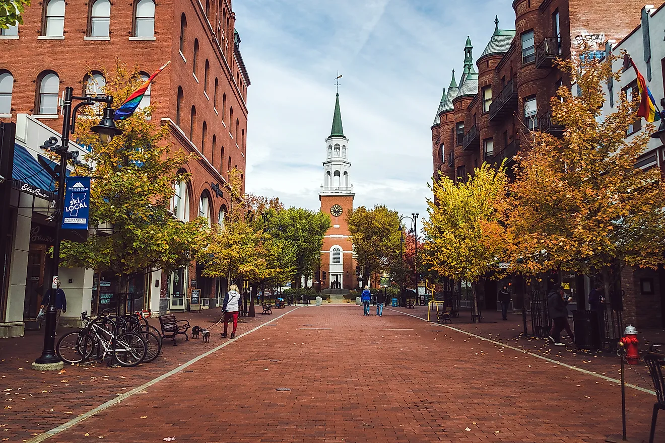
10. Connecticut - 50.4

Connecticut earns its place among America's ten wettest states thanks to a steady, year-round supply of rain and snow. Lying between humid continental and humid subtropical zones, the state has hot, stormy summers, colorful but increasingly soggy autumns, and moderately cold, snowy winters. Precipitation is fairly evenly spread across the calendar, with quick-hitting thunderstorms and the remnants of tropical systems adding intense downpours. Coastal towns along Long Island Sound see more rain than snow, while northern and upland areas can collect 60 inches of snow in a typical year, with occasional nor'easters dumping one to two feet at a time. Historic storms, from the devastating 1938 New England hurricane to Irene, Sandy, and Isaias, have driven coastal flooding, river surges on the Connecticut River, and prolonged power outages. Overall, Connecticut's lush forests, rivers, and wetlands owe their richness to this generous, if sometimes destructive, moisture. Climate models suggest future increases in precipitation.
US States Ranked By Mean Annual Precipitation In Inches
| Rank | State | Mean annual precipitation (inches) |
|---|---|---|
| 1 | Hawaii | 63.70 |
| 2 | Louisiana | 60.09 |
| 3 | Mississippi | 59.23 |
| 4 | Alabama | 58.28 |
| 5 | Florida | 54.57 |
| 6 | Tennessee | 54.22 |
| 7 | Arkansas | 50.78 |
| 8 | Georgia | 50.72 |
| 9 | North Carolina | 50.45 |
| 10 | Connecticut | 50.39 |
| 11 | South Carolina | 49.84 |
| 12 | Kentucky | 48.98 |
| 13 | Rhode Island | 47.98 |
| 14 | Massachusetts | 47.88 |
| 15 | New Jersey | 47.15 |
| 16 | Delaware | 45.68 |
| 17 | West Virginia | 45.30 |
| 18 | Maryland | 44.64 |
| 19 | Virginia | 44.39 |
| 20 | New Hampshire | 43.42 |
| 21 | Pennsylvania | 43.02 |
| 22 | Vermont | 42.82 |
| 23 | Maine | 42.28 |
| 24 | Missouri | 42.23 |
| 25 | New York | 41.90 |
| 26 | Indiana | 41.72 |
| 27 | Illinois | 39.32 |
| 28 | Ohio | 39.16 |
| 29 | Washington | 38.78 |
| 30 | Oklahoma | 36.55 |
| 31 | Iowa | 34.05 |
| 32 | Michigan | 32.84 |
| 33 | Wisconsin | 32.64 |
| 34 | Kansas | 28.92 |
| 35 | Texas | 28.87 |
| 36 | Oregon | 27.55 |
| 37 | Minnesota | 27.44 |
| 38 | Nebraska | 23.63 |
| 39 | Alaska | 22.70 |
| 40 | California | 22.20 |
| 41 | South Dakota | 20.14 |
| 42 | Idaho | 18.96 |
| 43 | North Dakota | 17.82 |
| 44 | Colorado | 15.97 |
| 45 | Montana | 15.37 |
| 46 | New Mexico | 14.63 |
| 47 | Arizona | 13.61 |
| 48 | Wyoming | 12.97 |
| 49 | Utah | 12.26 |
| 50 | Nevada | 9.54 |