Maps of Alabama
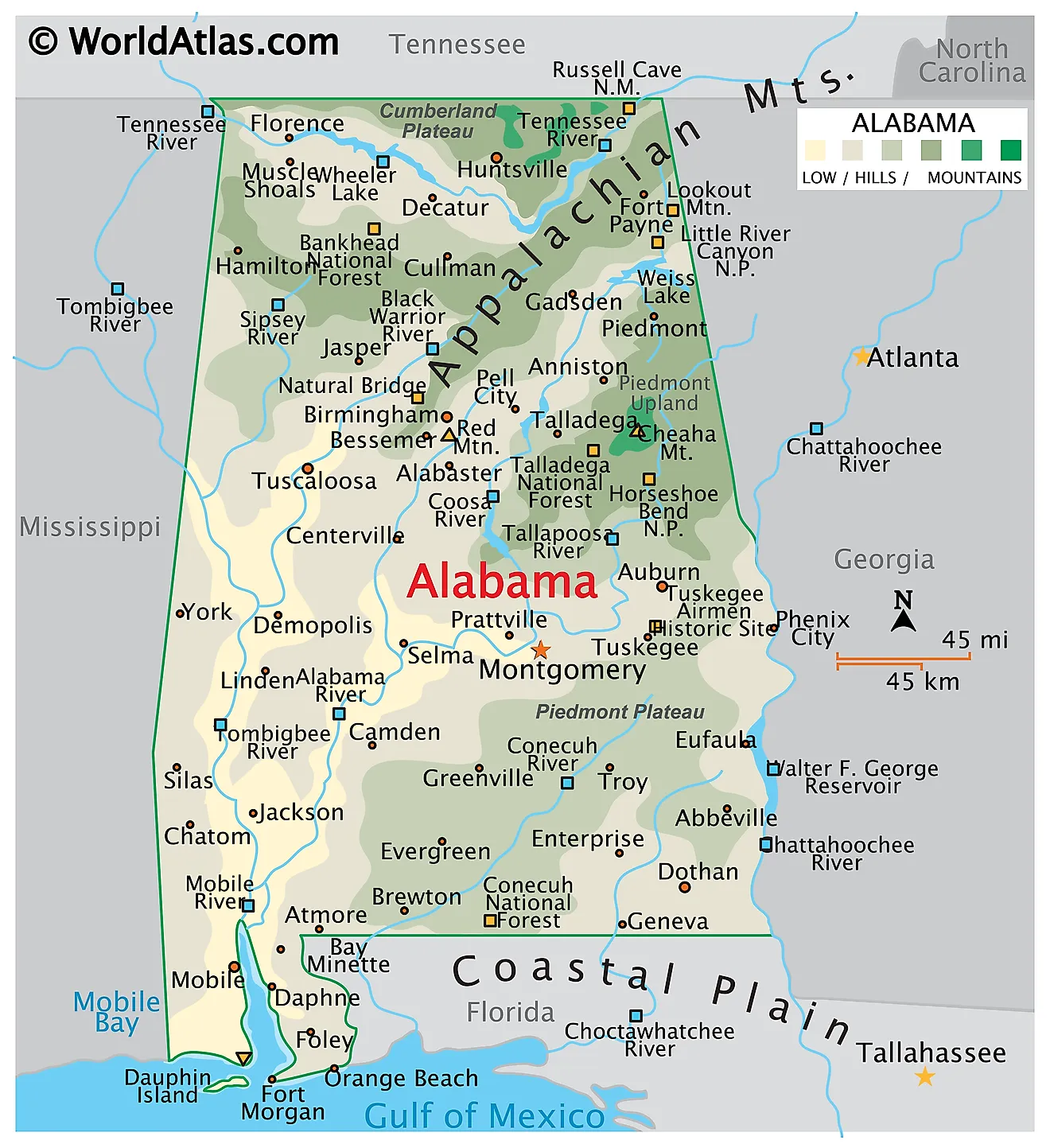
Alabama is a state in the southeastern United States. It shares borders with Tennessee to the north, Georgia to the east, Florida and the Gulf of Mexico to the south, and Mississippi to the west. The state encompasses a total area of about 52,420 square miles (135,767 square kilometers), making it the 30th largest state.

Alabama occupies the point where the southern Appalachians run out. The mountain chain that begins in Newfoundland makes its final appearance in the state's northeast before disappearing beneath the sediments of the Gulf Coastal Plain, and that meeting gives Alabama an unusually varied geology for a state of its size. It also gives the state something less obvious but more remarkable: an extraordinary concentration of fresh water. Alabama has more miles of navigable inland waterway than any other state and more species of freshwater fish, mussels, snails, crayfish, and turtles than anywhere else in the country.
Where Is Alabama?

Scenic Photo of Gantt Lake in Alabama at Sunrise.
The state measures roughly 330 miles north to south and 190 miles east to west. Its boundaries are mostly surveyed lines, with two exceptions: the Chattahoochee River forms the southern portion of the Georgia border, and the Perdido River divides Alabama from Florida at the southeastern corner.
Alabama reaches the Gulf of Mexico through a narrow southern outlet. Its general coastline is only about 53 miles, but counting Mobile Bay, the barrier islands, and every tidal creek, the shoreline runs to roughly 607 miles. With about 5.16 million residents, Alabama is the 24th most populous state, and it is divided into 67 counties.
The Highland Rim

Russell Cave National Monument in Alabama.
The Highland Rim occupies northern Alabama along the Tennessee River, an extension of the much larger region that surrounds Tennessee's Nashville Basin. It is the smallest of the state's five physiographic sections.
The bedrock is Mississippian limestone, gently dipping and easily dissolved, which gives the region classic karst character — caves, springs, sinkholes, and streams that vanish underground. Russell Cave in Jackson County holds one of the longest continuous records of human occupation in the southeastern United States, with artifacts spanning some 10,000 years. The broad Tennessee Valley floor, floored with fertile limestone soils, is the most productive farmland in north Alabama.
The Cumberland Plateau

The Cumberland Plateau, also called the Appalachian Plateau, is the largest of Alabama's upland sections. It sweeps across the northern third of the state, from the northeast corner southwest toward Tuscaloosa, and extends well into northwestern Alabama as well. Flat-lying sandstone and shale cap the plateau, and the coal seams beneath it built Birmingham's iron and steel industry.
Structurally this is a plateau rather than a range, but erosion has cut it so deeply that it reads as mountainous. Its northeastern edge carries Sand Mountain and Lookout Mountain, long flat-topped ridges rising above the valleys on either side.

Little River Canyon, on Lookout Mountain, reaches depths near 600 feet and is among the deepest gorges east of the Mississippi. The Little River itself is unusual in flowing almost its entire length along the top of a mountain rather than in a valley.

At the plateau's western end, in Franklin County, Dismals Canyon is a narrow sandstone gorge sheltering plants normally found hundreds of miles north. It is also one of the few places on earth where dismalites — the glowing larvae of a fungus gnat — light the canyon walls at night. Nearby, the Sipsey Wilderness in Bankhead National Forest holds so many waterfalls that the forest is nicknamed the Land of a Thousand Waterfalls.
The Alabama Valley and Ridge

The Valley and Ridge runs diagonally across east-central Alabama, a band of long, narrow ridges and broad valleys aligned northeast to southwest. It is the southernmost extension of the Valley and Ridge province that runs the length of the Appalachians, and it ends in Alabama where the folded rocks dip beneath the Coastal Plain.
The pattern comes from sedimentary layers that were folded and faulted during the Appalachian mountain-building some 300 million years ago. Resistant sandstone now stands as ridges while limestone and shale have worn into valleys. Birmingham sits in one of these — Jones Valley — where iron ore, coal, and limestone happened to occur within a few miles of one another, the combination that made the city.
Note that Alabama's highest point is not in this region, despite frequent claims to the contrary. Cheaha Mountain lies just to the east, in the Piedmont Upland.
The Piedmont Upland

East-central Alabama holds the Piedmont Upland, the southwestern tip of the Piedmont that runs northeast all the way to New Jersey. Its rocks are entirely different from the rest of the state: ancient metamorphic and igneous material — schist, gneiss, quartzite, and marble — rather than the sedimentary layers found elsewhere.
Cheaha Mountain, in the Talladega Mountains on the Clay–Cleburne county line, is the highest point in Alabama at 2,407 feet (733 meters), and it lies within the Piedmont Upland's northern district, not the Valley and Ridge. The Geological Survey of Alabama places it there, and the quartzite that caps the summit belongs to the Talladega Slate Belt. Some sources give the elevation as 2,413 feet.

Cheaha Mountain Alabama Aerial View.
The Piedmont divides into two districts. The northern part, including Cheaha and the Talladega Mountains, is genuinely rugged, with steep northeast-trending ridges. South of the Brevard Fault Zone, which roughly follows the Tallapoosa River near Lake Martin, the southern district flattens into the gently rolling plateau most people picture when they hear "Piedmont." Soils here are thin and acidic, and much of the region has returned to pine forest after generations of cotton farming.
The East Gulf Coastal Plain

The Coastal Plain covers roughly 60% of Alabama — more than all the other regions combined — sweeping across the southern two-thirds of the state and reaching up the western side into the northwest corner. Its rocks are young, soft, seaward-dipping marine sediments laid down when the Gulf reached far inland.
Its inner boundary is the Fall Line, running roughly through Tuscaloosa, Montgomery, and Phenix City, where rivers descend from hard upland rock onto soft sediment in a series of shoals. Just below it, the Black Belt forms a crescent of dark, sticky soils weathered from Selma Chalk — originally prairie rather than forest, and later the heart of the cotton economy that gave the region its name in both senses.

Where the Alabama and Tombigbee rivers converge north of Mobile, they form the Mobile-Tensaw Delta — roughly 250,000 acres of swamp, marsh, and bottomland forest, the largest inland delta in the United States. Its biological richness has earned it the nickname "America's Amazon." Elsewhere the plain carries longleaf pine on sandy ridges, and near Wetumpka a five-mile-wide crater marks where a meteorite struck about 85 million years ago.
The Gulf Coast

Mobile Bay is the dominant coastal feature, a shallow estuary roughly 31 miles long and up to 24 miles wide — the fourth largest estuary in the United States by freshwater inflow. It receives the combined discharge of a basin covering much of Alabama and parts of four other states.

Dauphin Island guards the bay's western entrance, a low barrier island that shifts noticeably with each major storm. East of the bay, a narrow peninsula carries the beaches of Gulf Shores and Orange Beach, backed by Little Lagoon and Perdido Bay. The sand here is nearly pure quartz, washed down from the Appalachians over millions of years and ground fine — which is why it is so startlingly white and stays cool underfoot.
Rivers

Almost all of Alabama drains to the Gulf through one enormous system. The Coosa and Tallapoosa join to form the Alabama River; the Black Warrior joins the Tombigbee; and the Alabama and Tombigbee meet above the delta to form the short Mobile River, which empties into Mobile Bay. Together they drain about two-thirds of the state.
The exception is the north. The Tennessee River enters from the northeast, loops west across the top of the state, and exits into Tennessee, eventually reaching the Ohio and the Mississippi. A series of TVA dams has converted its Alabama stretch into a chain of reservoirs.
The Cahaba deserves separate mention. At roughly 194 miles it is the longest substantially free-flowing river in the state, and its shoals bloom each May with Cahaba lilies. It supports more fish species per mile than almost any river in North America.
Lakes and Reservoirs

Alabama has no large natural lakes. Its terrain drains too efficiently and the last ice sheet stopped far to the north, so every major body of standing water in the state is an impoundment — and there are a great many, built for flood control, navigation, and power.
Lake Guntersville, behind Guntersville Dam on the Tennessee River, is the largest at about 69,000 acres with 949 miles of shoreline. Wheeler Lake and Wilson Lake complete the TVA chain across north Alabama; Wilson Dam's lock has one of the highest single lifts in the world at 94 feet.
Lewis Smith Lake, on the Sipsey Fork in the Cumberland Plateau, is the deepest in the state at over 260 feet and among the clearest. Lake Martin on the Tallapoosa, Weiss and Logan Martin on the Coosa, and Lake Eufaula on the Chattahoochee are the other major impoundments.
Climate

Alabama has a humid subtropical climate throughout, with hot, humid summers and mild winters. There is no mountain barrier of consequence, so Gulf moisture moves freely inland, and the north-south temperature gradient is gentle — January averages run about 46 °F in the north and 52 °F on the coast.
Rainfall is abundant and increases toward the Gulf: roughly 50 inches a year in the north, over 65 inches at Mobile, which is among the wettest cities in the continental United States. Snow is rare outside the northern counties.
The state sits in Dixie Alley, the southeastern tornado corridor, and its tornadoes tend to be more dangerous than those of the Great Plains because they often strike at night, move faster, and are hidden by rain and trees. The April 2011 outbreak produced 62 tornadoes in Alabama in a single day. Hurricanes are the other recurring hazard, with Frederic, Ivan, and Sally all causing major damage along the coast.
Alabama Geography at a Glance
| Feature | Detail |
|---|---|
| Total area | Approx. 52,420 sq mi (135,767 sq km) — 30th largest state |
| Dimensions | Approx. 330 mi north-south; 190 mi east-west |
| Highest point | Cheaha Mountain, 2,407 ft (733 m) — Piedmont Upland, Cleburne/Clay counties |
| Lowest point | Gulf of Mexico, sea level |
| Bordering states | Tennessee, Georgia, Florida, Mississippi |
| Coastline | Approx. 53 mi general; approx. 607 mi tidal shoreline |
| Physiographic sections | Five: Highland Rim, Cumberland Plateau, Valley and Ridge, Piedmont Upland, East Gulf Coastal Plain |
| Largest region | East Gulf Coastal Plain, about 60% of the state |
| Largest lake | Lake Guntersville, approx. 69,000 acres (reservoir) |
| Natural lakes | None of significant size |
| Counties | 67 |
Counties Map
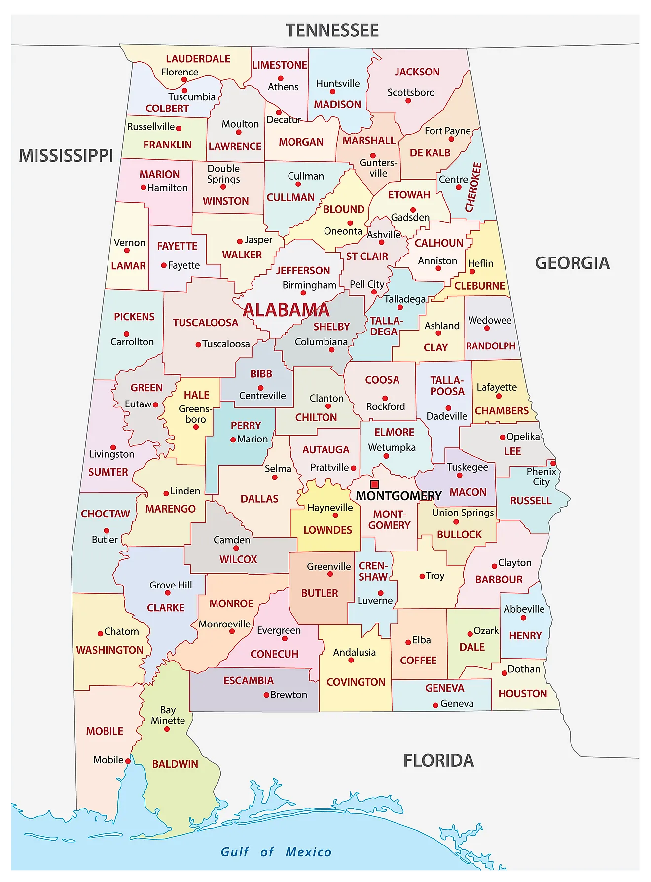
The State of Alabama is divided into 67 counties. In alphabetical order, these counties are: Autauga, Baldwin, Barbour, Bibb, Blount, Bullock, Butler, Calhoun, Chambers, Cherokee, Chilton, Choctaw, Clarke, Clay, Cleburne, Coffee, Colbert, Conecuh, Coosa, Covington, Crenshaw, Cullman, Dale, Dallas, DeKalb, Elmore, Escambia, Etowah, Fayette, Franklin, Geneva, Greene, Hale, Henry, Houston, Jackson, Jefferson, Lamar, Lauderdale, Lawrence, Lee, Limestone, Lowndes, Macon, Madison, Marengo, Marion, Marshall, Mobile, Monroe, Montgomery, Morgan, Perry, Pickens, Pike, Randolph, Russell, Saint Clair, Shelby, Sumter, Talladega, Tallapoosa, Tuscaloosa, Walker, Washington, Wilcox, and Winston.
With an area of 135,767 sq. km, Alabama is the 30th largest and the 24th most populous state in the USA. Located in the central part of the state, on the southern shores of the Alabama River is Montgomery – the capital and the 4th most populous city of Alabama. Due to its central location in the state's Black Belt region, Montgomery serves as the processing center for a variety of crops, including soybeans, peanuts, and cotton. It is also an important transportation and healthcare hub in the entire Black Belt region of Alabama. Situated in the north-central part of the state is Birmingham, which anchors Alabama's largest metropolitan area and serves as the cultural, financial, industrial, and economic hub of the state. Huntsville, in the far north, is the state's most populous city, having overtaken Birmingham in 2020 on the strength of its aerospace and defense industries.
Where is Alabama?
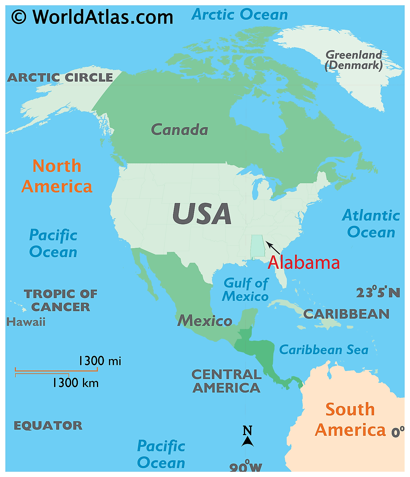
The State of Alabama is located in the South-Eastern region of the United States. Alabama is bordered by the state of Georgia in the east; by Mississippi in the west; by Tennessee in the north; and by Florida and the Gulf of Mexico in the south.
Regional Maps: Map of North America
Outline Map of Alabama
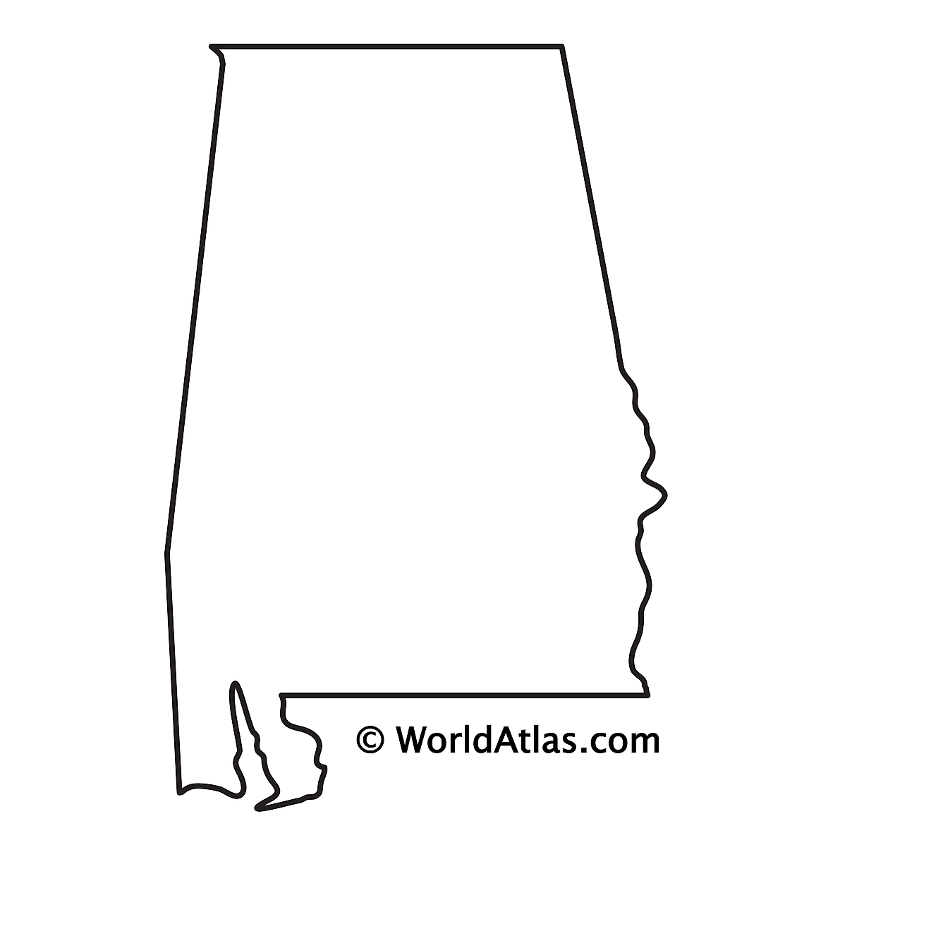
The above blank map represents the State of Alabama, located in the South-Eastern region of the United States. The above map can be downloaded, printed and used for geography education purposes like map-pointing and coloring activities.
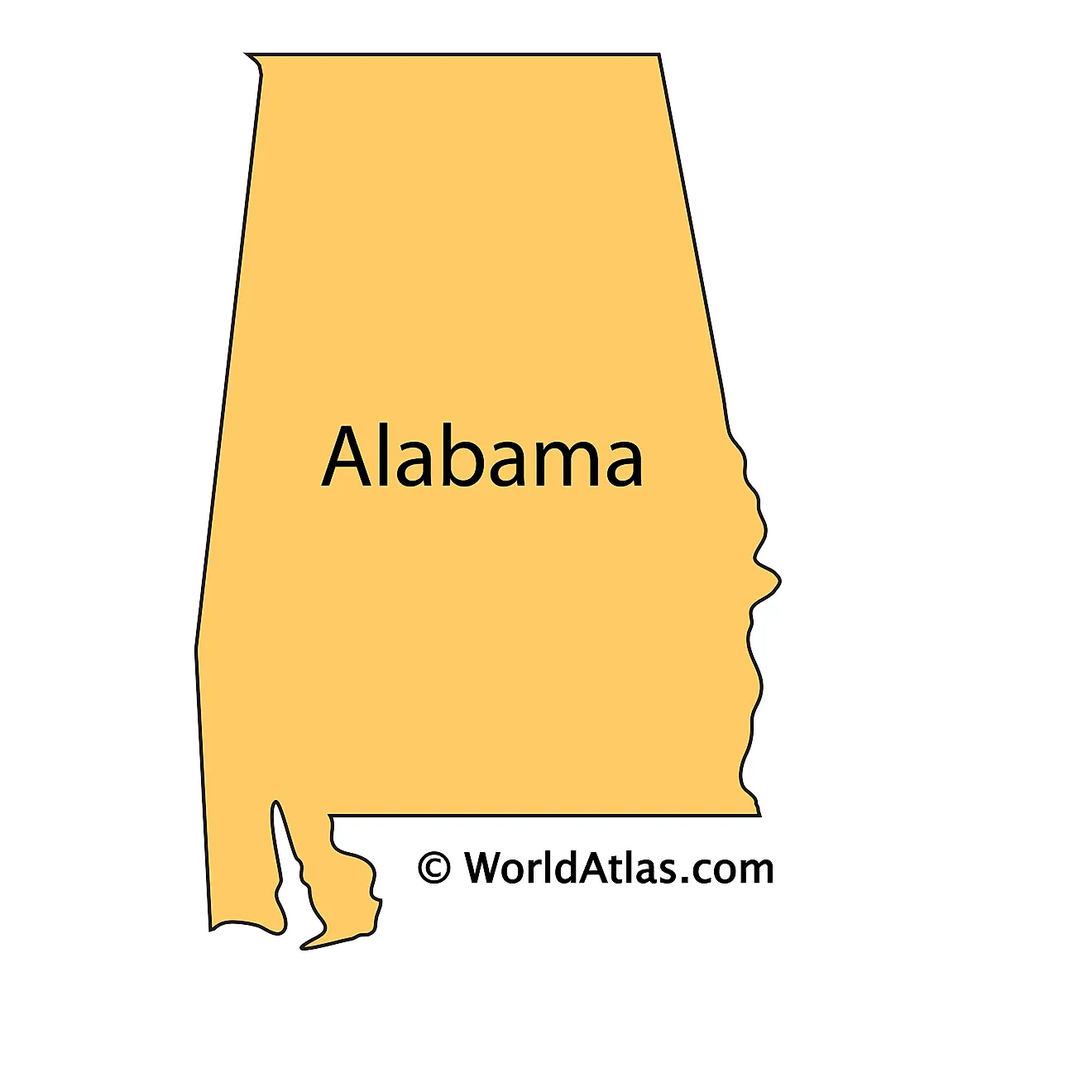
The above outline map represents the State of Alabama, located in the South-Eastern region of the United States. Alabama has been nicknamed as the "Yellowhammer State" in reference to the state bird - Colaptes auratus (Northern flicker).
Key Facts
| Legal Name | State of Alabama |
|---|---|
| ISO 3166 Code | US-AL |
| Capital City | Montgomery |
| Major Cities |
|
This page was last updated on September 17, 2026