The Most Charming River Towns In Arizona
The eight Arizona river towns below trade sunbaked highways for paddling runs, shaded riparian trails, and riverside history. The Colorado River carves canyons and fills reservoirs at Page, Bullhead City, and Parker, opening a wide range of outdoor water adventures. The Verde River greens the valley floor through Clarkdale, Cottonwood, and Camp Verde. The Hassayampa and the Santa Cruz rivers thread water and history through Wickenburg and Tubac. Any one of them turns desert Arizona a good deal wetter than its reputation lets on.
Page

Page rose in 1957 as a housing camp for the crews building Glen Canyon Dam, and the Colorado River still runs the show here. Four miles southwest of town, the river swings into Horseshoe Bend, a tight sandstone meander that draws more than two million visitors a year. A 1.5-mile round-trip trail off US Route 89 leads to the overlook, best caught in late-afternoon light. Glen Canyon Dam holds back Lake Powell just upstream, where houseboats and kayaks fan out across close to 2,000 miles of red-rock shoreline. For gentler water, half-day float trips glide out from the base of the dam down to Lees Ferry, no rapids involved. East of town, guided tours wind through the slot walls of Antelope Canyon on Navajo Nation land, where midday sun drops in shafts through the sandstone. Few towns put the Colorado on such constant display, held behind the dam, moving through the canyon, and curved hard at Horseshoe Bend.
Bullhead City

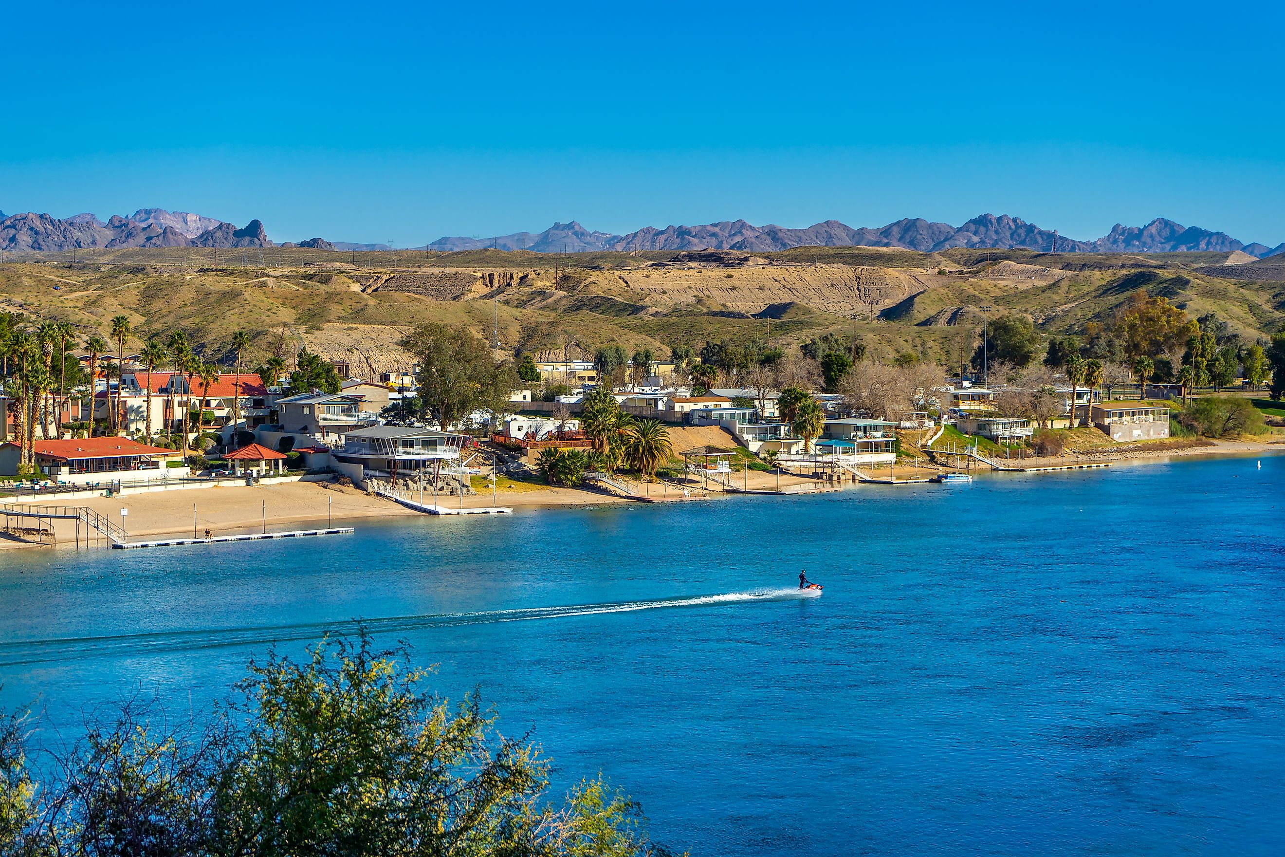
Far down the Colorado's western run, Bullhead City spreads along 13 miles of riverfront across from the Nevada casino town of Laughlin. The biggest town on this list, it still lives and breathes the water locals call Arizona's West Coast. Rotary Park opens onto the waterfront with swimming coves, boat ramps, and shaded lawns that fill with jet skiers on warm weekends. A few miles north, Davis Dam plugs the river to form Lake Mohave, and the campground at Davis Camp puts tents and RVs right on the water. A short walk inland, the Colorado River Museum fills a building raised in 1947 for the dam crews. Its cases hold steamboat relics, Mojave artifacts, and early settler records. The tame current between the dam and town also draws kayak paddlers and anglers after striped bass and rainbow trout. On a hot weekend the stretch between Davis Dam and town belongs to the anglers and the speedboats.
Parker

Downriver to the south, past Lake Havasu City, the Colorado reaches Parker, the small seat of La Paz County. The real draw lies just north of town along the Parker Strip, a recreation corridor where boaters, tubers, and water skiers pack the calm water below Parker Dam. Buckskin Mountain State Park lines this stretch with riverside campsites, desert hiking trails, and a boat launch under rocky bluffs. Back in town, the BlueWater Resort and Casino fronts the river with a marina and beach, both owned by the Colorado River Indian Tribes. For something odder, the Desert Bar sits off a dirt road in the Buckskin Mountains, solar powered and cash only, serving burgers and live music from October through April. By winter, the Desert Bar's dirt-road lot fills with off-roaders down for the burgers and the view.
Wickenburg

The Colorado is not the only river that made a town in Arizona. Inland toward Phoenix, Wickenburg grew up in 1863 around gold strikes along the Hassayampa River, which flows mostly underground through the desert here. The water surfaces for good at the Hassayampa River Preserve just southeast of town, where shaded paths trace a green riparian corridor that shelters close to 300 bird species. Downtown, Frontier Street keeps its 19th-century storefronts and the old Santa Fe depot, now the visitor center. The Desert Caballeros Western Museum hangs canvases by Frederic Remington and Maynard Dixon alongside a walk-through frontier town. Hikers climb Vulture Peak for a steep desert payoff, or drive out to the restored Vulture City ghost town at the mine that started it all. The preserve's shaded riverbank stays green even where the rest of the Hassayampa sinks underground.
Clarkdale

The Verde Valley opens Arizona's richest cluster of river towns, and Clarkdale sits at the top of it. Built in 1912 as the state's first master-planned town, Clarkdale spreads along the Verde River below the copper-mining hills of Jerome. The Verde Canyon Railroad rolls out of the depot on Broadway for a four-hour, 40-mile round trip. The route threads a canyon reachable only by rail, with bald eagles overhead in winter. Paddlers put in at two town-run river access points, TAPCO and Tuzigoot, for a 90-minute float past the reeds of Tavasci Marsh. The Arizona Copper Art Museum fills a restored 1928 schoolhouse with beaten-copper work you can actually touch. Above the river, Tuzigoot National Monument crowns a ridge with a 110-room Sinagua pueblo left standing for a thousand years. Clarkdale packs rail, water, and ruins into one small grid, and the river ties them together.
Cottonwood

A few miles down the Verde from Clarkdale, Cottonwood turns the same river into a full weekend. Dead Horse Ranch State Park sits across the water from town with three stocked fishing lagoons, riverside campsites, and the shaded Canopy Trail running under the cottonwoods. Kayakers launch here to float the Verde River Greenway, a six-mile ribbon of cottonwood and willow forest that ranks among fewer than 20 such riparian galleries on Earth. The short Jail Trail drops down to the greenway straight from the north end of Old Town. Old Town Cottonwood itself has become the hub of Arizona wine country, with roughly 10 tasting rooms within a few blocks on Main Street. Herons, beavers, and winter bald eagles work the water while sippers work the wine list. Only a few blocks separate the greenway put-in from Old Town's tasting rooms.
Camp Verde

Camp Verde grew around an Army fort rather than a mine, roughly 15 miles down the Verde from Cottonwood. Fort Verde State Historic Park keeps four original buildings from the Indian Wars era, with officers' quarters furnished as soldiers left them. The Verde River winds through town on its way south, and put-ins at Beasley Flat send canoes and kayaks into quieter water where herons, otters, and beavers outnumber people. North of downtown, Montezuma Castle National Monument sets a five-story Sinagua cliff dwelling into a limestone alcove above Beaver Creek. Families trade the history for a safari at Out of Africa Wildlife Park, where giraffes and big cats roam open enclosures in the hills. The Verde still runs past the fort that first put Camp Verde on the map.
Tubac

Arizona's river-town tour ends in the south, where the Santa Cruz River flows north through Tubac near the Mexican border. Barely 1,500 people live here, but Spain planted its first Arizona presidio on this spot in 1752. Tubac Presidio State Historic Park preserves the fort's excavated foundations, an 1885 schoolhouse, and the printing press that ran Arizona's first newspaper in 1859. From the park, a four-mile stretch of the Juan Bautista de Anza National Historic Trail leads south to the mission ruins at Tumacácori. The path crosses the Santa Cruz River twice along the way. The riverside cottonwoods draw painters and birders in equal measure, feeding a colony of more than 100 galleries and studios around the plaza. Come in February for the Tubac Festival of the Arts, running since 1959. Three centuries after the first soldiers marched in, the presidio marks the trailhead of the Anza Trail.
Eight Towns, Four Rivers
Arizona runs on rivers more than its cactus reputation lets on. Four rivers shape these eight towns in Arizona, and each one leaves its mark. At Page, the Colorado River coils into the tight loop of Horseshoe Bend just below Glen Canyon Dam. Southeast in the Verde Valley, kayakers drift past the birding marshes below Clarkdale, and down near the border the Santa Cruz threads the cottonwoods below Tubac's Spanish presidio. Water changes what a desert town can be.