Visiting The Best Spots Along Lake Huron's Shoreline
Born and raised on a Lake Huron border town, I've had the opportunity to thoroughly explore its Michigan and Ontario shores.
Both sides of this Great Lake have standout islands, peppered with beach towns and fishing villages, each state park matched by a worthy provincial park, and while Michigan excels at scenic byways, Ontario puts its stock in national parks.
So if you've never seen the waters of Lake Huron, or if you've tended to favor either the Canadian or American side, perhaps I can persuade you toward a binational balance. These are the best spots I've discovered around Lake Huron.
Ontario
Pinery Provincial Park

Pinery Provincial Park, or "the Pinery" for short, is the quintessential attraction of Lambton Shores. This well-rounded, immensely popular park harbors long, wild beaches that are soft to the touch but strewn with driftwood and flanked by grassy freshwater dunes.
Accessed by boardwalks and sneaky trails from various campsites, even in the peak of the summer, you'll be able to find your own little sunny sanctuary. Personally, I'm more inclined to outdoor recreation than sunbathing, so I'm always quick to lace up my runners and hit the Pinery's many shaded trails.
In fact, having grown up in Lambton County, I used to run my elementary school cross-country races through the Pinery's Carolinian forests.
Recently, I rented a kayak for the first time and explored the Old Ausable Channel, and then tried my hand at cowboy camping. The Pinery is one of my Lake Huron staples, so it seemed an appropriate place to start our tour.
Goderich

Heading further up Ontarios shortline, Goderich, once called "the prettiest town in Canada," puts its money where its mouth is.
Despite this summer's construction around the otherwise attractive historic town center, aka "The Square," I was able to pivot to peripheral assets. For starters Goderich is home to the oldest Canadian lighthouse on Lake Huron (we'll visit the outright champ in the Michigan section).
What it lacks in stature, the Goderich Lighthouse makes up for with striking views atop its green hilltop. This vantage point is reached via a set of wooden stairs that connects to Goderich's waterfront. Here, the modest Main Beach is complemented by restaurants and food trucks, playgrounds, and a pleasant paved path.
Ever drawn to Ontario's nature trails, I was delighted to discover the G2G Trail leading up to and well beyond the Menesetung Bridge, which spans 60 feet above the Maitland River.
Historic architecture rounds out this Lake Huron hotspot. Goderich's Historic Gaol (i.e. jail) and the Huron County Museum, which share the same entrance ticket, along with the Huron County Courthouse are the focal points. A wealth of opulent, old-timey homes turns walking the downtown streets into an architectural treasure hunt.
Tobermory

This touristic harbor town caps off the Bruce Peninsula, welcoming waves of summertime road-trippers to the shipwreck and island-littered waters of Georgian Bay — a massive wing of Lake Huron that is often called the "sixth Great Lake."
Whether it was early childhood family trips, my post-graduation hike here via the 900-kilometer Bruce Trail, or more recent visits involving glass boat tours and national parks, Tobermory has always been one of my favorite Lake Huron getaways.
I've heard frustrations expressed that Tobermory has gotten too popular. Knowing this, I've kept my visits to the shoulder seasons, which has proven to be a fruitful strategy. I've yet to feel bogged down by tourists, and have rather enjoyed the craft beer and all-you-can-eat fish n' chips that have risen in response to the crowds. Besides, Tobermory simply hugs Little Tub Harbour. Beyond that, it's all national park playgrounds.
On that note...
Bruce Peninsula & Fathom Five National Parks

Tobermory acts as a base for both Bruce Peninsula National Park and Fathom Five National Marine Park. In fact, they share the same visitor center on the east end of town. The former focuses on the peninsula's beauty.
Formed by the Niagara Escarpment (a UNESCO Biosphere Reserve), limestone cliffs drop into turquoise, Caribbean-esque (save for the temperature) waters of Georgian Bay, often punctuated by grottos and coves.
The Bruce Trail and other forested footpaths hug this spellbinding shoreline, but also dip inland to countless minor water bodies. Last time I camped here, I found the park warden to be a little overzealous, but the landscape is too beautiful for this to have dampened my enthusiasm.
Picking up right where Bruce Peninsula National Park leaves off and continuing to the 22 nearshore shipwrecks and 20-island archipelago, Fathom Five National Marine Park (the first of its kind in Canada) is best explored via Tobermory's glass bottom boat tours.
I was exceptionally pleased with the tour offered by Blue Heron Cruises. They got right over top of the two wrecks in Big Tub Harbour, and then dropped us off for some unstructured exploration of Flower Pot Island.
Manitoulin Island

Yet another of Tobermory's assets is the MS Chi-Cheemaun. This ferry services the southside of Manitoulin Island. The two-hour crossing of Lake Huron/Georgian Bay is a rewarding experience unto itself, but upon arrival in South Baymouth, passengers have full rein of the largest freshwater island on the planet.
Between the south and north terminus towns, beaches, scenic drives, waterfalls, Indigenous communities, and moose-filled forests sprawl in every direction. The last time I passed through Manitoulin was during a stint of van life. After a lovely beach day at Providence Bay, the third-hand vehicle refused to start.
Being in the absolute middle of nowhere just in time for the weekend, I got towed to the centralized community of Mindemoya, where I camped in the mechanic's parking lot until Monday. The silver lining of this mishap was that it forced me to slow things right down and witness everyday life on Manitoulin Island.
Georgian Bay Islands National Park

For all its assets, Manitoulin Island cuts off most of the Georgian Bay experience in favor of a fast-track to northern Ontario and the start of Michigan's shore.
The slower alternative is to drop back down from the Bruce Peninsula, continue east, and then up through the famed Muskoka region. Having attended summer camp on Beausoleil Island — the largest island within Georgian Bay Islands National Park (and the only one open to the public) — this is yet another of my nostalgic happy places on the Ontario side of Lake Huron.
Both black bears and massasauga rattlesnakes inhabit the dynamic granite landscape and deciduous forests. Familiar with both animals, though never truly habituated, my recent solo hiking excursion was augmented by persistent low-level adrenaline.
Once I got to the north end of the island, I started to see fellow groups of hikers, allowing me to relax into the unique setting in those final hours before my pre-ordained water taxi picked me up (for the low low price of $200 CAD!).
Michigan
Mackinac Island

Crossing into Michigan from northern Ontario, Mackinac Island is just a short ferry away. I encountered this exciting, frozen-in-time haven during that same van life era. Of course, I had to leave the van parked in St. Ignace, as there are no vehicles permitted on Mackinac Island. Leaning into the Victorian legacy, bicycles and horse-drawn taxis are the go-to modes of transportation here — that, and your own two feet.
As I often do, I started my exploration of this novel community at a cafe, followed by a couple of museums, which here are run by period actors.
Next, I headed up the hill to Fort Mackinac, where I saw scouts hoist the American flag and more period actors firing War of 1812 muskets. Beyond those fortress walls and first sliver of Lake Shore Drive, the rest of this four-square-mile island belongs to Mackinac Island State Park. Hiking through the woods and biking around the perimeter, I started to feel like I was alone in the wilderness, rather than in one of the most popular destinations in the Great Lakes.
Mackinaw City

Mackinac Island is serviced by two ferry ports: St. Ignace on Michigan's Upper Peninsula, and Mackinaw City at the apex of the Lower Peninsula. In case you're wondering, despite the percussive difference in spelling, both the latter city and the island are pronounced the same: Mack-in-awe.
Following this article's counter-clockwise momentum, Mackinaw City is reached via the four-lane, five-mile-long suspension bridge officially called Mackinac Bridge, but better known as "Mighty Mac." This marvel of engineering is quite a sight to behold from Mackinaw City's waterfront.
The Old Mackinac Point Lighthouse and Colonial Michilimackinac (i.e. the Indigenous term that is the root of all things Mackinac/Mackinaw) punctuate this scenic, pedestrian-friendly stretch all the more. I last passed through Mackinaw City at the end of a two-day tour of the Sunrise Coast Pure Michigan Byway. After the string of quaint towns and solitudinous spots, Mackinaw was a welcomed injection of social energy.
Sunrise Coast Pure Michigan Byway

The next 200 miles of southbound Lake Huron shoreline falls under the banner of the Sunrise Coast Pure Michigan Byway. So-called because of the ideal vantage points it presents to watch day break over Ontario, this scenic drive has surprises enough to last through to dusk.
Presque Isle, with its four historic lighthouses and isolated peninsula was my favorite place for quiet reflection and easy driving. Half an hour south, Alpena dives into its maritime heritage with shipwreck glass-bottom boat tours of its own, in conjunction with the Great Lakes Maritime Heritage Center and largely maritime-themed downtown mural trail.
Cap things off with another lighthouse and light hike at Tawas Point State Park, to say nothing of the River Road National Scenic Byway spur, and the Sunrise Coast is a road trip for the ages.
Thumbcoast

Don't let the lack of Michigan headers lead you to think this side of Lake Huron lacks in any way. Rather, Michigan collects dozens of attractions into themed scenic drives. The Sunrise Coast can be sub-divided into compelling stops, and in fact, I did just that in this article.
Likewise, the lesser-known Thumbcoast is not to be rushed through. For the sake of brevity, I think Caseville and Port Austin, at the top of the geographical thumb, and Port Huron, at the mouth of the St. Clair River, covers the essence of this shoreline drive.
Caseville is the most colorful and social Thumbcoast town. It has a large beach, lots of fun beach bars, and mural-splattered boutique shops. Port Austin has a similar beach town appeal, but is also a paddler's haven.
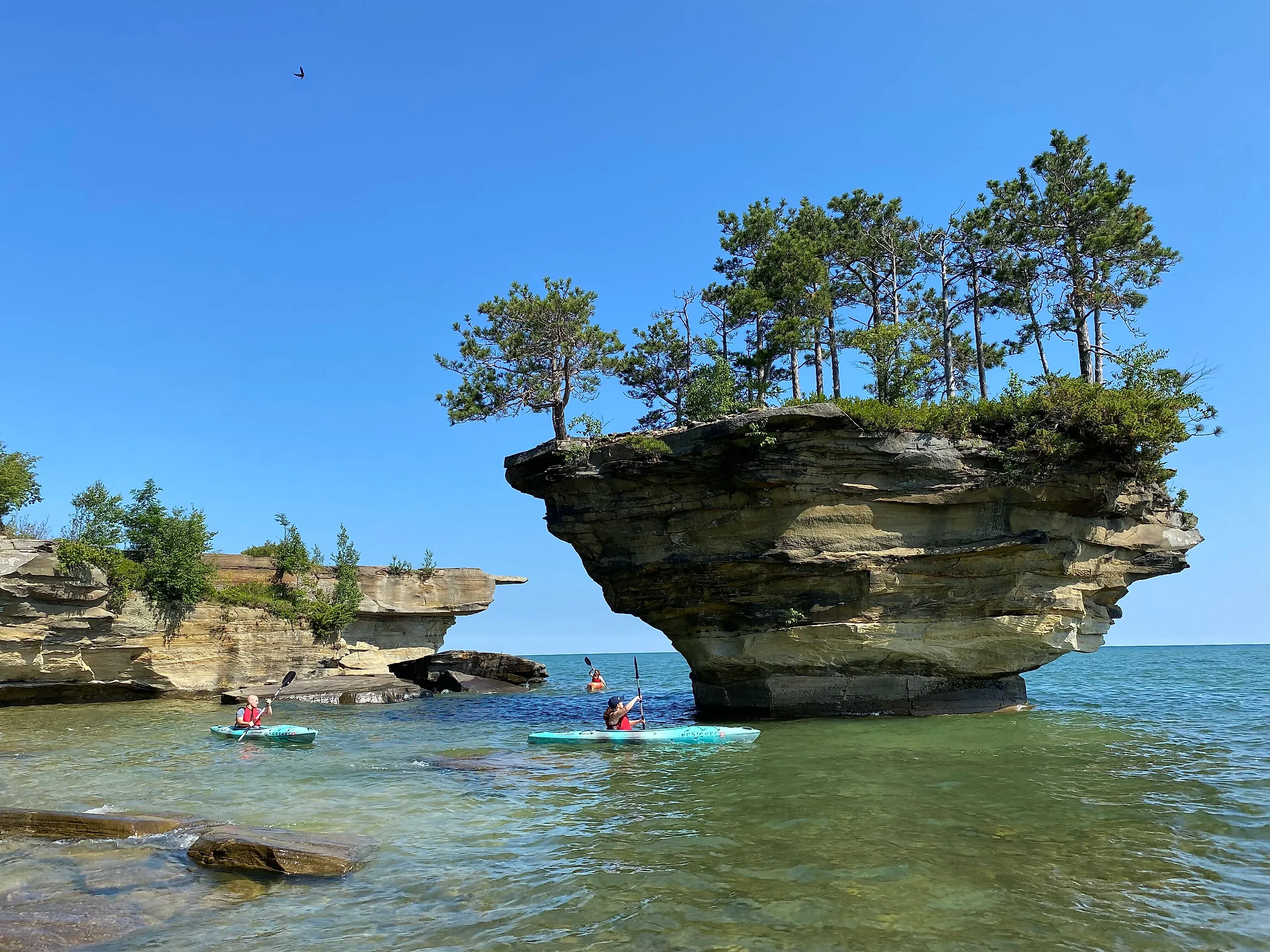
I rented a kayak from Port Austin Kayak and paddled the 7-mile shoreline round-trip to Turnip Rock. Rounding out the adventure with some sea caves and then a swim, and then capping things off with some fish tacos and suds back at base, left me with a great first impression.
Lastly, Port Huron is a Lake Huron city that I long took for granted, owing to the fact that my hometown is right across the water: Sarnia, Ontario. Failing to see the need to casually cross the Blue Water Bridge, I didn't really uncover this border town and Thumbcoast transition point until I picked up a tourist magazine advertising the Thumbcoast.
Soon after, standing atop the oldest operating lighthouse on all of Lake Huron, Port Huron took on a fresh new face — one with its string of waterfront museums and a rebounding historic downtown.
From Here On Out
Lake Huron is shared by Michigan and Ontario, who each do their part to promote and preserve the second-largest Great Lake. Having driven around the vast majority of its 3,827-mile binational shoreline over a number of seasons, these were some of my all-time favorite spots.
I could have easily made a list of exclusively waterfront towns, or just parks and trails, but I feel that these selections provide a seductive overview of Lake Huron's scope. Dive on in when you get a chance. It doesn't matter where you start.