Riding the Sunrise Coast Pure Michigan Byway
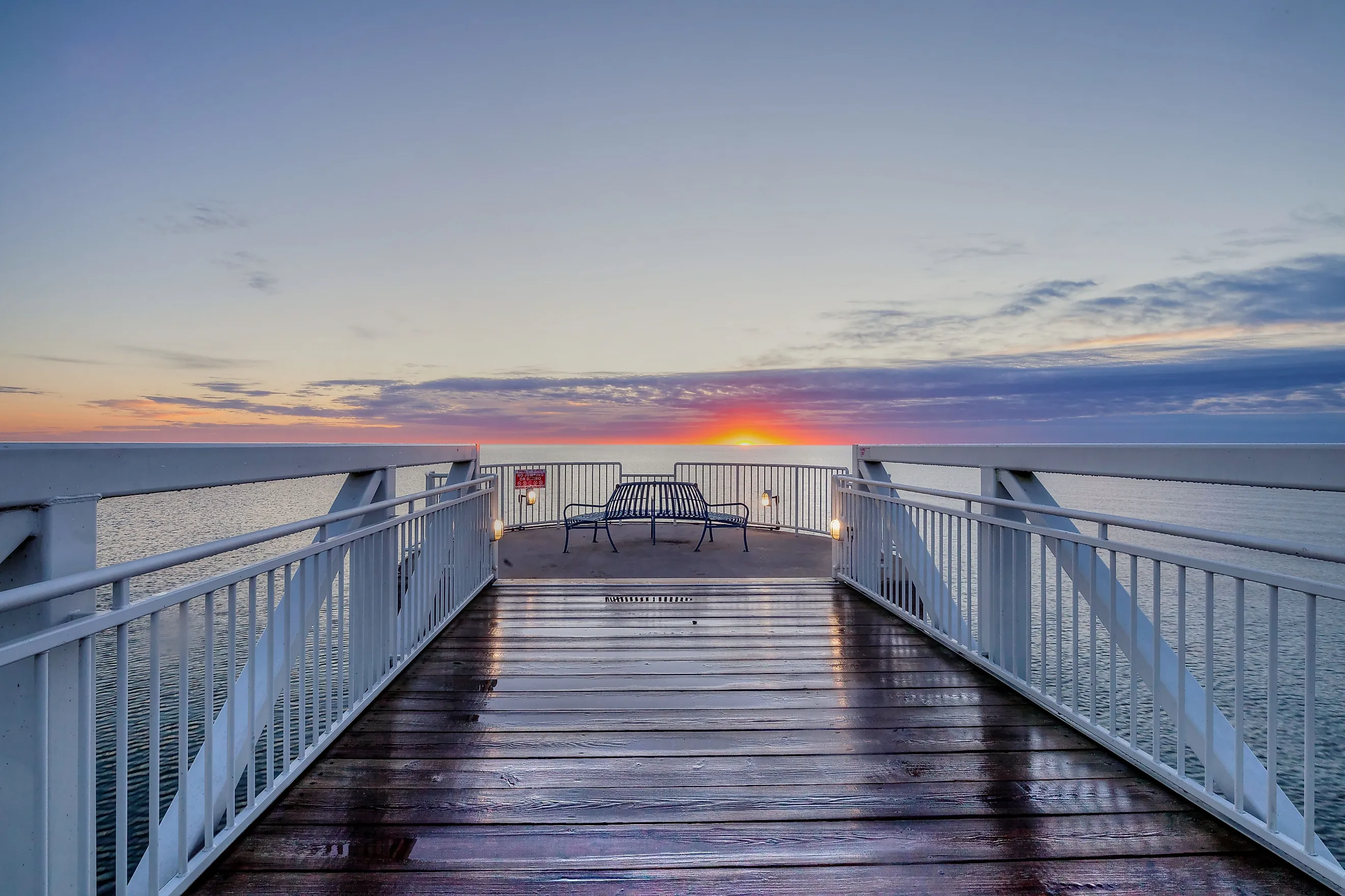
Riding Lake Huron's western shoreline for 200 miles, the Sunrise Coast Pure Michigan Byway showcases Great Lakes scenery and humble waterfront communities. Beginning in Standish, following US 23 the whole way north, the Sunrise Coast provides plenty of opportunities to chase daybreak on lengthy piers, stretch the legs in various state parks, seek historic lighthouses and the nearshore shipwrecks they were unable to save, and dig one's toes into sandy beaches en route to Mackinaw City, and maybe onwards to Mackinac Island. If you drive this Heritage Route north, then I'm guessing you'll have to come back down again, or vice versa. Hence, this article blends 2-3 days into one seamless itinerary. Feel free to mix n' match as you see fit, or if time permits, add on some side trips, and don't worry, I'll provide suggestions.
Bonus Trip: Michigan's Bavarian Enclave

Starting with a bonus trip? Well all sunrise seekers will need to base out of somewhere, so why not Michigan's Bavarian enclave? Frankenmuth sits only about 50 miles south of the southern terminus for the Sunrise Coast and will give you a great head start the following morning if you're coming from out-of-state, or in my case, out-of-country. Frankenmuth sets a fun tone for what's to come, without cannibalizing any of the Sunrise Coast's attractions. This is because the entire commercial core of the town has been modeled to look like a traditional Bavarian village. Chow down on German specialties, listen to the glockenspiel ding its bells and tell its tale, and cheers a couple frosty steins to the upcoming adventure.
East Tawas & Tawas Point State Park

Even though the Sunrise Coast Byway officially starts in the small city of Standish, on the north side of Saginaw Bay, if you got an early start, which is sort of the name of the game with this drive, then there won't be much to see or do until you get to Tawas. Yes, there is the Standish Historical Depot and Welcome Center, but it doesn't open until noon most days.
Instead, I recommend pushing on to East Tawas, grabbing a coffee from Cozy Cup Coffee Company, and then wheeling around Tawas Bay to the lengthy sandspit that houses Tawas Point State Park. Known as the "Cape Cod of the Midwest," this slim state park the perfect place to soak up some low UV rays while investigating the circa-1873 lighthouse tower and red-brick keeper's dwelling, or while walking gentle trails out to Tawas Point, a beautiful summertime sanctuary and a bird-watcher's dream come spring and fall migrations.
Swim in Oscoda

Just 15 miles north on US 23, the laid-back beach town of Oscoda is an ideal spot for a swim, or, given its due east orientation, an inspiring sunrise. My girlfriend and I missed the latter on the way up, but were thoroughly refreshed by the former. At Oscoda Beach Park, the sands are spacious and soft, save for some collections of washed up invasive mussels, and the waters are pure. The rest of the town is pretty sleepy, but there are still opportunities to reload on coffee, or upgrade to ice cream and pub grub. Oscoda also serves as a leaping off point for our next optional side trip, the River Road National Scenic Byway.
Bonus Trip: Au Sable's River Road

This 22-mile, one-way, minor highway follows the Au Sable River, or "river of sand," inland, through the Huron National Forest. Dense as these replenished trees may be, roadside turnouts and long wooden staircases unfurl sweeping valley vistas, massive sand dunes, hydroelectric dams, lumbermen and canoe-racer monuments, and scores of hiking, mountain biking, and ATV trails. The Au Sable River served Michigan's early timber industry, as giant white pines could be floated down its serpentine spine to various sawmill towns along Lake Huron. It also hosts the annual 120-mile Au Sable Canoe Marathon, aka "the world's toughest spectator race." But for everyday motorists, its River Road National Scenic Byway offers a glimpse into the natural beauty hiding just inland from the Great Lakes.
Late Lunch at Harrisville Beach

Having returned to Oscoda from the River Road side quest, proceed northbound on 23 for only about 20 minutes. Harrisville is a little light on restaurants, but if you grab something on your way up then you can enjoy it amongst the pines, cedars, and lapping waves at Harrisville State Park. A large pavilion with picnic tables sits just off of the beach, or if you'd prefer to dig your toes straight into the sand, you can snag a spot on the open-air benches, or lay a towel out pretty much anywhere.
Note that if you haven't already done so by this point, I recommend purchasing an annual Michigan Recreation Passport. It covers all state parks and pays for itself by the fourth visit, which you'll likely cover on this road trip alone.
Maritime Heritage in Alpena

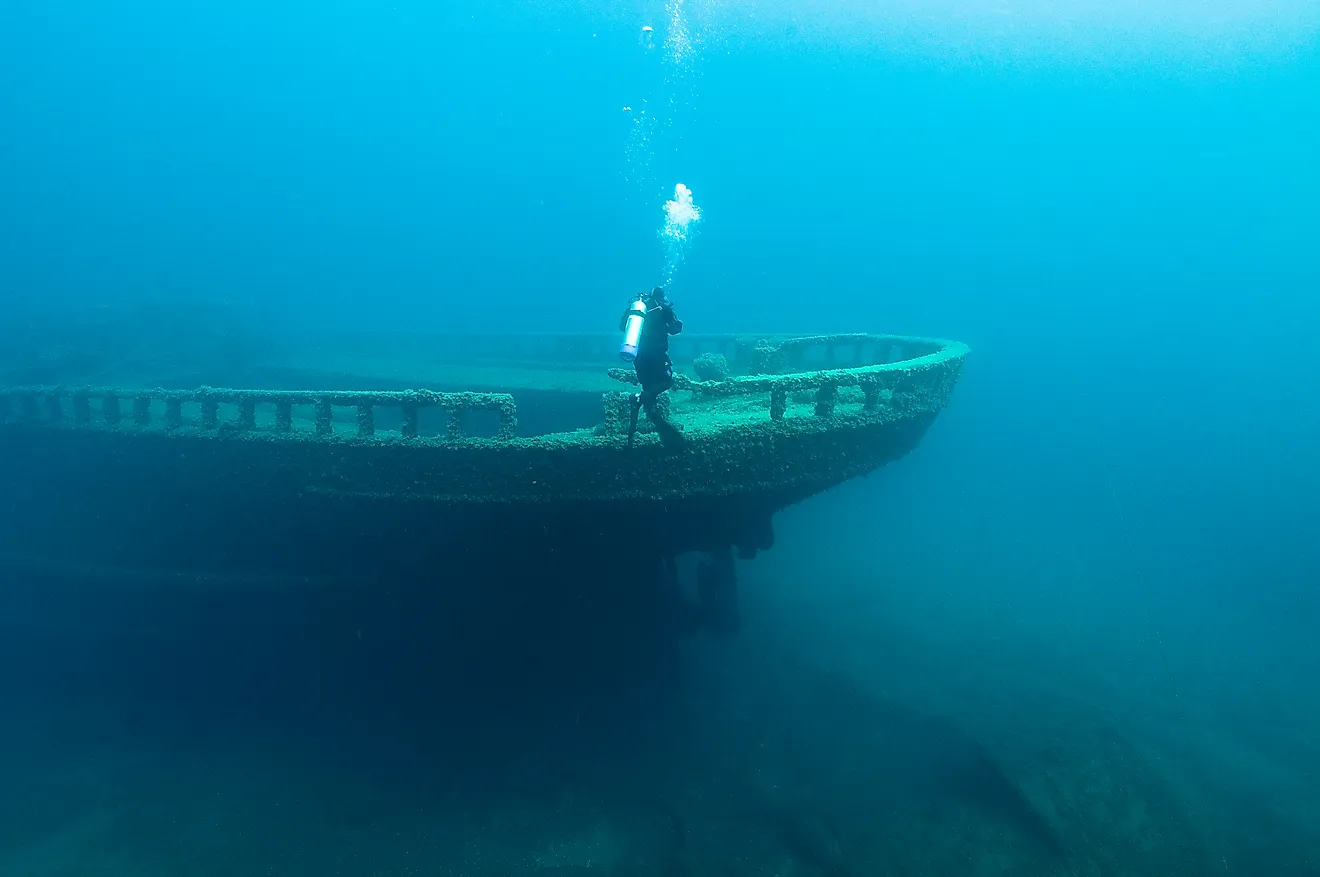
Alpena marks roughly the halfway point of the Sunrise Coast, and therefore, made for an appropriate end to our first day on the byway. Fixed around Thunder Bay and Thunder Bay River, this mid-sized city leans into its maritime heritage. The 4,300 square-mile Thunder Bay National Marine Sanctuary harbors an estimated 200 shipwrecks. Hence its nickname, "Shipwreck Alley." Our glass-bottom boat tour was unfortunately cancelled last-minute due to pending storms, but visiting the 10,000 square-foot Great Lakes Maritime Heritage Center made for a compelling alternative. This free, or by-donation, facility features images and backstories on some of the region's most notorious shipwrecks, as well as lively models and informative videos. Downtown Alpena is a bit hot and cold, but whether it's a happening patio or a vacant storefront, the brick walls are brightened with exquisite murals, 30 to be exact.
Presque Isle Light Stations

After catching the sunrise from Alpena's pier, a slight detour off of US 23 brought us out to wild and isolated, yet thoroughly illuminated, Presque Isle. Driving through this standalone community to its three historic lighthouses presents a scene straight out of Michigan's Upper Peninsula. The first beacon is found at Range Light Park. Just be sure to park in the gravel lot across the street…sorry guys! From this untouched beach, Old Presque Isle Lighthouse can be seen at the apex of Presque Isle Harbor. Upon arrival, give its 3,425 pound, circa-1896 Bronze Bell a ring. But trust me, it only needs a little tap! Finally, climb the 113-foot-tall New Presque Isle Lighthouse for a bird's-eye view of Lake Huron, North Bay, and the forested peninsula leading to its base.
Pit Stop in Cheboygan

A few more lighthouses and state parks later, everyday life resumes in Cheboygan. This is the most vibrant Main Street thus-far seen on the Sunrise Coast, though it is soon to be outdone in Mackinaw. Join the queue at Cheboygan Coffee Roasters, knock back some healthy food for a change at Lake n' Leaf, where the salmon poke bowls are spectacular, and, if applicable, let your girlfriend get her boutique shopping fix. Cheboygan has a little bit of everything crammed into a handful of decorative blocks. So if you have the time, this can be much more than a simple pit stop.
Marveling at Mackinaw City

The much anticipated peak of the Lower Peninsula is ushered in in style by Mackinaw City. Rolling into town, technically a village, a touristic fervor is felt for the first time across the entirety of the Sunrise Coast. These buzzing crowds are spurred on by the meeting of Lake Huron and Lake Michigan via the Straits of Mackinac, the convergence of Michigan's two major peninsulas, and a host of local landmarks. The most pronounced feature is easily Mackinac Bridge, also pronounced Mack-in-awe, aka "Mighty Mac," one of the longest suspension bridges in the western hemisphere. On its east side, visitors can climb aboard the U.S. Coast Guard's "Queen of the Great Lakes," now home to the Icebreaker Maritime Museum. Beginning immediately west of the bridge, the grounds of Colonial Michilimackinac can be explored. This 1715 fort was established by the French, but occupied for separate periods by the British and Chippewa, or Ojibwa. It also served as a precursor to Fort Mackinac, which sprouted on Mackinac Island. Speaking of which…
Bonus Trip: Mackinac Island

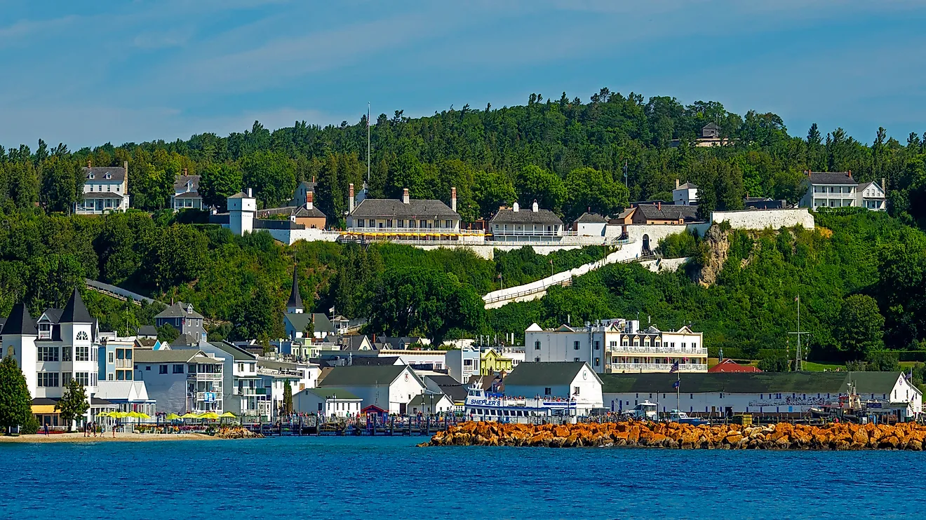
Though not featured on the standard byway maps, Mackinac Island is listed as the final stop in the official, Michigan-issued, Sunrise Coast Touring Guide. And because it's so aesthetically and culturally unique, I'm going to take the same liberty. Park your car in Mackinaw City, since cars have been barred on the island since the turn of the 20th-century, and walk onto Shepler's Ferry. Boats leave every 15-30 minutes and return nearly as often. Upon disembarking, prepare to walk into a Victorian world filled with horse-drawn carriages, cruiser bikes, regal architecture, world-famous fudge shops, and living historical sites, thanks to period-appropriate actors and cannon/rifle demonstrations atop Fort Mackinac. Only about 20% of Mackinac Island is developed. The rest belongs to the namesake state park, which uses nature trails, paved bike paths, and wooden staircases to network its forests, sea caves, and other enigmatic limestone formations.
Keep Chasing Sunrises

As you double back on the Sunrise Coast Pure Michigan Byway, watching that great ball of fire rise over Lake Huron, making up those missed tours and side trips, and sprinting across those state park beaches just for the heck of it, you might find yourself bemoaning the end of the road. Not to worry, 22 additional Pure Michigan Byways peruse Michigan's natural beauty and historical backbones. There are also remarkable drives that have yet to claim official designations. For instance, the closest option, the Thumbcoast, starts opposite Saginaw Bay and finishes out Lake Huron's western shoreline. So perhaps a "sick day" is in order.