Hiking Amongst The Black Bears And Rattlesnakes Of Beausoleil Island
Traversing a section of Beausoleil Island's Canadian Shield, I heard the heavy-footed snapping of a branch from within the pine forest. When my human calls went unanswered, I switched back to the "Hey bear!" mantra that I had been repeating for most of the day, especially after seeing a cub near the drop point, and then repeated piles of scat on the trails. Scanning the granite landscape for the next directional marker, I also had to watch out for massasauga rattlesnakes (i.e. Ontario's only venomous serpents) who might be sunning themselves on the exposed rocks. Talk about an unnerving juggling act!
The presence of black bears and rattlesnakes does add an element of danger to solo-hiking across Georgian Bay Islands National Park. Add in the fact that I had to hustle to meet my water taxi on the opposite end of the eight-kilometer-long island at a pre-ordained time, and this summer day-trip sure turned into an exhilarating one. Anyone up for such a challenge, or yearning for a taste of the world's largest freshwater archipelago, can consider following in my footsteps. Come along for the scenery, and stay for the helpful safety tips. This is Beausoleil Island!
Beausoleil Basics

Beausoleil Island is the largest of the 63 islands belonging to Georgian Bay Islands National Park, and the only one open to the public. It is also a significant contributor to Georgian Bay's broader "30,000 Islands" region, the largest freshwater archipelago on the planet. Continuing the accolades, Beausoleil Island, with its unique geology and nation-leading biodiversity, is included within the Georgian Bay UNESCO Biosphere. And thanks to its Indigenous and homesteader history, Beausoleil has been designated as a National Historic Site of Canada.
The island was named after Louis Beausoleil, a Métis settler who built his home on the southernmost tip (now known as Beausoleil Point) in 1819. Beausoleil's indigenous name, Bimadinaagogi, comes to us from the Anishinaabeg, and translates as "a ridge extending and growing along." I find both names rather appropriate, as there is no better place to spend a beautiful sunny day (beau soleil) and also because of the expansive section of exposed Canadian Shield stretching along the island's northern half.
Getting to the Island

Beausoleil Island can only be accessed by boat. The benefit of this transit bottleneck is that it keeps Georgian Bay Islands National Park wild, but it also drives up the fees for prospective visitors. For instance, even though the 2026 Canada Strong Pass grants free admission to national parks and 25% of their campsites from June 19 through September 7th, the round-trip price for my water taxi (plus parking at the docks) was nearly $200 CAD! You can cut that in half by taking the official park shuttle, Landmark Cruises, but it operates on tighter timelines and doesn't run at all on Wednesdays and Thursdays (which is when I was there). Ultimately, even though I paid an arm and a leg, I was ultimately satisfied with my arrangement. Plus the boat ride over is just so dang pretty! So I couldn't stay mad for too long.

Having stayed in the town of Midland, Ontario the night before, I drove half an hour up the shore to reach the marina community of Honey Harbour. Several of the private water taxis work out of here, as does Landmark Cruises, so unless you have your own boat, this will likely be your launch point. I called a few days in advance to reserve a taxi through Honey Harbour Boat Club, arranging to leave at 8:30 am, get dropped off at Cedar Spring (on the southeast side) just before 9 am, and be picked up at Honeymoon Bay, on the north end, at 4:30 pm. This gave me plenty of time to hike the majority of Beausoleil's dozen distinct trails from tail to tip.
Hiking Trails

Because Beausoleil Island sits on the edge of the Canadian Shield, but also within the Great Lakes - St. Lawrence Forest Region, it affords a wealth of varied hiking trails. There are six routes exploring the thick deciduous forests of the south side, and another six traversing the rocky landscape, and its many accompanying bays and inland lakes, around the island's northern extent. Patches of wildflowers, boulders, and windswept pines, so emblematic of the Group of Seven paintings, all punctuate the later circuits. As such, if you're pressed for time, I recommend focusing on Beausoleil Island's northern trails, campgrounds, and drop-off docks. But if you're looking to make some serious miles, or have more time alone in the woods (not counting the bears, snakes, and mosquitoes!), then perhaps a bottom-to-top itinerary calls to you too.

The premier section, in my opinion, was connecting Fairy Lake (2.5 km) and Cambrian (2 km). Like most of the northern trails, they are marked with colored posts plunked periodically across the granite slabs. Fairy Lake uses orange-tipped markers, whereas Cambrian uses yellow ones. Both trails take turns climbing up and down the Canadian Shield (a dynamic, occasionally hands-on experience) and delving into single-track forests. The additional appeal for Fairy Lake is the namesake waterbody, as well as the mirror-like visage of Goblin Lake. Cambrian, as the name suggests, highlights an ancient landscape, long eroded over the eons, and more recently ground down by glaciers. On this particular day, black bears were most present on this northeastern wing of the island. But hey, nothing ventured, nothing gained, right?
Tip: Bring more water than you think you'll need, or a method of purification. I carried over two litres but still had to ration quite a bit towards the end of the day. The sun can really smack on the Canadian Shield and the hikes can take longer and be more intensive than the kilometer readings suggest.
Black Bears

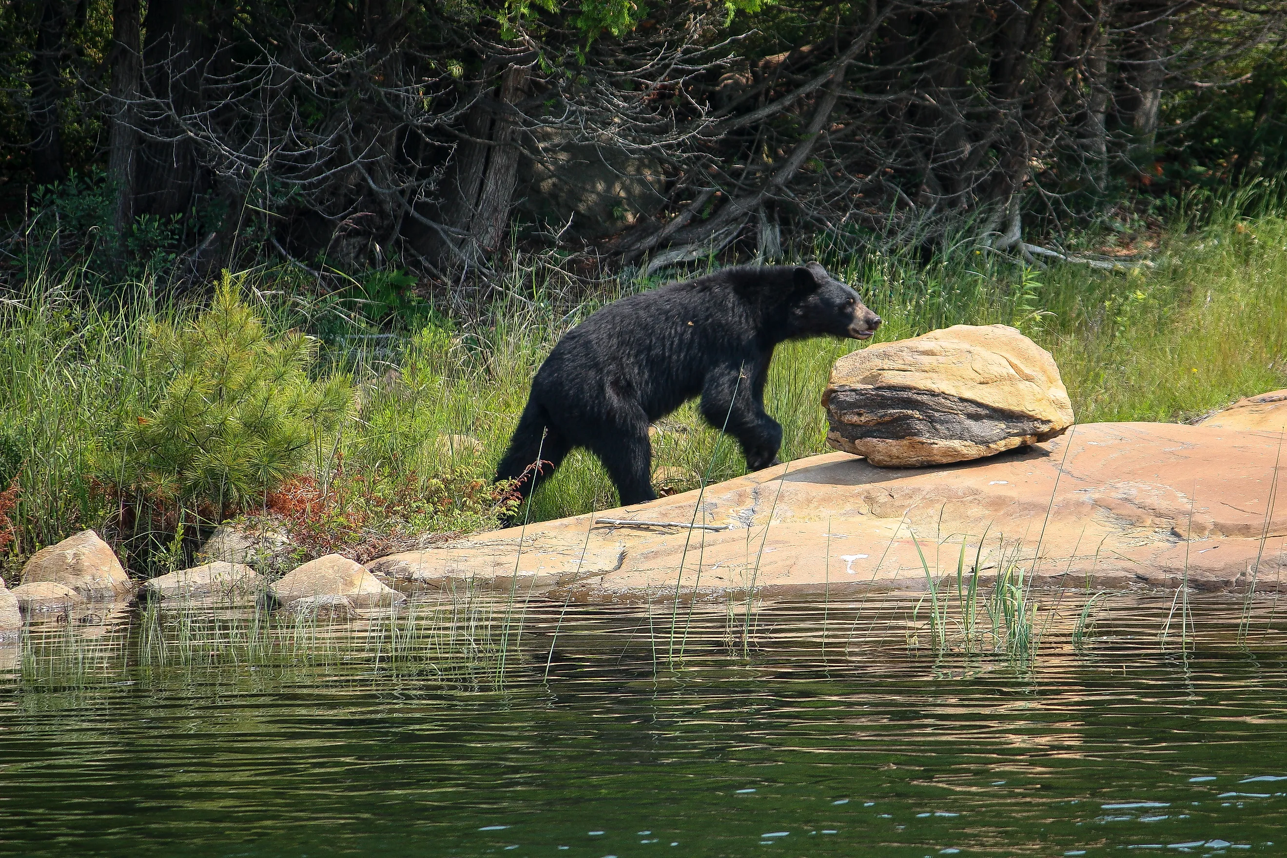
Georgian Bay is very much in Ontario's black bear country. In fact, moments after getting dropped off at Cedar Spring Campground, I saw the typical BEAR IN AREA sign posted outside of the ranger station. Moments after that, at the first fork in the trail, I saw a bear cub scurry across, thankfully from the direction I didn't need to go. Nonetheless, I began improvising a little anti-bear tune to get me through the thickest and most isolated parts of those southern trails. It went a little something like this:
Oh, where are you bear?
Are you right there?
I'll stay on the trail
I think that that's fair
Is your name Claire?
Or maybe it's Clarence
I like-a-da bears
But from a distance
And on and on it went…
During the fair weather season, black bears leap frog to Beausoleil Island from Muskoka's mainland in search of food. Sometimes this means investigating improperly stowed goods around campsites, but for the most part, they prefer to keep to themselves within the natural bounty of the island. As long as these black bears can hear, see, or smell you, they will most likely change course or keep a low profile. The key is for mountain bikers and solo hikers to actively make noise so as not to surprise them from upwind on a blind corner. Hence my little jingle, or the classic "Hey Bear!" call, which I usually switch to once I know for sure one is nearby.

Though the warning sign and cub sighting occurred on the southern part of the island, it was on the north end of Beausoleil that I encountered the most scat. Bear guides usually advise to "stay on the trail." But in this case, those piles of berry-infused droppings sat directly on the blazed paths. So evidently, Beausoleil's black bears were choosing the path of least resistance on that sweltering afternoon. Having learned this, I wouldn't blame anyone for sticking close to the docks out of an abundance of bear caution, but if you want to see some of the island's inner beauty, then simply hiking in a group is an effective deterrent.
Summary for Bear Safety:
- Hike with others. The more the better
- If hiking alone, make noise to let bears know you're around
- If camping, keep your site clean of food and other scents. Use Beausoleil's bear lockers.
- Consult Parks Canada in advance or Georgian Bay Islands NP rangers upon arrival about what to do in the event of an encounter (i.e. passive vs. defensive vs. aggressive posturing).
- Keep dogs on leash
- Consider carrying bear spray
Rattlesnakes

Black bears are always deserving of attention, but they are quite common throughout northern Ontario, and Canada as a whole. Beausoleil's real star is the eastern massasauga rattlesnake (Sistrurus catenatus). Or as it is known in the Anishinaabemowin language, Zhiishiigweg. This intimidating, yet elusive pit-viper is Ontario's only venomous snake species, and only remains in two small populations. The Great Lakes - St. Lawrence population, of which Beausoleil belongs to, is classified as Threatened on the Canadian Endangered Species List. This sub-species is found along the eastern side of Georgian Bay, as well as the Bruce Peninsula. Beausoleil Island's forests, wetlands, and open rocky areas offer the perfect confluence of habitats for the massasauga rattlesnake.
On my boat ride over, Captain Dave told me about a couple he shuttled the previous weekend who had hiked a similar route. "We saw more rattlesnakes than people," he said they said. Three, to be exact. So I was certainly on high alert. Not because I'm afraid of snakes (in fact, I was hoping to see one) but because I didn't want to catch one off guard. Growing up, I attended the YMCA's Camp Queen Elizabeth summer camp on the north end of Beausoleil Island. I didn't see a massasauga every year, but overall, I saw my share. I remember one morning I was walking from my cabin to the bathrooms when I saw one in the open, curled up and rattling its tail profusely. I was fascinated by its power, but also its timidness. As counsellors started to approach, it looked so vulnerable, and I'm glad that this species is still fiercely protected in Georgian Bay Islands National Park.

Jumping back to the present, while hiking the Dossyonshing Trail, I saw two park employees looking in caverns and taking readings. They told me that they were checking known dens but that they weren't seeing as many massasauga rattlesnakes because of a fungal disease. It seems this already threatened snake is facing yet another challenge. In the end, I didn't end up seeing a rattlesnake on this day, but I was treated to some garter snakes and lots of adorably-chubby toads. 33 species of reptiles and amphibians live on Beausoleil. That's more than anywhere else in Canada!
If your excursion does prove to be more snake-heavy than mine, here are a few distinguishing marks and behaviours to be mindful of. The massasauga rattlesnake measures between 47-76 centimeters, is stout-bodied, has a diamond-shaped head, and sports vertical pupils (but you won't want to get close enough to see these anyway!). At a passing glance, especially when obscured by rocks, detritus, or water, many of Beausoleil's non-venomous snakes can be mistaken for the massasauga. For instance, the fox snake, water snake, milk snake, and hognose snake all share blotched dorsal patterns, and the first three are known to shake their tails against vegetation in an effort to mimic the notorious rattle (which is actually more of a buzzing sound when executed by the real massasauga). Ultimately, it doesn't hurt to give every snake you encounter a respectful berth. And never attempt to handle them.
Tip: Wear long pants, long socks, and sturdy shoes. It can be a drag on a hot day, but these layers will protect you not only from snake bites, but the voracious bugs that plague parts of the island.
Bye Bye, Beausoleil

Beausoleil Island is my happy place. Sure, the smell of dead pine needles and DEET instantly stoked summer camp nostalgia. But having just returned after a quarter-century hiatus, I was able to see its beauty, its delicacy, and its immensity (geographically and geologically-speaking) with fresh eyes. I would have liked to see less of a financial barrier to accessing Georgian Bay Islands National Park, but once there, I felt free. Free to hike all day on marked trails, free to scramble up the modest pitches of the Canadian Shield, free to swim in the pristine waters of Georgian Bay, and free to relax anywhere on the infinite shoreline and think about life. I didn't see the massasauga rattlesnake this time around, but I did have some near misses with bears. Either way, it is a unique, rather primal feeling knowing that they are part of life on Beausoleil Island.