The Windiest Lakes In The United States
Wind behaves differently over water than it does over land. A forest slows it down. A city block breaks it into eddies. Open water does almost nothing to it, which is why a twenty mile per hour breeze onshore can arrive on a lake surface at thirty, and why the National Weather Service issues an entirely separate class of advisory for lakes. The distance wind travels uninterrupted across water is called fetch, and fetch is the single biggest reason some American lakes stay rough while others sit calm a few counties away.
There is no federal ranking of windiest lakes, because most lakes have no permanent anemometer. What exists instead is a combination of evidence: buoy records from the Great Lakes, National Weather Service advisory histories, wave records, and the quieter testimony of where windsurfers and sailors have chosen to build clubs and shops. The lakes below stand out across all of it.
Lake Superior

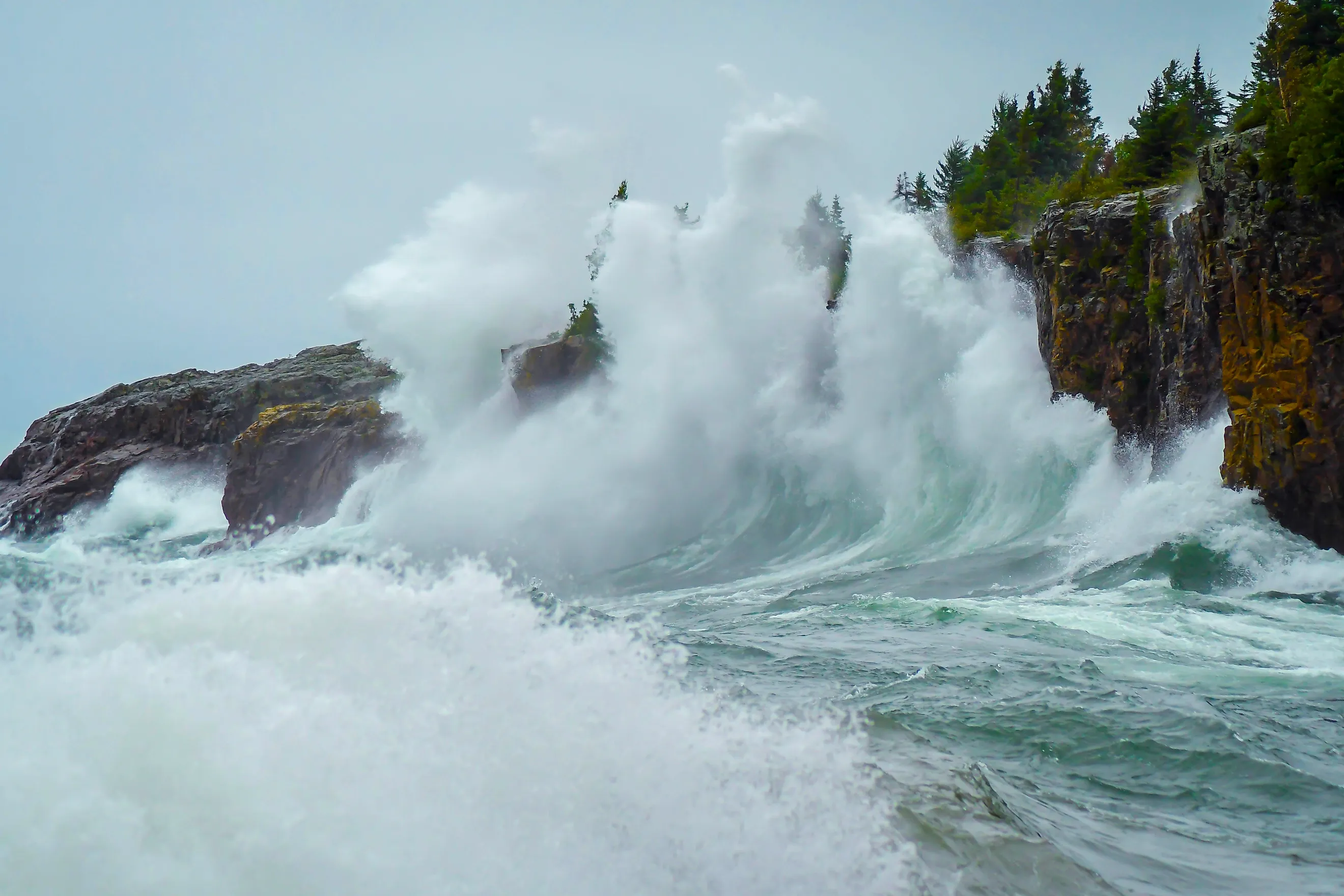
Superior has the longest fetch of any lake in the country, and it collects the strongest storms. On October 24, 2017, buoys operated by the Great Lakes Observing System measured waves of 28.8 feet, a record for the lake. Sightseers came to watch. Two of them were swept off a rock formation near Marquette and died.
The autumn pattern that produces those conditions has a name locally. The gales of November, sometimes the Witch of November, arrive when Arctic air drops south and collides with warm air pulled up from the Gulf. In Great Lakes forecasting, a gale warning means sustained winds or frequent gusts between 39 and 54 miles per hour over open water, and Superior sees them regularly from mid-October into December. The storm that took the Edmund Fitzgerald on November 10, 1975, was one of these. So was the 1913 White Hurricane, which produced gusts near 90 miles per hour and killed more than 250 people across the lakes.
Lake Erie

Erie is the shallowest of the Great Lakes, and it runs southwest to northeast for 225 miles. Those two facts together make it the most wind-sensitive large lake in the country. When a storm's winds line up with the long axis of the lake, they do not just build waves. They tilt the entire lake surface. The Ohio Department of Natural Resources calls this wind set-up, and it happens a few times a year.
The result is a seiche. Water piles against one end and drains away from the other, then sloshes back for hours after the wind quits. On December 29, 2025, southwesterly winds of 35 to 45 miles per hour gusting to 75 pushed water toward Buffalo, where the lake rose more than six feet in eight hours. National Weather Service meteorologist Tom Niziol measured close to an eight-foot difference between the Buffalo and Toledo ends of the lake at the same moment. In Ohio, boats in Maumee Bay have been known to settle onto the lake bottom when the water leaves.
Lake Michigan

Lake Michigan is oriented north to south, which is the same direction cold fronts tend to sweep through the region. Wind gets the full length of the lake to work with. On November 1, 2020, a passing upper-level trough pushed gusts of 50 to 60 miles per hour across the lake and built waves of 12 to 16 feet, flooding piers and stripping sand off the dunes at South Haven.
Gales here are not confined to autumn either. In April 2025, forecasters posted gale warnings across most of the lake with waves of six to nine feet predicted for the southern basin. The lake's piers and breakwaters are the real hazard on those days, since waves wash over them without warning and people are swept off every year.
Lake Winnebago

Winnebago is Wisconsin's largest lake inside state lines, roughly 30 miles long and 10 miles wide, with an average depth of about 15 feet and a maximum of 21. Shallow water responds to wind almost immediately, and there is nothing between Oshkosh and Stockbridge to slow anything down. Chop builds within minutes of a front arriving and flattens just as fast when it passes.
The reliability shows in what has grown up around the lake. Fond du Lac sits at the southern tip and supports a surf shop that claims the largest windsurfing and kiteboarding inventory in the Midwest. Its owner is a former Windsurfer of the Year. Shops like that do not survive on a lake that only occasionally cooperates.
Lake Champlain

Champlain sits in a long trough between the Adirondacks and the Green Mountains, and that valley works like a duct. Air moving up or down it has nowhere to spread out, so it accelerates. The lake runs more than 100 miles north to south, giving a sustained southerly plenty of room to build.
Regional tourism officials on the New York side describe it as offering some of the best inland windsurfing in the East, and say a strong south wind will nearly always produce waves above four feet. Plattsburgh City Beach and Cumberland Bay are the established launch points, and Ausable Point State Park has a jetty and beach area set aside specifically for windsurfers. Across the water in Vermont, Delta Park draws the same crowd.
Fort Peck Lake

Fort Peck Lake is Montana's largest body of water, about 134 miles long with more than 1,520 miles of shoreline reaching into six counties. It sits on the eastern prairie, well clear of the Rockies. Nothing shelters it, and the wind that crosses eastern Montana crosses the reservoir at full strength.
Lake Wind Advisories here are close to routine. A typical one calls for northwest winds of 15 to 25 miles per hour with gusts to 35 and waves of two to four feet on open water, with an explicit warning that conditions can overturn small craft. The arms of the reservoir make it worse in a specific way: a boat can round a point out of shelter and into full exposure in a matter of minutes.
Lake Sakakawea

Sakakawea stretches 180 miles along the Missouri River in North Dakota, covers roughly 368,000 acres, and has more shoreline than the Pacific coast of California. It also sits in one of the windiest corridors in the Lower 48. Fargo sits a few hours east on the same flat plain and averages more than 12 miles per hour of sustained wind annually under NOAA's most recent climate normals. March is its windiest month.
North Dakota's parks agency puts it plainly, inviting sailors and windsurfers to take advantage of the state's fabled wind. The state has also flagged Sakakawea's wind among the reasons the lake deserves respect, since the same conditions that reward a sailboat produce rough water for swimmers and paddlers. Low water compounds it. As of August 2026, the Army Corps of Engineers had the reservoir sitting about 12 feet below average, with ramps and marinas closed and boat traffic concentrated at whatever access remains open.
Great Salt Lake

The Great Salt Lake occupies a broad basin with mountains on either side, an arrangement that channels frontal winds straight down the length of the water. Staff at the Great Salt Lake Marina note that because of where the marina sits, it records some of the strongest gusts measured anywhere in Utah when a storm front comes through.
State climate records support that. A long-running survey of Utah wind observations logged a 65 mile per hour gust at Antelope Island, out in the middle of the lake. The region's capacity for extremes became obvious in September 2020, when a windstorm along the Wasatch Front produced a 112 mile per hour gust in Salt Lake City and cut power to roughly 200,000 customers. One thing sets this lake apart from every other entry here. Its water is heavily saline and therefore denser than fresh water, so a given wave carries more mass than its height would suggest.
Lake Tahoe

Tahoe is the rare lake whose wind runs on a schedule. Summer heating over the Great Basin to the east builds a thermal low, which pulls cooler Sierra air down through the canyons on the eastern slope. The result is the Washoe Zephyr, a west to southwest wind that Mark Twain wrote about in Roughing It in 1871, noting drily that its office hours began at two in the afternoon.
Forecasters at the National Weather Service office in Reno have since confirmed Twain's timing. The zephyr typically starts within two hours of 2 p.m. local time, peaks at sustained speeds of roughly 12 to 20 knots, and fades by nine in the evening. On the lake itself, afternoon winds of 10 to 25 miles per hour from the southwest are the norm, and the canyons along the west shore funnel gusts down onto the surface. The west shore stays relatively protected because the wind originates there. The north, east, and south shores take the waves, which is how Zephyr Cove on the Nevada side earned its name.
Lake Okeechobee

Okeechobee covers 730 square miles at an average depth of about nine feet, reaching only 12 or 13 feet at its deepest. Boaters describe it as a saucer of water, and it sits in the middle of a flat peninsula with no terrain anywhere to interrupt the airflow. That combination gives Florida's largest lake a wind profile closer to open ocean than to a typical inland lake.
Florida's Fish and Wildlife Conservation Commission points out that the lake's shallow depth, long fetch, and steady winds keep it from ever stratifying by temperature. Wind and wave action mix the whole water column continuously, which is unusual for a lake this size and a large part of why the fishery is as productive as it is. The Army Corps of Engineers warns mariners that strong winds alone can shift available navigation depth by more than a foot, and the Rim Canal around the southern shore exists in part as a sheltered alternative to crossing open water in chop.
Reading The Wind Before You Launch

What these lakes share is not a wind speed but a shape. Long fetch, low surrounding terrain, and in several cases a shallow bottom that lets waves stack up steeply rather than roll. The practical lesson is that lake wind is a forecast product in its own right. Lake Wind Advisories, Small Craft Advisories, and Great Lakes gale warnings all exist because conditions on the water diverge sharply from conditions in the parking lot, and morning calm on any of these lakes says very little about two in the afternoon.