The Largest Lakes Created By A Single Dam
The world’s largest lakes created by a single dam can cover thousands of square miles, flooding former river valleys, forests, and settlements. This list highlights exceptionally large reservoirs formed primarily by a single river-closing dam, based on published surface-area estimates. Because reservoir size changes with water level and sources may measure area at different operating elevations, close rankings are approximate. Several larger reservoirs listed in conventional rankings are excluded because they do not meet the single-dam criterion. Lake Volta, for example, covers about 8,502 square kilometers but relies on the Akosombo Dam and a separate saddle dam. Canada’s Smallwood and Caniapiscau reservoirs depend on numerous dikes, while Russia’s Rybinsk Reservoir is retained by more than one major dam. Bukhtarma Reservoir is also excluded because its creation incorporated and substantially raised the pre-existing natural Lake Zaysan.
Lake Nasser-Nubia, Egypt and Sudan

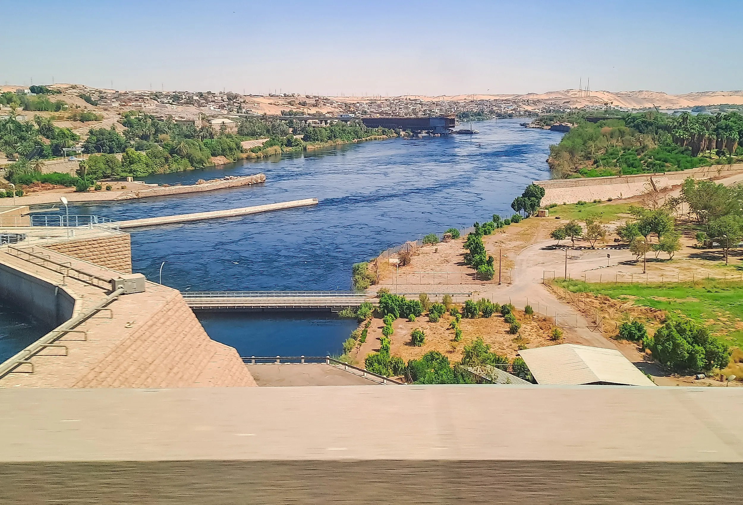
Lake Nasser and its Sudanese extension, Lake Nubia, form the vast reservoir behind Egypt's Aswan High Dam. At the upper storage level, the combined reservoir can cover about 2,645 square miles (6,850 square kilometers). At a water level of 180 meters, a frequently used reference point, its measured area is about 2,400 square miles (6,216 square kilometers). The reservoir extends nearly 500 kilometers through the Nile Valley, with most of its surface in Egypt and the remainder in Sudan.
The Aswan High Dam fundamentally changed the management of the Nile River. Stored water supports irrigation, municipal supply, flood management, and hydroelectric generation downstream. The project also created one of the best-known archaeological rescue efforts of the 20th century. The temples at Abu Simbel were dismantled and reconstructed on higher ground before the rising reservoir covered their original location. Today, long sandstone shores, desert islands, and enormous stretches of open water make this artificial lake unlike any other on the list.
Kuybyshev Reservoir, Russia

Kuybyshev Reservoir spreads across the middle Volga River and lower Kama in western Russia. A widely cited surface-area figure is about 2,490 square miles (6,450 square kilometers), although Russia's state water registry gives 6,150 square kilometers at the normal retention level. The reservoir began forming after the Volga was blocked by the hydroelectric complex now known as the Zhiguli Hydroelectric Station. It extends for roughly 510 kilometers along the Volga and holds approximately 58 cubic kilometers of water.
Its unusual scale is easier to appreciate from the cities along its shores. Kazan, Ulyanovsk, Tolyatti, and several smaller communities face sections of a reservoir wide enough to resemble a natural lake. Water stored here supports hydroelectric generation, navigation, water supply, agriculture, and fisheries. The Volga and Kama valleys give the lake a branching outline, with broad reaches interrupted by islands, steep banks, and flooded tributary mouths. Shoreline erosion has also become an important scientific concern because waves continually reshape some of the reservoir's banks.
Lake Kariba, Zambia and Zimbabwe

Lake Kariba covers about 2,154 square miles (5,580 square kilometers) at full capacity along the border between Zambia and Zimbabwe. The lake formed behind Kariba Dam, the great concrete arch structure that blocks the Zambezi River at Kariba Gorge. It reaches roughly 174 miles (280 kilometers) upstream and is about 20 miles (32 kilometers) wide at its broadest point.
Surface area tells only part of Kariba's scale. At full capacity, the reservoir holds roughly 181 billion cubic meters of water, which places it among the largest artificial reservoirs on Earth by volume. That enormous store drives hydroelectric stations serving both countries.
Kariba has also developed an identity far removed from the engineering project that created it. Houseboats travel between drowned valleys and islands, tigerfish draw anglers onto the water, and wildlife occupies long sections of the Zimbabwean shore. Matusadona National Park lies along Lake Kariba's southern shore, where elephants, hippos, crocodiles, buffalo, and other animals inhabit the lakeside landscape.
Bratsk Reservoir, Russia

Bratsk Reservoir covers approximately 2,112 square miles (5,470 square kilometers) across Siberia's Irkutsk region. It was formed by damming the Angara River, the great outlet of Lake Baikal, at the Bratsk Hydroelectric Plant. Its flooded river valleys stretch for more than 500 kilometers and create several huge arms separated by forested peninsulas.
The lake is particularly impressive because area is only one measure of its size. Bratsk stores close to 170 cubic kilometers of water, putting it among the world's most voluminous wholly artificial reservoirs. Construction was tied closely to Soviet-era industrial expansion, with the hydroelectric station supplying electricity to energy-intensive industries in eastern Siberia. Several communities and extensive tracts of land disappeared beneath the rising water during filling.
Conditions here are dramatically different from the warm African reservoirs higher on the list. Bratsk freezes during the long Siberian winter, and the boreal forest surrounds much of its shoreline. In summer, broad open reaches, wooded bays, and distant settlements give parts of the reservoir the appearance of a northern inland sea.
Guri Reservoir, Venezuela

Guri Reservoir, or Embalse de Guri, can cover roughly 1,641 square miles (4,250 square kilometers) in southeastern Venezuela. The Guri Dam blocks the Caroní River, a major tributary of the Orinoco, within the ancient landscapes of the Guiana Shield. Its flooded tributaries and valleys produced an irregular shoreline broken by countless coves, peninsulas, and islands.
The reservoir feeds the Simón Bolívar Hydroelectric Plant, better known as the Guri power station. Development occurred in stages as both the dam and the generating complex were enlarged. The completed reservoir can store roughly 135 billion cubic meters of water, giving the project enormous importance to Venezuela's electricity system.
The creation of Guri also submerged an extensive terrestrial habitat. Hills became islands as water rose through the former forest, leaving a landscape very different from the original Caroní Valley. Water levels have varied substantially during droughts, revealing how strongly even an artificial lake of this size responds to prolonged changes in rainfall and river inflow.
Sobradinho Reservoir, Brazil

Sobradinho Reservoir occupies about 1,629 square miles (4,220 square kilometers) of northern Bahia in Brazil. It was created by the Sobradinho Dam across the São Francisco River, one of the country's great interior waterways. The reservoir is comparatively shallow for its enormous area, averaging about 28 feet (8.6 meters) deep while storing roughly 34.1 cubic kilometers of water at its upper operating level.
Sobradinho lies in Brazil's semi-arid northeast, where high evaporation and large seasonal water-level changes expose broad margins around the lake. During low-water periods, parts of those temporarily uncovered areas have even been cultivated. The dam supports hydroelectric generation and helps regulate the São Francisco, while stored water is closely tied to irrigation and regional water management. Creating the lake came at a high social cost, however, as communities and agricultural land were inundated and residents had to relocate. The modern shoreline now stretches for roughly 1,690 kilometers through an environment that was once dominated by river channels and dry interior landscapes.
Volgograd Reservoir, Russia
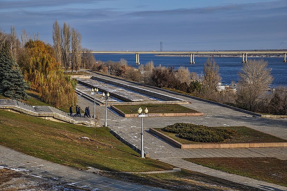
Volgograd Reservoir covers about 1,203 square miles (3,117 square kilometers) at its normal retention level. It stretches along the lower Volga River behind the Volga Hydroelectric Station near the cities of Volgograd and Volzhsky. Although much narrower than the broadest reservoirs in this ranking, it runs for roughly 336 miles (540 kilometers), giving it a remarkably elongated shape.
The reservoir holds about 31.45 cubic kilometers of water at the normal level. Its official uses include electricity production, water supply, river transport, fisheries, and agriculture, reflecting the Volga's central role in the economy of European Russia. Creating such a long artificial lake required flooding settlements, farmland, and sections of the former river floodplain; tens of thousands of residents were resettled during the development of the project.
Modern Volgograd Reservoir still follows the old Volga corridor closely. From many points along the shore, it appears less like a conventional round lake than an enormously widened river, sometimes reaching about 17 kilometers across before narrowing again between higher banks.
Tucuruí Reservoir, Brazil

The reservoir behind Tucuruí Dam covers roughly 1,100 square miles, with published figures around 2,850 to 2,875 square kilometers at high operating levels. It formed when the Tocantins River was blocked in the Brazilian state of Pará, and filling took place during the mid-1980s. The resulting lake extends roughly 170 to 200 kilometers upstream through what had been tropical forest and river valleys.
Water from the reservoir drives the enormous Tucuruí Hydroelectric Power Plant, one of Brazil's major generating stations. The landscape created behind the dam is extraordinarily intricate. Higher pieces of the former terrain remained above water as islands, leaving a reservoir with long channels and an extremely irregular shoreline rather than one uninterrupted sheet of water.
That transformation was environmentally costly. Thousands of square kilometers were flooded, including extensive forest, and the project disrupted communities, fisheries, wildlife habitat, and the Tocantins River's natural flow. Tucuruí, therefore, represents both the extraordinary geographic reach of a single large dam and the scale of ecological change that can accompany a reservoir of this size.
Tsimlyansk Reservoir, Russia

Tsimlyansk Reservoir covers about 1,043 square miles (2,702 square kilometers) across southern Russia. It formed behind Tsimlyansk Dam on the Don River in the early 1950s and holds approximately 23.7 cubic kilometers of water. Unlike Siberia's Bratsk Reservoir, Tsimlyansk lies in a much drier steppe environment, where the broad water surface interrupts landscapes dominated by farmland, grassland, and low river terraces.
The dam and reservoir became closely linked to Soviet plans to improve transportation and water management across southern European Russia. Regulating the Don helped support navigation connected with the Volga-Don waterway, while stored water serves agriculture, power generation, fisheries, and regional supply needs. The reservoir is generally shallow, with an average depth of less than 30 feet (9 meters), so changes in water level can shift the shoreline noticeably across its broad margins. Towns, archaeological sites, and farmland were affected when the basin filled, making Tsimlyansk another example where the geographic scale visible on a modern map came with extensive changes on the ground.
Cahora Bassa Lake, Mozambique

Cahora Bassa Lake covers about 1,029 square miles (2,665 square kilometers) along the Zambezi River in Mozambique. It began filling after the closure of the Cahora Bassa Dam in December 1974. At an elevation of 326 meters, FAO data gives the reservoir a length of about 153 miles (246 kilometers), a maximum width of nearly 25 miles (40 kilometers), and a volume of approximately 55.75 cubic kilometers.
Cahora Bassa occupies a dramatically confined section of the Zambezi Valley, so steep terrain surrounds many parts of the long reservoir. Water stored behind the dam feeds a major hydroelectric station, while the lake also supports fishing communities spread along its remote shoreline.
The dam interrupted the natural movement of water and sediment through the lower Zambezi, adding Cahora Bassa to a chain of large engineering projects that altered the river's hydrology. On the lake itself, narrow passages open unexpectedly into wide expanses of water between rugged hills. That combination of sheer scale and steep topography gives Cahora Bassa a very different shape from shallow, sprawling reservoirs such as Sobradinho.
How One Dam Can Create A Lake The Size Of A Region
The reservoirs in this ranking show just how far the effects of one river barrier can extend. The Aswan High Dam backs the Nile across Egypt and Sudan, Kariba stretches between two countries, and the Zhiguli dam transformed hundreds of miles of the Volga and Kama system into the Kuybyshev Reservoir. Even the smallest entry here, Cahora Bassa, covers more than 1,000 square miles. Those dimensions also explain why reservoir size cannot be separated from environmental and human consequences. Filling these basins submerged settlements and ecosystems, interrupted sediment transport and fish movement, and permanently changed downstream river conditions. At the same time, the reservoirs became major sources of electricity, irrigation water, transportation, fisheries, and flood regulation. Their maps may resemble natural lakes today, but each one records an extraordinary act of landscape engineering.